Otley Bottom

Valley in Suffolk East Suffolk

England

Otley Bottom

A wheat field near Gibraltar
A wheat field near Gibraltar Credit: Philip Halling

Otley Bottom is a picturesque valley located in Suffolk, England. Nestled amidst the rolling countryside, this idyllic spot offers stunning views and a tranquil atmosphere. The valley is situated near the village of Otley, which is about eight miles north of Ipswich.

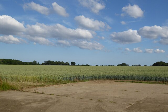
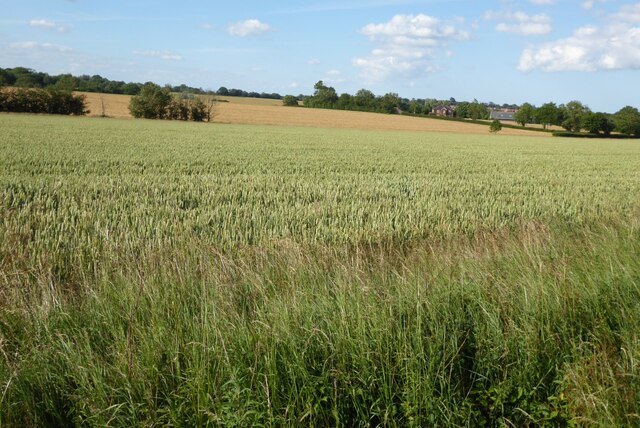
The landscape of Otley Bottom is characterized by lush green meadows, gentle slopes, and a meandering stream that flows through the valley. The area is rich in wildlife and is home to a diverse range of plants, birds, and animals. Visitors can often spot deer, rabbits, and various species of birds while exploring the valley.

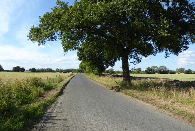
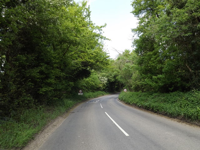
The valley is a popular destination for nature lovers, hikers, and photographers. Its natural beauty and peaceful ambiance make it an ideal place for a leisurely stroll or a picnic with family and friends. The surrounding countryside offers a network of footpaths and bridleways, allowing visitors to explore the area and enjoy the stunning vistas.

Historically, Otley Bottom has been an important agricultural area, with fields and farmland dominating the landscape. The valley has retained its rural charm and is dotted with charming cottages and traditional farmhouses. The nearby village of Otley has a rich history and offers amenities such as a village pub and a church.

Overall, Otley Bottom in Suffolk is a hidden gem, offering visitors a chance to escape the hustle and bustle of everyday life and immerse themselves in the beauty of the English countryside. Whether you are seeking relaxation, wildlife spotting, or simply a peaceful retreat, Otley Bottom is a must-visit destination.

If you have any feedback on the listing, please let us know in the comments section below.

Otley Bottom Images

Images are sourced within 2km of 52.142562/1.2243023 or Grid Reference TM2054. Thanks to Geograph Open Source API. All images are credited.

A wheat field near Gibraltar
Arable fields near Otley Wheat fields near Otley.
Arable fields near Otley
Wheat fields near Otley.
Cottage on Ipswich Road, Otley from a nearby footpath
View towards Otley Church
Field north of the B1078 at Gibraltar, Ashbocking
Otley, St Mary
Otley, St Mary
Country road near Gibraltar Oak tree beside a country road passing through farmland near Gibraltar.
Country road near Gibraltar
Oak tree beside a country road passing through farmland near Gibraltar.
Derelict tin tabernacle next to the B1078, Clopton A Clopton village website (<span class="nowrap"><a title="http://clopton.onesuffolk.net/clopton-village/history-and-heritage/" rel="nofollow ugc noopener" href="http://clopton.onesuffolk.net/clopton-village/history-and-heritage/">Link</a><img style="margin-left:2px;" alt="External link" title="External link - shift click to open in new window" src="https://s1.geograph.org.uk/img/external.png" width="10" height="10"/></span> ) implies that these are the former Mission Rooms, which were replaced by a new village hall in the early 1990s.
Derelict tin tabernacle next to the B1078, Clopton
A Clopton village website (LinkExternal link ) implies that these are the former Mission Rooms, which were replaced by a new village hall in the early 1990s.
Derelict tin tabernacle next to the B1078, Clopton As can just be made out, the roof of the chapel has collapsed at the north-west end (liturgical east end) and the window at that end can be seen from the "inside" side.
A Clopton village website (<span class="nowrap"><a title="http://clopton.onesuffolk.net/clopton-village/history-and-heritage/" rel="nofollow ugc noopener" href="http://clopton.onesuffolk.net/clopton-village/history-and-heritage/">Link</a><img style="margin-left:2px;" alt="External link" title="External link - shift click to open in new window" src="https://s1.geograph.org.uk/img/external.png" width="10" height="10"/></span> ) implies that these are the former Mission Rooms, which were replaced by a new village hall in the early 1990s.
Derelict tin tabernacle next to the B1078, Clopton
As can just be made out, the roof of the chapel has collapsed at the north-west end (liturgical east end) and the window at that end can be seen from the "inside" side. A Clopton village website (LinkExternal link ) implies that these are the former Mission Rooms, which were replaced by a new village hall in the early 1990s.
View out of the valley from the B1078
Former school, Clopton, Suffolk According to a Clopton village website (<span class="nowrap"><a title="http://clopton.onesuffolk.net/clopton-village/history-and-heritage/" rel="nofollow ugc noopener" href="http://clopton.onesuffolk.net/clopton-village/history-and-heritage/">Link</a><img style="margin-left:2px;" alt="External link" title="External link - shift click to open in new window" src="https://s1.geograph.org.uk/img/external.png" width="10" height="10"/></span> ), Clopton school closed in the late 1930s.
Former school, Clopton, Suffolk
According to a Clopton village website (LinkExternal link ), Clopton school closed in the late 1930s.
Fish  Ponds  in  the  grounds  of  Otley  Hall Building on the left over the reeds is the cafe and entrance to the gardens of the hall
Fish Ponds in the grounds of Otley Hall
Building on the left over the reeds is the cafe and entrance to the gardens of the hall
Otley  Hall  c15  and  early  c16  House Pevsner states it is one of the most interesting houses in Suffolk
Otley Hall c15 and early c16 House
Pevsner states it is one of the most interesting houses in Suffolk
Otley  Primary  School  and  Under  5s  Centre.  Chapel  Road
Otley Primary School and Under 5s Centre. Chapel Road
Otley  Post  Office  and  Store.  Chapel  Road
Otley Post Office and Store. Chapel Road
Road  junction  in  Otley  village The village name sign is to the left of the Stop sign
Road junction in Otley village
The village name sign is to the left of the Stop sign
B1079 in Otley Bottom
Entering Otley on the B1079 <span class="nowrap"><a title="https://en.wikipedia.org/wiki/Otley,_Suffolk" rel="nofollow ugc noopener" href="https://en.wikipedia.org/wiki/Otley,_Suffolk">Link</a><img style="margin-left:2px;" alt="External link" title="External link - shift click to open in new window" src="https://s1.geograph.org.uk/img/external.png" width="10" height="10"/></span>
Entering Otley on the B1079
Show me another place!

Otley Bottom is located at Grid Ref: TM2054 (Lat: 52.142562, Lng: 1.2243023)

Administrative County: Suffolk

District: East Suffolk

Police Authority: Suffolk

What 3 Words

///chainsaw.picnic.scraper. Near Grundisburgh, Suffolk

Nearby Locations

Otley Bottom Otley Bottom

Related Wikis

Suffolk Rural College

Suffolk Rural College is an English further education college in the village of Otley, Suffolk. The college was founded in 1970 as Otley College of Agriculture...
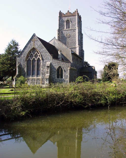
Otley, Suffolk

Otley is a village and civil parish in the East Suffolk district, in the English county of Suffolk. It is around 7 miles (11 km) north-east of Ipswich...
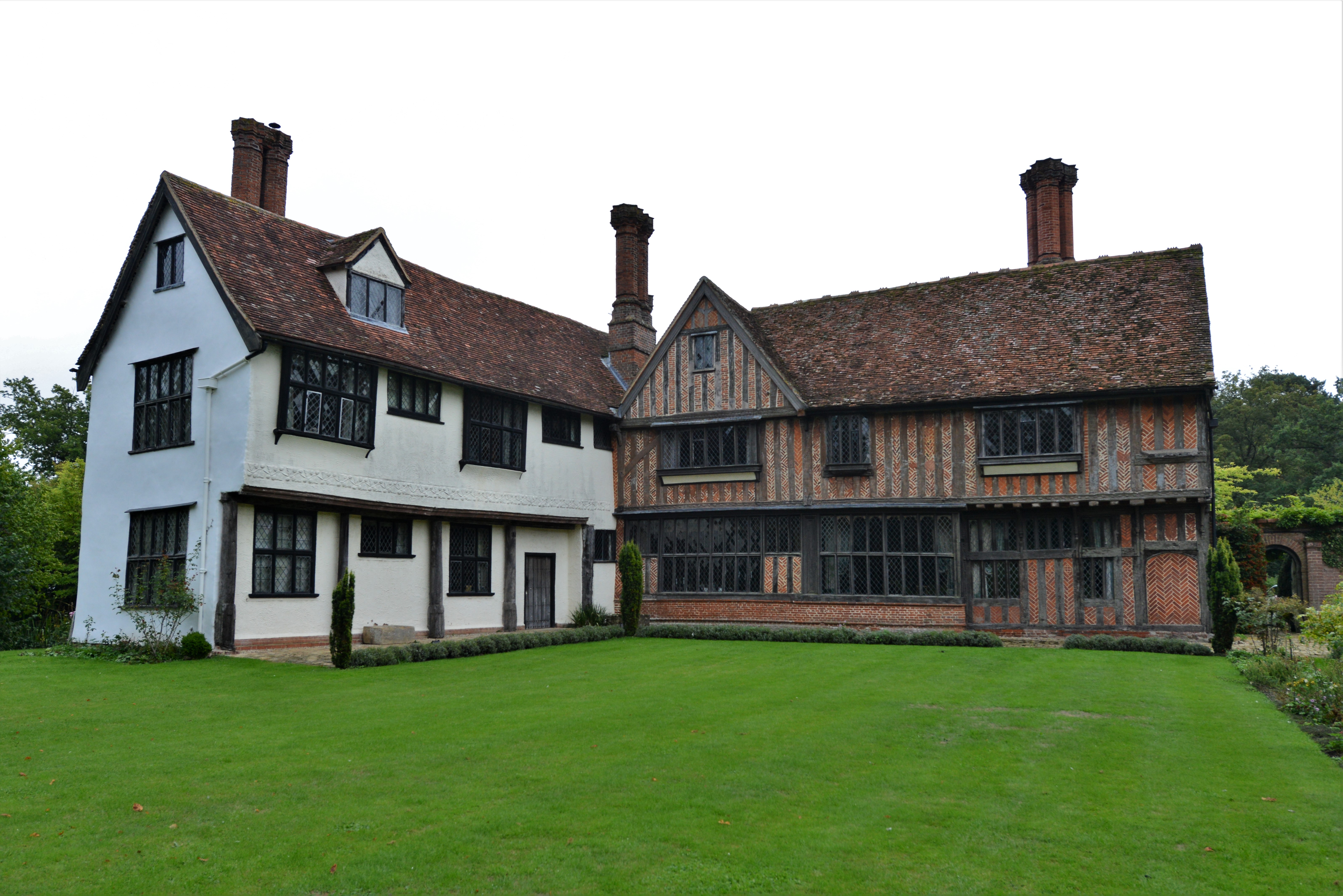
Otley Hall

Otley Hall is a 16th-century English manor house in the civil parish of Otley, in the East Suffolk district, Suffolk, England. It is a Grade I listed building...

Ashbocking

Ashbocking is a village and civil parish in the Mid Suffolk district of Suffolk, England. The village is about seven miles north of Ipswich, and according...

Nearby Amenities

Located within 500m of 52.142562,1.2243023
castle mound
Historic: archaeological_site
Is In Country Code: GB
Is In County: Suffolk
Is In Municipality: Suffolk Coastal
Lat/Long: 52.144793/1.2182191
Church Road
Naptan AtcoCode: 390060322
Naptan Bearing: W
Naptan BusStopType: CUS
Naptan CommonName: Church Road
Naptan Indicator: adj
Naptan Landmark: Otley Bottom
Naptan NaptanCode: sufgpgjd
Naptan Street: B1078
Naptan Verified: no
Source: naptan_import
Lat/Long: 52.142369/1.2229453
Church Road
Naptan AtcoCode: 390060323
Naptan Bearing: E
Naptan BusStopType: CUS
Naptan CommonName: Church Road
Naptan Indicator: opp
Naptan Landmark: Otley Bottom
Naptan NaptanCode: sufgpgjg
Naptan Street: B1078
Naptan Verified: no
Source: naptan_import
Lat/Long: 52.1423847/1.2233557
The data included in this document is from www.openstreetmap.org. The data is made available under ODbL.

Have you been to Otley Bottom?

Leave your review of Otley Bottom below (or comments, questions and feedback).