Barton

Settlement in Gloucestershire Cotswold

England

Barton

Guiting Power Baptist Church The church was closed and put on the market earlier this year, but I don't know whether a sale successfully went through. The building is Grade II listed.
Guiting Power Baptist Church Credit: Bill Boaden

Barton is a small village located in the county of Gloucestershire, England. Situated in the South West region of the country, it lies approximately 5 miles south of the historic market town of Tetbury and 10 miles north of the city of Bristol.

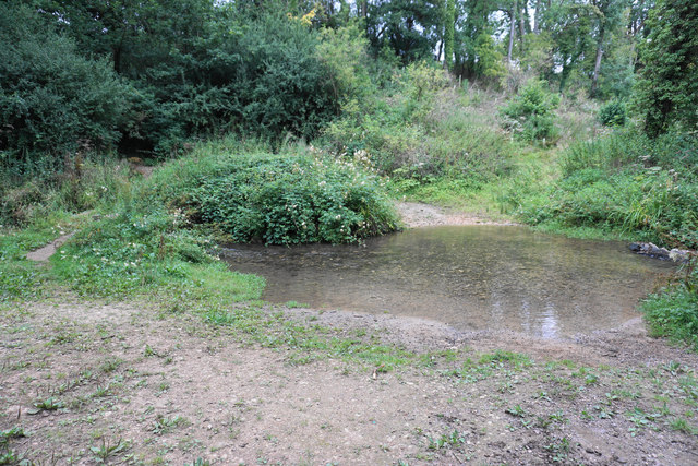
With a population of around 500 residents, Barton is known for its picturesque countryside and charming rural setting. The village is surrounded by rolling hills and farmland, offering stunning views and a peaceful atmosphere. The nearby Cotswold Area of Outstanding Natural Beauty further enhances the area's natural appeal.

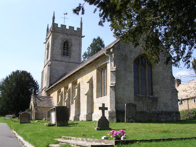
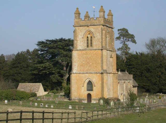
Barton boasts a rich history, dating back centuries. The village features several historic buildings, including St. James' Church, a beautiful Grade II listed structure that dates back to the 12th century. The church is renowned for its impressive architecture and hosts regular religious services and community events.

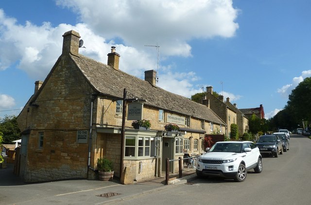
Despite its small size, Barton offers a range of amenities for its residents. These include a village hall, a primary school, and a pub, providing a close-knit community feel. The village is also well-connected, with good transport links to nearby towns and cities, making it an ideal location for those seeking a peaceful countryside lifestyle while still being within reach of urban conveniences.

Overall, Barton in Gloucestershire offers a charming and idyllic village setting, perfect for those looking to enjoy the tranquility of the English countryside.

If you have any feedback on the listing, please let us know in the comments section below.
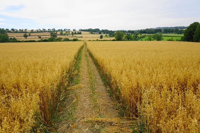
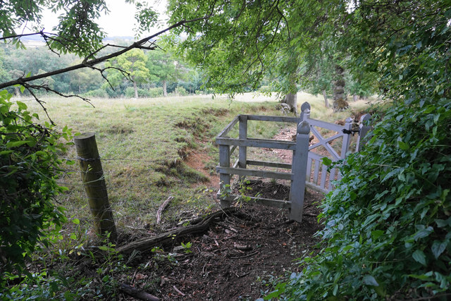
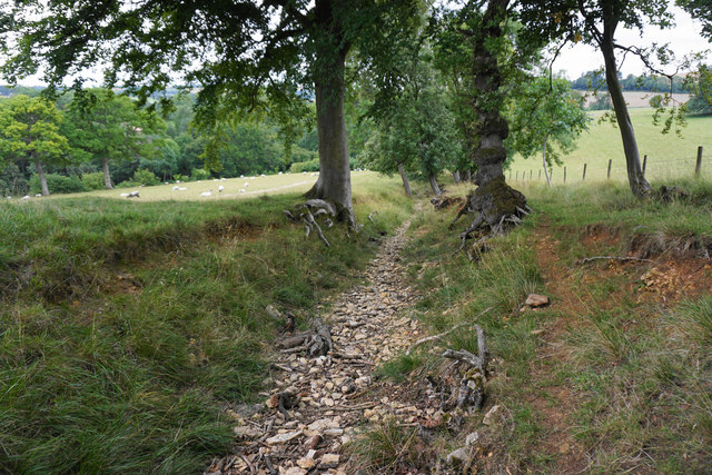
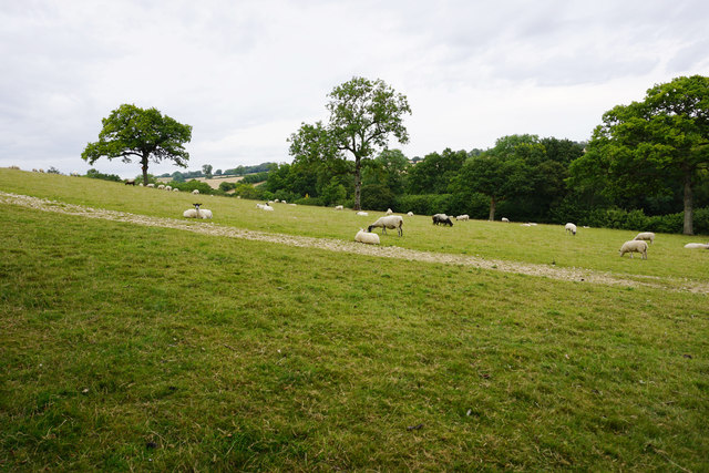
Barton Images

Images are sourced within 2km of 51.926451/-1.858032 or Grid Reference SP0925. Thanks to Geograph Open Source API. All images are credited.

Guiting Power Baptist Church The church was closed and put on the market earlier this year, but I don't know whether a sale successfully went through. The building is Grade II listed.
Guiting Power Baptist Church
The church was closed and put on the market earlier this year, but I don't know whether a sale successfully went through. The building is Grade II listed.
War memorial in Guiting Power Situated on the village green.
War memorial in Guiting Power
Situated on the village green.
Path to Guiting Power The path is passing through a field of barley. The first part of the village is St Michael and All Angels Church which can be seen in the trees to the right.
Path to Guiting Power
The path is passing through a field of barley. The first part of the village is St Michael and All Angels Church which can be seen in the trees to the right.
Path through a field of oats The path leads to Guiting Power which can be seen on the far slope.
Path through a field of oats
The path leads to Guiting Power which can be seen on the far slope.
From oats to maize A change of crops on the path between Guiting Power and Naunton.
From oats to maize
A change of crops on the path between Guiting Power and Naunton.
Wardens' Way emerging from Guiting Wood The gate is in the locally universal Farmcote Estate livery.
Wardens' Way emerging from Guiting Wood
The gate is in the locally universal Farmcote Estate livery.
Path to Guiting Power The path is following a rough stream bed and it is much easier to walk on the grass up on the left.
Path to Guiting Power
The path is following a rough stream bed and it is much easier to walk on the grass up on the left.
Sheep above Castlett Wood Looking from the Wardens' Way across the hillside above a tributary of the River Windrush.
Sheep above Castlett Wood
Looking from the Wardens' Way across the hillside above a tributary of the River Windrush.
Road towards Farmcote The road is signed as unsuitable for motors though it is marked as yellow on the OS map. Top left is Wood House also known as Manor House, a Grade II listed building.
Road towards Farmcote
The road is signed as unsuitable for motors though it is marked as yellow on the OS map. Top left is Wood House also known as Manor House, a Grade II listed building.
Farm track near Guiting Power Part of the Wardens' Way, heading away from the village.
Farm track near Guiting Power
Part of the Wardens' Way, heading away from the village.
Harvested field above Castlett Farm The farm is in the trees on the other side of a tributary of the River Windrush. I think the last crop in this field was maize.
Harvested field above Castlett Farm
The farm is in the trees on the other side of a tributary of the River Windrush. I think the last crop in this field was maize.
Quarry sheds near Guiting Power Part of a business trying to meet the demand for Cotswold Stone.
Quarry sheds near Guiting Power
Part of a business trying to meet the demand for Cotswold Stone.
Ford over the river near Guiting Power The river is a tributary of the River Windrush, but I have been unable to find a name for it. People crossing by foot can take the small bridge on the left.
Ford over the river near Guiting Power
The river is a tributary of the River Windrush, but I have been unable to find a name for it. People crossing by foot can take the small bridge on the left.
Path to Guiting Power The path is climbing out of a small river valley.
Path to Guiting Power
The path is climbing out of a small river valley.
The Wardens' Way leaving Guiting Power This is the end of a dead-end residential road.
The Wardens' Way leaving Guiting Power
This is the end of a dead-end residential road.
Allotments at Guiting Power
The Hollow Bottom, Guiting Power This pub in the Cotswold village of Guiting Power has the unusual name "The Hollow Bottom". It has quite a horse-racing theme inside and is distinctly contemporary in décor. Their own website here <span class="nowrap"><a title="http://hollowbottom.com" rel="nofollow ugc noopener" href="http://hollowbottom.com">Link</a><img style="margin-left:2px;" alt="External link" title="External link - shift click to open in new window" src="https://s1.geograph.org.uk/img/external.png" width="10" height="10"/></span>
The Hollow Bottom, Guiting Power
This pub in the Cotswold village of Guiting Power has the unusual name "The Hollow Bottom". It has quite a horse-racing theme inside and is distinctly contemporary in décor. Their own website here LinkExternal link
The Hollow Bottom
The Hollow Bottom
Show me another place!

Barton is located at Grid Ref: SP0925 (Lat: 51.926451, Lng: -1.858032)

Administrative County: Gloucestershire

District: Cotswold

Police Authority: Gloucestershire

What 3 Words

///timidly.detonated.tonality. Near Westfield, Gloucestershire

Nearby Locations

Barton

Related Wikis

Barton, Gloucestershire

Barton is a village in Gloucestershire, on the Windrush River, near Naunton. It appears in written records as Berton as early as 1287. == References... ==

St Michael's and All Angels Church, Guiting Power

St Michael's and All Angels Church is in the village of Guiting Power, Gloucestershire, England. It is an active Anglican parish church in the deanery...

Lark Wood

Lark Wood (grid reference SP104262) is a 1.11-hectare (2.7-acre) biological Site of Special Scientific Interest in Gloucestershire, notified in 1974. The...

Guiting Power

Guiting Power is a village and civil parish in the Cotswolds, in Gloucestershire, England. The population of the parish at the 2011 census was 296.Guiting...

Barton Bushes

Barton Bushes (grid reference SP110259) is a 5.7-hectare (14-acre) biological Site of Special Scientific Interest in Gloucestershire, notified in 1996...

Temple Guiting Preceptory

Temple Guiting Preceptory was a medieval monastic house of the Knights Templar in Gloucestershire, England. It was founded around the middle of the twelfth...

St Andrew's Church, Naunton

St Andrew's Church is an Anglican parish church in Naunton, Gloucestershire, dedicated to St Andrew the Apostle. == History == Dating from the 13th century...

Temple Guiting

Temple Guiting is a village and civil parish in the Cotswolds, in Gloucestershire, England. The civil parish includes the smaller settlements of Barton...

Nearby Amenities

Located within 500m of 51.926451,-1.858032
Barton
Is In: Gloucestershire, England, UK
Place: hamlet
Source: NPE
Wikidata: Q4865567
Lat/Long: 51.9277826/-1.8537585
Power: pole
Lat/Long: 51.923917/-1.8622604
Power: pole
Lat/Long: 51.9245108/-1.8608952
Power: pole
Lat/Long: 51.9251576/-1.8595004
Power: pole
Lat/Long: 51.9262294/-1.8590525
Power: pole
Lat/Long: 51.9273889/-1.8585348
Barton House Barn
Power: pole
Transformer: distribution
Voltage Primary: 11000
Lat/Long: 51.928421/-1.858964
Power: pole
Lat/Long: 51.9293588/-1.8593422
Power: pole
Lat/Long: 51.9303677/-1.8597633
Addr City: Cheltenham
Addr Housename: Barton Farm
Addr Postcode: GL54 5UF
Addr Street: Temple Guiting Road
Addr Village: Guiting Power
Source: survey
Lat/Long: 51.9277919/-1.855881
Post Box
Collection Times: Mo-Fr 09:00; Sa 07:00; Su off
Drive Through: no
Operator: Royal Mail
Post Box Mounting: pier
Post Box Type: lamp
Ref: GL54 151D
Royal Cypher: EIIR
Royal Cypher Wikidata: Q33102113
Source: survey
Lat/Long: 51.9278812/-1.8565596
Barton Farm
Power: pole
Transformer: distribution
Voltage Primary: 11000
Lat/Long: 51.9288295/-1.8574029
Castlett Mill Farm
Power: pole
Transformer: distribution
Voltage Primary: 11000
Lat/Long: 51.9282655/-1.8632019
Moor Cottage
Power: pole
Transformer: distribution
Voltage Primary: 11000
Lat/Long: 51.923049/-1.8575954
Power: pole
Lat/Long: 51.9222091/-1.8577744
Guiting Power Sewage Works
Power: pole
Transformer: distribution
Voltage Primary: 11000
Lat/Long: 51.922659/-1.8613887
The data included in this document is from www.openstreetmap.org. The data is made available under ODbL.

Have you been to Barton?

Leave your review of Barton below (or comments, questions and feedback).