Oxteddle Bottom

Valley in Sussex Lewes

England

Oxteddle Bottom

The descent View downhill from the permissive footpath on the Glynde estate from the village to Saxon Down.  The deeply incised character of the track suggests this is a long-established route over Saxon Down from Glynde to Lewes.
The descent Credit: Hugh Craddock

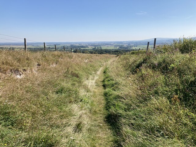
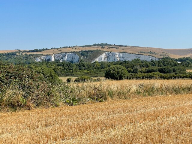
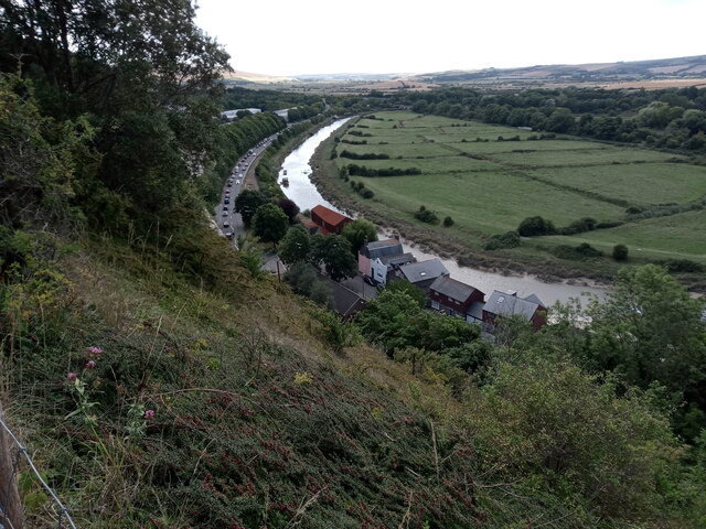
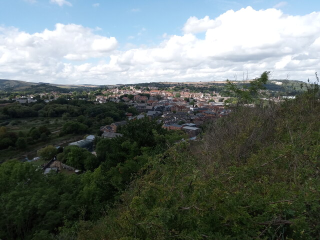
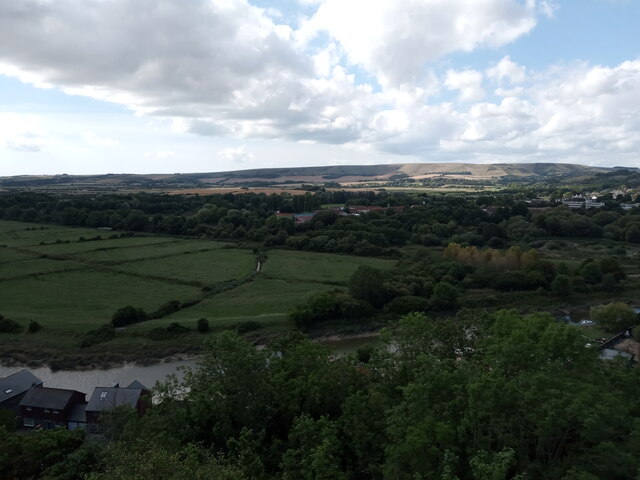
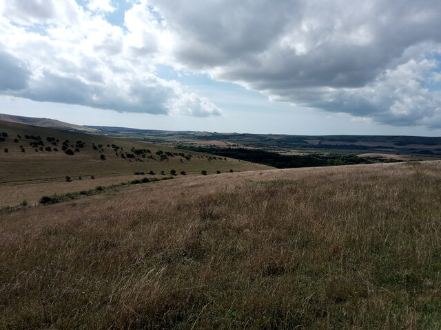
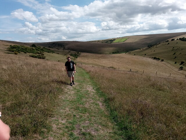
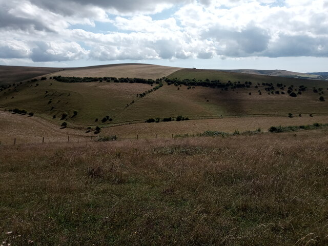
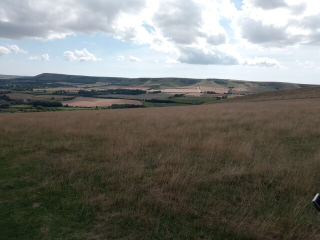
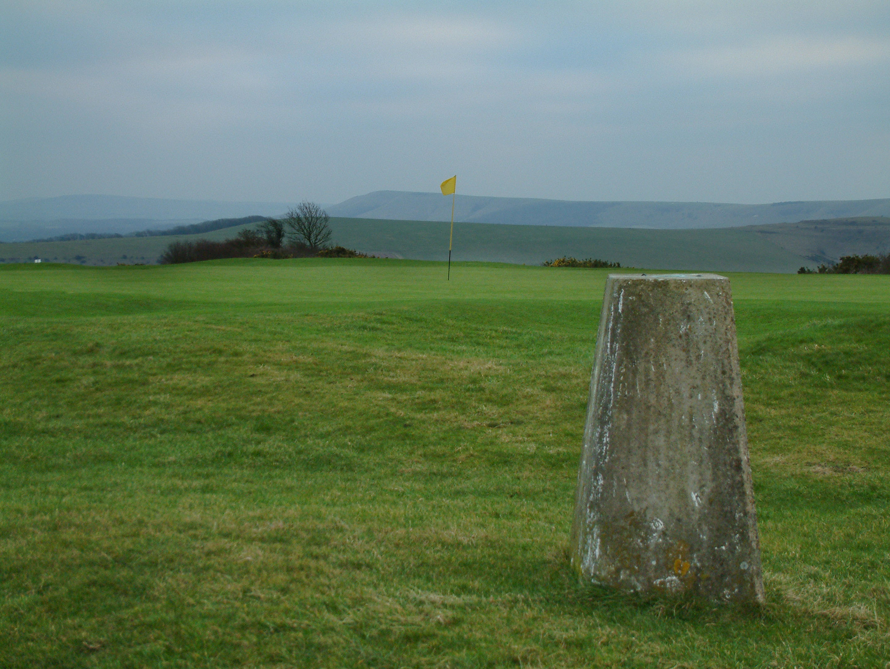
Oxteddle Bottom is a picturesque valley located in the county of Sussex, England. Nestled between rolling hills and surrounded by lush greenery, this idyllic spot is renowned for its natural beauty and tranquil atmosphere. The valley stretches for approximately 2 miles, offering visitors a peaceful retreat away from the hustle and bustle of city life.

The name "Oxteddle Bottom" is believed to have originated from the Old English term "oxan tæthel," meaning "ox pasture." This suggests that the area was once used for grazing cattle, a tradition that can still be seen in the presence of grazing livestock today.

The valley is home to a diverse range of flora and fauna, making it a haven for nature lovers and wildlife enthusiasts. Walking trails meander through the valley, allowing visitors to explore its enchanting woodlands, wildflower meadows, and babbling brooks. The area is particularly renowned for its vibrant display of bluebells in the spring, attracting photographers and nature enthusiasts from far and wide.

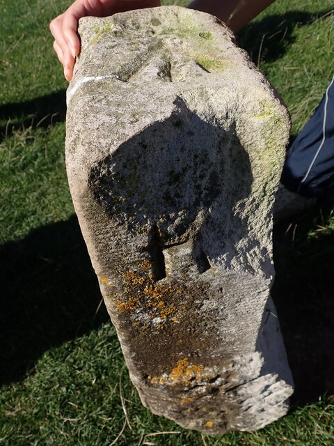
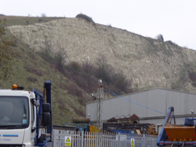
Historically, Oxteddle Bottom has been inhabited for centuries, with evidence of ancient settlements and burial mounds dating back to the Bronze Age. The valley also played a significant role during the Roman period, with remnants of a Roman road found nearby.

Today, Oxteddle Bottom remains a cherished natural gem in Sussex, offering visitors a chance to reconnect with nature, experience stunning landscapes, and immerse themselves in the rich history of the area.

If you have any feedback on the listing, please let us know in the comments section below.

Oxteddle Bottom Images

Images are sourced within 2km of 50.870723/0.040172926 or Grid Reference TQ4309. Thanks to Geograph Open Source API. All images are credited.

The descent View downhill from the permissive footpath on the Glynde estate from the village to Saxon Down.  The deeply incised character of the track suggests this is a long-established route over Saxon Down from Glynde to Lewes.
The descent
View downhill from the permissive footpath on the Glynde estate from the village to Saxon Down. The deeply incised character of the track suggests this is a long-established route over Saxon Down from Glynde to Lewes.
Chandlers Wharf development The re-development of Chandlers Wharf for riverside living
Chandlers Wharf development
The re-development of Chandlers Wharf for riverside living
Chalk cliffs above the A26 south of Lewes Tunnel
View of Old Quarries at Southerham As viewed from the small hill called Upper Rise.
View of Old Quarries at Southerham
As viewed from the small hill called Upper Rise.
View of the River Ouse meandering alongside the A26 near Lewes from the footpath leading from Chapel Hill to Lewes Golf Club Looking south-southeast.
View of the River Ouse meandering alongside the A26 near Lewes from the footpath leading from Chapel Hill to Lewes Golf Club
Looking south-southeast.
View of Lewes from the footpath leading from Chapel Hill to Lewes Golf Club Looking south-southwest.
View of Lewes from the footpath leading from Chapel Hill to Lewes Golf Club
Looking south-southwest.
View over the South Downs from the footpath leading from Chapel Hill to Lewes Golf Club Looking south.
View over the South Downs from the footpath leading from Chapel Hill to Lewes Golf Club
Looking south.
View over the South Downs from the footpath leading from Chapel Hill to Lewes Golf Club #2 Looking south-southwest.
View over the South Downs from the footpath leading from Chapel Hill to Lewes Golf Club #2
Looking south-southwest.
View over the South Downs from the footpath leading from Chapel Hill to Lewes Golf Club #3 Looking south-southeast.
View over the South Downs from the footpath leading from Chapel Hill to Lewes Golf Club #3
Looking south-southeast.
View over Bible Bottom from the path leading from Chapel Hill to Lewes Golf Club Looking south.
View over Bible Bottom from the path leading from Chapel Hill to Lewes Golf Club
Looking south.
View over the South Downs from the footpath leading from Chapel Hill to Lewes Golf Club #4 Looking south-southwest.
View over the South Downs from the footpath leading from Chapel Hill to Lewes Golf Club #4
Looking south-southwest.
View over Glynde from the footpath from Lewes Looking south-southeast.
View over Glynde from the footpath from Lewes
Looking south-southeast.
View over Glynde from the footpath from Lewes #2 Looking south-southeast.
View over Glynde from the footpath from Lewes #2
Looking south-southeast.
Old Boundary Marker at Saxon Cross Parish Boundary Marker at Saxon Cross, found fallen beside a footpath on Saxon Down between the opera house and a golf club. Inscribed G, M and R on three faces. On the former boundary of Glynde, South Malling and Ringmer parishes, then Glynde, South Malling Without and Ringmer parishes from 1894, but since 1984 just Glynd and Ringmer parishes. See also <a title="https://www.geograph.org.uk/photo/3134471" href="https://www.geograph.org.uk/photo/3134471">Link</a>.

Milestone Society National ID: SX_GLYRIN01pb
Old Boundary Marker at Saxon Cross
Parish Boundary Marker at Saxon Cross, found fallen beside a footpath on Saxon Down between the opera house and a golf club. Inscribed G, M and R on three faces. On the former boundary of Glynde, South Malling and Ringmer parishes, then Glynde, South Malling Without and Ringmer parishes from 1894, but since 1984 just Glynd and Ringmer parishes. See also Link. Milestone Society National ID: SX_GLYRIN01pb
Harvey's Brewery in Lewes The signs proclaim that Harvey's have been brewing since 1790, but the building here is from 1881. Seen from the pedestrian bridge over the River Ouse.
Harvey's Brewery in Lewes
The signs proclaim that Harvey's have been brewing since 1790, but the building here is from 1881. Seen from the pedestrian bridge over the River Ouse.
Harvey's Brewery Shop On the corner of Cliffe High Street.
Harvey's Brewery Shop
On the corner of Cliffe High Street.
Bridge House in Lewes A number of cottages brought together as one house, and now a link between Harvey's Brewery and the Brewery shop on Cliffe High Street.
Bridge House in Lewes
A number of cottages brought together as one house, and now a link between Harvey's Brewery and the Brewery shop on Cliffe High Street.
Bags of Books Children's bookshop on the corner of Chapel Hill and South Street.
Bags of Books
Children's bookshop on the corner of Chapel Hill and South Street.
Show me another place!

Oxteddle Bottom is located at Grid Ref: TQ4309 (Lat: 50.870723, Lng: 0.040172926)

Administrative County: East Sussex

District: Lewes

Police Authority: Sussex

What 3 Words

///supposing.sobbed.views. Near Lewes, East Sussex

Related Wikis

Lewes Downs

Lewes Downs is a 165-hectare (410-acre) biological Site of Special Scientific Interest east of Lewes in East Sussex. It is a Nature Conservation Review...

Cliffe Hill

Cliffe Hill is a hill to the east of the town of Lewes in East Sussex, England. It is impressive on its western edge, where it looms over Lewes. Its summit...

Southerham Machine Bottom Pit

Southerham Machine Bottom Pit is a 1.8-hectare (4.4-acre) geological Site of Special Scientific Interest in Lewes in the East Sussex. It is a Geological...

Southerham Works Pit

Southerham Works Pit is a 1-hectare (2.5-acre) geological Site of Special Scientific Interest in Lewes in East Sussex. It is a Geological Conservation...

Nearby Amenities

Located within 500m of 50.870723,0.040172926
Barrier: kissing_gate
Source: gps
Lat/Long: 50.8691149/0.04485
Bible Bottom
Place: locality
Lat/Long: 50.8726855/0.0406873
Oxteddle Bottom
Place: locality
Lat/Long: 50.8687994/0.0430714
Barrier: kissing_gate
Lat/Long: 50.868835/0.0445761
Barrier: stile
Lat/Long: 50.8729084/0.0406944
The data included in this document is from www.openstreetmap.org. The data is made available under ODbL.

Have you been to Oxteddle Bottom?

Leave your review of Oxteddle Bottom below (or comments, questions and feedback).