Lime Side

Settlement in Lancashire

England

Lime Side

Royd Mill, Hollinwood A magnificent Edwardian era spinning mill built in 1907 and photographed in 2006. It has now been demolished and the site has been built on. I can no longer work out where the photographers position was as there has been redevelopment of this area in the meantime. The six figure reference for the mill is correct.
Royd Mill, Hollinwood Credit: Chris Allen

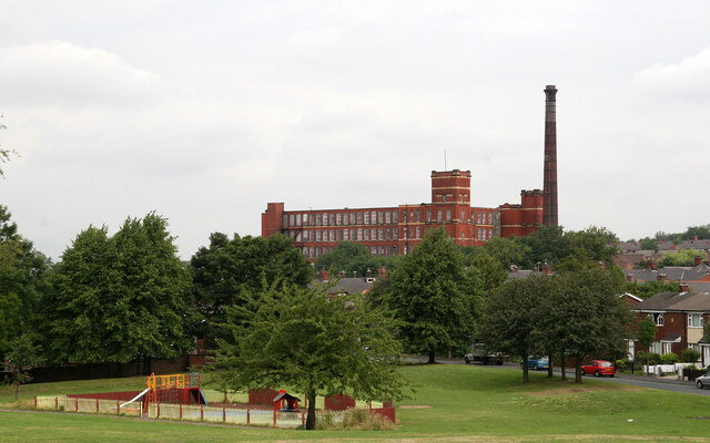
Lime Side is a small village located in the county of Lancashire, in the North West of England. Situated about 3 miles to the east of Oldham, Lime Side falls within the borough of Oldham Metropolitan. The village is nestled in a picturesque setting, surrounded by rolling hills and green fields.

Lime Side is primarily a residential area, consisting mainly of houses and a few local amenities. The village is known for its close-knit community and friendly atmosphere. It offers a tranquil and peaceful environment, making it an attractive place to live for families and those seeking a quieter lifestyle.

Despite its small size, Lime Side benefits from its proximity to larger towns and cities. Oldham, with its shopping centers, entertainment venues, and cultural attractions, is easily accessible by car or public transport. Lime Side also benefits from good transportation links, with several bus routes connecting it to nearby areas.

For outdoor enthusiasts, Lime Side offers plenty of opportunities for exploration and recreation. The surrounding countryside provides a beautiful backdrop for walking, cycling, and enjoying nature. Additionally, Lime Side is within close proximity to the Peak District National Park, offering a wealth of outdoor activities and stunning landscapes to explore.

In conclusion, Lime Side is a charming village in Lancashire, offering a peaceful and close-knit community, beautiful surroundings, and easy access to nearby amenities. It is an ideal place for those seeking a quieter lifestyle while remaining within reach of larger towns and cities.

If you have any feedback on the listing, please let us know in the comments section below.
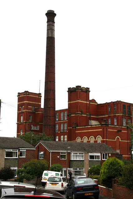
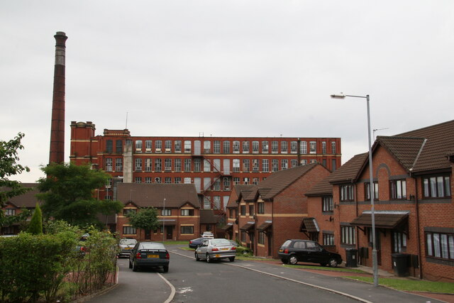
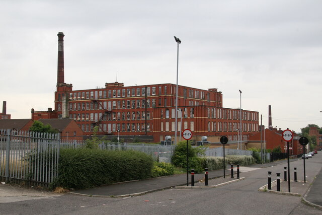
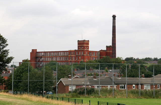
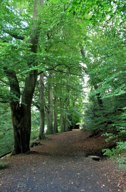
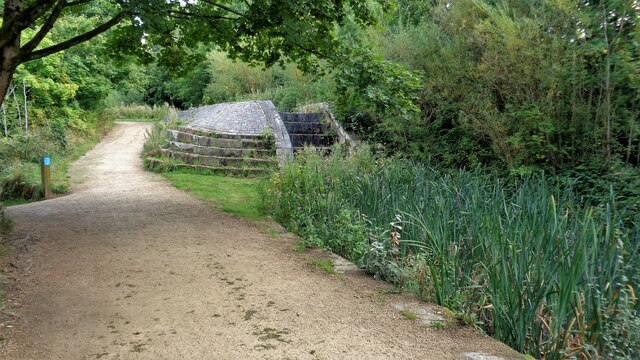
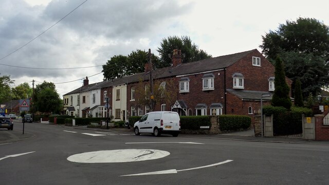
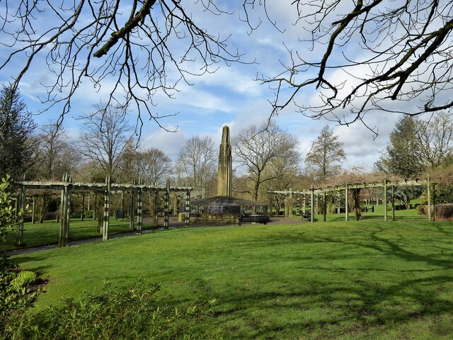
Lime Side Images

Images are sourced within 2km of 53.51694/-2.127405 or Grid Reference SD9102. Thanks to Geograph Open Source API. All images are credited.

Royd Mill, Hollinwood A magnificent Edwardian era spinning mill built in 1907 and photographed in 2006. It has now been demolished and the site has been built on. I can no longer work out where the photographers position was as there has been redevelopment of this area in the meantime. The six figure reference for the mill is correct.
Royd Mill, Hollinwood
A magnificent Edwardian era spinning mill built in 1907 and photographed in 2006. It has now been demolished and the site has been built on. I can no longer work out where the photographers position was as there has been redevelopment of this area in the meantime. The six figure reference for the mill is correct.
Royd Mill, Chamber Road, Hollinwood This mill was built in 1907 and has now been demolished with housing built on the site. This shows the engine house that once held a J & E Wood of Bolton inverted vertical triple expansion steam engine. That was  scrapped long ago but a small steam fire pump survived and is now at the Astley Green Mining Museum site. This was a fine Edwardian era mill and really deserved listing, especially as the chimney survived intact with its oversailing cap.
Royd Mill, Chamber Road, Hollinwood
This mill was built in 1907 and has now been demolished with housing built on the site. This shows the engine house that once held a J & E Wood of Bolton inverted vertical triple expansion steam engine. That was scrapped long ago but a small steam fire pump survived and is now at the Astley Green Mining Museum site. This was a fine Edwardian era mill and really deserved listing, especially as the chimney survived intact with its oversailing cap.
Royd Mill, Hollinwood Seen from about the end of Mulmount Close. The mill was built in 1907 as a cotton spinning mill and has now been replaced by houses.
Royd Mill, Hollinwood
Seen from about the end of Mulmount Close. The mill was built in 1907 as a cotton spinning mill and has now been replaced by houses.
Royd Mill from Armitage Close, Hollinwood The mill was built in 1907 and has now been replaced by undistinguished housing. I was able to locate this shot accurately by the modern housing development. Oldham Council has now produced a plan for the surviving mill stock but this was gone before that.
Royd Mill from Armitage Close, Hollinwood
The mill was built in 1907 and has now been replaced by undistinguished housing. I was able to locate this shot accurately by the modern housing development. Oldham Council has now produced a plan for the surviving mill stock but this was gone before that.
Hawksley Street, Hollinwood The large former cotton spinning mill was built in 1907 as Royd Mill and has now been replaced with housing.
Hawksley Street, Hollinwood
The large former cotton spinning mill was built in 1907 as Royd Mill and has now been replaced with housing.
Royd Mill, Hollinwood Built as a cotton spinning mill in 1907 and since demolished and replaced with houses. A shame it was not listed as it was one of the better Edwardian mills in Oldham. I have struggled to locate the photographer positions and not succeeded with them all.
Royd Mill, Hollinwood
Built as a cotton spinning mill in 1907 and since demolished and replaced with houses. A shame it was not listed as it was one of the better Edwardian mills in Oldham. I have struggled to locate the photographer positions and not succeeded with them all.
Broad Track from Valley Bridge A former carriage drive from the now demolished Riversvale Hall?
Broad Track from Valley Bridge
A former carriage drive from the now demolished Riversvale Hall?
Former Lock No.19 On the Hollinwood Canal with the site of the lower lock gates now a concrete stepped weir
Former Lock No.19
On the Hollinwood Canal with the site of the lower lock gates now a concrete stepped weir
Crime Lake A former supply reservoir for the now abandoned Hollinwood Branch canal. The canal actually passed through the reservoir.
Crime Lake
A former supply reservoir for the now abandoned Hollinwood Branch canal. The canal actually passed through the reservoir.
Terraced Housing, Woodhouses On Ashton Road
Terraced Housing, Woodhouses
On Ashton Road
Music Room awaiting restoration At Werneth Park
Music Room awaiting restoration
At Werneth Park
Memorial to Sarah Lees Historic monument in Werneth Park
Memorial to Sarah Lees
Historic monument in Werneth Park
Werneth Primary School On Coppice Street with its amazing clock tower
Werneth Primary School
On Coppice Street with its amazing clock tower
Heron Mill Viewed from across the playing fields along College Avenue
Heron Mill
Viewed from across the playing fields along College Avenue
Derelict commercial premises The property has some ornate original decoration but old OS maps give no indication of the original purpose of the building. The property is numbered 188-190 Chapel Road at the junction with Jenny Street
Derelict commercial premises
The property has some ornate original decoration but old OS maps give no indication of the original purpose of the building. The property is numbered 188-190 Chapel Road at the junction with Jenny Street
Bridge Works A build of 1909 now occupied by Waterton Laser Profiling on Raymond Avenue. The works backs on to the Metrolink line near South Chadderton station.
Bridge Works
A build of 1909 now occupied by Waterton Laser Profiling on Raymond Avenue. The works backs on to the Metrolink line near South Chadderton station.
Former Albert Mills Now a business centre on Albert Street, Hollinwood
Former Albert Mills
Now a business centre on Albert Street, Hollinwood
A glimpse of a canal footbridge There was once a public footpath under this bridge but it appears to have been extinguished and built over. This glimpse from Albert Street shows the masonry of the ramp up to the iron bridge that crossed the defunct Hollinwood Branch of the Ashton Canal.
A glimpse of a canal footbridge
There was once a public footpath under this bridge but it appears to have been extinguished and built over. This glimpse from Albert Street shows the masonry of the ramp up to the iron bridge that crossed the defunct Hollinwood Branch of the Ashton Canal.
Show me another place!

Lime Side is located at Grid Ref: SD9102 (Lat: 53.51694, Lng: -2.127405)

Unitary Authority: Oldham

Police Authority: Greater Manchester

What 3 Words

///alert.vague.added. Near Oldham, Manchester

Related Wikis

Limeside

Limeside is a large housing estate in Oldham, Lancashire, England, 2 miles south of the town centre in the Hollinwood ward, contiguous with Failsworth...

Oldham Borough F.C.

Oldham Borough F.C. was an English association football club based in Oldham, Greater Manchester, England. The club was founded in 1964 as Oldham Dew F...

Whitebank Stadium

Whitebank Stadium, currently also known as the Vestacare Stadium for sponsorship purposes, is a rugby league and association football stadium which forms...
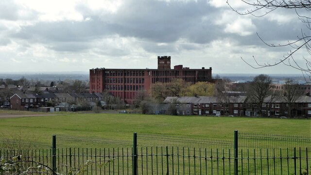
Fox Mill

Fox Mill was a cotton spinning mill in Hollinwood, Oldham, Greater Manchester, England. It was taken over by the Lancashire Cotton Corporation in the 1930s...

Nearby Amenities

Located within 500m of 53.51694,-2.127405
Bus Stop
Limeside, Roman Road / opposite Hollinwood Cemetery
Bus: yes
Naptan AtcoCode: 1800ED10271
Naptan Bearing: NE
Naptan CommonName: Roman Road/Hollinwood Cemetery
Naptan Indicator: Nr Grass Land
Naptan Landmark: HOUSE 459
Naptan NaptanCode: manamjdt
Naptan PlusbusZoneRef: MNCRPIC
Naptan ShortCommonName: Hollinwood Cemete
Naptan Street: ROMAN ROAD
Naptan Verified: no
Network: TfGM
Operator: TfGM
Public Transport: platform
Source: naptan_import
Lat/Long: 53.517979/-2.13346
Bus Stop
Limeside, Elm Road / near Oak Road
Bus: yes
Naptan AtcoCode: 1800ED28791
Naptan Bearing: NE
Naptan CommonName: Elm Road/Oak Road
Naptan Indicator: O/s House 40
Naptan Landmark: HOUSE 40
Naptan NaptanCode: manatmad
Naptan PlusbusZoneRef: MNCRPIC
Naptan ShortCommonName: Oak Road
Naptan Street: ELM ROAD
Naptan Verified: no
Network: TfGM
Operator: TfGM
Public Transport: platform
Source: naptan_import
Lat/Long: 53.5196613/-2.1237672
Bus Stop
Limeside, Elm Road / opposite Oak Road
Bus: yes
Naptan AtcoCode: 1800ED28801
Naptan Bearing: SW
Naptan CommonName: Elm Road/Oak Road
Naptan Indicator: O/s House 63
Naptan Landmark: HOUSES 55
Naptan NaptanCode: manatmag
Naptan PlusbusZoneRef: MNCRPIC
Naptan ShortCommonName: Oak Road
Naptan Street: ELM ROAD
Naptan Verified: no
Network: TfGM
Operator: TfGM
Public Transport: platform
Source: naptan_import
Lat/Long: 53.5194365/-2.1239023
Bus Stop
Limeside, Elm Road / near Acacia Road
Bus: yes
Naptan AtcoCode: 1800ED28811
Naptan Bearing: N
Naptan CommonName: Elm Road/Acacia Road
Naptan Indicator: O/s House 102
Naptan Landmark: HOUSE 102
Naptan NaptanCode: manatmaj
Naptan PlusbusZoneRef: MNCRPIC
Naptan ShortCommonName: Acacia Road
Naptan Street: ELM ROAD
Naptan Verified: no
Network: TfGM
Operator: TfGM
Public Transport: platform
Source: naptan_import
Lat/Long: 53.5169014/-2.1241664
Bus Stop
Limeside, Elm Road / opposite Acacia Road
Bus: yes
Naptan AtcoCode: 1800ED28821
Naptan Bearing: S
Naptan CommonName: Elm Road/Acacia Road
Naptan Indicator: O/s House 139
Naptan Landmark: HOUSE 123
Naptan NaptanCode: manatmam
Naptan PlusbusZoneRef: MNCRPIC
Naptan ShortCommonName: Acacia Road
Naptan Street: ELM ROAD
Naptan Verified: no
Network: TfGM
Operator: TfGM
Public Transport: platform
Source: naptan_import
Lat/Long: 53.5167037/-2.1241055
Bus Stop
Limeside, St Chads Crescent / outside Limehurst School
Bus: yes
Naptan AtcoCode: 1800ED28831
Naptan Bearing: W
Naptan CommonName: St Chads Crescent/Limehurst School
Naptan Indicator: School Fields
Naptan Landmark: SCHOOL GROUNDS
Naptan NaptanCode: manatmap
Naptan PlusbusZoneRef: MNCRPIC
Naptan ShortCommonName: Limehurst School
Naptan Street: St Chads Crescent
Naptan Verified: no
Network: TfGM
Operator: TfGM
Public Transport: platform
Source: naptan_import
Lat/Long: 53.5146613/-2.1260449
Bus Stop
Limeside, Lime Green Road / near Lower Lime Road
Bus: yes
Naptan AtcoCode: 1800ED28841
Naptan Bearing: S
Naptan CommonName: Lime Green Road/Lower Lime Road
Naptan Indicator: School
Naptan Landmark: SCHOOL
Naptan NaptanCode: manatmat
Naptan PlusbusZoneRef: MNCRPIC
Naptan ShortCommonName: Lower Lime Road
Naptan Street: LIME GREEN ROAD
Naptan Verified: no
Network: TfGM
Operator: TfGM
Public Transport: platform
Source: naptan_import
Lat/Long: 53.5135275/-2.1272027
Bus Stop
Limeside, Lime Green Road / opposite Lower Lime Road
Bus: yes
Naptan AtcoCode: 1800ED28851
Naptan Bearing: NE
Naptan CommonName: Lime Green Road/Lower Lime Road
Naptan Indicator: Green
Naptan Landmark: HOUSE 18
Naptan NaptanCode: manatmaw
Naptan PlusbusZoneRef: MNCRPIC
Naptan ShortCommonName: Lower Lime Road
Naptan Street: LIME GREEN ROAD
Naptan Verified: no
Network: TfGM
Operator: TfGM
Public Transport: platform
Source: naptan_import
Lat/Long: 53.5130865/-2.1276387
Bus Stop
Limeside, Elm Road / near St Chads Crescent
Bus: yes
Naptan AtcoCode: 1800ED28881
Naptan Bearing: NE
Naptan CommonName: Elm Road/St Chads Crescent
Naptan Indicator: Post Office
Naptan Landmark: POST OFFICE
Naptan NaptanCode: manatmdm
Naptan PlusbusZoneRef: MNCRPIC
Naptan ShortCommonName: St Chads Crescent
Naptan Street: ELM ROAD
Naptan Verified: no
Network: TfGM
Operator: TfGM
Public Transport: platform
Source: naptan_import
Lat/Long: 53.5154615/-2.1257758
Bus Stop
Limeside, Limeside Road / near Pine Tree Road
Bus: yes
Naptan AtcoCode: 1800ED28891
Naptan Bearing: SE
Naptan CommonName: Limeside Road/Pine Tree Road
Naptan Indicator: O/s Church
Naptan Landmark: CHURCH
Naptan NaptanCode: manatmdp
Naptan Notes: LOCATION AMENDED
Naptan PlusbusZoneRef: MNCRPIC
Naptan ShortCommonName: Pine Tree Road
Naptan Street: LIMESIDE ROAD
Naptan Verified: no
Network: TfGM
Operator: TfGM
Public Transport: platform
Source: naptan_import
Lat/Long: 53.5160236/-2.1297589
Bus Stop
Limeside, Limeside Road / opposite Pine Tree Road
Bus: yes
Naptan AtcoCode: 1800ED28901
Naptan Bearing: NW
Naptan CommonName: Limeside Road/Pine Tree Road
Naptan Indicator: Church Opp
Naptan Landmark: CEMETERY
Naptan NaptanCode: manatmdt
Naptan PlusbusZoneRef: MNCRPIC
Naptan ShortCommonName: Pine Tree Road
Naptan Street: LIMESIDE ROAD
Naptan Verified: no
Network: TfGM
Operator: TfGM
Public Transport: platform
Source: naptan_import
Lat/Long: 53.5156912/-2.1295468
Bus Stop
Limeside, Limeside Road / near Roman Road
Bus: yes
Naptan AtcoCode: 1800ED28911
Naptan Bearing: NW
Naptan CommonName: Limeside Road/Roman Road
Naptan Indicator: Opp House 121
Naptan Landmark: HOUSE 121
Naptan NaptanCode: manatmdw
Naptan Notes: LOCATION AMENDED
Naptan PlusbusZoneRef: MNCRPIC
Naptan ShortCommonName: Roman Road
Naptan Street: LIMESIDE ROAD
Naptan Verified: no
Network: TfGM
Operator: TfGM
Public Transport: platform
Source: naptan_import
Lat/Long: 53.51781/-2.131891
Bus Stop
Limeside Road/Roman Road
Bus: yes
Naptan AtcoCode: 1800ED28921
Naptan Bearing: SE
Naptan CommonName: Limeside Road/Roman Road
Naptan Indicator: O/s House 95
Naptan Landmark: HOUSE 95
Naptan NaptanCode: manatmga
Naptan PlusbusZoneRef: MNCRPIC
Naptan ShortCommonName: Roman Road
Naptan Street: LIMESIDE ROAD
Naptan Verified: no
Network: TfGM
Public Transport: platform
Source: naptan_import
Lat/Long: 53.5185464/-2.1324362
Mini Roundabout
Source: Bing
Lat/Long: 53.5204583/-2.1296297
Lime Gate
Is In: Oldham, Greater Manchester, England, UK
Place: suburb
Source: OS OpenData StreetView
Lat/Long: 53.5181769/-2.1341263
Source: Bing
Lat/Long: 53.5190632/-2.1276242
Source Geometry: Bing
Lat/Long: 53.5190187/-2.1340093
Source Geometry: Bing
Lat/Long: 53.5188815/-2.1340844
Parking
Lat/Long: 53.5190886/-2.1226351
Limeside
Place: suburb
Source: OS_OpenData_StreetView
Lat/Long: 53.51697/-2.1270425
Source Geometry: Bing
Lat/Long: 53.5188065/-2.1341282
Addr Housenumber: 121
Addr Postcode: OL8 3NA
Addr Street: Limeside Road
Source: Naptan
Source Postcode: ONS Postcode Open Data
Lat/Long: 53.5179005/-2.1316212
Addr Housenumber: 95
Addr Postcode: OL8 3NA
Addr Street: Limeside Road
Source: Naptan
Source Postcode: ONS Postcode Open Data
Lat/Long: 53.5185926/-2.1323133
Generator Method: photovoltaic
Generator Output Electricity: yes
Generator Source: solar
Generator Type: solar_photovoltaic_panel
Location: roof
Power: generator
Lat/Long: 53.5189988/-2.133303
Generator Method: photovoltaic
Generator Output Electricity: yes
Generator Source: solar
Generator Type: solar_photovoltaic_panel
Location: roof
Power: generator
Lat/Long: 53.5189382/-2.1332386
Generator Method: photovoltaic
Generator Output Electricity: yes
Generator Source: solar
Generator Type: solar_photovoltaic_panel
Location: roof
Power: generator
Lat/Long: 53.5162172/-2.1274063
Generator Method: photovoltaic
Generator Output Electricity: yes
Generator Source: solar
Generator Type: solar_photovoltaic_panel
Location: roof
Power: generator
Lat/Long: 53.5159891/-2.12827
Golf: pin
Lat/Long: 53.5165286/-2.1201903
The data included in this document is from www.openstreetmap.org. The data is made available under ODbL.

Have you been to Lime Side?

Leave your review of Lime Side below (or comments, questions and feedback).