Lime Gate

Settlement in Lancashire

England

Lime Gate

Royd Mill, Hollinwood A magnificent Edwardian era spinning mill built in 1907 and photographed in 2006. It has now been demolished and the site has been built on. I can no longer work out where the photographers position was as there has been redevelopment of this area in the meantime. The six figure reference for the mill is correct.
Royd Mill, Hollinwood Credit: Chris Allen

Lime Gate is a small village located in the county of Lancashire in North West England. Situated approximately 10 miles east of the city of Preston, Lime Gate is nestled in a picturesque countryside setting with rolling hills and lush green fields surrounding the area.

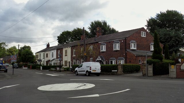
The village is known for its tranquility and charm, providing a peaceful escape from the hustle and bustle of city life. It is home to a close-knit community of residents who take pride in their village and its heritage. Lime Gate retains a traditional feel, with its historic stone buildings, quaint cottages, and a beautiful village green.

The village offers a range of amenities for its residents, including a local pub, a village hall, and a small convenience store. Lime Gate is also served by regular bus services, providing easy access to nearby towns and cities.

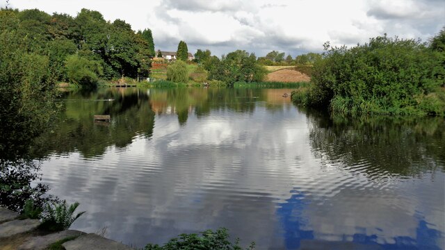
Nature enthusiasts will find plenty to explore in the surrounding area. Lime Gate is situated close to several nature reserves and country parks, offering opportunities for walking, hiking, and birdwatching. The nearby River Ribble is a popular spot for fishing and boating.

Lime Gate is conveniently located for those seeking a rural lifestyle without being too far from urban conveniences. The city of Preston, with its vibrant shopping centers, cultural attractions, and excellent transport links, is just a short drive away.

Overall, Lime Gate offers a peaceful and idyllic setting for those looking to escape the city, while still enjoying the convenience of nearby amenities and attractions.

If you have any feedback on the listing, please let us know in the comments section below.
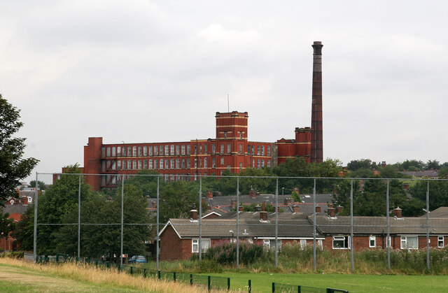
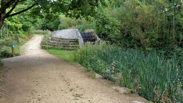
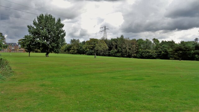
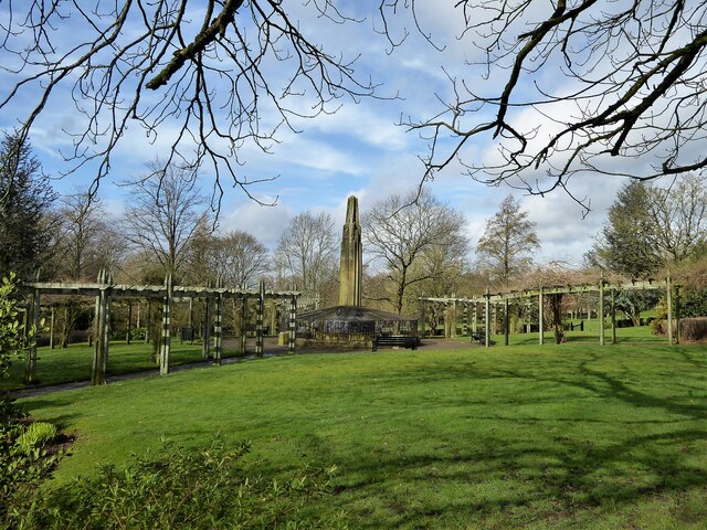
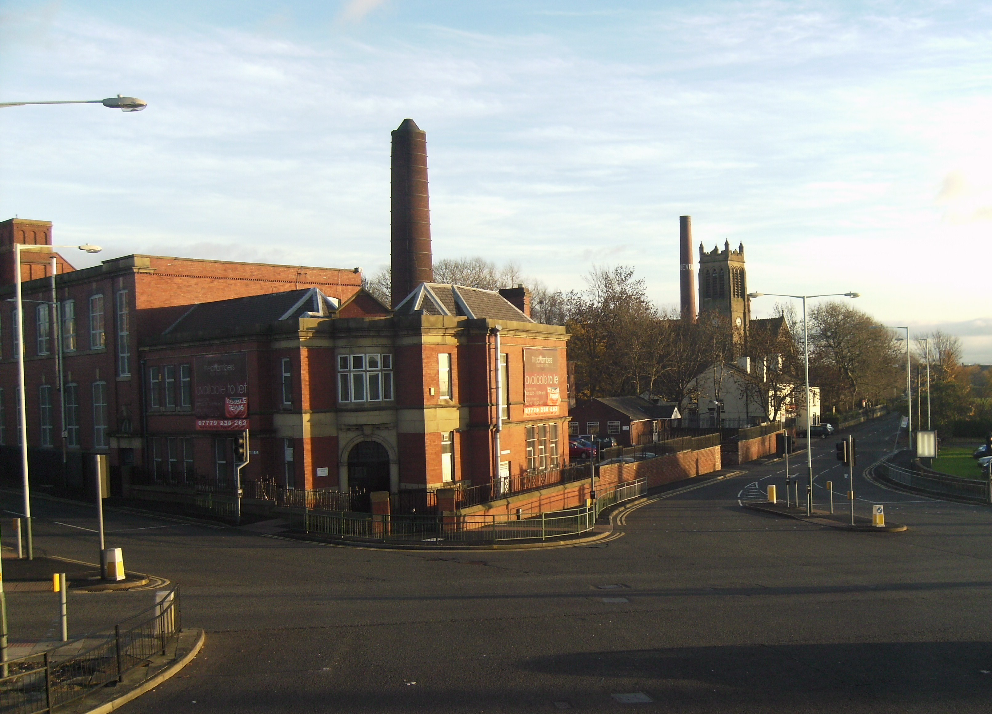
Lime Gate Images

Images are sourced within 2km of 53.517831/-2.134195 or Grid Reference SD9102. Thanks to Geograph Open Source API. All images are credited.

Royd Mill, Hollinwood A magnificent Edwardian era spinning mill built in 1907 and photographed in 2006. It has now been demolished and the site has been built on. I can no longer work out where the photographers position was as there has been redevelopment of this area in the meantime. The six figure reference for the mill is correct.
Royd Mill, Hollinwood
A magnificent Edwardian era spinning mill built in 1907 and photographed in 2006. It has now been demolished and the site has been built on. I can no longer work out where the photographers position was as there has been redevelopment of this area in the meantime. The six figure reference for the mill is correct.
Royd Mill, Chamber Road, Hollinwood This mill was built in 1907 and has now been demolished with housing built on the site. This shows the engine house that once held a J & E Wood of Bolton inverted vertical triple expansion steam engine. That was  scrapped long ago but a small steam fire pump survived and is now at the Astley Green Mining Museum site. This was a fine Edwardian era mill and really deserved listing, especially as the chimney survived intact with its oversailing cap.
Royd Mill, Chamber Road, Hollinwood
This mill was built in 1907 and has now been demolished with housing built on the site. This shows the engine house that once held a J & E Wood of Bolton inverted vertical triple expansion steam engine. That was scrapped long ago but a small steam fire pump survived and is now at the Astley Green Mining Museum site. This was a fine Edwardian era mill and really deserved listing, especially as the chimney survived intact with its oversailing cap.
Royd Mill, Hollinwood Seen from about the end of Mulmount Close. The mill was built in 1907 as a cotton spinning mill and has now been replaced by houses.
Royd Mill, Hollinwood
Seen from about the end of Mulmount Close. The mill was built in 1907 as a cotton spinning mill and has now been replaced by houses.
Royd Mill from Armitage Close, Hollinwood The mill was built in 1907 and has now been replaced by undistinguished housing. I was able to locate this shot accurately by the modern housing development. Oldham Council has now produced a plan for the surviving mill stock but this was gone before that.
Royd Mill from Armitage Close, Hollinwood
The mill was built in 1907 and has now been replaced by undistinguished housing. I was able to locate this shot accurately by the modern housing development. Oldham Council has now produced a plan for the surviving mill stock but this was gone before that.
Hawksley Street, Hollinwood The large former cotton spinning mill was built in 1907 as Royd Mill and has now been replaced with housing.
Hawksley Street, Hollinwood
The large former cotton spinning mill was built in 1907 as Royd Mill and has now been replaced with housing.
Royd Mill, Hollinwood Built as a cotton spinning mill in 1907 and since demolished and replaced with houses. A shame it was not listed as it was one of the better Edwardian mills in Oldham. I have struggled to locate the photographer positions and not succeeded with them all.
Royd Mill, Hollinwood
Built as a cotton spinning mill in 1907 and since demolished and replaced with houses. A shame it was not listed as it was one of the better Edwardian mills in Oldham. I have struggled to locate the photographer positions and not succeeded with them all.
Former Lock No.19 On the Hollinwood Canal with the site of the lower lock gates now a concrete stepped weir
Former Lock No.19
On the Hollinwood Canal with the site of the lower lock gates now a concrete stepped weir
Crime Lake A former supply reservoir for the now abandoned Hollinwood Branch canal. The canal actually passed through the reservoir.
Crime Lake
A former supply reservoir for the now abandoned Hollinwood Branch canal. The canal actually passed through the reservoir.
Terraced Housing, Woodhouses On Ashton Road
Terraced Housing, Woodhouses
On Ashton Road
Brookdale Golf Club Land View from the public footpath that now is curtailed with the removal of Ash Bridge across the River Medlock
Brookdale Golf Club Land
View from the public footpath that now is curtailed with the removal of Ash Bridge across the River Medlock
Music Room awaiting restoration At Werneth Park
Music Room awaiting restoration
At Werneth Park
Memorial to Sarah Lees Historic monument in Werneth Park
Memorial to Sarah Lees
Historic monument in Werneth Park
Werneth Primary School On Coppice Street with its amazing clock tower
Werneth Primary School
On Coppice Street with its amazing clock tower
Heron Mill Viewed from across the playing fields along College Avenue
Heron Mill
Viewed from across the playing fields along College Avenue
Derelict commercial premises The property has some ornate original decoration but old OS maps give no indication of the original purpose of the building. The property is numbered 188-190 Chapel Road at the junction with Jenny Street
Derelict commercial premises
The property has some ornate original decoration but old OS maps give no indication of the original purpose of the building. The property is numbered 188-190 Chapel Road at the junction with Jenny Street
Bridge Works A build of 1909 now occupied by Waterton Laser Profiling on Raymond Avenue. The works backs on to the Metrolink line near South Chadderton station.
Bridge Works
A build of 1909 now occupied by Waterton Laser Profiling on Raymond Avenue. The works backs on to the Metrolink line near South Chadderton station.
Former Albert Mills Now a business centre on Albert Street, Hollinwood
Former Albert Mills
Now a business centre on Albert Street, Hollinwood
A glimpse of a canal footbridge There was once a public footpath under this bridge but it appears to have been extinguished and built over. This glimpse from Albert Street shows the masonry of the ramp up to the iron bridge that crossed the defunct Hollinwood Branch of the Ashton Canal.
A glimpse of a canal footbridge
There was once a public footpath under this bridge but it appears to have been extinguished and built over. This glimpse from Albert Street shows the masonry of the ramp up to the iron bridge that crossed the defunct Hollinwood Branch of the Ashton Canal.
Show me another place!

Lime Gate is located at Grid Ref: SD9102 (Lat: 53.517831, Lng: -2.134195)

Unitary Authority: Oldham

Police Authority: Greater Manchester

What 3 Words

///cars.signal.tinsel. Near Failsworth, Manchester

Related Wikis

Fox Mill

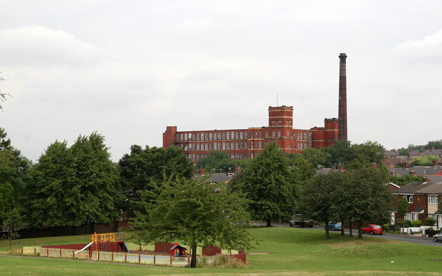
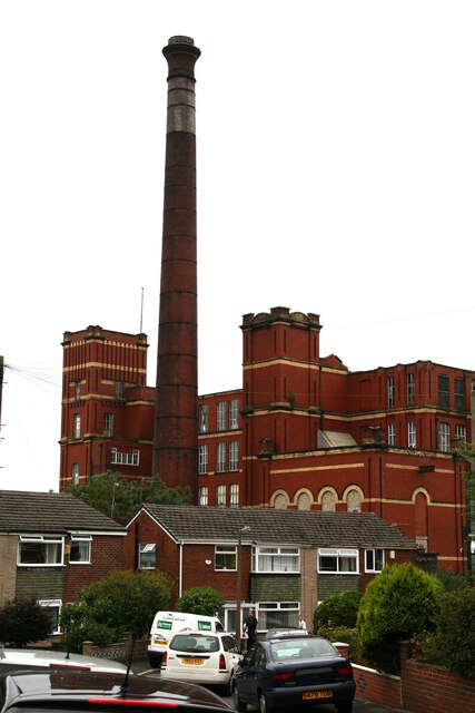
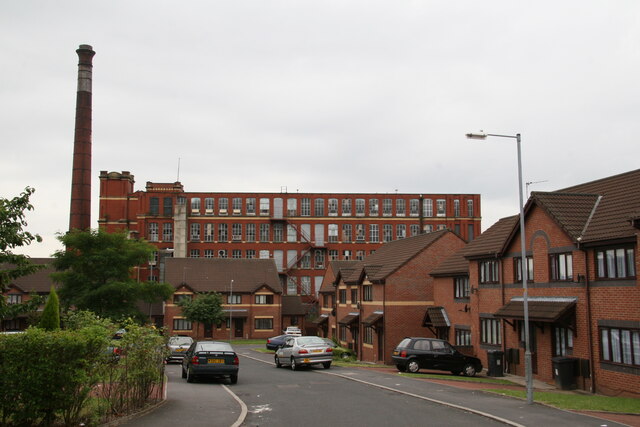
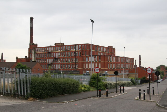
Fox Mill was a cotton spinning mill in Hollinwood, Oldham, Greater Manchester, England. It was taken over by the Lancashire Cotton Corporation in the 1930s...

Kaskenmoor School

Kaskenmoor School was a mixed gender comprehensive secondary school for 11- to 16-year-old children in the Hollinwood area of Oldham in Greater Manchester...

Limeside

Limeside is a large housing estate in Oldham, Lancashire, England, 2 miles south of the town centre in the Hollinwood ward, contiguous with Failsworth...

Hollinwood, Greater Manchester

Hollinwood is an area and electoral ward of the Metropolitan Borough of Oldham, Greater Manchester, England. The population at the 2011 census was 10,920...

Nearby Amenities

Located within 500m of 53.517831,-2.134195
Motorway Junction
Hollinwood Interchange
Ref: 22
Lat/Long: 53.5168168/-2.138921
Bus Stop
Roman Road/Kaskenmoor School
Bus: yes
Naptan AtcoCode: 1800ED05801
Naptan Bearing: SW
Naptan CommonName: Roman Road/Kaskenmoor School
Naptan Indicator: Kaskenmoor Sch
Naptan Landmark: OASIS ACADEMY
Naptan NaptanCode: manamawg
Naptan PlusbusZoneRef: MNCRPIC
Naptan ShortCommonName: Kaskenmoor School
Naptan Street: ROMAN ROAD
Naptan Verified: no
Network: TfGM
Public Transport: platform
Source: naptan_import
Lat/Long: 53.5152211/-2.1399361
Bus Stop
Limeside, Roman Road / opposite Hollinwood Cemetery
Bus: yes
Naptan AtcoCode: 1800ED10271
Naptan Bearing: NE
Naptan CommonName: Roman Road/Hollinwood Cemetery
Naptan Indicator: Nr Grass Land
Naptan Landmark: HOUSE 459
Naptan NaptanCode: manamjdt
Naptan PlusbusZoneRef: MNCRPIC
Naptan ShortCommonName: Hollinwood Cemete
Naptan Street: ROMAN ROAD
Naptan Verified: no
Network: TfGM
Operator: TfGM
Public Transport: platform
Source: naptan_import
Lat/Long: 53.517979/-2.13346
Bus Stop
Hollinwood, Roman Road / outside Holy Family Church
Bus: yes
Naptan AtcoCode: 1800ED14441
Naptan Bearing: NE
Naptan CommonName: Roman Road/Holy Family Church
Naptan Indicator: Holy Family Church
Naptan Landmark: CHURCH
Naptan NaptanCode: mantmwpg
Naptan Notes: New Stop
Naptan ShortCommonName: Holy Family RCC
Naptan Street: ROMAN ROAD
Naptan Verified: no
Network: TfGM
Operator: TfGM
Public Transport: platform
Source: naptan_import
Lat/Long: 53.517069/-2.1354027
Bus Stop
Hollinwood, Hollins Road / outside Tenby Road
Bench: yes
Bus: yes
Naptan AtcoCode: 1800ED19511
Naptan Bearing: E
Naptan CommonName: Hollins Road/Gardeners Rest
Naptan Indicator: Opp House 839
Naptan Landmark: SUB STATION
Naptan NaptanCode: manapwtg
Naptan PlusbusZoneRef: MNCRPIC
Naptan ShortCommonName: Gardeners Rest
Naptan Street: HOLLINS ROAD
Naptan Verified: no
Network: TfGM
Operator: TfGM
Public Transport: platform
Shelter: yes
Source: naptan_import
Lat/Long: 53.5200479/-2.1388864
Bus Stop
Hollinwood, Hollins Road / near Hawthorn Road
Bench: no
Bin: no
Bus: yes
Naptan AtcoCode: 1800ED28221
Naptan Bearing: W
Naptan CommonName: Hollins Road/Gardeners Rest
Naptan Indicator: Reflections Sal
Naptan Landmark: HOUSE 861
Naptan NaptanCode: manatgwg
Naptan PlusbusZoneRef: MNCRPIC
Naptan ShortCommonName: Gardeners Rest
Naptan Street: HOLLINS ROAD
Naptan Verified: no
Network: TfGM
Operator: TfGM
Public Transport: platform
Shelter: no
Source: naptan_import
Lat/Long: 53.5197912/-2.1398794
Bus Stop
Hollins, Hollins Road / opposite Chapel Road
Bench: yes
Bin: yes
Bus: yes
Lit: yes
Naptan AtcoCode: 1800ED28241
Naptan Bearing: W
Naptan CommonName: Hollins Road/Chapel Road
Naptan Indicator: Opp House 760
Naptan Landmark: ASDA
Naptan NaptanCode: manatgwj
Naptan Notes: INDICATOR AMENDED
Naptan PlusbusZoneRef: MNCRPIC
Naptan ShortCommonName: Chapel Road
Naptan Street: HOLLINS ROAD
Naptan Verified: no
Network: TfGM
Operator: TfGM
Public Transport: platform
Shelter: yes
Source: naptan_import
Tactile Paving: no
Lat/Long: 53.5205566/-2.1353535
Bus Stop
Hollins, Hollins Road / near Chapel Road
Bus: yes
Naptan AtcoCode: 1800ED28251
Naptan Bearing: E
Naptan CommonName: Hollins Road/Chapel Road
Naptan Indicator: Os House 706
Naptan Landmark: HOUSE 694
Naptan NaptanCode: manatgwm
Naptan PlusbusZoneRef: MNCRPIC
Naptan ShortCommonName: Chapel Road
Naptan Street: HOLLINS ROAD
Naptan Verified: no
Network: TfGM
Operator: TfGM
Public Transport: platform
Source: naptan_import
Lat/Long: 53.5211249/-2.1336056
Bus Stop
Limeside, Limeside Road / near Pine Tree Road
Bus: yes
Naptan AtcoCode: 1800ED28891
Naptan Bearing: SE
Naptan CommonName: Limeside Road/Pine Tree Road
Naptan Indicator: O/s Church
Naptan Landmark: CHURCH
Naptan NaptanCode: manatmdp
Naptan Notes: LOCATION AMENDED
Naptan PlusbusZoneRef: MNCRPIC
Naptan ShortCommonName: Pine Tree Road
Naptan Street: LIMESIDE ROAD
Naptan Verified: no
Network: TfGM
Operator: TfGM
Public Transport: platform
Source: naptan_import
Lat/Long: 53.5160236/-2.1297589
Bus Stop
Limeside, Limeside Road / opposite Pine Tree Road
Bus: yes
Naptan AtcoCode: 1800ED28901
Naptan Bearing: NW
Naptan CommonName: Limeside Road/Pine Tree Road
Naptan Indicator: Church Opp
Naptan Landmark: CEMETERY
Naptan NaptanCode: manatmdt
Naptan PlusbusZoneRef: MNCRPIC
Naptan ShortCommonName: Pine Tree Road
Naptan Street: LIMESIDE ROAD
Naptan Verified: no
Network: TfGM
Operator: TfGM
Public Transport: platform
Source: naptan_import
Lat/Long: 53.5156912/-2.1295468
Bus Stop
Limeside, Limeside Road / near Roman Road
Bus: yes
Naptan AtcoCode: 1800ED28911
Naptan Bearing: NW
Naptan CommonName: Limeside Road/Roman Road
Naptan Indicator: Opp House 121
Naptan Landmark: HOUSE 121
Naptan NaptanCode: manatmdw
Naptan Notes: LOCATION AMENDED
Naptan PlusbusZoneRef: MNCRPIC
Naptan ShortCommonName: Roman Road
Naptan Street: LIMESIDE ROAD
Naptan Verified: no
Network: TfGM
Operator: TfGM
Public Transport: platform
Source: naptan_import
Lat/Long: 53.51781/-2.131891
Bus Stop
Limeside Road/Roman Road
Bus: yes
Naptan AtcoCode: 1800ED28921
Naptan Bearing: SE
Naptan CommonName: Limeside Road/Roman Road
Naptan Indicator: O/s House 95
Naptan Landmark: HOUSE 95
Naptan NaptanCode: manatmga
Naptan PlusbusZoneRef: MNCRPIC
Naptan ShortCommonName: Roman Road
Naptan Street: LIMESIDE ROAD
Naptan Verified: no
Network: TfGM
Public Transport: platform
Source: naptan_import
Lat/Long: 53.5185464/-2.1324362
Bus Stop
Limeside Road/Side Street
Bus: yes
Naptan AtcoCode: 1800ED28931
Naptan Bearing: SE
Naptan CommonName: Limeside Road/Side Street
Naptan Indicator: Opp House 24
Naptan Landmark: HOUSE 24
Naptan NaptanCode: manatmgd
Naptan PlusbusZoneRef: MNCRPIC
Naptan ShortCommonName: Side Street
Naptan Street: LIMESIDE ROAD
Naptan Verified: no
Network: TfGM
Public Transport: platform
Source: naptan_import
Lat/Long: 53.519965/-2.1338584
Bus Stop
Limeside Road/Hollins Road
Bus: yes
Naptan AtcoCode: 1800ED28941
Naptan Bearing: NW
Naptan CommonName: Limeside Road/Hollins Road
Naptan Indicator: The Sett
Naptan Landmark: ASDA
Naptan NaptanCode: manatmgj
Naptan PlusbusZoneRef: MNCRPIC
Naptan ShortCommonName: Hollins Road
Naptan Street: LIMESIDE ROAD
Naptan Verified: no
Network: TfGM
Public Transport: platform
Source: naptan_import
Lat/Long: 53.5206022/-2.1347805
Bus Stop
Hollins, Hollins Road / near Oak Road
Bench: no
Bin: no
Bus: yes
Naptan AtcoCode: 1800ED28951
Naptan Bearing: W
Naptan CommonName: Hollins Road/Oak Road
Naptan Indicator: O/s House 619
Naptan Landmark: HOUSE 611
Naptan NaptanCode: manatmgm
Naptan PlusbusZoneRef: MNCRPIC
Naptan ShortCommonName: Oak Road
Naptan Street: HOLLINS ROAD
Naptan Verified: no
Network: TfGM
Operator: TfGM
Public Transport: platform
Shelter: no
Source: naptan_import
Lat/Long: 53.5215224/-2.1317969
Bus Stop
Hollinwood, Roman Road / near Lime Lane
Bus: yes
Naptan AtcoCode: 1800ED01301
Naptan Bearing: SW
Naptan CommonName: Roman Road/Lime Lane
Naptan Indicator: Opp House 395
Naptan Landmark: HOUSE 1
Naptan NaptanCode: manajtjd
Naptan PlusbusZoneRef: MNCRPIC
Naptan ShortCommonName: Lime Lane
Naptan Street: ROMAN ROAD
Naptan Verified: no
Network: TfGM
Operator: TfGM
Public Transport: platform
Source: naptan_import
Lat/Long: 53.5165466/-2.136321
Source Geometry: Bing
Lat/Long: 53.5191469/-2.1349339
Mini Roundabout
Source: Bing
Lat/Long: 53.5204583/-2.1296297
Lime Gate
Is In: Oldham, Greater Manchester, England, UK
Place: suburb
Source: OS OpenData StreetView
Lat/Long: 53.5181769/-2.1341263
Source: Bing
Lat/Long: 53.5190632/-2.1276242
Turning Circle
Source: Bing
Lat/Long: 53.5180072/-2.136669
Turning Circle
Lat/Long: 53.5183872/-2.1372451
Turning Circle
Lat/Long: 53.5206882/-2.1388749
Turning Circle
Lat/Long: 53.5205784/-2.1397525
Place Of Worship
Holy Family Church
Denomination: catholic
Religion: christian
Source: NaPTAN
Source Location: OS OpenData StreetView
Lat/Long: 53.5171194/-2.1358851
Addr Housenumber: 395
Source: NaPTAN
Lat/Long: 53.516659/-2.1364671
Source Geometry: Bing
Lat/Long: 53.5190187/-2.1340093
Source Geometry: Bing
Lat/Long: 53.5188815/-2.1340844
Limeside
Place: suburb
Source: OS_OpenData_StreetView
Lat/Long: 53.51697/-2.1270425
Noexit: yes
Lat/Long: 53.5211062/-2.1386013
Noexit: yes
Lat/Long: 53.5193356/-2.1408922
Noexit: yes
Lat/Long: 53.5175864/-2.1363573
Noexit: yes
Lat/Long: 53.5175071/-2.136192
Addr Housenumber: 28
Addr Postcode: OL8 3RG
Addr Street: Knowl Street
Source: local_knowledge
Source Postcode: ONS Postcode Open Data
Lat/Long: 53.5194237/-2.1367743
Addr Housenumber: 2
Addr Postcode: OL8 3RG
Addr Street: Knowl Street
Source: extrapolation
Source Postcode: ONS Postcode Open Data
Lat/Long: 53.5199722/-2.1370448
Addr Housenumber: 40
Addr Postcode: OL8 3RG
Addr Street: Knowl Street
Building: house
Source: local_knowledge
Source Postcode: ONS Postcode Open Data
Lat/Long: 53.5188653/-2.1366041
Addr Housenumber: 31
Addr Postcode: OL8 3RG
Addr Street: Knowl Street
Source: local_knowledge
Source Postcode: ONS Postcode Open Data
Lat/Long: 53.5193931/-2.1364162
Addr Housenumber: 43
Addr Postcode: OL8 3RG
Addr Street: Knowl Street
Building: house
Source: local_knowledge
Source Postcode: ONS Postcode Open Data
Lat/Long: 53.518851/-2.1361026
Addr Housenumber: 32
Addr Postcode: OL8 3RG
Addr Street: Knowl Street
Building: house
Source: local_knowledge
Source Postcode: ONS Postcode Open Data
Lat/Long: 53.5192448/-2.1367812
Addr Housenumber: 41
Addr Postcode: OL8 3RG
Addr Street: Knowl Street
Building: house
Source: local_knowledge
Source Postcode: ONS Postcode Open Data
Lat/Long: 53.5189482/-2.1361562
Addr Housenumber: 30
Addr Postcode: OL8 3RG
Addr Street: Knowl Street
Building: semidetached_house
Source: local_knowledge
Source Postcode: ONS Postcode Open Data
Lat/Long: 53.5193102/-2.1368135
Addr Housenumber: 52
Addr Postcode: OL8 3RG
Addr Street: Knowl Street
Building: house
Source: local_knowledge
Source Postcode: ONS Postcode Open Data
Lat/Long: 53.5183038/-2.1363276
Addr Housenumber: 51
Addr Postcode: OL8 3RG
Addr Street: Knowl Street
Building: house
Source: local_knowledge
Source Postcode: ONS Postcode Open Data
Lat/Long: 53.5185129/-2.1359389
Addr Housenumber: 47
Addr Postcode: OL8 3RG
Addr Street: Knowl Street
Building: house
Source: local_knowledge
Source Postcode: ONS Postcode Open Data
Lat/Long: 53.5186771/-2.136014
Addr Housenumber: 1
Addr Postcode: OL8 3RG
Addr Street: Knowl Street
Source: local_knowledge
Source Postcode: ONS Postcode Open Data
Lat/Long: 53.5200214/-2.1367113
Addr Housenumber: 44
Addr Postcode: OL8 3RG
Addr Street: Knowl Street
Building: house
Source: local_knowledge
Source Postcode: ONS Postcode Open Data
Lat/Long: 53.518674/-2.1365102
Addr Housenumber: 50
Addr Postcode: OL8 3RG
Addr Street: Knowl Street
Building: house
Source: local_knowledge
Source Postcode: ONS Postcode Open Data
Lat/Long: 53.5183614/-2.1363466
Addr Housenumber: 37
Addr Postcode: OL8 3RG
Addr Street: Knowl Street
Building: house
Source: local_knowledge
Source Postcode: ONS Postcode Open Data
Lat/Long: 53.5191157/-2.1362367
Addr Housenumber: 33
Addr Postcode: OL8 3RG
Addr Street: Knowl Street
Building: house
Source: local_knowledge
Source Postcode: ONS Postcode Open Data
Lat/Long: 53.5193008/-2.1363146
Addr Housenumber: 34
Addr Postcode: OL8 3RG
Addr Street: Knowl Street
Building: house
Source: local_knowledge
Source Postcode: ONS Postcode Open Data
Lat/Long: 53.5191252/-2.1367221
Addr Housenumber: 39
Addr Postcode: OL8 3RG
Addr Street: Knowl Street
Building: house
Source: local_knowledge
Source Postcode: ONS Postcode Open Data
Lat/Long: 53.5190168/-2.1361777
Addr Housenumber: 35
Addr Postcode: OL8 3RG
Addr Street: Knowl Street
Building: house
Source: local_knowledge
Source Postcode: ONS Postcode Open Data
Lat/Long: 53.5191842/-2.1362635
Addr Housenumber: 49
Addr Postcode: OL8 3RG
Addr Street: Knowl Street
Building: house
Source: local_knowledge
Source Postcode: ONS Postcode Open Data
Lat/Long: 53.5186165/-2.1359953
Addr Housenumber: 38
Addr Postcode: OL8 3RG
Addr Street: Knowl Street
Building: house
Source: local_knowledge
Source Postcode: ONS Postcode Open Data
Lat/Long: 53.5189291/-2.1366336
Addr Housenumber: 45
Addr Postcode: OL8 3RG
Addr Street: Knowl Street
Building: house
Source: local_knowledge
Source Postcode: ONS Postcode Open Data
Lat/Long: 53.5187791/-2.1360677
Addr Housenumber: 53
Addr Postcode: OL8 3RG
Addr Street: Knowl Street
Building: house
Source: local_knowledge
Source Postcode: ONS Postcode Open Data
Lat/Long: 53.5184411/-2.1359094
Addr Housenumber: 36
Addr Postcode: OL8 3RG
Addr Street: Knowl Street
Building: house
Source: local_knowledge
Source Postcode: ONS Postcode Open Data
Lat/Long: 53.5190567/-2.1366926
Addr Housenumber: 42
Addr Postcode: OL8 3RG
Addr Street: Knowl Street
Building: house
Source: local_knowledge
Source Postcode: ONS Postcode Open Data
Lat/Long: 53.5187409/-2.1365424
Addr Housenumber: 46
Addr Postcode: OL8 3RG
Addr Street: Knowl Street
Building: house
Source: local_knowledge
Source Postcode: ONS Postcode Open Data
Lat/Long: 53.5185463/-2.1364512
Addr Housenumber: 48
Addr Postcode: OL8 3RG
Addr Street: Knowl Street
Building: house
Source: local_knowledge
Source Postcode: ONS Postcode Open Data
Lat/Long: 53.5184874/-2.1364164
Source Geometry: Bing
Lat/Long: 53.5187204/-2.1344581
Source Geometry: Bing
Lat/Long: 53.5188368/-2.134898
Source Geometry: Bing
Lat/Long: 53.5188065/-2.1341282
Source Geometry: Bing
Lat/Long: 53.5186296/-2.1348341
Source Geometry: Bing
Lat/Long: 53.5188336/-2.1348336
Source Geometry: Bing
Lat/Long: 53.5186247/-2.1346539
Source Geometry: Bing
Lat/Long: 53.5186357/-2.1345742
Addr Housenumber: 619
Addr Postcode: OL8 3UT
Addr Street: Hollins Road
Source: Naptan
Source Postcode: ONS Postcode Open Data
Lat/Long: 53.5214439/-2.131691
Addr Housenumber: 706
Addr Postcode: OL8 4JZ
Addr Street: Hollins Road
Source: Naptan
Source Postcode: ONS Postcode Open Data
Lat/Long: 53.5211856/-2.1336597
Addr Housenumber: 121
Addr Postcode: OL8 3NA
Addr Street: Limeside Road
Source: Naptan
Source Postcode: ONS Postcode Open Data
Lat/Long: 53.5179005/-2.1316212
Addr Housenumber: 95
Addr Postcode: OL8 3NA
Addr Street: Limeside Road
Source: Naptan
Source Postcode: ONS Postcode Open Data
Lat/Long: 53.5185926/-2.1323133
Addr Housenumber: 24
Addr Postcode: OL8 3SX
Addr Street: Limeside Road
Source: Naptan
Source Postcode: ONS Postcode Open Data
Lat/Long: 53.5199545/-2.1340674
Addr City: Oldham
Addr Housenumber: 839
Addr Postcode: OL8 3QB
Addr Street: Hollins Road
Lat/Long: 53.519899/-2.138821
5 STAR
Addr City: Oldham
Addr Housenumber: 851
Addr Postcode: OL8 3QB
Addr Street: Hollins Road
Shop: alcohol
Source: interpolation
Source Postcode: FHRS Open Data
Lat/Long: 53.5198333/-2.1393105
Addr City: Oldham
Addr Housenumber: 849
Addr Postcode: OL8 3QB
Addr Street: Hollins Road
Source: interpolation
Source Postcode: ONS Postcode Open Data
Lat/Long: 53.5198433/-2.1392387
Addr City: Oldham
Addr Housenumber: 847
Addr Postcode: OL8 3QB
Addr Street: Hollins Road
Source: interpolation
Source Postcode: ONS Postcode Open Data
Lat/Long: 53.5198537/-2.1391703
Addr City: Oldham
Addr Housenumber: 845
Addr Postcode: OL8 3QB
Addr Street: Hollins Road
Source: interpolation
Source Postcode: ONS Postcode Open Data
Lat/Long: 53.5198585/-2.1391072
Crossing
Crossing: traffic_signals
Crossing Ref: pelican
Source: Bing
Lat/Long: 53.5199344/-2.1391607
Addr City: Oldham
Addr Housenumber: 843
Addr Postcode: OL8 3QB
Addr Street: Hollins Road
Lat/Long: 53.5198783/-2.1389705
Addr City: Oldham
Addr Housenumber: 841
Addr Postcode: OL8 3QB
Addr Street: Hollins Road
Lat/Long: 53.5198881/-2.1388991
Addr Housenumber: 738
Addr Postcode: OL8 4SR
Addr Street: Hollins Road
Source: FHRS Open Data;Bing Streetside
Lat/Long: 53.5201586/-2.1383429
Post Box
Brand: Royal Mail
Brand Wikidata: Q638098
Brand Wikipedia: en:Royal Mail
Collection Times: Mo-Fr 17:00; Sa 11:15
Operator: Royal Mail
Operator Wikidata: Q638098
Post Box Type: pillar
Ref: OL8 47
Royal Cypher: EIIR
Royal Cypher Wikidata: Q33102113
Source: Geograph
Lat/Long: 53.520889/-2.1344738
Crossing
Crossing: uncontrolled
Crossing Markings: zebra
Lat/Long: 53.5149673/-2.1389725
Crossing
Crossing: uncontrolled
Crossing Markings: zebra
Lat/Long: 53.5148774/-2.139657
Crossing
Crossing: uncontrolled
Crossing Markings: zebra
Lat/Long: 53.51497/-2.13937
Generator Method: photovoltaic
Generator Output Electricity: yes
Generator Source: solar
Generator Type: solar_photovoltaic_panel
Location: roof
Power: generator
Lat/Long: 53.5189988/-2.133303
Generator Method: photovoltaic
Generator Output Electricity: yes
Generator Source: solar
Generator Type: solar_photovoltaic_panel
Location: roof
Power: generator
Lat/Long: 53.5189382/-2.1332386
Generator Method: photovoltaic
Generator Output Electricity: yes
Generator Source: solar
Generator Type: solar_photovoltaic_panel
Location: roof
Power: generator
Lat/Long: 53.5165002/-2.1360556
Generator Method: photovoltaic
Generator Output Electricity: yes
Generator Source: solar
Generator Type: solar_photovoltaic_panel
Location: roof
Power: generator
Lat/Long: 53.5165462/-2.135955
Generator Method: photovoltaic
Generator Output Electricity: yes
Generator Source: solar
Generator Type: solar_photovoltaic_panel
Location: roof
Power: generator
Lat/Long: 53.516358/-2.1362768
Generator Method: photovoltaic
Generator Output Electricity: yes
Generator Source: solar
Generator Type: solar_photovoltaic_panel
Location: roof
Power: generator
Lat/Long: 53.5177481/-2.1379391
Generator Method: photovoltaic
Generator Output Electricity: yes
Generator Source: solar
Generator Type: solar_photovoltaic_panel
Location: roof
Power: generator
Lat/Long: 53.5182352/-2.1371855
Generator Method: photovoltaic
Generator Output Electricity: yes
Generator Source: solar
Generator Type: solar_photovoltaic_panel
Location: roof
Power: generator
Lat/Long: 53.5183389/-2.1369592
Generator Method: photovoltaic
Generator Output Electricity: yes
Generator Source: solar
Generator Type: solar_photovoltaic_panel
Location: roof
Power: generator
Lat/Long: 53.5184458/-2.1368734
Generator Method: photovoltaic
Generator Output Electricity: yes
Generator Source: solar
Generator Type: solar_photovoltaic_panel
Location: roof
Power: generator
Lat/Long: 53.5162172/-2.1274063
Generator Method: photovoltaic
Generator Output Electricity: yes
Generator Source: solar
Generator Type: solar_photovoltaic_panel
Location: roof
Power: generator
Lat/Long: 53.5159891/-2.12827
Direction: SSE
Generator Method: photovoltaic
Generator Output Electricity: yes
Generator Solar Modules: 12
Generator Source: solar
Generator Type: solar_photovoltaic_panel
Location: roof
Power: generator
Lat/Long: 53.5209982/-2.1352993
Noexit: yes
Lat/Long: 53.5191219/-2.1394611
Noexit: yes
Lat/Long: 53.5206579/-2.1394876
Barrier: yes
Lat/Long: 53.5213662/-2.1366392
Barrier: yes
Lat/Long: 53.5214213/-2.1364586
Crossing
Crossing: marked
Lat/Long: 53.5210862/-2.1335352
Crossing
Crossing: marked
Crossing Markings: yes
Lat/Long: 53.5207019/-2.1350248
Crossing
Crossing: traffic_signals
Crossing Markings: yes
Lat/Long: 53.520061/-2.1383235
Give Way
Direction: forward
Lat/Long: 53.5197523/-2.1401605
Noexit: yes
Lat/Long: 53.5201175/-2.140284
Noexit: yes
Lat/Long: 53.5201223/-2.1400446
Give Way
Direction: backward
Lat/Long: 53.5198594/-2.1394456
Give Way
Direction: forward
Lat/Long: 53.5199345/-2.1394125
Dentist
M60 Dental Care
Addr City: Oldham
Addr Housenumber: 872-874
Addr Postcode: OL8 4SR
Addr Street: Hollins Road
Healthcare: dentist
Old Amenity: pub
Old Fhrs Id: 117069
Old Name: Gardener's Arms
Source Addr: FHRS Open Data
Source Old Amenity: FHRS Open Data;Bing;Naptan
Lat/Long: 53.5199457/-2.139688
Noexit: yes
Lat/Long: 53.5199275/-2.1398943
Give Way
Direction: forward
Lat/Long: 53.519964/-2.1387013
Give Way
Direction: forward
Lat/Long: 53.5200857/-2.1379489
Noexit: yes
Lat/Long: 53.5207188/-2.1388029
Noexit: yes
Lat/Long: 53.519946/-2.1399941
Addr City: Oldham
Addr Housenumber: 27
Addr Postcode: OL8 4SH
Addr Street: Barmouth Walk
Lat/Long: 53.5199928/-2.1405181
Addr City: Oldham
Addr Housenumber: 28
Addr Postcode: OL8 4SH
Addr Street: Barmouth Walk
Lat/Long: 53.5199725/-2.1404582
Addr City: Oldham
Addr Housenumber: 29
Addr Postcode: OL8 4SH
Addr Street: Barmouth Walk
Lat/Long: 53.5199514/-2.1403997
Addr City: Oldham
Addr Housenumber: 30
Addr Postcode: OL8 4SH
Addr Street: Barmouth Walk
Lat/Long: 53.5199465/-2.1402193
Addr City: Oldham
Addr Housenumber: 31
Addr Postcode: OL8 4SH
Addr Street: Barmouth Walk
Lat/Long: 53.519958/-2.1401558
Addr City: Oldham
Addr Housenumber: 32
Addr Postcode: OL8 4SH
Addr Street: Barmouth Walk
Lat/Long: 53.5199698/-2.1400948
Addr City: Oldham
Addr Housenumber: 33
Addr Postcode: OL8 4SH
Addr Street: Barmouth Walk
Lat/Long: 53.5199765/-2.1400283
Addr City: Oldham
Addr Housenumber: 24
Addr Postcode: OL8 4SH
Addr Street: Barmouth Walk
Lat/Long: 53.5202988/-2.1403618
Addr City: Oldham
Addr Housenumber: 25
Addr Postcode: OL8 4SH
Addr Street: Barmouth Walk
Lat/Long: 53.5202586/-2.1403481
Addr City: Oldham
Addr Housenumber: 26
Addr Postcode: OL8 4SH
Addr Street: Barmouth Walk
Lat/Long: 53.520183/-2.1402972
Noexit: yes
Lat/Long: 53.5191275/-2.1406447
Noexit: yes
Lat/Long: 53.5192601/-2.1404979
Noexit: yes
Lat/Long: 53.5182526/-2.1389878
Noexit: yes
Lat/Long: 53.5189768/-2.1405527
Noexit: yes
Lat/Long: 53.5193384/-2.1396625
Noexit: yes
Lat/Long: 53.5183956/-2.1394388
Noexit: yes
Lat/Long: 53.5195729/-2.1410858
Addr City: Oldham
Addr Housenumber: 9
Addr Postcode: OL8 3QQ
Addr Street: Cardiff Close
Lat/Long: 53.5196368/-2.1406078
Addr City: Oldham
Addr Housenumber: 11
Addr Postcode: OL8 3QQ
Addr Street: Cardiff Close
Lat/Long: 53.5196256/-2.1406862
Addr City: Oldham
Addr Housenumber: 15
Addr Postcode: OL8 3QQ
Addr Street: Cardiff Close
Lat/Long: 53.5196117/-2.1407607
Addr City: Oldham
Addr Housenumber: 17
Addr Postcode: OL8 3QQ
Addr Street: Cardiff Close
Lat/Long: 53.5195977/-2.1408331
Addr City: Oldham
Addr Housenumber: 19
Addr Postcode: OL8 3QQ
Addr Street: Cardiff Close
Lat/Long: 53.5195842/-2.1409042
Addr City: Oldham
Addr Housenumber: 21
Addr Postcode: OL8 3QQ
Addr Street: Cardiff Close
Lat/Long: 53.519569/-2.1409873
Addr City: Oldham
Addr Housenumber: 23
Addr Postcode: OL8 3QQ
Addr Street: Cardiff Close
Lat/Long: 53.5195507/-2.1411006
Addr City: Oldham
Addr Housenumber: 7
Addr Postcode: OL8 3QQ
Addr Street: Cardiff Close
Lat/Long: 53.5196537/-2.1402792
Addr City: Oldham
Addr Housenumber: 5
Addr Postcode: OL8 3QQ
Addr Street: Cardiff Close
Lat/Long: 53.5196079/-2.1402661
Addr City: Oldham
Addr Housenumber: 3
Addr Postcode: OL8 3QQ
Addr Street: Cardiff Close
Lat/Long: 53.5195639/-2.1402461
Addr City: Oldham
Addr Housenumber: 1
Addr Postcode: OL8 3QQ
Addr Street: Cardiff Close
Lat/Long: 53.5195122/-2.1402291
Addr City: Oldham
Addr Housenumber: 8
Addr Postcode: OL8 3QQ
Addr Street: Cardiff Close
Lat/Long: 53.5192941/-2.1406639
Addr City: Oldham
Addr Housenumber: 6
Addr Postcode: OL8 3QQ
Addr Street: Cardiff Close
Lat/Long: 53.5192445/-2.1406456
Addr City: Oldham
Addr Housenumber: 2
Addr Postcode: OL8 3QQ
Addr Street: Cardiff Close
Lat/Long: 53.5193184/-2.1401388
Addr City: Oldham
Addr Housenumber: 4
Addr Postcode: OL8 3QQ
Addr Street: Cardiff Close
Lat/Long: 53.5192363/-2.1401535
Addr City: Oldham
Addr Housenumber: 10
Addr Postcode: OL8 3QQ
Addr Street: Cardiff Close
Lat/Long: 53.5191067/-2.1405599
Addr City: Oldham
Addr Housenumber: 12
Addr Postcode: OL8 3QQ
Addr Street: Cardiff Close
Lat/Long: 53.5191155/-2.1404747
Addr City: Oldham
Addr Housenumber: 14
Addr Postcode: OL8 3QQ
Addr Street: Cardiff Close
Lat/Long: 53.5191259/-2.1403869
Noexit: yes
Lat/Long: 53.5196752/-2.1395539
Give Way
Direction: forward
Lat/Long: 53.5197605/-2.1406019
Addr City: Oldham
Addr Housenumber: 863
Addr Postcode: OL8 3QE
Addr Street: Hollins Road
Lat/Long: 53.519737/-2.1399282
Addr City: Oldham
Addr Housenumber: 861
Addr Postcode: OL8 3QE
Addr Street: Hollins Road
Lat/Long: 53.5197495/-2.1398539
Addr City: Oldham
Addr Housenumber: 859
Addr Postcode: OL8 3QE
Addr Street: Hollins Road
Lat/Long: 53.5197611/-2.1397866
Addr City: Oldham
Addr Housenumber: 857
Addr Postcode: OL8 3QE
Addr Street: Hollins Road
Lat/Long: 53.5197705/-2.1397212
Addr City: Oldham
Addr Housenumber: 855
Addr Postcode: OL8 3QE
Addr Street: Hollins Road
Lat/Long: 53.5197784/-2.1396451
Addr City: Oldham
Addr Housenumber: 853
Addr Postcode: OL8 3QE
Addr Street: Hollins Road
Lat/Long: 53.5197889/-2.139569
Addr City: Oldham
Addr Housenumber: 36
Addr Postcode: OL8 4SF
Addr Street: Cardigan Road
Lat/Long: 53.5200513/-2.140773
Addr City: Oldham
Addr Housenumber: 36
Addr Postcode: OL8 4SH
Addr Street: Barmouth Walk
Lat/Long: 53.5202208/-2.1405984
Addr City: Oldham
Addr Housenumber: 24
Addr Postcode: OL8 3QF
Addr Street: Hawthorn Road
Lat/Long: 53.5188866/-2.1400293
Addr City: Oldham
Addr Housenumber: 22
Addr Postcode: OL8 3QF
Addr Street: Hawthorn Road
Lat/Long: 53.5189381/-2.1400435
Addr City: Oldham
Addr Housenumber: 20
Addr Postcode: OL8 3QF
Addr Street: Hawthorn Road
Lat/Long: 53.5189883/-2.140059
Addr City: Oldham
Addr Housenumber: 18
Addr Postcode: OL8 3QF
Addr Street: Hawthorn Road
Lat/Long: 53.5190433/-2.1400556
Addr City: Oldham
Addr Housenumber: 16
Addr Postcode: OL8 3QF
Addr Street: Hawthorn Road
Lat/Long: 53.5190971/-2.140073
Addr City: Oldham
Addr Housenumber: 1
Addr Postcode: OL8 3QF
Addr Street: Hawthorn Road
Lat/Long: 53.5195634/-2.1399132
Addr City: Oldham
Addr Housenumber: 3
Addr Postcode: OL8 3QF
Addr Street: Hawthorn Road
Lat/Long: 53.5195255/-2.1399065
Addr City: Oldham
Addr Housenumber: 5
Addr Postcode: OL8 3QF
Addr Street: Hawthorn Road
Lat/Long: 53.5194841/-2.1399024
Addr City: Oldham
Addr Housenumber: 7
Addr Postcode: OL8 3QF
Addr Street: Hawthorn Road
Lat/Long: 53.5194462/-2.1398944
Addr City: Oldham
Addr Housenumber: 9
Addr Postcode: OL8 3QF
Addr Street: Hawthorn Road
Lat/Long: 53.5194095/-2.1398877
Addr City: Oldham
Addr Housenumber: 11
Addr Postcode: OL8 3QF
Addr Street: Hawthorn Road
Lat/Long: 53.519372/-2.139881
Addr City: Oldham
Addr Housenumber: 13
Addr Postcode: OL8 3QF
Addr Street: Hawthorn Road
Lat/Long: 53.5193338/-2.1398743
Noexit: yes
Lat/Long: 53.5190904/-2.1394524
Noexit: yes
Lat/Long: 53.5183238/-2.1392956
Noexit: yes
Lat/Long: 53.5190445/-2.1394651
Noexit: yes
Lat/Long: 53.5190372/-2.1395947
Noexit: yes
Lat/Long: 53.5190355/-2.1396782
Addr City: Oldham
Addr Housenumber: 21
Addr Postcode: OL8 3QF
Addr Street: Hawthorn Road
Lat/Long: 53.5190036/-2.1396791
Addr City: Oldham
Addr Housenumber: 23
Addr Postcode: OL8 3QF
Addr Street: Hawthorn Road
Lat/Long: 53.5190092/-2.1395805
Addr City: Oldham
Addr Housenumber: 25
Addr Postcode: OL8 3QF
Addr Street: Hawthorn Road
Lat/Long: 53.5190123/-2.1394913
Noexit: yes
Lat/Long: 53.5206227/-2.1392689
Noexit: yes
Lat/Long: 53.5203427/-2.1400265
Noexit: yes
Lat/Long: 53.5205246/-2.139936
Addr City: Oldham
Addr Housenumber: 23
Addr Postcode: OL8 4SH
Addr Street: Barmouth Walk
Lat/Long: 53.5203945/-2.1403309
Addr City: Oldham
Addr Housenumber: 22
Addr Postcode: OL8 4SH
Addr Street: Barmouth Walk
Lat/Long: 53.5204411/-2.1402973
Addr City: Oldham
Addr Housenumber: 21
Addr Postcode: OL8 4SH
Addr Street: Barmouth Walk
Lat/Long: 53.5204817/-2.1402599
Addr City: Oldham
Addr Housenumber: 20
Addr Postcode: OL8 4SH
Addr Street: Barmouth Walk
Lat/Long: 53.5205153/-2.1402255
Addr City: Oldham
Addr Housenumber: 19
Addr Postcode: OL8 4SH
Addr Street: Barmouth Walk
Lat/Long: 53.5205535/-2.1401905
Addr City: Oldham
Addr Housenumber: 18
Addr Postcode: OL8 4SH
Addr Street: Barmouth Walk
Lat/Long: 53.5206243/-2.1400889
Childcare
Sunny Smiles Day Nursery
Addr City: Oldham
Addr Housenumber: 45
Addr Postcode: OL8 3QF
Addr Street: Hawthorn Road
Lat/Long: 53.5181457/-2.1391041
Addr City: Oldham
Addr Flats: 1-41
Addr Housename: Montgomery House
Addr Postcode: OL8 3QG
Addr Street: Hawthorn Road
Lat/Long: 53.5185312/-2.1393578
Noexit: yes
Lat/Long: 53.5188151/-2.1399142
Noexit: yes
Lat/Long: 53.5193101/-2.1394824
Noexit: yes
Lat/Long: 53.5192559/-2.1394701
Noexit: yes
Lat/Long: 53.5192133/-2.1394656
Noexit: yes
Lat/Long: 53.519141/-2.1390845
Addr City: Oldham
Addr Housenumber: 2
Addr Postcode: OL8 3QD
Addr Street: Withins Road
Lat/Long: 53.519612/-2.1395187
Addr City: Oldham
Addr Housenumber: 4
Addr Postcode: OL8 3QD
Addr Street: Withins Road
Lat/Long: 53.5195667/-2.1395072
Addr City: Oldham
Addr Housenumber: 6
Addr Postcode: OL8 3QD
Addr Street: Withins Road
Lat/Long: 53.5195262/-2.1394913
Addr City: Oldham
Addr Housenumber: 8
Addr Postcode: OL8 3QD
Addr Street: Withins Road
Lat/Long: 53.5194826/-2.1394851
Addr City: Oldham
Addr Housenumber: 10
Addr Postcode: OL8 3QD
Addr Street: Withins Road
Lat/Long: 53.5194436/-2.1394718
Addr City: Oldham
Addr Housenumber: 12
Addr Postcode: OL8 3QD
Addr Street: Withins Road
Lat/Long: 53.5194026/-2.1394674
Addr City: Oldham
Addr Housenumber: 14
Addr Postcode: OL8 3QD
Addr Street: Withins Road
Lat/Long: 53.5193621/-2.1394621
Addr City: Oldham
Addr Housenumber: 16
Addr Postcode: OL8 3QD
Addr Street: Withins Road
Lat/Long: 53.5193011/-2.1395249
Addr City: Oldham
Addr Housenumber: 18
Addr Postcode: OL8 3QD
Addr Street: Withins Road
Lat/Long: 53.5192548/-2.1395143
Addr City: Oldham
Addr Housenumber: 18A
Addr Postcode: OL8 3QD
Addr Street: Withins Road
Lat/Long: 53.519209/-2.139509
Place Of Worship
Beulah Community Church
Addr City: Oldham
Addr Housename: Beulah Community Church
Addr Postcode: OL8 3QD
Addr Street: Withins Road
Denomination: baptist
Religion: christian
Source: local_knowledge
Source Postcode: ONS Postcode Open Data
Lat/Long: 53.519598/-2.1391984
Addr City: Oldham
Addr Housenumber: 15
Addr Postcode: OL8 3QD
Addr Street: Withins Road
Lat/Long: 53.5191702/-2.139155
Addr City: Oldham
Addr Housenumber: 13
Addr Postcode: OL8 3QD
Addr Street: Withins Road
Lat/Long: 53.5192136/-2.1391664
Addr City: Oldham
Addr Housenumber: 11
Addr Postcode: OL8 3QD
Addr Street: Withins Road
Lat/Long: 53.5192555/-2.1391725
Addr City: Oldham
Addr Housenumber: 9
Addr Postcode: OL8 3QD
Addr Street: Withins Road
Lat/Long: 53.5192966/-2.1391852
Noexit: yes
Lat/Long: 53.5198491/-2.1383072
Addr City: Oldham
Addr Housenumber: 837
Addr Postcode: OL8 3PP
Addr Street: Hollins Road
Lat/Long: 53.5199315/-2.1385714
Addr City: Oldham
Addr Housenumber: 833
Addr Postcode: OL8 3PP
Addr Street: Hollins Road
Lat/Long: 53.5199503/-2.1384628
The Doll Academy
Addr City: Oldham
Addr Housenumber: 831
Addr Postcode: OL8 3PP
Addr Street: Hollins Road
Shop: hairdresser
Lat/Long: 53.5199659/-2.1383611
Addr City: Oldham
Addr Housenumber: 829
Addr Postcode: OL8 3PP
Addr Street: Hollins Road
Lat/Long: 53.5199773/-2.1382879
Addr City: Oldham
Addr Housenumber: 825
Addr Postcode: OL8 3PP
Addr Street: Hollins Road
Lat/Long: 53.5199957/-2.1381647
The Ink Suite
Addr City: Oldham
Addr Housenumber: 823
Addr Postcode: OL8 3PP
Addr Street: Hollins Road
Shop: tattoo
Lat/Long: 53.520014/-2.1380615
Parking
Access: customers
Parking: surface
Lat/Long: 53.5157195/-2.1355267
Noexit: yes
Lat/Long: 53.5187212/-2.1374988
Noexit: yes
Lat/Long: 53.5186869/-2.1373647
Noexit: yes
Lat/Long: 53.5186343/-2.1375954
Addr City: Oldham
Addr Housenumber: 821
Addr Postcode: OL8 3PN
Addr Street: Hollins Road
Lat/Long: 53.520057/-2.1378157
Addr City: Oldham
Addr Housenumber: 819
Addr Postcode: OL8 3PN
Addr Street: Hollins Road
Lat/Long: 53.5200701/-2.1377484
Addr City: Oldham
Addr Housenumber: 817
Addr Postcode: OL8 3PN
Addr Street: Hollins Road
Lat/Long: 53.5200812/-2.1376794
Addr City: Oldham
Addr Housenumber: 815
Addr Postcode: OL8 3PN
Addr Street: Hollins Road
Lat/Long: 53.5200891/-2.1376148
Addr City: Oldham
Addr Housenumber: 813
Addr Postcode: OL8 3PN
Addr Street: Hollins Road
Lat/Long: 53.5201006/-2.1375502
Cycleway: asl
Direction: forward
Lat/Long: 53.5206876/-2.1350847
Traffic Signals
Traffic Signals: signal
Traffic Signals Direction: forward
Lat/Long: 53.5206726/-2.1351474
Cycleway: asl
Direction: forward
Lat/Long: 53.5206158/-2.1346859
Traffic Signals
Traffic Signals: signal
Traffic Signals Direction: forward
Lat/Long: 53.5205886/-2.1346491
Traffic Signals
Direction: backward
Traffic Signals: signal
Lat/Long: 53.5208367/-2.1345105
Give Way
Direction: backward
Lat/Long: 53.5209889/-2.1340844
Noexit: yes
Lat/Long: 53.5160199/-2.136208
Traffic Calming: hump
Lat/Long: 53.5153088/-2.1398516
Traffic Calming: hump
Lat/Long: 53.5157816/-2.1385733
Addr City: Oldham
Addr Housenumber: 2
Addr Postcode: OL8 3QA
Addr Street: Montgomery Street
Lat/Long: 53.5197025/-2.138762
Addr City: Oldham
Addr Housenumber: 4
Addr Postcode: OL8 3QA
Addr Street: Montgomery Street
Lat/Long: 53.5196604/-2.1387514
Addr City: Oldham
Addr Housenumber: 6
Addr Postcode: OL8 3QA
Addr Street: Montgomery Street
Lat/Long: 53.5196173/-2.13874
Addr City: Oldham
Addr Housenumber: 8
Addr Postcode: OL8 3QA
Addr Street: Montgomery Street
Lat/Long: 53.5195739/-2.1387259
Addr City: Oldham
Addr Housenumber: 10
Addr Postcode: OL8 3QA
Addr Street: Montgomery Street
Lat/Long: 53.51953/-2.1387152
Addr City: Oldham
Addr Housenumber: 12
Addr Postcode: OL8 3QA
Addr Street: Montgomery Street
Lat/Long: 53.5194909/-2.1387064
Addr City: Oldham
Addr Housenumber: 14
Addr Postcode: OL8 3QA
Addr Street: Montgomery Street
Lat/Long: 53.5194483/-2.1386944
Addr City: Oldham
Addr Housenumber: 16
Addr Postcode: OL8 3QA
Addr Street: Montgomery Street
Lat/Long: 53.5194048/-2.1386796
Addr City: Oldham
Addr Housenumber: 18
Addr Postcode: OL8 3QA
Addr Street: Montgomery Street
Lat/Long: 53.5193614/-2.1386669
Addr City: Oldham
Addr Housenumber: 20
Addr Postcode: OL8 3QA
Addr Street: Montgomery Street
Lat/Long: 53.5193203/-2.1386555
Addr City: Oldham
Addr Housenumber: 22
Addr Postcode: OL8 3QA
Addr Street: Montgomery Street
Lat/Long: 53.5192737/-2.1386447
Addr City: Oldham
Addr Housenumber: 24
Addr Postcode: OL8 3QA
Addr Street: Montgomery Street
Lat/Long: 53.5192298/-2.1386307
Crossing
Crossing: uncontrolled
Crossing Markings: zebra
Lat/Long: 53.5147085/-2.1387144
The data included in this document is from www.openstreetmap.org. The data is made available under ODbL.

Have you been to Lime Gate?

Leave your review of Lime Gate below (or comments, questions and feedback).