The Dell

Valley in Sussex Lewes

England

The Dell

England Coast Path at Telscombe Cliffs, near Newhaven A view of the England Coast Path on the clifftop at Telscombe Cliffs, on the Sussex coast.

This image was taken in July 2022 after a period of hot weather and a prolonged dry spell.  The ground was very dry and grass had turned yellow.
England Coast Path at Telscombe Cliffs, near Newhaven Credit: Malc McDonald

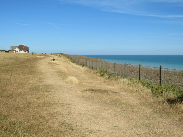
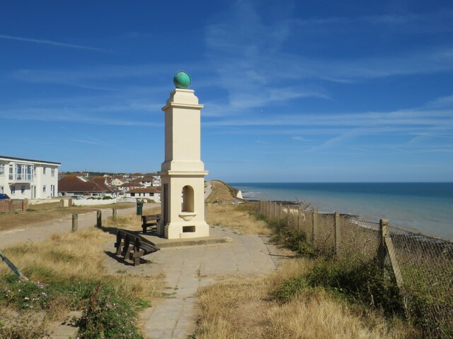
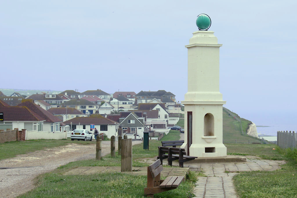
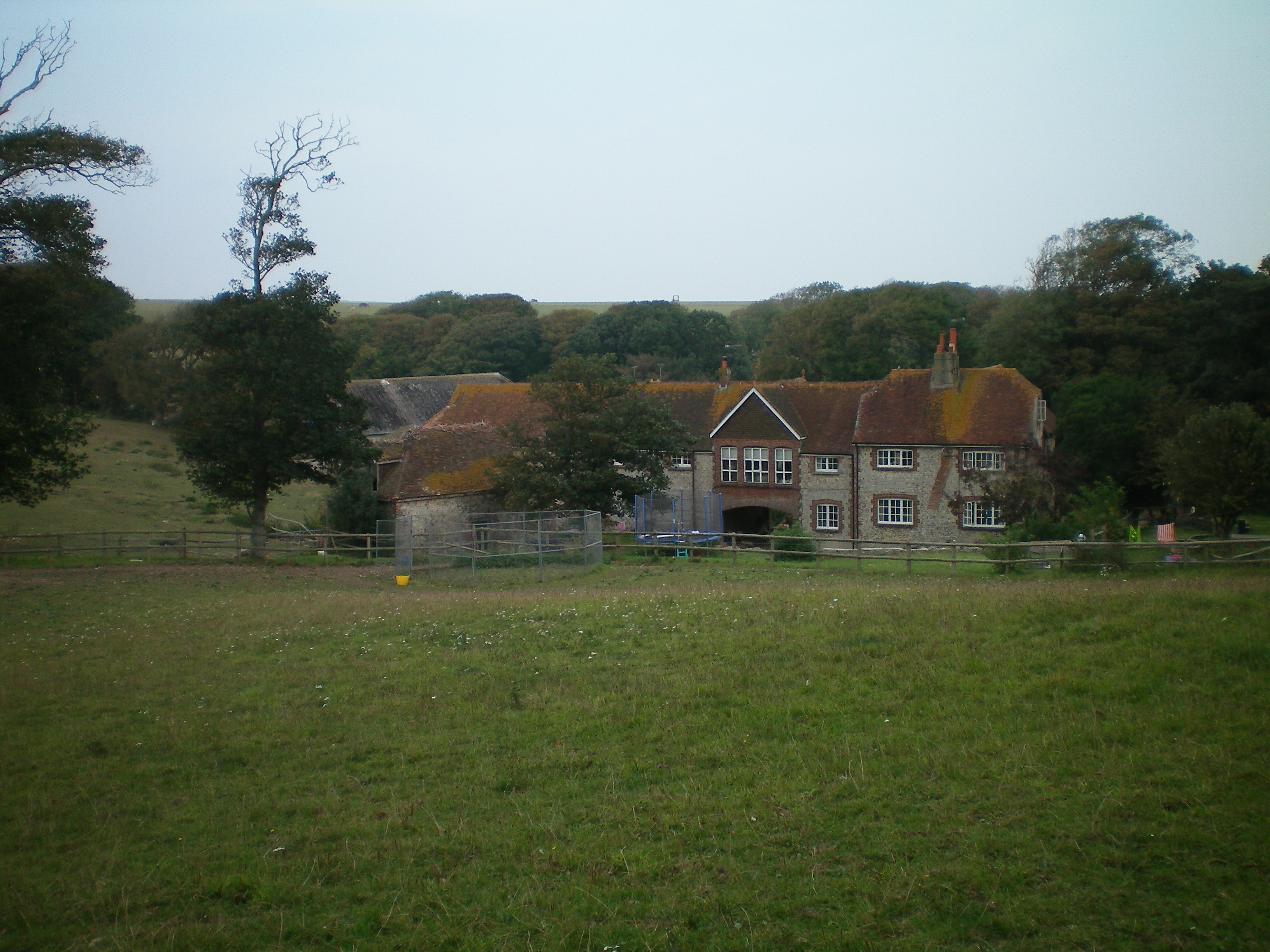
The Dell, Sussex, also known as The Dell Valley, is a picturesque location nestled in the South Downs National Park in southern England. Situated in the county of Sussex, this tranquil valley is known for its natural beauty and scenic views.

The Dell is characterized by its rolling hills, dense woodlands, and meandering streams. The valley is home to an array of flora and fauna, making it an ideal destination for nature enthusiasts and wildlife lovers. Visitors can expect to encounter a variety of bird species, butterflies, wildflowers, and ancient trees that add to the charm of the area.

The Dell offers a range of activities for outdoor enthusiasts. It is a popular spot for hiking, with numerous trails that cater to different fitness levels. The valley also provides opportunities for cycling, horseback riding, and picnicking amidst the serene surroundings.

Historically, The Dell has been a place of significance. It was once part of a large estate and has remnants of old buildings and ruins that date back centuries, adding a touch of mystery and intrigue to the area.

The Dell is easily accessible, with parking facilities available nearby. Visitors can enjoy the peacefulness and tranquility of the valley, immersing themselves in the natural beauty that Sussex has to offer. Whether it's a leisurely stroll, a family outing, or a chance to connect with nature, The Dell, Sussex provides a welcome retreat for all who visit.

If you have any feedback on the listing, please let us know in the comments section below.

The Dell Images

Images are sourced within 2km of 50.790938/-0.004933061 or Grid Reference TQ4000. Thanks to Geograph Open Source API. All images are credited.

England Coast Path at Telscombe Cliffs, near Newhaven A view of the England Coast Path on the clifftop at Telscombe Cliffs, on the Sussex coast.

This image was taken in July 2022 after a period of hot weather and a prolonged dry spell.  The ground was very dry and grass had turned yellow.
England Coast Path at Telscombe Cliffs, near Newhaven
A view of the England Coast Path on the clifftop at Telscombe Cliffs, on the Sussex coast. This image was taken in July 2022 after a period of hot weather and a prolonged dry spell. The ground was very dry and grass had turned yellow.
The Promenade, Telscombe Cliffs, near Newhaven The Promenade is a short stretch of minor road on the clifftop at Telscombe Cliffs, on the Sussex coast.  The road is on the route of the England Coast Path.
The Promenade, Telscombe Cliffs, near Newhaven
The Promenade is a short stretch of minor road on the clifftop at Telscombe Cliffs, on the Sussex coast. The road is on the route of the England Coast Path.
England Coast Path at Telscombe Cliffs, near Newhaven A view of the England Coast Path on the clifftop at Telscombe Cliffs, on the Sussex coast.
England Coast Path at Telscombe Cliffs, near Newhaven
A view of the England Coast Path on the clifftop at Telscombe Cliffs, on the Sussex coast.
Bench and signpost, Peacehaven A bench and signpost on the England Coast Path at Peacehaven, on the Sussex Coast.  This location is on a clifftop, the bench looks out over the English Channel.

The ground was very dry and the grass was yellow when this image was taken.  There had been some extreme hot weather and a prolonged dry spell in the days and weeks beforehand.
Bench and signpost, Peacehaven
A bench and signpost on the England Coast Path at Peacehaven, on the Sussex Coast. This location is on a clifftop, the bench looks out over the English Channel. The ground was very dry and the grass was yellow when this image was taken. There had been some extreme hot weather and a prolonged dry spell in the days and weeks beforehand.
Phyllis Avenue, Peacehaven A modernised house at the end of Phyllis Avenue in Peacehaven, on the Sussex coast.
Phyllis Avenue, Peacehaven
A modernised house at the end of Phyllis Avenue in Peacehaven, on the Sussex coast.
The Promenade, Peacehaven, near Newhaven The Promenade runs a short distance along the clifftop at Peacehaven, on the Sussex coast.  This stretch of road is on the route of the England Coast Path.
The Promenade, Peacehaven, near Newhaven
The Promenade runs a short distance along the clifftop at Peacehaven, on the Sussex coast. This stretch of road is on the route of the England Coast Path.
Hoddern Avenue, Peacehaven Hoddern Avenue is a short residential road close to the clifftop at Peacehaven, on the Sussex coast.  This image was taken in July 2022, during a prolonged spell of dry weather.
Hoddern Avenue, Peacehaven
Hoddern Avenue is a short residential road close to the clifftop at Peacehaven, on the Sussex coast. This image was taken in July 2022, during a prolonged spell of dry weather.
England Coast Path at Peacehaven, near Newhaven The England Coast Path clings to the clifftop at Peacehaven, on the Sussex coast.
England Coast Path at Peacehaven, near Newhaven
The England Coast Path clings to the clifftop at Peacehaven, on the Sussex coast.
Roderick Avenue, Peacehaven Roderick Avenue is a minor residential road leading to and from the clifftop at Peacehaven on the Sussex coast.
Roderick Avenue, Peacehaven
Roderick Avenue is a minor residential road leading to and from the clifftop at Peacehaven on the Sussex coast.
The Promenade, Peacehaven, near Newhaven The Promenade runs along part of the clifftop at Peacehaven, on the Sussex coast.  It forms part of the route of the England Coast Path.
The Promenade, Peacehaven, near Newhaven
The Promenade runs along part of the clifftop at Peacehaven, on the Sussex coast. It forms part of the route of the England Coast Path.
Greenwich Meridian Memorial, Peacehaven Where east meets west.  At Peacehaven on the Sussex coast, the Greenwich Meridian leaves England and heads southwards across the English Channel to France.  Here it is marked with a monument, dating from 1936, which also commemorates the reign of King George V.

The line of the meridian can be seen crossing the road, to the bottom left of the image.

The minor road passing the memorial is on the route of the England Coast Path.
Greenwich Meridian Memorial, Peacehaven
Where east meets west. At Peacehaven on the Sussex coast, the Greenwich Meridian leaves England and heads southwards across the English Channel to France. Here it is marked with a monument, dating from 1936, which also commemorates the reign of King George V. The line of the meridian can be seen crossing the road, to the bottom left of the image. The minor road passing the memorial is on the route of the England Coast Path.
Greenwich Meridian Memorial, Peacehaven Where east meets west.  At Peacehaven on the Sussex coast, the Greenwich Meridian leaves England and heads southwards across the English Channel to France.  Here it is marked with a monument, dating from 1936, which also commemorates the reign of King George V.

The line of the meridian is marked on the ground, in front of and behind the memorial.

The memorial is on the route of the England Coast Path.
Greenwich Meridian Memorial, Peacehaven
Where east meets west. At Peacehaven on the Sussex coast, the Greenwich Meridian leaves England and heads southwards across the English Channel to France. Here it is marked with a monument, dating from 1936, which also commemorates the reign of King George V. The line of the meridian is marked on the ground, in front of and behind the memorial. The memorial is on the route of the England Coast Path.
South Coast Road, Peacehaven South Coast Road is on the route of the A259 as it passes through Peacehaven, on the Sussex coast.
South Coast Road, Peacehaven
South Coast Road is on the route of the A259 as it passes through Peacehaven, on the Sussex coast.
South Coast Road, Peacehaven South Coast Road is on the route of the A259 as it passes through Peacehaven on the Sussex coast.
South Coast Road, Peacehaven
South Coast Road is on the route of the A259 as it passes through Peacehaven on the Sussex coast.
Greenwich Meridian Memorial, Peacehaven Where east meets west.  At Peacehaven on the Sussex coast, the Greenwich Meridian leaves England and heads southwards across the English Channel to France.  Here it is marked with a monument, dating from 1936, which also commemorates the reign of King George V.

The memorial is on the route of the England Coast Path.
Greenwich Meridian Memorial, Peacehaven
Where east meets west. At Peacehaven on the Sussex coast, the Greenwich Meridian leaves England and heads southwards across the English Channel to France. Here it is marked with a monument, dating from 1936, which also commemorates the reign of King George V. The memorial is on the route of the England Coast Path.
Beach access Beach access below Howard Park in Peacehaven.
Beach access
Beach access below Howard Park in Peacehaven.
Beach access Beach access below Howard Park in Peacehaven.
Beach access
Beach access below Howard Park in Peacehaven.
Beach access Beach access below Howard Park in Peacehaven with houses on The Promenade and Cairo Avenue South in the background.
Beach access
Beach access below Howard Park in Peacehaven with houses on The Promenade and Cairo Avenue South in the background.
Show me another place!

The Dell is located at Grid Ref: TQ4000 (Lat: 50.790938, Lng: -0.004933061)

Administrative County: East Sussex

District: Lewes

Police Authority: Sussex

What 3 Words

///select.cupboards.inflict. Near Peacehaven, East Sussex

Nearby Locations

The Dell

Related Wikis

Peacehaven Community School

Peacehaven Community School is a mixed secondary school for 11 to 16-year-olds in Peacehaven, East Sussex in the United Kingdom. The school was opened...

Peacehaven

Peacehaven is a town and civil parish in the Lewes district of East Sussex, England. It is located above the chalk cliffs of the South Downs approximately...

Peacehaven & Telscombe F.C.

Peacehaven & Telscombe Football Club is a football club based in Peacehaven, East Sussex, England. The club is affiliated to the Sussex County Football...

Telscombe

Telscombe is a town and civil parish in the Lewes District of East Sussex, England. It consists of three distinct settlements, separated from each other...

Nearby Amenities

Located within 500m of 50.790938,-0.004933061
Traffic Signals
Lat/Long: 50.7948104/-0.0032334
Barrier: bollard
Bollard: fixed
Lat/Long: 50.7927024/-0.0065459
Meridian Monument
Historic: monument
Lat/Long: 50.7896798/-0.0015817
Parking
Lat/Long: 50.7905958/-0.0042272
Pub
The Dewdrop Inn
Addr City: Peacehaven
Addr Housenumber: 19
Addr Postcode: BN10 8LT
Addr Street: Steyning Avenue
Fhrs Id: 170600
Fhrs Local Authority Id: PI/000018018
Source Addr: FHRS Open Data
Lat/Long: 50.7903701/0.0020649
Crossing
Crossing Island: yes
Lat/Long: 50.7909629/0.0012992
Atm
Operator: Barclays Bank PLC
Lat/Long: 50.7918042/-0.002476
Toilets
Lat/Long: 50.7918832/-0.0027795
Cycleway: asl
Lat/Long: 50.794713/-0.0032807
Cycleway: asl
Lat/Long: 50.794858/-0.0034431
Cycleway: asl
Lat/Long: 50.7949116/-0.0031752
Leisure: playground
Lat/Long: 50.792022/-0.0054844
Bus Stop
Roderick Avenue
Bench: yes
Bus: yes
Naptan AtcoCode: 1400LE0124
Naptan NaptanCode: esuamgap
Public Transport: platform
Seats: 3
Shelter: yes
Shelter Type: public_transport
Source: gps
Wheelchair: yes
Lat/Long: 50.7914306/-0.0022848
Bus Stop
Roderick Avenue
Bus: yes
Naptan AtcoCode: 1400LE0125
Naptan NaptanCode: esuamgat
Public Transport: platform
Wheelchair: yes
Lat/Long: 50.7915029/-0.0021184
Bus Stop
Meridian Court
Bus: yes
Naptan AtcoCode: 1400LE0162
Naptan NaptanCode: esuamgtw
Public Transport: platform
Lat/Long: 50.7934022/-0.0039079
Bus Stop
Bramber Avenue
Bench: yes
Bus: yes
Public Transport: platform
Seats: 3
Shelter: yes
Shelter Type: public_transport
Source: gps
Lat/Long: 50.7909104/0.0016217
Bus Stop
Hoddern Avenue
Bus: yes
Public Transport: platform
Lat/Long: 50.7923673/-0.0060897
Bus Stop
Lincoln Avenue
Bus: yes
Public Transport: platform
Lat/Long: 50.7933401/-0.0100302
Bus Stop
Bramber Avenue
Bus: yes
Public Transport: platform
Lat/Long: 50.7910095/0.0016699
Bus Stop
Hoddern Avenue
Bus: yes
Public Transport: platform
Seats: 3
Shelter: yes
Shelter Type: public_transport
Lat/Long: 50.7924466/-0.0071181
Bus Stop
Meridian Court
Bus: yes
Public Transport: platform
Lat/Long: 50.7936209/-0.003972
Post Box
Collection Times: Mo-Fr 16:45; Sa 12:15
Operator: Royal Mail
Operator Wikidata: Q638098
Post Box Design: type_k
Post Box Type: pillar
Ref: BN10 644
Royal Cypher: EIIR
Royal Cypher Wikidata: Q33102113
Lat/Long: 50.7911837/0.0003689
Atm
Check Date: 2022-07-20
Operator: Sainsbury's Bank
Source: &bmForm=store_details
Lat/Long: 50.7911291/0.0005402
The Dell
Leisure: park
Lat/Long: 50.7906681/-0.0049168
Select Convenience
Brand: Bargain Booze Select Convenience
Brand Wikidata: Q124473514
Shop: supermarket
Lat/Long: 50.7914074/-0.0025284
Your Daily Needs
Addr City: Peacehaven
Addr Housenumber: 234
Addr Postcode: BN10 8JS
Addr Street: South Coast Road
Fhrs Id: 169911
Fhrs Local Authority Id: PI/000016147
Opening Hours: 24/7
Shop: supermarket
Source Addr: FHRS Open Data
Lat/Long: 50.7915584/-0.0020799
Cafe
Coffee Haven
Addr City: Peacehaven
Addr Housenumber: 243
Addr Postcode: BN10 8LD
Addr Street: South Coast Road
Fhrs Id: 169919
Fhrs Local Authority Id: PI/000016159
Source Addr: FHRS Open Data
Lat/Long: 50.7915852/-0.0028616
Noexit: yes
Lat/Long: 50.792029/-0.0029173
Noexit: yes
Lat/Long: 50.7940453/-0.0040675
Noexit: yes
Lat/Long: 50.7925392/-0.0078736
Noexit: yes
Lat/Long: 50.7923985/-0.007941
Noexit: yes
Lat/Long: 50.7925447/-0.0085938
Noexit: yes
Lat/Long: 50.7929047/-0.0072738
Noexit: yes
Lat/Long: 50.7912982/0.0009986
Noexit: yes
Lat/Long: 50.7947406/-0.0016835
Post Box
Collection Times: Mo-Fr 17:15; Sa 11:15
Operator: Royal Mail
Operator Wikidata: Q638098
Post Box Mounting: brick_pillar
Post Box Type: wall
Ref: BN10 629
Royal Cypher: GR
Royal Cypher Wikidata: Q33102273
Lat/Long: 50.7926827/-0.0080768
Post Box
Collection Times: Mo-Fr 16:15; Sa 12:15
Operator: Royal Mail
Post Box Mounting: brick_pillar
Post Box Type: wall
Ref: BN10 643
Royal Cypher: EIIR
Royal Cypher Wikidata: Q33102113
Lat/Long: 50.7920928/-0.0025508
Noexit: yes
Lat/Long: 50.7906753/-0.0006659
Open House Estate Agents
Office: estate_agent
Lat/Long: 50.7912167/0.0001422
Crossing
Crossing: traffic_signals
Lat/Long: 50.791526/-0.00245
Crossing
Crossing Island: yes
Lat/Long: 50.7912216/-0.0011186
Pharmacy
Kamsons Pharmacy
Shop: chemist
Lat/Long: 50.7914409/-0.0026876
Carruthers & Luck Estate Agents Ltd
Office: estate_agent
Lat/Long: 50.7912849/-0.0020787
Fox & Sons
Brand: Fox & Sons
Brand Wikidata: Q81855298
Office: estate_agent
Lat/Long: 50.7912646/-0.0019741
King & Chasemore Lettings
Addr City: Peacehaven
Addr Housenumber: 236
Addr Postcode: BN10 8JS
Addr Street: South Coast Road
Office: estate_agent
Phone: +44 1273803294
Website: https://www.kingandchasemore.co.uk/toletoffice/peacehaven/2071
Lat/Long: 50.7915986/-0.002294
Ladbrokes
Brand: Ladbrokes
Brand Wikidata: Q1799875
Brand Wikipedia: en:Ladbrokes Coral
Shop: bookmaker
Lat/Long: 50.7915041/-0.0018923
Fast Food
Big Mouths
Cuisine: burger
Lat/Long: 50.7910802/-0.0009736
Robinsons
Shop: yes
Lat/Long: 50.7911442/-0.0012895
J. Wagstaff
Shop: funeral_directors
Lat/Long: 50.7912226/-0.0017126
Cubitt & West
Office: estate_agent
Lat/Long: 50.7913273/-0.0022215
Cafe
The Coffee Co
Lat/Long: 50.791532/-0.0029538
Disused Office: business
Old Name: Teale Construction Ltd
Lat/Long: 50.7910717/0.0011916
Disused Amenity: fast_food
Old Name: Curry Hut
Lat/Long: 50.7910819/0.0010809
Dentist
Peacehaven Dental Practice
Lat/Long: 50.7912294/-0.0005257
Ingham & Schofield
Shop: yes
Lat/Long: 50.7913684/-0.0013753
Disused Office: estate_agent
Lat/Long: 50.7913973/-0.0015738
Barwells
Office: estate_agent
Lat/Long: 50.7916647/-0.0025541
Bank
Nationwide
Brand: Nationwide
Brand Wikidata: Q846735
Lat/Long: 50.7918355/-0.003214
Bicycle Parking
Bicycle Parking: stands
Capacity: 6
Covered: no
Fee: no
Lat/Long: 50.7910523/0.0006071
Noexit: yes
Lat/Long: 50.7924471/-0.0050078
Noexit: yes
Lat/Long: 50.7925238/-0.0053874
Crossing
Crossing: traffic_signals
Lat/Long: 50.7947699/-0.0031257
Crossing
Crossing: traffic_signals
Lat/Long: 50.7947978/-0.0031121
Crossing
Crossing: unmarked
Lat/Long: 50.7950762/-0.004181
Crossing
Crossing: unmarked
Lat/Long: 50.7924791/-0.0045418
Crossing
Crossing: traffic_signals
Lat/Long: 50.7948475/-0.0033989
Crossing
Crossing: traffic_signals
Lat/Long: 50.7948829/-0.003192
Crossing
Crossing: traffic_signals
Lat/Long: 50.7947409/-0.0032672
Crossing
Crossing: unmarked
Lat/Long: 50.7945401/-0.0022751
Crossing
Crossing: unmarked
Lat/Long: 50.7927499/-0.004243
Street Lamp
Lamp Mount: straight_mast
Lamp Type: electric
Lat/Long: 50.7954013/-0.0056699
Street Lamp
Lamp Mount: straight_mast
Lamp Type: electric
Lat/Long: 50.7952061/-0.005124
Street Lamp
Lamp Mount: straight_mast
Lamp Type: electric
Lat/Long: 50.7950211/-0.0043197
Street Lamp
Lamp Mount: straight_mast
Lamp Type: electric
Lat/Long: 50.7949734/-0.0041242
Street Lamp
Lamp Mount: straight_mast
Lamp Type: electric
Lat/Long: 50.794827/-0.0034828
Street Lamp
Lamp Mount: straight_mast
Lamp Type: electric
Lat/Long: 50.7947865/-0.0030228
Street Lamp
Lamp Mount: straight_mast
Lamp Type: electric
Lat/Long: 50.7947062/-0.0026789
Street Lamp
Lamp Mount: straight_mast
Lamp Type: electric
Lat/Long: 50.7946297/-0.0023261
Street Lamp
Lamp Mount: straight_mast
Lamp Type: electric
Lat/Long: 50.7945284/-0.0021756
Street Lamp
Lamp Mount: straight_mast
Lamp Type: electric
Lat/Long: 50.7944928/-0.0017451
Street Lamp
Lamp Mount: straight_mast
Lamp Type: electric
Lat/Long: 50.7944343/-0.001784
Street Lamp
Lamp Mount: straight_mast
Lamp Type: electric
Lat/Long: 50.7943919/-0.0013723
Street Lamp
Lamp Mount: straight_mast
Lamp Type: electric
Lat/Long: 50.7946674/-0.0011755
Street Lamp
Lamp Mount: straight_mast
Lamp Type: electric
Lat/Long: 50.7946632/-0.0010239
Street Lamp
Lamp Mount: straight_mast
Lamp Type: electric
Lat/Long: 50.7939871/0.0001774
Traffic Calming: choker
Lat/Long: 50.7950603/-0.0043971
Barrier: bollard
Bollard: fixed
Lat/Long: 50.791331/-0.0007596
Barrier: bollard
Bollard: fixed
Lat/Long: 50.7913335/-0.0007321
Barrier: bollard
Bollard: fixed
Lat/Long: 50.7913274/-0.0007063
Barrier: bollard
Bollard: fixed
Lat/Long: 50.7913235/-0.0006823
Barrier: bollard
Bollard: fixed
Lat/Long: 50.7913179/-0.0006617
Barrier: bollard
Bollard: fixed
Lat/Long: 50.7913026/-0.0006493
Bench
Lat/Long: 50.7920666/-0.0099678
Bench
Lat/Long: 50.7927289/-0.0076896
Barrier: bollard
Bollard: fixed
Lat/Long: 50.7926903/-0.0064916
Barrier: bollard
Bollard: fixed
Lat/Long: 50.7926963/-0.0065188
Barrier: bollard
Bollard: fixed
Lat/Long: 50.7927084/-0.0065731
Barrier: bollard
Bollard: fixed
Lat/Long: 50.7927145/-0.0066002
Noexit: yes
Lat/Long: 50.791432/-0.000405
The data included in this document is from www.openstreetmap.org. The data is made available under ODbL.

Have you been to The Dell?

Leave your review of The Dell below (or comments, questions and feedback).