Landport Bottom

Valley in Sussex Lewes

England

Landport Bottom

Mount Harry, South Downs A beacon has been installed at the summit of Mount Harry, on the South Downs.
Mount Harry, South Downs Credit: Malc McDonald

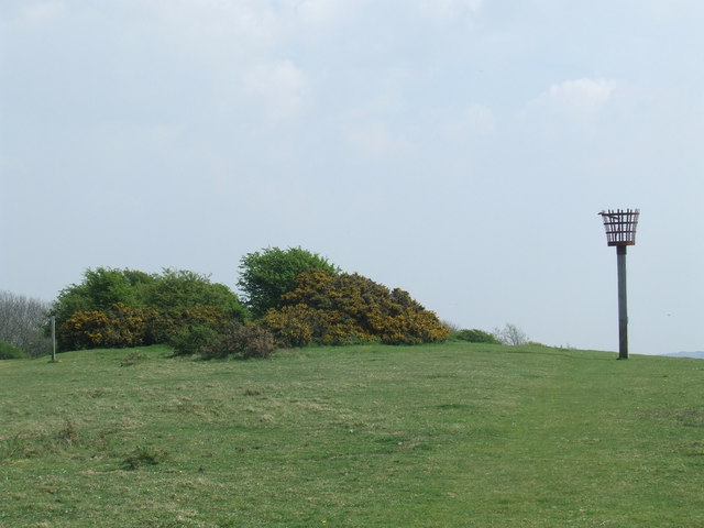
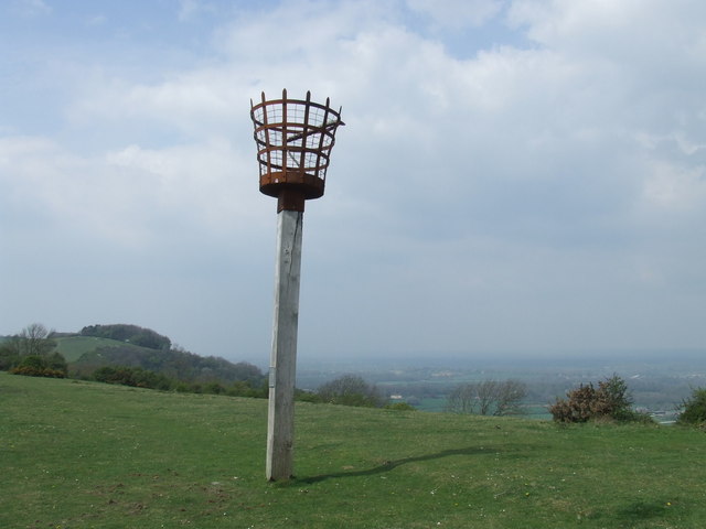
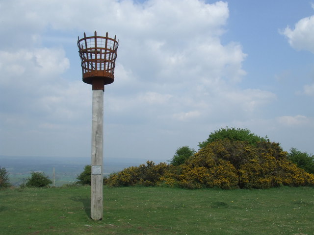
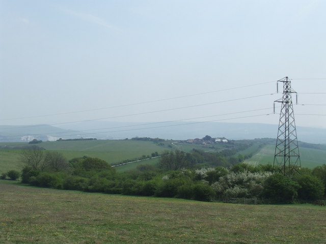
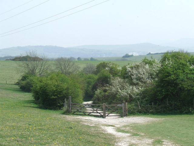
Landport Bottom is a picturesque valley located in Sussex, England. Situated near the village of Lewes, it is renowned for its natural beauty and historical significance. The valley is nestled between rolling hills and lush greenery, offering visitors a tranquil and idyllic setting.

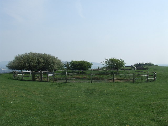
With its rich history dating back centuries, Landport Bottom has remained a significant archaeological site. The valley is home to several ancient burial mounds, known as barrows, which provide valuable insights into the region's past. These burial mounds are believed to have been constructed during the Bronze Age, making them over 4,000 years old.

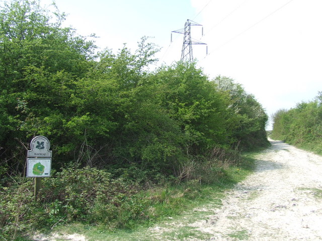
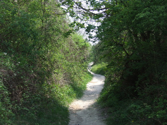
The valley also boasts a diverse range of flora and fauna, making it a haven for nature enthusiasts. It is home to various species of wildflowers, including orchids, as well as a myriad of butterflies and birds. The surrounding woodland offers a peaceful retreat for walkers and hikers, with numerous trails and footpaths to explore.

Landport Bottom is not only a site of natural beauty but also plays a role in local folklore. Legend has it that the valley is haunted by the ghost of a headless horseman, adding an air of mystery and intrigue to the area.

Overall, Landport Bottom in Sussex is a captivating destination that combines natural splendor with a fascinating history. Whether one is interested in archaeology, nature, or simply seeking a peaceful escape, this valley offers something for everyone.

If you have any feedback on the listing, please let us know in the comments section below.

Landport Bottom Images

Images are sourced within 2km of 50.883018/-0.015645586 or Grid Reference TQ3911. Thanks to Geograph Open Source API. All images are credited.

Mount Harry, South Downs A beacon has been installed at the summit of Mount Harry, on the South Downs.
Mount Harry, South Downs
A beacon has been installed at the summit of Mount Harry, on the South Downs.
Mount Harry beacon, South Downs A fire beacon at the top of Mount Harry on the South Downs.
Mount Harry beacon, South Downs
A fire beacon at the top of Mount Harry on the South Downs.
Mount Harry beacon, South Downs Just visible in the distance, to the right of the beacon, are cliffs in the hillside near Lewes.
Mount Harry beacon, South Downs
Just visible in the distance, to the right of the beacon, are cliffs in the hillside near Lewes.
Mount Harry beacon, South Downs This beacon stands at the top of Mount Harry on the South Downs, nearly 200 metres above sea level.
Mount Harry beacon, South Downs
This beacon stands at the top of Mount Harry on the South Downs, nearly 200 metres above sea level.
South Downs near Lewes A view from near Mount Harry, looking towards Lewes.
South Downs near Lewes
A view from near Mount Harry, looking towards Lewes.
Path on the South Downs A path on the South Downs, leading from Blackcap towards Lewes.
Path on the South Downs
A path on the South Downs, leading from Blackcap towards Lewes.
Path at Blackcap, South Downs A path on the South Downs, at Blackcap.  Blackcap is an area managed by the National Trust.
Path at Blackcap, South Downs
A path on the South Downs, at Blackcap. Blackcap is an area managed by the National Trust.
Path on the South Downs A footpath through woodland on the South Downs, near Lewes.
Path on the South Downs
A footpath through woodland on the South Downs, near Lewes.
Horse training ground near Lewes A training ground for racehorses near Lewes.
Horse training ground near Lewes
A training ground for racehorses near Lewes.
Track on the South Downs A track on the South Downs
Track on the South Downs
A track on the South Downs
House near Landport Bottom, Lewes
Rural road near Landport Bottom, Lewes A rural road near Landport Bottom, outside Lewes.
Rural road near Landport Bottom, Lewes
A rural road near Landport Bottom, outside Lewes.
Landport Bottom, near Lewes Landport Bottom is the site of a battle, near Lewes.

In the background is the Landport housing estate, while in the distance are chalk cliffs.
Landport Bottom, near Lewes
Landport Bottom is the site of a battle, near Lewes. In the background is the Landport housing estate, while in the distance are chalk cliffs.
Landport Estate, Lewes Landport Estate is a development of low-density housing on the edge of Lewes.
Landport Estate, Lewes
Landport Estate is a development of low-density housing on the edge of Lewes.
Jill's Pond, Landport Bottom, near Lewes Jill's Pond is a dew pond at Landport Bottom near Lewes.
Jill's Pond, Landport Bottom, near Lewes
Jill's Pond is a dew pond at Landport Bottom near Lewes.
Sheep at Landport Bottom near Lewes A solitary sheep grazing at Landport Bottom.  In the background is the Landport estate, a development of low-density housing on the edge of Lewes.
Sheep at Landport Bottom near Lewes
A solitary sheep grazing at Landport Bottom. In the background is the Landport estate, a development of low-density housing on the edge of Lewes.
Landport Bottom, near Lewes Landport Bottom near Lewes.  This was the site of the Battle of Lewes in the year 1264 A.D.
Landport Bottom, near Lewes
Landport Bottom near Lewes. This was the site of the Battle of Lewes in the year 1264 A.D.
Reservoir near Lewes A water reservoir near Lewes.

In the background, the hills form part of the South Downs ridge.
Reservoir near Lewes
A water reservoir near Lewes. In the background, the hills form part of the South Downs ridge.
Show me another place!

Landport Bottom is located at Grid Ref: TQ3911 (Lat: 50.883018, Lng: -0.015645586)

Administrative County: East Sussex

District: Lewes

Police Authority: Sussex

What 3 Words

///slows.expiring.like. Near Lewes, East Sussex

Related Wikis

Offham Hill

Offham Hill is a causewayed enclosure near Lewes, East Sussex, England. Causewayed enclosures were built in England from shortly before 3700 BC until...

Battle of Lewes

The Battle of Lewes was one of two main battles of the conflict known as the Second Barons' War. It took place at Lewes in Sussex, on 14 May 1264. It marked...

Lewes Speed Trials

The Lewes Speed Trials were speed trials held on a defunct course in Lewes, Sussex, England, sometimes known as "The Motor Road." == History == The first...

Offham Marshes

Offham Marshes, also known as The Pells and Offham Marsh, is a 39.1-hectare (97-acre) biological Site of Special Scientific Interest on the northern outskirts...

Nearby Amenities

Located within 500m of 50.883018,-0.015645586
Historic: battlefield
Lat/Long: 50.884017/-0.0159123
Offham Hill
Place: locality
Source: NPE
Lat/Long: 50.8871576/-0.0128653
Barrier: stile
Lat/Long: 50.8793778/-0.0126521
Bench
Backrest: no
Material: wood
Seats: 5
Lat/Long: 50.8785937/-0.0160348
Waste Basket
Waste: dog_excrement
Lat/Long: 50.8793284/-0.0126788
Chalk Pit
Direction: E
Tourism: viewpoint
Lat/Long: 50.8855264/-0.0111342
Crossing
Lat/Long: 50.8841001/-0.015031
Post Box
Collection Times: Mo-Fr 09:00; Sa 07:00
Operator: Royal Mail
Post Box Type: lamp
Ref: BN7 442D
Royal Cypher: EIIR
Royal Cypher Wikidata: Q33102113
Lat/Long: 50.8811241/-0.0114195
Man Made: reservoir_covered
Lat/Long: 50.8872122/-0.0135394
Bench
Lat/Long: 50.885286/-0.0120127
Barrier: stile
Material: wood
Stile: stepover
Lat/Long: 50.8854457/-0.012479
Barrier: kissing_gate
Kissing Gate: square_profile
Wheelchair: no
Lat/Long: 50.8854373/-0.0124435
Board Title: A Working Landscape: The Chalk and the River
Board Type: history;geology
Information: board
Tourism: information
Lat/Long: 50.8862061/-0.0118752
Barrier: kissing_gate
Lat/Long: 50.8824071/-0.0111679
The data included in this document is from www.openstreetmap.org. The data is made available under ODbL.

Have you been to Landport Bottom?

Leave your review of Landport Bottom below (or comments, questions and feedback).