Addington Vale

Valley in Surrey

England

Addington Vale

Layhams Farm Shop, Addington
Layhams Farm Shop, Addington Credit: David Howard

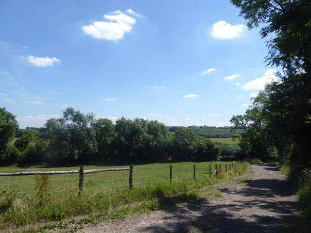
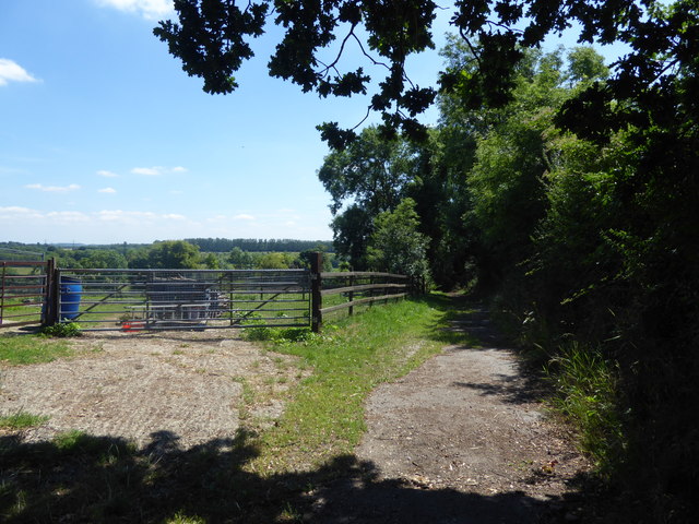
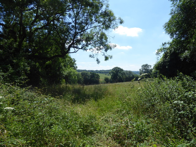
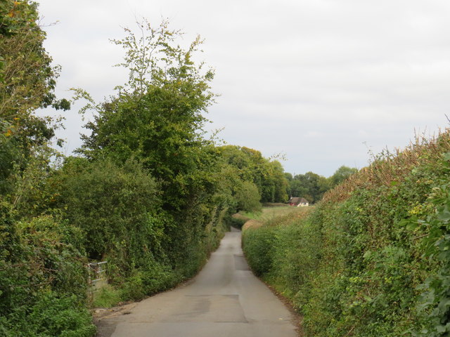
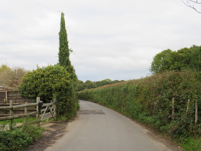
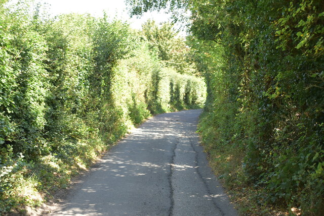
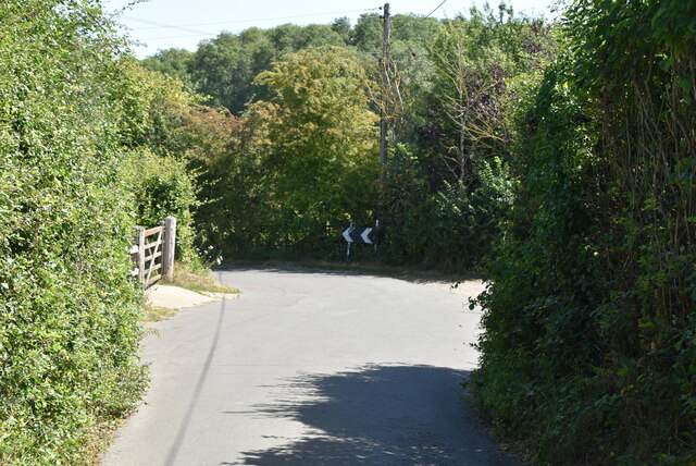
Addington Vale is a suburban area located in the county of Surrey, England. Situated in the picturesque valley of Surrey Hills, Addington Vale offers a tranquil and scenic environment for its residents. The area is known for its stunning natural beauty, with rolling hills, green pastures, and charming country lanes.

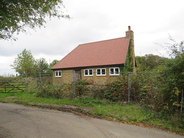
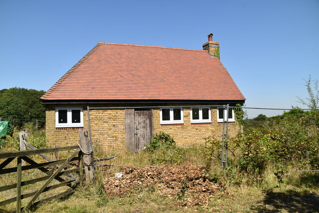
The community in Addington Vale is predominantly residential, consisting of a mix of housing types such as detached houses, semi-detached houses, and cottages. The properties in the area are often spacious, offering ample gardens and beautiful views of the surrounding countryside.

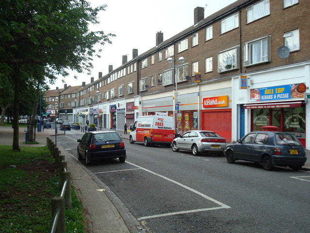
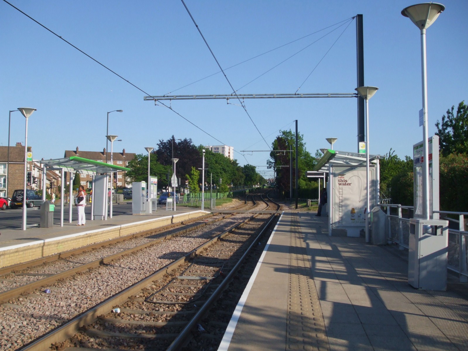
Despite its peaceful setting, Addington Vale is conveniently located close to amenities and transportation links. The nearby town of Croydon provides residents with a range of shopping centers, restaurants, and entertainment options. Additionally, the area benefits from excellent transport connections, with easy access to major roads and motorways, making it an ideal location for commuters.

Nature lovers will find plenty to explore in the area surrounding Addington Vale. The nearby Surrey Hills Area of Outstanding Natural Beauty offers an array of outdoor activities, including hiking, cycling, and horseback riding. The valley itself provides a peaceful retreat, with opportunities for picnics and leisurely walks.

Overall, Addington Vale is a charming and idyllic location in Surrey, offering a combination of natural beauty, convenient amenities, and a peaceful community atmosphere. It is a sought-after area for those looking to enjoy the tranquility of the countryside while still being within reach of urban conveniences.

If you have any feedback on the listing, please let us know in the comments section below.

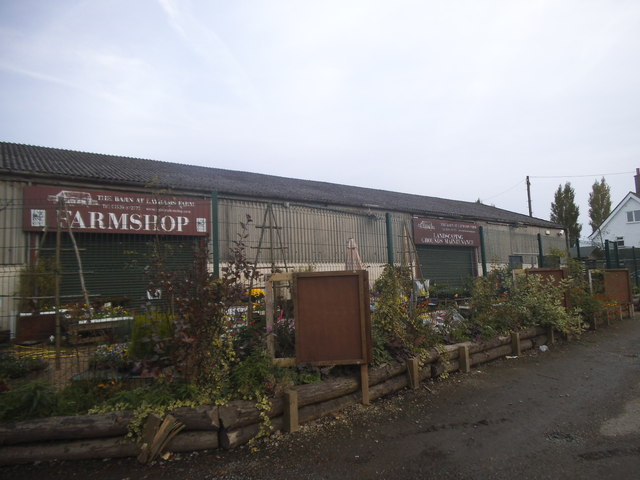
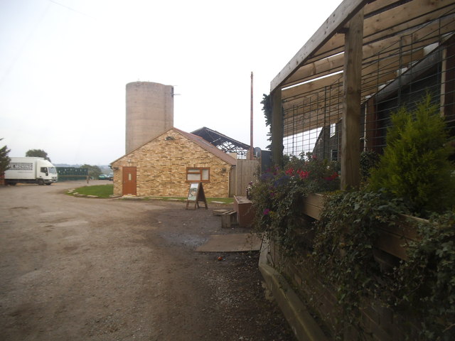
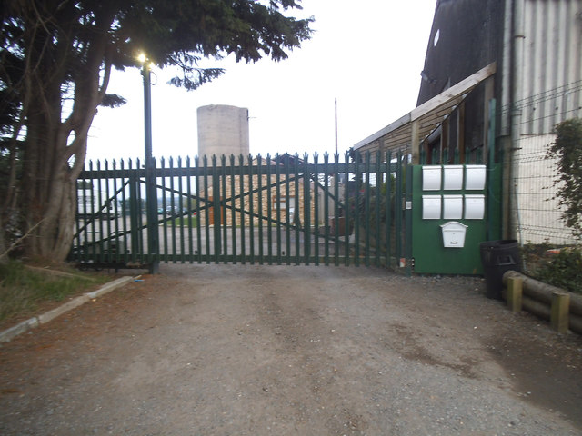
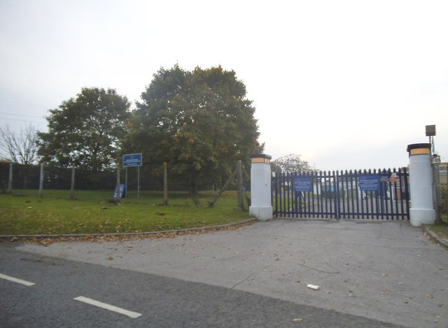
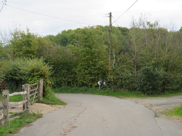
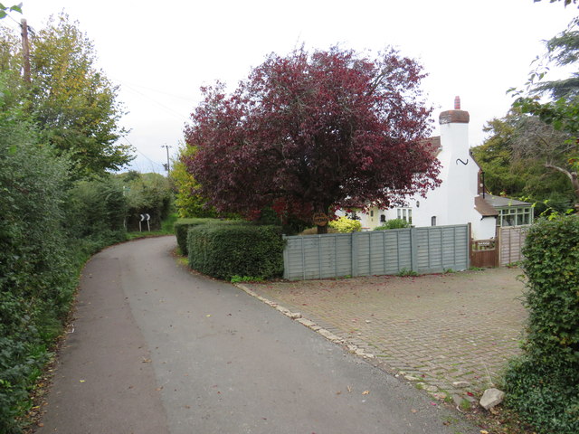
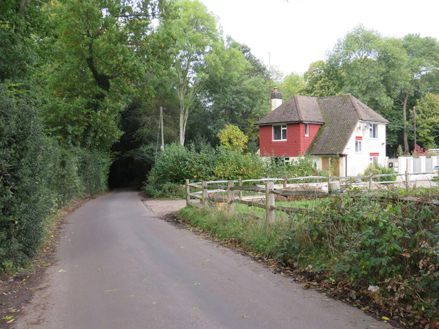
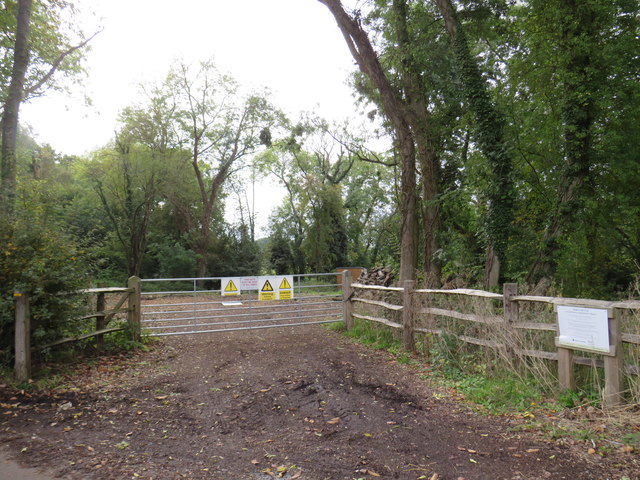
Addington Vale Images

Images are sourced within 2km of 51.346902/-0.010175212 or Grid Reference TQ3862. Thanks to Geograph Open Source API. All images are credited.

Layhams Farm Shop, Addington
Layhams Farm, Addington
The entrance to the Metropolitan Police Dog Training Establishment There is also one in the Welsh Harp in Kinsgbury where I live.
The entrance to the Metropolitan Police Dog Training Establishment
There is also one in the Welsh Harp in Kinsgbury where I live.
Track near Layham's Farm The public footpath is to the right of the hedge and trees alongside the track. The woodland at Furze Bottom is ahead at the bottom of the valley.
Track near Layham's Farm
The public footpath is to the right of the hedge and trees alongside the track. The woodland at Furze Bottom is ahead at the bottom of the valley.
Footpath at Layham's Farm The public footpath follows down ahead to Furze Bottom at the bottom of the valley. Then there is a choice of three paths in this seemingly remote countryside yet which is so close to New Addington.
Footpath at Layham's Farm
The public footpath follows down ahead to Furze Bottom at the bottom of the valley. Then there is a choice of three paths in this seemingly remote countryside yet which is so close to New Addington.
View from a footpath near Layham's Farm This view is from the public footpath which leads from Layham's Farm down the side of the valley to Furze Bottom at the bottom. Then there is a choice of three paths in this seemingly remote countryside yet which is so close to New Addington. In the distance are the woods around Saltbox Hill.
View from a footpath near Layham's Farm
This view is from the public footpath which leads from Layham's Farm down the side of the valley to Furze Bottom at the bottom. Then there is a choice of three paths in this seemingly remote countryside yet which is so close to New Addington. In the distance are the woods around Saltbox Hill.
Outbuilding near Keston An isolated outbuilding on North Pole Lane, on the outer fringe of south east London.
Outbuilding near Keston
An isolated outbuilding on North Pole Lane, on the outer fringe of south east London.
North Pole Lane, near Keston North Pole Lane is a narrow lane in countryside on the outer fringe of south east London.  Here it has a sharp bend to the left.
North Pole Lane, near Keston
North Pole Lane is a narrow lane in countryside on the outer fringe of south east London. Here it has a sharp bend to the left.
North Pole Lane, near Keston North Pole lane is a narrow lane through countryside on the outer fringe of south east London.
North Pole Lane, near Keston
North Pole lane is a narrow lane through countryside on the outer fringe of south east London.
Nash Lane, near Keston Nash Lane is a minor road through countryside on the outer fringe of south east London.
Nash Lane, near Keston
Nash Lane is a minor road through countryside on the outer fringe of south east London.
Fullers Wood, near Keston The entrance to Fullers Wood, a small area of woodland on the outer fringe of south east London.
Fullers Wood, near Keston
The entrance to Fullers Wood, a small area of woodland on the outer fringe of south east London.
Nash Lane, near Keston Nash lane is a narrow lane through countryside on the outer fringe of south east London.  Despite its rural setting, this location is within the Greater London boundary.
Nash Lane, near Keston
Nash lane is a narrow lane through countryside on the outer fringe of south east London. Despite its rural setting, this location is within the Greater London boundary.
Nash Lane, near Keston Nash Lane is a minor country lane on the outer fringe of south east London.

The tall green conical shape is not a tree, but a telegraph pole to which greenery has attached itself and grown.
Nash Lane, near Keston
Nash Lane is a minor country lane on the outer fringe of south east London. The tall green conical shape is not a tree, but a telegraph pole to which greenery has attached itself and grown.
Public footpath near New Addington A public footpath passing through a farm on the outer fringe of south east London.
Public footpath near New Addington
A public footpath passing through a farm on the outer fringe of south east London.
Building on North Pole Lane
North Pole Lane
North Pole Lane
Sharp bend, North Pole lane
Show me another place!

Addington Vale is located at Grid Ref: TQ3862 (Lat: 51.346902, Lng: -0.010175212)

Unitary Authority: Croydon

Police Authority: Metropolitan

What 3 Words

///terms.finely.clock. Near West Wickham, London

Nearby Locations

Addington Vale

Related Wikis

Addington Vale

Addington Vale is a 48 acres (19 ha) park situated in New Addington in the London Borough of Croydon. The park extends from King Henrys Drive in the north...

New Addington

New Addington is an area of South London, England, within the London Borough of Croydon. It is located 5 miles south east of Croydon and is adjacent to...

New Addington tram stop

New Addington is a terminal tram stop serving the centre of New Addington, in the London Borough of Croydon, in the southern suburbs of London. The tram...

New Addington Library

New Addington Library is a public library in New Addington, South London. It stands in the London Borough of Croydon and is part of the Croydon Libraries...

King Henry's Drive tram stop

King Henry's Drive tram stop is a light rail stop serving the Betchworth Way residential area of New Addington, in the London Borough of Croydon in the...

Fieldway (ward)

Fieldway was a ward in the London Borough of Croydon, covering part of the New Addington estate in London in the United Kingdom. The ward formed part of...

New Addington North (ward)

New Addington North is a ward in the London Borough of Croydon, covering part of the New Addington estate in London in the United Kingdom. The ward currently...

Fieldway tram stop

Fieldway tram stop is a light rail stop serving the Fieldway residential area of New Addington, in the London Borough of Croydon in the southern suburbs...

Nearby Amenities

Located within 500m of 51.346902,-0.010175212
Traffic Calming: hump
Lat/Long: 51.349965/-0.0144989
Mini Roundabout
Direction: clockwise
Lat/Long: 51.3511323/-0.0108093
Crossing
Crossing: uncontrolled
Crossing Markings: yes
Lat/Long: 51.3441928/-0.0059765
Traffic Calming: hump
Lat/Long: 51.3463257/-0.0124849
Traffic Calming: cushion
Lat/Long: 51.3447988/-0.0132484
Traffic Calming: cushion
Lat/Long: 51.3444464/-0.013557
Turning Circle
Lat/Long: 51.3424486/-0.0105995
Traffic Calming: table
Lat/Long: 51.3440598/-0.007248
Place Of Worship
Christ's Day Evangelical Ministry
Religion: christian
Lat/Long: 51.3442522/-0.0054333
Turning Circle
Lat/Long: 51.3489162/-0.0071796
Barrier: kissing_gate
Lat/Long: 51.3492258/-0.0067339
Crossing
Crossing: unmarked
Crossing Markings: no
Traffic Calming: island
Lat/Long: 51.3465824/-0.0072771
Post Box
Operator: Royal Mail
Operator Wikidata: Q638098
Ref: CR0 491
Ref GB Uprn: 10015387256
Lat/Long: 51.344291/-0.0066905
Post Box
Operator: Royal Mail
Operator Wikidata: Q638098
Ref: CR0 490
Lat/Long: 51.3429548/-0.0117239
Traffic Calming: hump
Lat/Long: 51.3502881/-0.013294
Bus Stop
Wolsey Crescent
Bus: yes
Naptan AtcoCode: 490003187S
Naptan Bearing: S
Naptan CommonName: Aldrich Crescent
Naptan Indicator: Stop
Naptan Street: GASCOIGNE ROAD
Naptan Verified: no
Public Transport: platform
Ref: 49114
Source Ref: naptan
Lat/Long: 51.3469994/-0.0120335
Bus Stop
Bothwell Road
Bus: yes
Naptan AtcoCode: 490004173N
Naptan Bearing: N
Naptan CommonName: Bothwell Road
Naptan Street: GASCOIGNE ROAD
Naptan Verified: no
Public Transport: platform
Ref: 51998
Source Ref: naptan
Lat/Long: 51.3450923/-0.0130928
Bus Stop
Walsingham Road
Bus: yes
Local Ref: F
Naptan AtcoCode: 490007135N
Naptan Bearing: N
Naptan CommonName: Walsingham Road Gascoigne Rd
Naptan Indicator: Stop F
Naptan Street: GASCOIGNE ROAD
Naptan Verified: no
Public Transport: platform
Lat/Long: 51.3434799/-0.0147075
Bus Stop
Goldcrest Community Centre
Bus: yes
Naptan AtcoCode: 490007266N
Naptan Bearing: N
Naptan CommonName: Goldcrest Community Centre
Naptan Street: GOLDCREST WAY
Naptan Verified: no
Public Transport: platform
Ref: 77951
Source Ref: naptan
Lat/Long: 51.3505773/-0.0103144
Bus Stop
Goldcrest Community Centre
Bus: yes
Naptan AtcoCode: 490007266S
Naptan Bearing: N
Naptan CommonName: Goldcrest Community Centre
Naptan Street: GOLDCREST WAY
Naptan Verified: no
Public Transport: platform
Ref: 51557
Source Ref: naptan
Lat/Long: 51.3501915/-0.0101536
Bus Stop
Kestrel Way
Bus: yes
Naptan AtcoCode: 490008685N
Naptan Bearing: N
Naptan CommonName: Kestrel Way
Naptan Street: KING HENRY'S DRIVE
Naptan Verified: no
Public Transport: platform
Ref: 55557
Source Ref: naptan
Lat/Long: 51.3476655/-0.0093851
Bus Stop
Kestrel Way
Bus: yes
Naptan AtcoCode: 490008685S
Naptan Bearing: N
Naptan CommonName: Kestrel Way
Naptan Street: KING HENRY'S DRIVE
Naptan Verified: no
Public Transport: platform
Ref: 53949
Source Ref: naptan
Lat/Long: 51.3474799/-0.0086648
Bus Stop
Goldcrest Way / King Henry's Drive
Bus: yes
Naptan AtcoCode: 490008753N
Naptan Bearing: N
Naptan CommonName: Goldcrest Way
Naptan Indicator: Stop
Naptan Street: GOLDCREST WAY
Naptan Verified: no
Public Transport: platform
Ref: 74144
Source Ref: naptan
Lat/Long: 51.3487593/-0.0105223
Bus Stop
Goldcrest Way / King Henry's Drive
Bus: yes
Naptan AtcoCode: 490008753S
Naptan Bearing: S
Naptan CommonName: Goldcrest Way
Naptan Indicator: Stop
Naptan Street: GOLDCREST WAY
Naptan Verified: no
Public Transport: platform
Ref: 48138
Source Ref: naptan
Lat/Long: 51.3483869/-0.0105267
Bus Stop
Vulcan Way
Bus: yes
Naptan AtcoCode: 490014105Z
Naptan Bearing: E
Naptan CommonName: New Addington Vulcan Way
Naptan Indicator: Stand
Naptan Street: VULCAN WAY
Naptan Verified: no
Public Transport: platform
Ref: 92123
Lat/Long: 51.3437148/-0.0055616
Bus Stop
Walsingham Road
Bus: yes
Local Ref: G
Naptan AtcoCode: 490014151S
Naptan Bearing: S
Naptan CommonName: Gascoigne Road Walsingham Rd
Naptan Indicator: Stop G
Naptan Street: GASCOIGNE ROAD
Naptan Verified: no
Public Transport: platform
Lat/Long: 51.3441556/-0.0137393
Bus Stop
Tilford Avenue
Bus: yes
Naptan AtcoCode: 490013672E
Naptan Bearing: E
Naptan CommonName: Tilford Avenue
Naptan Street: KING HENRY'S DRIVE
Naptan Verified: no
Public Transport: platform
Ref: 72340
Source Ref: naptan
Lat/Long: 51.3484151/-0.0153059
Bus Stop
Wolsey Crescent
Bus: yes
Naptan AtcoCode: 490014803N
Naptan Bearing: N
Naptan CommonName: Wolsey Crescent Gascoigne Road
Naptan Street: GASCOIGNE ROAD
Naptan Verified: no
Public Transport: platform
Ref: 50101
Source Ref: naptan
Lat/Long: 51.3472868/-0.011982
Bus Stop
Vulcan Way
Bus: yes
Naptan AtcoCode: 490015467N
Naptan Bearing: N
Naptan CommonName: Vulcan Way King Henrys Drive
Naptan Street: KING HENRY'S DRIVE
Naptan Verified: no
Note: Alighting point only.
Public Transport: platform
Ref: 76432
Lat/Long: 51.3433236/-0.0058892
Bus Stop
Vulcan Way King Henrys Drive
Bus: yes
Naptan AtcoCode: 490015467S
Naptan Bearing: S
Naptan CommonName: Vulcan Way King Henrys Drive
Naptan Indicator: Stop
Naptan Verified: no
Public Transport: platform
Lat/Long: 51.3448709/-0.0060935
Post Box
Operator: Royal Mail
Operator Wikidata: Q638098
Ref: CR0 501
Lat/Long: 51.3462244/-0.0125939
Traffic Calming: hump
Lat/Long: 51.3479732/-0.0112927
Traffic Calming: island
Lat/Long: 51.3480968/-0.0111798
Give Way
Direction: backward
Lat/Long: 51.3481544/-0.0111336
Crossing
Crossing: uncontrolled
Crossing Markings: yes
Lat/Long: 51.3488486/-0.0131199
Traffic Calming: hump
Lat/Long: 51.3505623/-0.0121868
Traffic Calming: bump
Lat/Long: 51.3496977/-0.0155039
Give Way
Direction: forward
Lat/Long: 51.3498698/-0.0149779
Give Way
Direction: forward
Lat/Long: 51.3510827/-0.0108795
Give Way
Direction: forward
Lat/Long: 51.348149/-0.010718
Give Way
Direction: backward
Lat/Long: 51.3478158/-0.0113789
Traffic Calming: hump
Lat/Long: 51.350971/-0.0110327
Traffic Calming: cushion
Lat/Long: 51.3436961/-0.0143388
Bicycle Parking
Bicycle Parking: stands
Capacity: 12
Ref GB Tflcid: RWG204530
Lat/Long: 51.3488219/-0.0102454
Bicycle Parking
Bicycle Parking: stands
Capacity: 2
Ref GB Tflcid: RWG204446
Lat/Long: 51.3443483/-0.0063001
Bicycle Parking
Bicycle Parking: stands
Capacity: 2
Ref GB Tflcid: RWG204445
Lat/Long: 51.3442964/-0.0066726
Ref GB Tflcid: RWG202938
Traffic Calming: cushion
Lat/Long: 51.3473218/-0.0118701
Ref GB Tflcid: RWG202934
Traffic Calming: cushion
Lat/Long: 51.3452746/-0.0129118
Ref GB Tflcid: RWG203350
Traffic Calming: hump
Lat/Long: 51.3436351/-0.007971
Ref GB Tflcid: RWG202937
Traffic Calming: cushion
Lat/Long: 51.3468597/-0.0121936
Ref GB Tflcid: RWG203348
Traffic Calming: hump
Lat/Long: 51.3426439/-0.0085043
Traffic Calming: island
Lat/Long: 51.3511006/-0.0107325
Traffic Calming: hump
Lat/Long: 51.3501817/-0.0136852
Crossing
Crossing: traffic_signals
Crossing Markings: yes
Lat/Long: 51.3484343/-0.0138
Crossing
Crossing: unmarked
Crossing Markings: no
Traffic Calming: island
Lat/Long: 51.3483179/-0.0120373
Crossing
Crossing: unmarked
Crossing Markings: no
Traffic Calming: island
Lat/Long: 51.3479846/-0.010179
Crossing
Crossing: uncontrolled
Crossing Markings: yes
Lat/Long: 51.3489732/-0.0132861
Leisure: picnic_table
Lat/Long: 51.3494806/-0.0127146
Leisure: picnic_table
Lat/Long: 51.3494452/-0.0126931
Leisure: picnic_table
Lat/Long: 51.3494673/-0.0125962
Leisure: picnic_table
Lat/Long: 51.3494747/-0.0124772
Leisure: picnic_table
Lat/Long: 51.3494897/-0.01244
Leisure: picnic_table
Lat/Long: 51.3498009/-0.0123289
Leisure: picnic_table
Lat/Long: 51.3504203/-0.0118232
Leisure: picnic_table
Lat/Long: 51.3503726/-0.0118336
Leisure: picnic_table
Lat/Long: 51.3503249/-0.0118477
Traffic Calming: island
Lat/Long: 51.3459442/-0.0066696
Crossing
Crossing: unmarked
Crossing Markings: no
Lat/Long: 51.3459267/-0.0066588
Traffic Calming: island
Lat/Long: 51.3459098/-0.0066475
Traffic Calming: island
Lat/Long: 51.3465953/-0.0072927
Traffic Calming: island
Lat/Long: 51.3465683/-0.0072612
Traffic Calming: island
Lat/Long: 51.3479911/-0.0102016
Traffic Calming: island
Lat/Long: 51.3479765/-0.0101533
Speed Camera
Direction: 130
Lat/Long: 51.3480811/-0.0103512
Speed Camera
Direction: 310
Lat/Long: 51.3478339/-0.0098654
Traffic Calming: island
Lat/Long: 51.3483209/-0.0120598
Traffic Calming: island
Lat/Long: 51.3483147/-0.0120126
Traffic Calming: hump
Lat/Long: 51.3477161/-0.0115393
Street Lamp
Lat/Long: 51.3469722/-0.0142305
Street Lamp
Lat/Long: 51.3468494/-0.0124384
Street Lamp
Lat/Long: 51.3472946/-0.0119806
Street Lamp
Lat/Long: 51.3475103/-0.01275
Street Lamp
Lat/Long: 51.3476526/-0.0132019
Street Lamp
Lat/Long: 51.3475747/-0.0136877
Street Lamp
Lat/Long: 51.3475808/-0.0141299
Street Lamp
Lat/Long: 51.3475726/-0.0147023
Street Lamp
Lat/Long: 51.3475433/-0.015183
Street Lamp
Lat/Long: 51.3475008/-0.0156738
Street Lamp
Lat/Long: 51.347542/-0.0161925
Street Lamp
Lat/Long: 51.3473548/-0.0166702
Street Lamp
Lat/Long: 51.3481696/-0.0169915
Street Lamp
Lat/Long: 51.3483204/-0.0161113
Street Lamp
Lat/Long: 51.3483851/-0.0156011
Street Lamp
Lat/Long: 51.3483294/-0.015202
Street Lamp
Lat/Long: 51.3483714/-0.014742
Street Lamp
Lat/Long: 51.348477/-0.0142795
Street Lamp
Lat/Long: 51.3484683/-0.0134112
Street Lamp
Lat/Long: 51.3483671/-0.0129812
Street Lamp
Lat/Long: 51.3484181/-0.0125335
Street Lamp
Lat/Long: 51.3483664/-0.0120808
Street Lamp
Lat/Long: 51.3483014/-0.0115836
Street Lamp
Lat/Long: 51.3482195/-0.0110391
Street Lamp
Lat/Long: 51.3480675/-0.010692
Street Lamp
Lat/Long: 51.3479209/-0.0098495
Street Lamp
Lat/Long: 51.3476415/-0.0090623
Street Lamp
Lat/Long: 51.3474776/-0.0086679
Street Lamp
Lat/Long: 51.3472919/-0.0082903
Street Lamp
Lat/Long: 51.3483111/-0.0107105
Street Lamp
Lat/Long: 51.3486196/-0.0105677
Street Lamp
Lat/Long: 51.3493861/-0.0103392
Street Lamp
Lat/Long: 51.3497458/-0.010295
Street Lamp
Lat/Long: 51.3500774/-0.0102857
Street Lamp
Lat/Long: 51.3503995/-0.010161
Street Lamp
Lat/Long: 51.3507193/-0.010361
Street Lamp
Lat/Long: 51.3508987/-0.0105542
Street Lamp
Lat/Long: 51.3511987/-0.0108461
Street Lamp
Lat/Long: 51.3508672/-0.0111105
Street Lamp
Lat/Long: 51.350632/-0.0120469
Street Lamp
Lat/Long: 51.3505477/-0.0125148
Street Lamp
Lat/Long: 51.3503129/-0.0133547
Street Lamp
Lat/Long: 51.3501539/-0.0139992
Street Lamp
Lat/Long: 51.3499969/-0.0145498
Street Lamp
Lat/Long: 51.3497786/-0.0150525
Street Lamp
Lat/Long: 51.3496164/-0.0156633
Street Lamp
Lat/Long: 51.350803/-0.0099492
Street Lamp
Lat/Long: 51.3468333/-0.0151279
Street Lamp
Lat/Long: 51.3468219/-0.0160817
Street Lamp
Lat/Long: 51.3468443/-0.0133539
Street Lamp
Lat/Long: 51.3461507/-0.0127807
Street Lamp
Lat/Long: 51.3462287/-0.0136104
Street Lamp
Lat/Long: 51.3462367/-0.014516
Street Lamp
Lat/Long: 51.3458949/-0.0168239
Traffic Calming: hump
Lat/Long: 51.3458224/-0.0126768
Street Lamp
Lat/Long: 51.3456635/-0.0128165
Street Lamp
Lat/Long: 51.3461183/-0.0152832
Street Lamp
Lat/Long: 51.3454146/-0.0155739
Street Lamp
Lat/Long: 51.3454989/-0.0148932
Street Lamp
Lat/Long: 51.3455311/-0.0141865
Street Lamp
Lat/Long: 51.3454203/-0.0132753
Street Lamp
Lat/Long: 51.3451546/-0.0164219
Street Lamp
Lat/Long: 51.3447241/-0.0152902
Street Lamp
Lat/Long: 51.3448121/-0.0144162
Street Lamp
Lat/Long: 51.3448681/-0.0132844
Street Lamp
Lat/Long: 51.3447819/-0.013471
Street Lamp
Lat/Long: 51.3452545/-0.0130069
Street Lamp
Lat/Long: 51.3444567/-0.0161108
Street Lamp
Lat/Long: 51.3440931/-0.01448
Street Lamp
Lat/Long: 51.3438992/-0.0142063
Street Lamp
Lat/Long: 51.343956/-0.01507
Street Lamp
Lat/Long: 51.3478189/-0.0112564
Street Lamp
Lat/Long: 51.3476193/-0.0115295
Street Lamp
Lat/Long: 51.3468384/-0.0121161
Street Lamp
Lat/Long: 51.3464591/-0.0123299
Street Lamp
Lat/Long: 51.346072/-0.0125058
Street Lamp
Lat/Long: 51.3476111/-0.0107818
Street Lamp
Lat/Long: 51.3471878/-0.0107196
Street Lamp
Lat/Long: 51.346806/-0.0109907
Street Lamp
Lat/Long: 51.3460908/-0.0114355
Street Lamp
Lat/Long: 51.3457364/-0.0116004
Street Lamp
Lat/Long: 51.3453236/-0.0117576
Street Lamp
Lat/Long: 51.3445071/-0.0119223
Street Lamp
Lat/Long: 51.3441528/-0.0119447
Street Lamp
Lat/Long: 51.3438027/-0.0119236
Street Lamp
Lat/Long: 51.3434106/-0.0118674
Street Lamp
Lat/Long: 51.3441567/-0.0137302
Street Lamp
Lat/Long: 51.3438824/-0.0136716
Street Lamp
Lat/Long: 51.3435686/-0.0143924
Street Lamp
Lat/Long: 51.3436123/-0.0130839
Street Lamp
Lat/Long: 51.3434402/-0.0123042
Street Lamp
Lat/Long: 51.3427171/-0.0125599
Street Lamp
Lat/Long: 51.3429389/-0.0120803
Street Lamp
Lat/Long: 51.3426838/-0.0116244
Street Lamp
Lat/Long: 51.348491/-0.0072836
Street Lamp
Lat/Long: 51.3488361/-0.0070958
Street Lamp
Lat/Long: 51.3480996/-0.0074343
Street Lamp
Lat/Long: 51.3476439/-0.007538
Street Lamp
Lat/Long: 51.3473014/-0.0077109
Street Lamp
Lat/Long: 51.3468747/-0.007549
Street Lamp
Lat/Long: 51.346636/-0.0072396
Street Lamp
Lat/Long: 51.3463489/-0.0070965
Street Lamp
Lat/Long: 51.3464029/-0.0064823
Street Lamp
Lat/Long: 51.3461223/-0.0067354
Street Lamp
Lat/Long: 51.3465015/-0.0057737
Street Lamp
Lat/Long: 51.3462776/-0.0056162
Street Lamp
Lat/Long: 51.3459095/-0.005496
Street Lamp
Lat/Long: 51.3455136/-0.0053541
Street Lamp
Lat/Long: 51.3452344/-0.0052319
Street Lamp
Lat/Long: 51.3459181/-0.006653
Street Lamp
Lat/Long: 51.3458528/-0.0065407
Street Lamp
Lat/Long: 51.3455625/-0.0063804
Street Lamp
Lat/Long: 51.3452782/-0.0062412
Street Lamp
Lat/Long: 51.3452126/-0.0058107
Street Lamp
Lat/Long: 51.3449626/-0.0061287
Traffic Calming: table
Lat/Long: 51.3443212/-0.0061659
Crossing
Crossing: unmarked
Crossing Markings: no
Lat/Long: 51.3445566/-0.0060723
Traffic Calming: island
Lat/Long: 51.3445804/-0.0060789
Traffic Calming: island
Lat/Long: 51.3445352/-0.0060665
Street Lamp
Lat/Long: 51.3466766/-0.0081667
Street Lamp
Lat/Long: 51.346356/-0.0087854
Street Lamp
Lat/Long: 51.3456942/-0.008368
Street Lamp
Lat/Long: 51.3460934/-0.0092425
Street Lamp
Lat/Long: 51.3454732/-0.0088235
Street Lamp
Lat/Long: 51.3449116/-0.0101102
Street Lamp
Lat/Long: 51.3449084/-0.0104369
Street Lamp
Lat/Long: 51.345775/-0.0097878
Street Lamp
Lat/Long: 51.345351/-0.0101374
Street Lamp
Lat/Long: 51.3443582/-0.0063564
Street Lamp
Lat/Long: 51.34426/-0.0068407
Restaurant
Addington Charcoal Grill
Cuisine: barbeque
Lat/Long: 51.3443141/-0.0069168
Fast Food
Bangers & Mash
Lat/Long: 51.3443351/-0.0068114
Mini Superstore
Shop: convenience
Lat/Long: 51.3443565/-0.0066965
Exclusive Hairdressing
Shop: hairdresser
Lat/Long: 51.3443796/-0.0065811
Morrisons Daily
Brand: Morrisons Daily
Brand Wikidata: Q99752411
Operator: McColl's
Operator Wikidata: Q16997477
Shop: convenience
Website: https://my.morrisons.com/storefinder/66249/morrisons-daily-new-addington-calley-down
Lat/Long: 51.3444238/-0.0063591
Street Lamp
Lat/Long: 51.3453406/-0.0086737
Street Lamp
Lat/Long: 51.344774/-0.0077119
Street Lamp
Lat/Long: 51.3446047/-0.0073821
Street Lamp
Lat/Long: 51.3445047/-0.0088321
Street Lamp
Lat/Long: 51.3444639/-0.010363
Street Lamp
Lat/Long: 51.3447675/-0.0092872
Street Lamp
Lat/Long: 51.3440458/-0.0093651
Street Lamp
Lat/Long: 51.3440142/-0.0103012
Street Lamp
Lat/Long: 51.343682/-0.009432
Street Lamp
Lat/Long: 51.3431943/-0.0098368
Street Lamp
Lat/Long: 51.3445384/-0.0081708
Street Lamp
Lat/Long: 51.3443614/-0.0092094
Street Lamp
Lat/Long: 51.3442751/-0.0089507
Street Lamp
Lat/Long: 51.3438389/-0.0083102
Street Lamp
Lat/Long: 51.3440034/-0.0078542
Street Lamp
Lat/Long: 51.343688/-0.0082683
Street Lamp
Lat/Long: 51.3443007/-0.0072198
Street Lamp
Lat/Long: 51.3438669/-0.0077346
Street Lamp
Lat/Long: 51.3435331/-0.0081634
Street Lamp
Lat/Long: 51.3431374/-0.0084104
Street Lamp
Lat/Long: 51.3441008/-0.0070206
Street Lamp
Lat/Long: 51.3438365/-0.0075551
Street Lamp
Lat/Long: 51.3432496/-0.0094102
Street Lamp
Lat/Long: 51.3428613/-0.00953
Street Lamp
Lat/Long: 51.3426572/-0.0105851
Street Lamp
Lat/Long: 51.3432544/-0.0102856
Street Lamp
Lat/Long: 51.342768/-0.0085437
Street Lamp
Lat/Long: 51.3425281/-0.0095888
Street Lamp
Lat/Long: 51.3428597/-0.0079289
Street Lamp
Lat/Long: 51.3440314/-0.0060066
Street Lamp
Lat/Long: 51.343711/-0.0059445
Street Lamp
Lat/Long: 51.3433659/-0.0058916
Street Lamp
Lat/Long: 51.3443477/-0.0059496
Street Lamp
Lat/Long: 51.3443175/-0.0043462
Street Lamp
Lat/Long: 51.3442263/-0.0049813
Street Lamp
Lat/Long: 51.3435954/-0.0055117
Street Lamp
Lat/Long: 51.3438901/-0.0055634
Barrier: bollard
Lat/Long: 51.3440379/-0.00551
Barrier: bollard
Lat/Long: 51.3440346/-0.0055394
Barrier: bollard
Lat/Long: 51.3440205/-0.0055656
Street Lamp
Lat/Long: 51.3512414/-0.0115971
Barrier: bollard
Lat/Long: 51.3484687/-0.0132141
Barrier: bollard
Lat/Long: 51.3484763/-0.0132047
Barrier: bollard
Lat/Long: 51.3484661/-0.0131176
Barrier: bollard
Lat/Long: 51.3484817/-0.0131266
The data included in this document is from www.openstreetmap.org. The data is made available under ODbL.

Have you been to Addington Vale?

Leave your review of Addington Vale below (or comments, questions and feedback).