Severals Bottom

Valley in Sussex Horsham

England

Severals Bottom

Inholms Gill A tributary of the River Arun that rises in St Leonard's Forest.
Inholms Gill Credit: Simon Carey

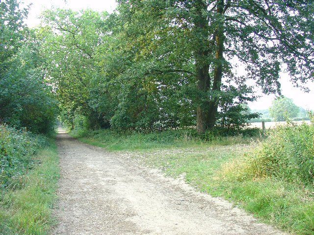
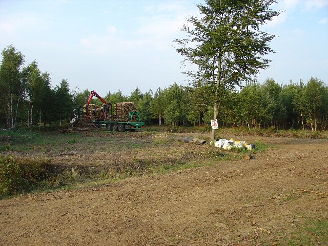
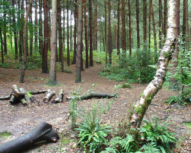
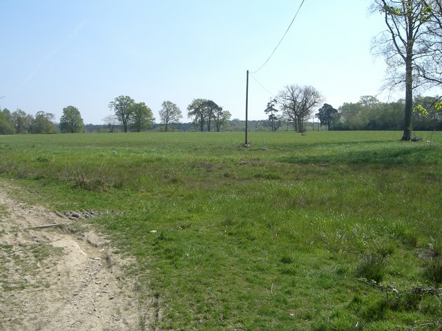
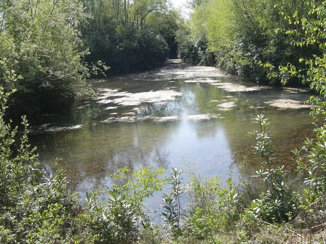
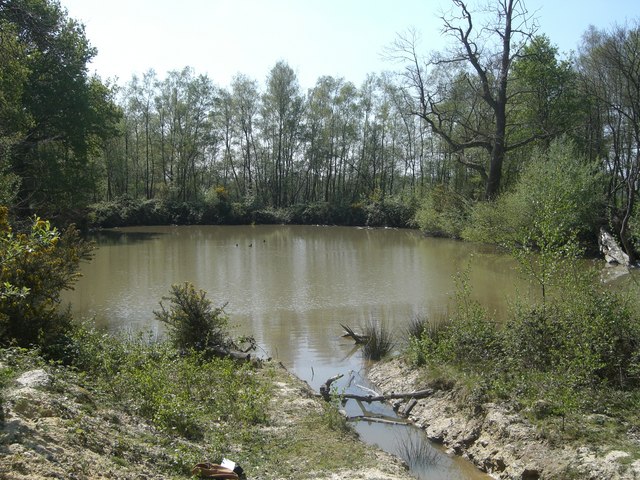
Severals Bottom is a picturesque valley located in the county of Sussex, England. Nestled in the heart of the South Downs National Park, this rural area is known for its natural beauty and peaceful atmosphere. The valley is surrounded by rolling hills, lush green meadows, and dense woodlands, creating an idyllic setting for nature lovers and outdoor enthusiasts.

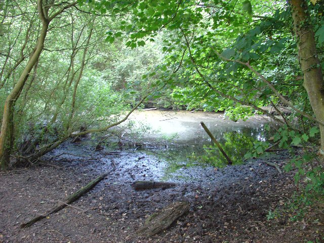
Severals Bottom is home to a diverse range of wildlife, including various bird species, mammals, and insects. The area's rich biodiversity is due to its unique habitat, which supports a wide array of flora and fauna. Visitors can often spot deer roaming freely, rabbits hopping across the fields, and birds hovering above.

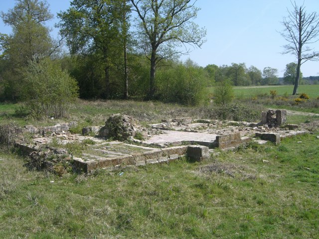
The valley is also renowned for its historical significance. Several ancient burial mounds and archaeological sites have been discovered in the area, providing a glimpse into the region's past. These remnants from bygone eras add an air of mystique and intrigue to Severals Bottom, attracting history buffs and archaeology enthusiasts.

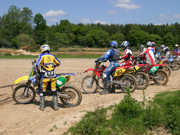
For those seeking recreational activities, Severals Bottom offers ample opportunities for hiking, cycling, and picnicking. The valley is crisscrossed with scenic walking trails that weave through the countryside, allowing visitors to explore the area's natural wonders at their own pace. In addition, the nearby River Severn provides a peaceful spot for fishing and boating.

Overall, Severals Bottom in Sussex is a hidden gem that combines natural beauty, tranquility, and historical significance. Whether it is to immerse oneself in nature, discover ancient landmarks, or simply relax in a serene setting, this valley offers a delightful escape from the hustle and bustle of everyday life.

If you have any feedback on the listing, please let us know in the comments section below.

Severals Bottom Images

Images are sourced within 2km of 51.072167/-0.28630328 or Grid Reference TQ2031. Thanks to Geograph Open Source API. All images are credited.

Inholms Gill A tributary of the River Arun that rises in St Leonard's Forest.
Inholms Gill
A tributary of the River Arun that rises in St Leonard's Forest.
Track, St Leonard's Forest The surfaced track heads north from the car park on Hammerpond Road to Mick's Cross.
Track, St Leonard's Forest
The surfaced track heads north from the car park on Hammerpond Road to Mick's Cross.
Rural Bridleway near Horsham, West Sussex This bridleway runs up a straight avenue of trees that cuts across the old St. Leonards estate from a gate lodge on the public road to the "Big House". Offered a very pleasant cycle ride on the day of the photo! Photo taken looking N along the avenue. Corn fields can be seen on the other side of the trees on the right.
Rural Bridleway near Horsham, West Sussex
This bridleway runs up a straight avenue of trees that cuts across the old St. Leonards estate from a gate lodge on the public road to the "Big House". Offered a very pleasant cycle ride on the day of the photo! Photo taken looking N along the avenue. Corn fields can be seen on the other side of the trees on the right.
Stew Pond, adjacent to bridleway, St Leonards Park Estate, Near Horsham, West Sussex. The original purpose of this pond (and an adjacent pond) is not obvious, but its proximity to the main estate buildings may mean that it was used as water storage or a fish pond to supply the estate. Relatively overgrown and unused these days!
Stew Pond, adjacent to bridleway, St Leonards Park Estate, Near Horsham, West Sussex.
The original purpose of this pond (and an adjacent pond) is not obvious, but its proximity to the main estate buildings may mean that it was used as water storage or a fish pond to supply the estate. Relatively overgrown and unused these days!
Level Crossing (Horsham-Crawley line), Wimland Road, Faygate, West Sussex An automatic (un-manned) rural level crossing on this railway line, which connects Horsham to the London Victoria terminus, via Three Bridges.
Level Crossing (Horsham-Crawley line), Wimland Road, Faygate, West Sussex
An automatic (un-manned) rural level crossing on this railway line, which connects Horsham to the London Victoria terminus, via Three Bridges.
Forest Grange, in the heart of St Leonards Forest, Near Horsham, West Sussex Earlier maps (e.g. 1993) show this as the site of Forest Grange School. Later maps have dropped school from the name. It didn't looked like it was being used as a school at the time the picture was taken.
Forest Grange, in the heart of St Leonards Forest, Near Horsham, West Sussex
Earlier maps (e.g. 1993) show this as the site of Forest Grange School. Later maps have dropped school from the name. It didn't looked like it was being used as a school at the time the picture was taken.
Forestry Operations, St Leonards Forest, Near Horsham, West Sussex The forest is run by the Forestry Commission for commercial timber extraction. Here we see a lorry on the main access track (also a public bridleway) being loaded up with logs.
Forestry Operations, St Leonards Forest, Near Horsham, West Sussex
The forest is run by the Forestry Commission for commercial timber extraction. Here we see a lorry on the main access track (also a public bridleway) being loaded up with logs.
"The Meadow", Roffey Park Institute, Forest Road, Colgate, West Sussex "The Meadow" is the name of the newest part of the Institute, opened in 2003. Roffey Park Institute is a management training centre. Details at <span class="nowrap"><a title="http://www.roffeypark.com/aboutroffey.html" rel="nofollow ugc noopener" href="http://www.roffeypark.com/aboutroffey.html">Link</a><img style="margin-left:2px;" alt="External link" title="External link - shift click to open in new window" src="https://s1.geograph.org.uk/img/external.png" width="10" height="10"/></span>
"The Meadow", Roffey Park Institute, Forest Road, Colgate, West Sussex
"The Meadow" is the name of the newest part of the Institute, opened in 2003. Roffey Park Institute is a management training centre. Details at LinkExternal link
Owlbeech Woods, Horsham, West Sussex Mixed woodland. The part shown is a coniferous plantation. The woods join on to Leechpool woods <a href="https://www.geograph.org.uk/gridref/TQ1931">TQ1931</a>. Owned an run by Horsham District Council, who permit general public access.
Owlbeech Woods, Horsham, West Sussex
Mixed woodland. The part shown is a coniferous plantation. The woods join on to Leechpool woods TQ1931. Owned an run by Horsham District Council, who permit general public access.
Road Bend on Forest Road, between Horsham and Colgate, West Sussex Although classified as minor, a busy country road with local traffic. A private road to Forest Grange <a href="https://www.geograph.org.uk/gridref/TQ2131">TQ2131</a> leads off from this corner (just visible to the left). View taken looking SW.
Road Bend on Forest Road, between Horsham and Colgate, West Sussex
Although classified as minor, a busy country road with local traffic. A private road to Forest Grange TQ2131 leads off from this corner (just visible to the left). View taken looking SW.
Covered Reservoir, Forest Road, between Colgate and Horsham, West Sussex A covered water reservoir on the N side of Forest Road. At approx 120m above sea level, the reservoir is located on a ridge above Horsham.
Covered Reservoir, Forest Road, between Colgate and Horsham, West Sussex
A covered water reservoir on the N side of Forest Road. At approx 120m above sea level, the reservoir is located on a ridge above Horsham.
Motocross track near to Horsham, West Sussex A view facing roughly north of the start line, with St. Leonard's forest in the background.
Motocross track near to Horsham, West Sussex
A view facing roughly north of the start line, with St. Leonard's forest in the background.
Turf  Plain Turf Plain looking to the south east.  The ground dips just beyond the trees to Sheepwash Ghyll and then rises to Scragged Oak Hill in St Leonard's Forest.
Bottom left of the picture passes the High Weald Landscape Trail.
Turf Plain
Turf Plain looking to the south east. The ground dips just beyond the trees to Sheepwash Ghyll and then rises to Scragged Oak Hill in St Leonard's Forest. Bottom left of the picture passes the High Weald Landscape Trail.
Turf Plain Lodge The ground floor pattern of Turf Plain Lodge can be clearly seen.  The High Weald Landscape Trail passes just beyond the remains.
Turf Plain Lodge
The ground floor pattern of Turf Plain Lodge can be clearly seen. The High Weald Landscape Trail passes just beyond the remains.
Turf Plain pond One of several ponds on Turf Plain.  This one feeds to a commercial fishery.
Turf Plain pond
One of several ponds on Turf Plain. This one feeds to a commercial fishery.
Earthbank on Greenbroom Hill The earthbank goes west down Greenbroom Hill for approximately 200m.  Silver birch is here on the top of the bank which heads into a pine plantation.  The earthbank continues east for approximately 25m on the other side of the forestry track.
Earthbank on Greenbroom Hill
The earthbank goes west down Greenbroom Hill for approximately 200m. Silver birch is here on the top of the bank which heads into a pine plantation. The earthbank continues east for approximately 25m on the other side of the forestry track.
Whitevane Pond The notice says it all,  this is a very private fishery.
Try <span class="nowrap"><a title="http://www.fisheries.co.uk/whitevane/index.htm" rel="nofollow ugc noopener" href="http://www.fisheries.co.uk/whitevane/index.htm">Link</a><img style="margin-left:2px;" alt="External link" title="External link - shift click to open in new window" src="https://s1.geograph.org.uk/img/external.png" width="10" height="10"/></span>  for more pictures.
In 1879 Whitevane pond had Boat House on the west shore.
Whitevane Pond
The notice says it all, this is a very private fishery. Try LinkExternal link for more pictures. In 1879 Whitevane pond had Boat House on the west shore.
Pond on Turf  Plain Another pond on Turf Plain, this one drains a nearby motocross circuit.
Pond on Turf Plain
Another pond on Turf Plain, this one drains a nearby motocross circuit.
Show me another place!

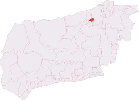
Severals Bottom is located at Grid Ref: TQ2031 (Lat: 51.072167, Lng: -0.28630328)

Administrative County: West Sussex

District: Horsham

Police Authority: Sussex

What 3 Words

///table.deflated.mavericks. Near Horsham, West Sussex

Related Wikis

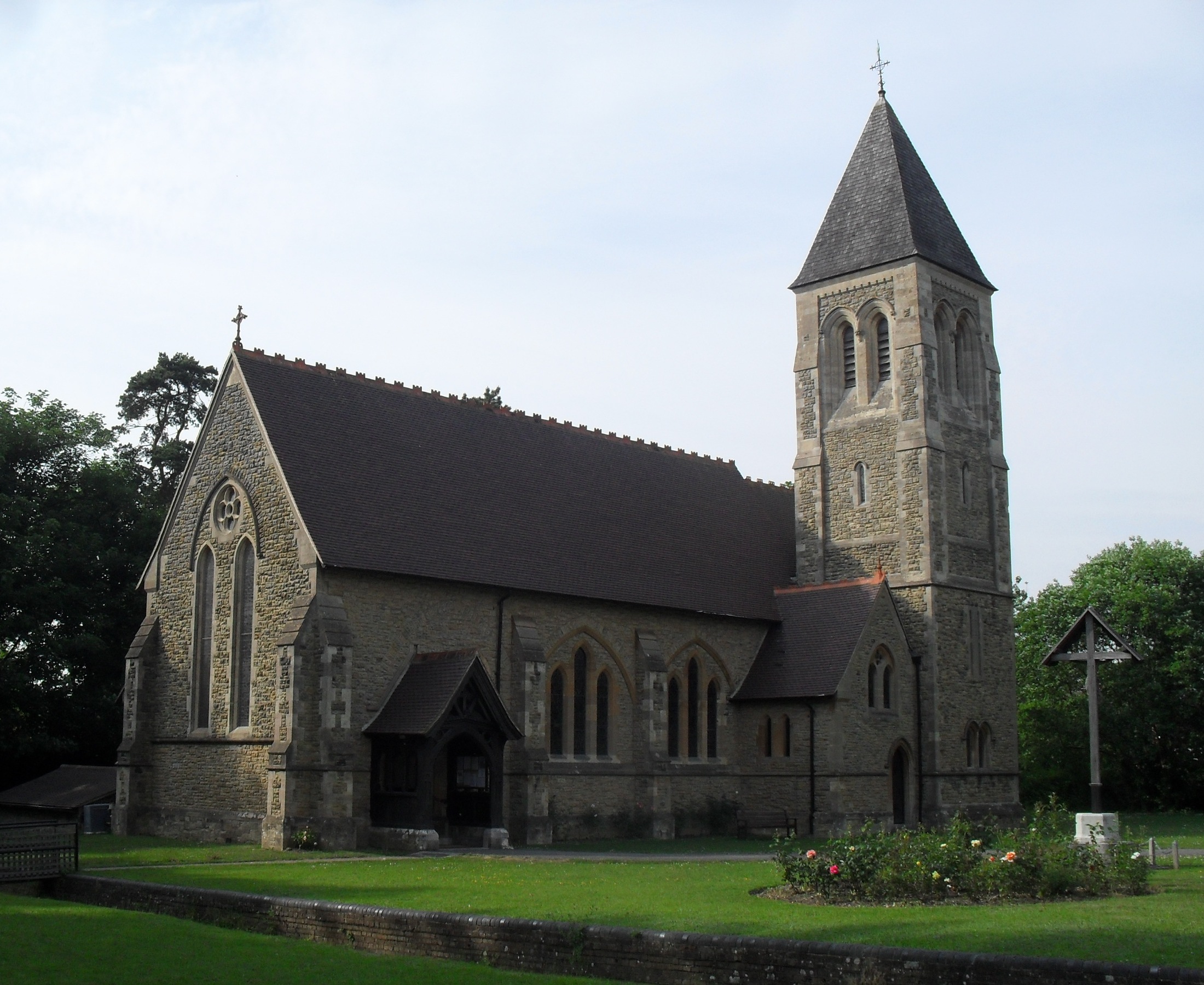
All Saints Church, Roffey

All Saints Church is the Anglican parish church of Roffey, in the Horsham district of the English county of West Sussex. The present church, built to...

Roffey (electoral division)

Roffey is an electoral division of West Sussex in the United Kingdom and returns one member to sit on West Sussex County Council. == Extent == The division...

St Leonard's Park Ponds

St Leonard's Park Ponds is a 3.9-hectare (9.6-acre) biological Site of Special Scientific Interest east of Horsham in West Sussex.These ponds and adjacent...

North Horsham

North Horsham is a civil parish in the district of Horsham in West Sussex, England, covering the northern part of the Horsham town area. According to...

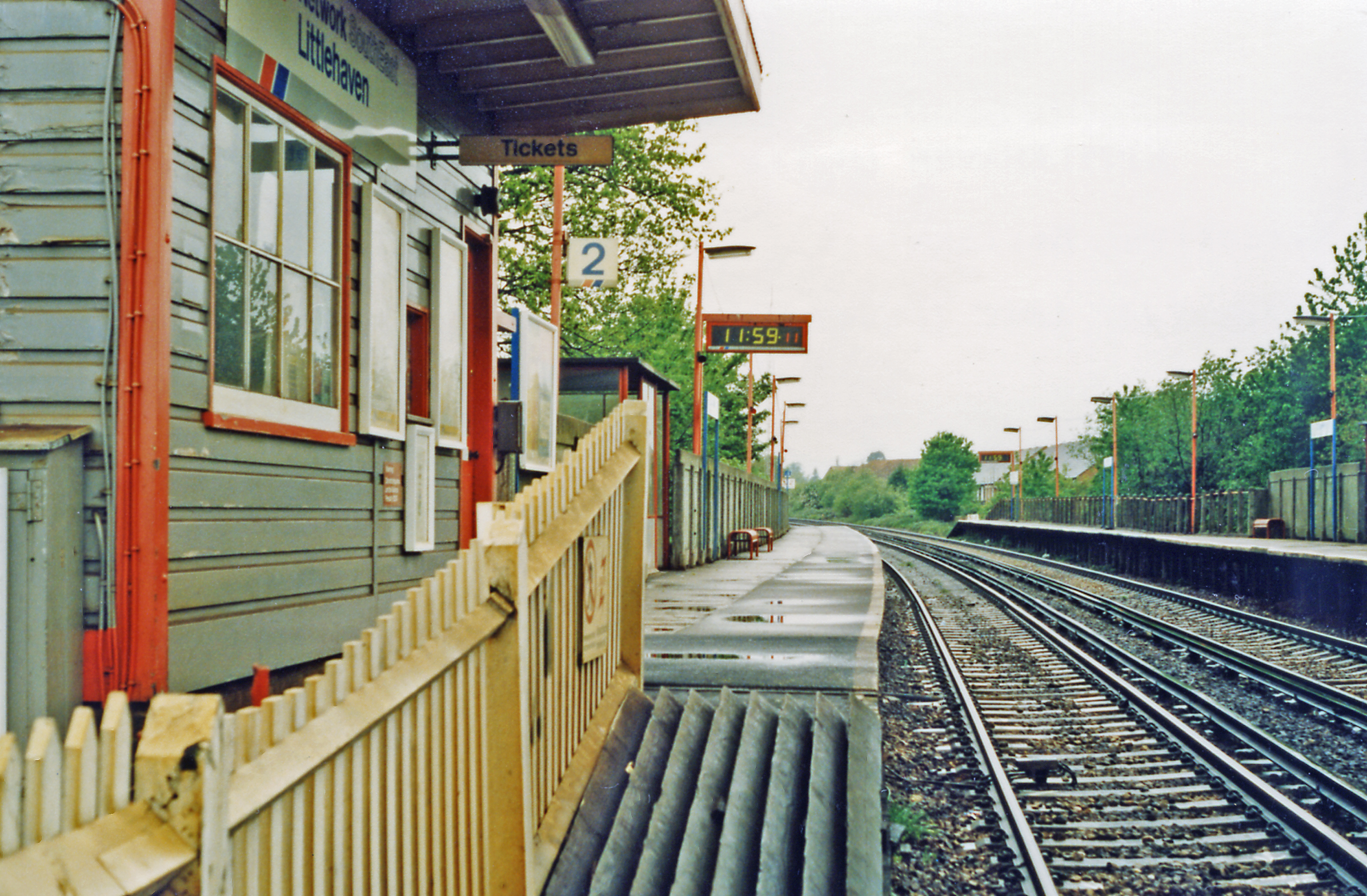
North Horsham railway station

North Horsham is a proposed railway station in Horsham, West Sussex which would serve the North Horsham Business Park. The proposal was backed by West...

Roffey Road Halt railway station

Roffey Road Halt is a now disused station on the Arun Valley Line in West Sussex, England and was the second station north from Horsham on the stretch...

Roffey F.C.

Roffey F.C. is an English football club located in Roffey, Horsham in West Sussex. The club are currently members of the Southern Combination Division...

St Leonard's Forest

St Leonard's Forest is at the western end of the Wealden Forest Ridge which runs from Horsham to Tonbridge, and is part of the High Weald Area of Outstanding...

Nearby Amenities

Located within 500m of 51.072167,-0.28630328
Bus Stop
Rowan Way
Bus: yes
Naptan AtcoCode: 4400HO0149
Naptan Bearing: SW
Naptan CommonName: Rowan Way
Naptan Indicator: adj Rowan Way
Naptan Landmark: Rowan Way
Naptan NaptanCode: wsxatadg
Naptan Street: Beech Road
Naptan Verified: no
Public Transport: platform
Source: naptan_import
Lat/Long: 51.0762884/-0.2891304
Bus Stop
South Holmes Road
Bus: yes
Naptan AtcoCode: 4400HO0150
Naptan Bearing: E
Naptan CommonName: South Holmes Road
Naptan Indicator: adj Gillett Court
Naptan Landmark: Harwood Road
Naptan NaptanCode: wsxatadj
Naptan Street: South Holmes Road
Naptan Verified: no
Public Transport: platform
Source: naptan_import
Lat/Long: 51.0737029/-0.2927574
Bus Stop
South Holmes Road
Bus: yes
Naptan AtcoCode: 4400HO0151
Naptan Bearing: S
Naptan CommonName: South Holmes Road
Naptan Indicator: opp. Murray Court
Naptan Landmark: Murray Court
Naptan NaptanCode: wsxatadm
Naptan Street: South Holmes Road
Naptan Verified: no
Public Transport: platform
Source: naptan_import
Lat/Long: 51.0731017/-0.2912327
Bus Stop
Falklands Drive
Bus: yes
Naptan AtcoCode: 4400HO0152
Naptan Bearing: SW
Naptan CommonName: Falklands Drive
Naptan Indicator: adj Falklands Drive
Naptan Landmark: Falklands Drive
Naptan NaptanCode: wsxatadp
Naptan Street: Roebuck Close
Naptan Verified: no
Public Transport: platform
Source: naptan_import
Lat/Long: 51.0715369/-0.2924412
Park Wood
Natural: wood
Lat/Long: 51.0690186/-0.2906217
Washout Hydrant
Fire Hydrant
Emergency: fire_hydrant
Fire Hydrant Type: underground
Survey Date: 2018-11-11
Water Source: main
Lat/Long: 51.0721771/-0.2916064
Washout Hydrant
Fire Hydrant
Emergency: fire_hydrant
Fire Hydrant Type: underground
Survey Date: 2018-11-11
Water Source: main
Lat/Long: 51.075435/-0.2907935
Noexit: yes
Lat/Long: 51.0719608/-0.2929035
The data included in this document is from www.openstreetmap.org. The data is made available under ODbL.

Have you been to Severals Bottom?

Leave your review of Severals Bottom below (or comments, questions and feedback).