Old Barn Gill

Valley in Sussex Horsham

England

Old Barn Gill

Old Milepost by A24, Durfold, a mile North of Warnham The Milepost is located by fence at back of verge on the East of the road.  Parish of Warnham (Horsham District). Cast iron post, Horsham post design, erected by the Horsham & Dorking turnpike trust in the 19th Century. 

Inscription reads:-  
25 MILES / TO / BRIGHTON / 3½ / TO / HORSHAM : : 33 MILES / TO / LONDON / 10 / MILES TO / DORKING : : WARNHAM

Milestone Society National ID: SX_LA33
Old Milepost by A24, Durfold, a mile North of Warnham Credit: Andrew Knorpel

Old Barn Gill is a picturesque valley located in Sussex, England. Nestled in the heart of the South Downs National Park, it is known for its stunning natural beauty and tranquil atmosphere. The valley is named after a historic barn that sits at its entrance, adding to its charm and character.

The landscape of Old Barn Gill is defined by rolling hills, lush meadows, and meandering streams. The valley is adorned with an abundance of native flora and fauna, making it a haven for nature enthusiasts and wildlife lovers. Visitors can spot various species of birds, butterflies, and small mammals as they explore the area.

The valley is also a popular destination for outdoor activities such as hiking and cycling. There are numerous well-marked trails that wind through the valley, offering breathtaking views of the surrounding countryside. In addition, the gently flowing streams provide opportunities for fishing and picnicking by the water's edge.

Old Barn Gill is not only a natural paradise but also steeped in history. The barn itself is believed to date back several centuries and is a testament to the area's agricultural heritage. Nearby, ancient burial mounds and archaeological sites provide glimpses into the valley's past, adding an extra layer of intrigue to the visitor experience.

Overall, Old Barn Gill is a hidden gem in Sussex, offering visitors a chance to escape the hustle and bustle of everyday life and immerse themselves in the beauty of the English countryside. Whether it's for a leisurely stroll, an active adventure, or a peaceful retreat, this valley has something for everyone.

If you have any feedback on the listing, please let us know in the comments section below.

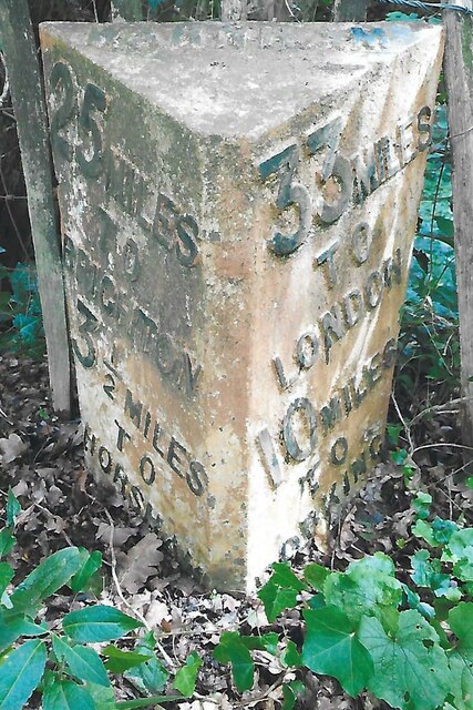
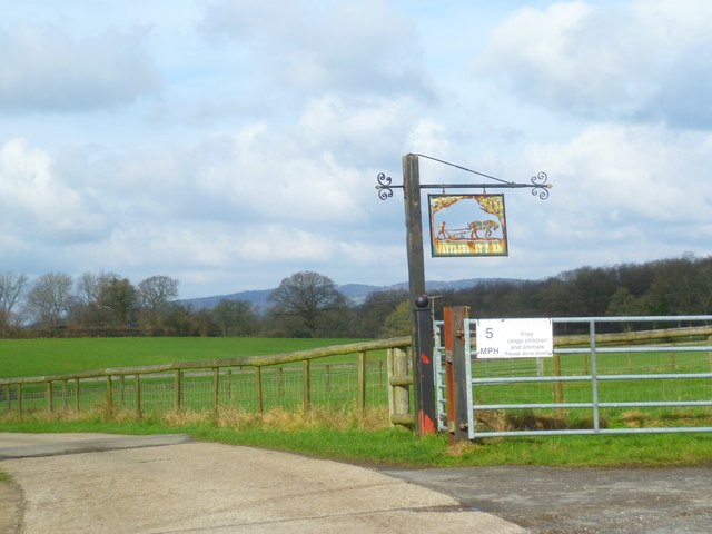
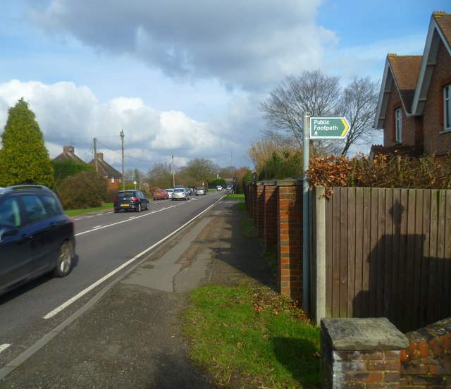
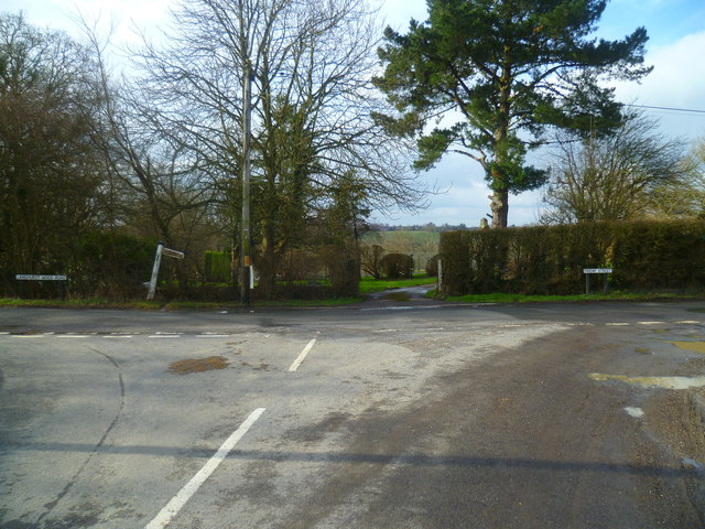
Old Barn Gill Images

Images are sourced within 2km of 51.119364/-0.32303727 or Grid Reference TQ1736. Thanks to Geograph Open Source API. All images are credited.

Old Milepost by A24, Durfold, a mile North of Warnham The Milepost is located by fence at back of verge on the East of the road.  Parish of Warnham (Horsham District). Cast iron post, Horsham post design, erected by the Horsham & Dorking turnpike trust in the 19th Century. 

Inscription reads:-  
25 MILES / TO / BRIGHTON / 3½ / TO / HORSHAM : : 33 MILES / TO / LONDON / 10 / MILES TO / DORKING : : WARNHAM

Milestone Society National ID: SX_LA33
Old Milepost by A24, Durfold, a mile North of Warnham
The Milepost is located by fence at back of verge on the East of the road.  Parish of Warnham (Horsham District). Cast iron post, Horsham post design, erected by the Horsham & Dorking turnpike trust in the 19th Century.  Inscription reads:- 25 MILES / TO / BRIGHTON / 3½ / TO / HORSHAM : : 33 MILES / TO / LONDON / 10 / MILES TO / DORKING : : WARNHAM Milestone Society National ID: SX_LA33
Looking across stile near pond on Smugglers Lane This is in Surrey.
Looking across stile near pond on Smugglers Lane
This is in Surrey.
Footbridge over Letts Gill This is in Surrey.
Footbridge over Letts Gill
This is in Surrey.
Footpath south of Smugglers Lane with obstacle ahead This is in Surrey.
Footpath south of Smugglers Lane with obstacle ahead
This is in Surrey.
Looking north on footpath leading to Smugglers Lane The obstacle seems to have been there for some time judging by the route which gets round it.  See <a href="https://www.geograph.org.uk/photo/4824083">TQ1536 : Footpath south of Smugglers Lane with obstacle ahead</a> for a view the other way.  This is in Surrey.
Looking north on footpath leading to Smugglers Lane
The obstacle seems to have been there for some time judging by the route which gets round it. See TQ1536 : Footpath south of Smugglers Lane with obstacle ahead for a view the other way. This is in Surrey.
Woodland stile
Woodland stile
Public footbridge over Tickfold Gill A view from July 2010 is at <a title="https://www.geograph.org.uk/photo/1972116" href="https://www.geograph.org.uk/photo/1972116">Link</a>.
Public footbridge over Tickfold Gill
A view from July 2010 is at Link.
Oakdale Farm seen from Smugglers Lane A closer view from 2010 is at <a title="https://www.geograph.org.uk/photo/1972108" href="https://www.geograph.org.uk/photo/1972108">Link</a>.
This is in Surrey.
Oakdale Farm seen from Smugglers Lane
A closer view from 2010 is at Link. This is in Surrey.
Footpath to Wattlehurst Farm from the A24 On the right is a builders' merchant's premises.
Footpath to Wattlehurst Farm from the A24
On the right is a builders' merchant's premises.
Derelict structure by footpath
Sign with a view The skyline is in the Surrey Hills.  The camera is in West Sussex.
Sign with a view
The skyline is in the Surrey Hills. The camera is in West Sussex.
Dorking Road looking northwards north of Kingsfold
Old Barn Cottage on the A24
The A24 in Kingsfold
Looking northwards on Foxwood
Footpath junction east of Kingsfold
Sign at footpath junction east of Kingsfold
Junction at the west end of Green Lane A view of this junction from the south is at <a title="https://www.geograph.org.uk/photo/1779327" href="https://www.geograph.org.uk/photo/1779327">Link</a>.
Junction at the west end of Green Lane
A view of this junction from the south is at Link.
Show me another place!

Old Barn Gill is located at Grid Ref: TQ1736 (Lat: 51.119364, Lng: -0.32303727)

Administrative County: West Sussex

District: Horsham

Police Authority: Sussex

What 3 Words

///eternally.sparkles.suiting. Near Capel, Surrey

Nearby Locations

Old Barn Gill

Related Wikis

Shiremark Mill, Capel

Shiremark Mill, also known as Kingsfold Mill or Capel Mill was a listed Smock mill at Capel, Surrey, England, which was burnt down in 1972. == History... ==

Warnham SSSI

Warnham SSSI is a 28.5-hectare (70-acre) geological Site of Special Scientific Interest north of Horsham in West Sussex. It is a Geological Conservation...

Clock House Brickworks

Clock House Brickworks is a 35.9-hectare (89-acre) geological Site of Special Scientific Interest south of Capel in Surrey. It is a Geological Conservation...

Auclaye

Auclaye is a 0.6-hectare (1.5-acre) geological Site of Special Scientific Interest south of Capel in Surrey. It is a Geological Conservation Review site...

Vann Lake and Ockley Woods

Vann Lake and Ockley Woods is a 57.8-hectare (143-acre) biological Site of Special Scientific Interest south of Ockley in Surrey. Vann Lake is part of...

Warnham railway station

Warnham railway station serves the village of Warnham in West Sussex, England. It is 33 miles 46 chains (54.0 km) measured from London Waterloo (although...

Graylands

Graylands is a hamlet in the Horsham district of West Sussex, England. The largely rural hamlet is located north of Holbrook beyond the A264. It is bordered...

Old Holbrook

Old Holbrook (formerly known as Northlands) is a hamlet in the Horsham district of West Sussex, England. This rural hamlet is located north of the Horsham...

Nearby Amenities

Located within 500m of 51.119364,-0.32303727
Source: Landsat photo
Lat/Long: 51.1165664/-0.3225752
Source: Landsat photo
Lat/Long: 51.1182047/-0.3211958
Source: Landsat photo
Lat/Long: 51.1221252/-0.3193507
Source: Landsat photo
Lat/Long: 51.120952/-0.3196874
Barrier: stile
Lat/Long: 51.1205366/-0.3243704
Barrier: stile
Lat/Long: 51.1193291/-0.3269848
Barrier: stile
Lat/Long: 51.1209799/-0.3195815
Barrier: stile
Lat/Long: 51.1209885/-0.3198011
Barrier: stile
Lat/Long: 51.1209704/-0.3194925
Moat
Historic: archaeological_site
Lat/Long: 51.1206858/-0.3236794
Ford: yes
Lat/Long: 51.1197079/-0.3257758
Source: Landsat photo
Lat/Long: 51.1221462/-0.3193443
The data included in this document is from www.openstreetmap.org. The data is made available under ODbL.

Have you been to Old Barn Gill?

Leave your review of Old Barn Gill below (or comments, questions and feedback).