Blake's Gill

Valley in Sussex Horsham

England

Blake's Gill

Stables at Elliotts Farm
Stables at Elliotts Farm Credit: Ian Cunliffe

Blake's Gill, also known as Sussex Valley, is a picturesque valley located in Sussex, England. It is named after the renowned English poet and artist William Blake, who is said to have found inspiration in the natural beauty of this area.

The valley is nestled between the South Downs and the High Weald, offering stunning views of rolling hills, lush green meadows, and dense woodlands. It is characterized by a tranquil and serene atmosphere, making it a popular destination for nature lovers and hikers.

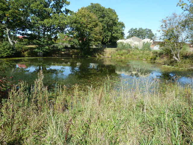
The gill itself is a small stream that runs through the valley, adding to its charm and providing a soothing soundtrack as it gently flows over pebbles and rocks. The stream is surrounded by an abundance of flora and fauna, including wildflowers, ferns, and various species of birds and butterflies.

Visitors to Blake's Gill can enjoy peaceful walks along the valley floor, taking in the sights and sounds of nature. There are also several walking trails that lead up to the surrounding hills, offering panoramic views of the countryside. The area is home to a diverse range of wildlife, including deer, rabbits, and foxes, which can often be spotted during these walks.

In addition to its natural beauty, Blake's Gill is also steeped in history. There are several archaeological sites in the area, including ancient burial mounds and remnants of Iron Age settlements, providing an insight into the region's past.

Overall, Blake's Gill is a tranquil and idyllic valley, offering visitors a chance to immerse themselves in the beauty of nature and explore the rich history of Sussex.

If you have any feedback on the listing, please let us know in the comments section below.
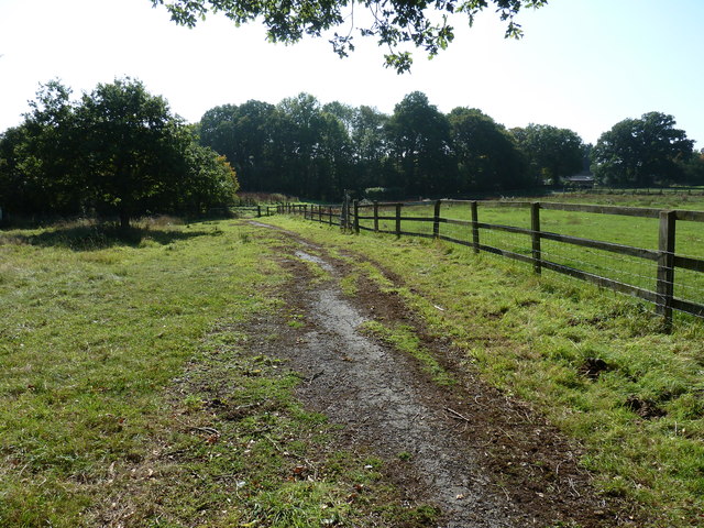
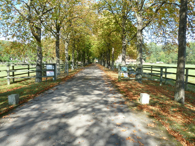
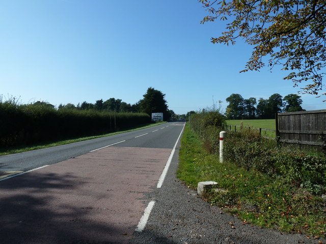
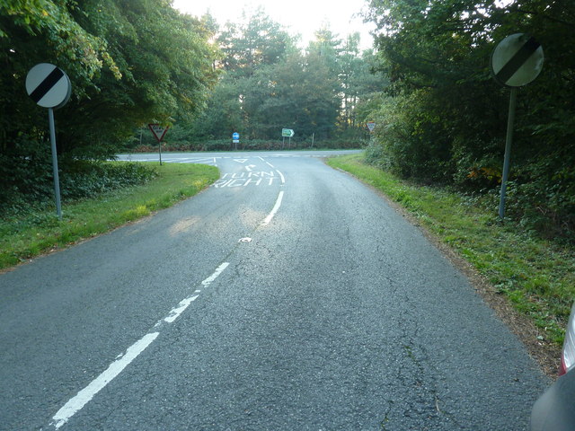
Blake's Gill Images

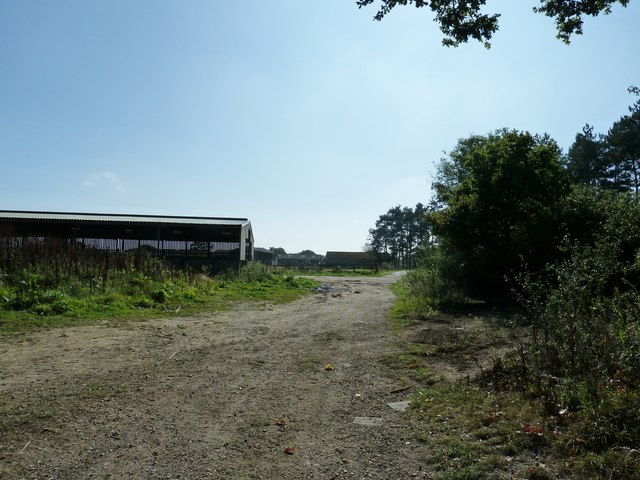
Images are sourced within 2km of 51.005992/-0.32882492 or Grid Reference TQ1724. Thanks to Geograph Open Source API. All images are credited.

Stables at Elliotts Farm
New houses south of "The Wilderness"
Horse's head painted on gatepost They keep horses in the field on the west side of the bridleway.
Horse's head painted on gatepost
They keep horses in the field on the west side of the bridleway.
Old Milestone by the former A24, Mill Straight, Southwater parish Carved stone post by the UC road (was A24), in parish of Southwater (Horsham District), Mill Straight, West of Fieldings, against fence, on South side of road at end of bus lay-by. Steyning stone, erected by the Horsham & Steyning turnpike trust in the 19th century. Painted and re-engraved by Lionel Joseph in about 2011.

Inscription reads:-
40
MILES
FROM
LONDON
Carved benchmark upper centre, rivet on top.

West Sussex HER.
HER Ref: MWS8538 <span class="nowrap"><a title="https://www.heritagegateway.org.uk/Gateway/Results_Single.aspx?uid=MWS8538&resourceID=1032" rel="nofollow ugc noopener" href="https://www.heritagegateway.org.uk/Gateway/Results_Single.aspx?uid=MWS8538&resourceID=1032">Link</a><img style="margin-left:2px;" alt="External link" title="External link - shift click to open in new window" src="https://s1.geograph.org.uk/img/external.png" width="10" height="10"/></span>

Milestone Society National ID: SX_LA40
Old Milestone by the former A24, Mill Straight, Southwater parish
Carved stone post by the UC road (was A24), in parish of Southwater (Horsham District), Mill Straight, West of Fieldings, against fence, on South side of road at end of bus lay-by. Steyning stone, erected by the Horsham & Steyning turnpike trust in the 19th century. Painted and re-engraved by Lionel Joseph in about 2011. Inscription reads:- 40 MILES FROM LONDON Carved benchmark upper centre, rivet on top. West Sussex HER. HER Ref: MWS8538 LinkExternal link Milestone Society National ID: SX_LA40
McDonald's restaurant, A24 near West Grinstead
A24 near West Grinstead
Heathtolt Farm Accessed from Park Lane by the track coming down the hill. The track is also a public footpath, which comes through the farmyard and up a wooded ridge, passing the viewpoint.
Heathtolt Farm
Accessed from Park Lane by the track coming down the hill. The track is also a public footpath, which comes through the farmyard and up a wooded ridge, passing the viewpoint.
Footpath 1809 near Conies Farm The footpath passes down this long field without clear definition, to exit onto Maplehurst Road via a stile just to the right of the pair of trees at the end. Conies Farm is just visible at the right. It seems to have withdrawn from serious agricultural activity, but it does sell free range eggs.
Footpath 1809 near Conies Farm
The footpath passes down this long field without clear definition, to exit onto Maplehurst Road via a stile just to the right of the pair of trees at the end. Conies Farm is just visible at the right. It seems to have withdrawn from serious agricultural activity, but it does sell free range eggs.
Shaggy Ink Caps at the footpath and bridleway junction in Freeman's Wood
Bridleway in Freeman's Wood
Mixed woodland trees on the edge of Freeman's Wood
Farm bridge on footpath 1819 The stream below is one of the main tributaries of the western arm of the River Adur.
Farm bridge on footpath 1819
The stream below is one of the main tributaries of the western arm of the River Adur.
Out buildings at Newhouse Farm
Pond at Newhouse Farm
Footpath 1793 to Model Farm
Driveway to Model Farm Although I couldn't see a name, the name on the WSCC map is Model Farm.
Driveway to Model Farm
Although I couldn't see a name, the name on the WSCC map is Model Farm.
View west on the A272 towards Buckbarn Crossroads
Link road between the two carriageways of the A24 This short section of road enables traffic, from Copsale, to join the A24 in either directions.
Many years ago while returning south from Horsham we encountered an elderly lady heading north on the southbound carriageway. Fortunately it is a two lane carriageway and we were in the left lane and she was in the other as we rounded the bend a little further north from here. We only said one word which now translate into 'excrement'.
Link road between the two carriageways of the A24
This short section of road enables traffic, from Copsale, to join the A24 in either directions. Many years ago while returning south from Horsham we encountered an elderly lady heading north on the southbound carriageway. Fortunately it is a two lane carriageway and we were in the left lane and she was in the other as we rounded the bend a little further north from here. We only said one word which now translate into 'excrement'.
Show me another place!

Blake's Gill is located at Grid Ref: TQ1724 (Lat: 51.005992, Lng: -0.32882492)

Administrative County: West Sussex

District: Horsham

Police Authority: Sussex

What 3 Words

///parks.executive.widely. Near Southwater, West Sussex

Related Wikis

Copsale

Copsale is a hamlet in the civil parish of Nuthurst, and the Horsham District of West Sussex, England. It lies on the Southwater to Maplehurst road 3.5...

Maplehurst, West Sussex

Maplehurst is a hamlet in the civil parish of Nuthurst, and the Horsham District of West Sussex, England. The hamlet is on the Copsale to Nuthurst road...

West Grinstead railway station

West Grinstead was a railway station on the Steyning Line which served the village of West Grinstead. It had a goods yard with a cattle loading bay and...

Southwater railway station

Southwater was a railway station on the Steyning Line which served the village of Southwater. A goods siding allowed for the transportation of coal and...

Nearby Amenities

Located within 500m of 51.005992,-0.32882492
Barrier: stile
Lat/Long: 51.0065002/-0.322429
Barrier: stile
Lat/Long: 51.0060962/-0.3220417
Power: pole
Lat/Long: 51.0097147/-0.3322318
Power: pole
Lat/Long: 51.0097856/-0.3321809
Power: pole
Lat/Long: 51.0094025/-0.3311643
Power: pole
Lat/Long: 51.0090093/-0.330137
Power: pole
Lat/Long: 51.009313/-0.331234
Power: pole
Lat/Long: 51.0089384/-0.330247
Power: pole
Lat/Long: 51.0075714/-0.3287262
Power: pole
Lat/Long: 51.0064845/-0.3274763
Power: pole
Lat/Long: 51.0076507/-0.3286243
Power: pole
Lat/Long: 51.0065402/-0.3273529
Power: pole
Lat/Long: 51.0048895/-0.3254807
Power: pole
Lat/Long: 51.0048423/-0.3256121
Power: pole
Lat/Long: 51.0039781/-0.3246412
Power: pole
Lat/Long: 51.0034481/-0.3240269
Power: pole
Lat/Long: 51.0034971/-0.3239116
Tuckmans Farm
Place: farm
Lat/Long: 51.0029555/-0.3317236
Blake's Farm
Place: isolated_dwelling
Lat/Long: 51.0057783/-0.3223238
Oaktree Farm
Place: farm
Lat/Long: 51.009908/-0.3313722
Barrier: stile
Lat/Long: 51.0076641/-0.3227624
The data included in this document is from www.openstreetmap.org. The data is made available under ODbL.

Have you been to Blake's Gill?

Leave your review of Blake's Gill below (or comments, questions and feedback).