Hanby's Ghyll

Valley in Sussex Horsham

England

Hanby's Ghyll

South Downs Way Climbing towards Chanctonbury Ring on the South Downs Way.
South Downs Way Credit: Chris Thomas-Atkin

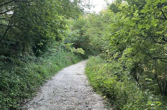
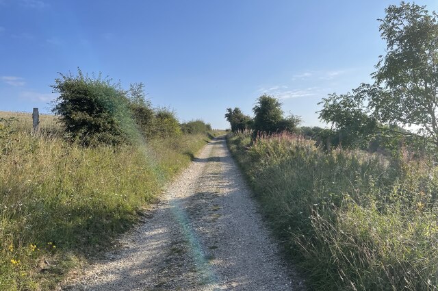
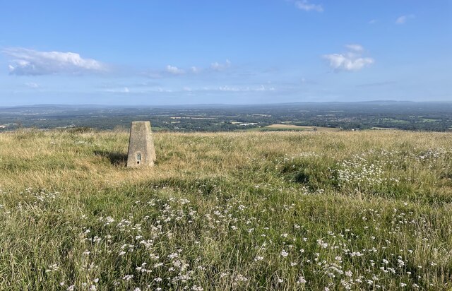
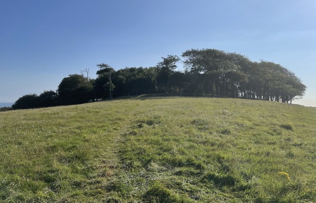
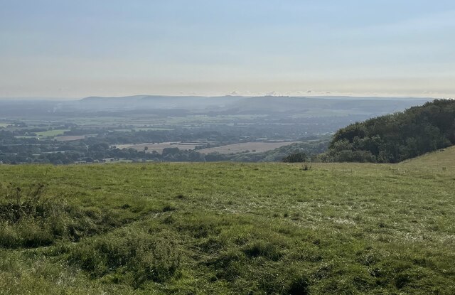
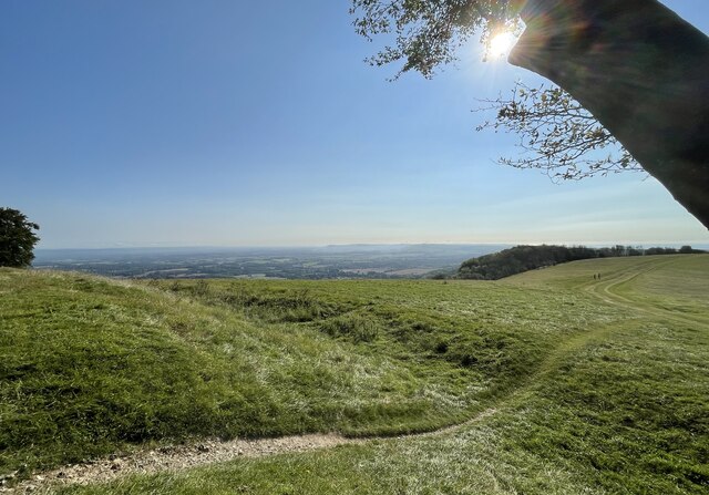
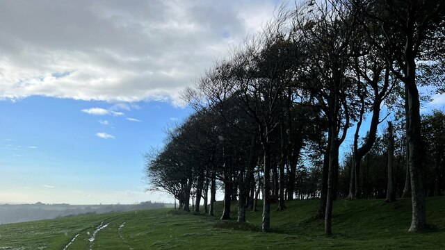
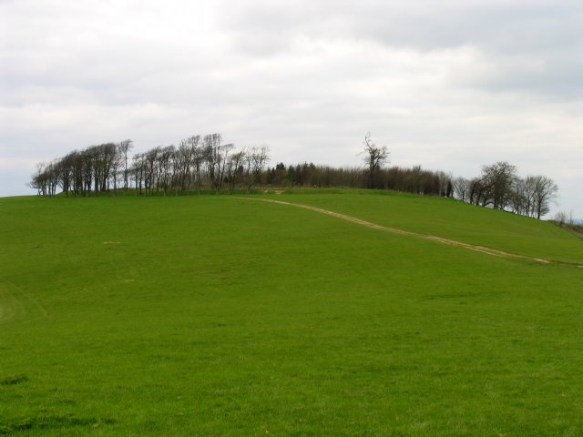
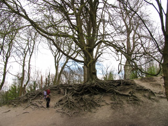
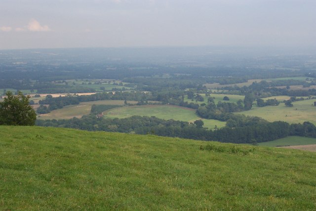
Hanby's Ghyll is a picturesque valley located in the county of Sussex, England. Situated amidst the South Downs National Park, this valley offers breathtaking natural beauty and tranquil surroundings. The ghyll, which is the Sussex term for a narrow valley or ravine, is surrounded by rolling hills and dense woodlands, providing a haven for wildlife and a peaceful retreat for visitors.

The valley is named after the Hanby family, who were the original owners of the land. Hanby's Ghyll is known for its diverse ecosystem, with a wide range of plant and animal species calling it home. The woodlands are particularly noteworthy, with ancient oak and beech trees creating a majestic canopy overhead. The valley floor is carpeted with a rich assortment of wildflowers, adding vibrant colors to the landscape during spring and summer.

A winding stream flows through Hanby's Ghyll, its crystal-clear waters meandering through the valley. The stream is home to various species of fish, making it a popular spot for anglers. The ghyll also offers numerous walking trails, allowing visitors to explore its natural wonders at their own pace. From leisurely strolls to more challenging hikes, there is a trail suitable for every level of fitness.

Hanby's Ghyll is not only a haven for nature lovers but also a place of historical significance. The valley is dotted with ancient archaeological sites, including Iron Age hillforts and burial mounds, providing a glimpse into the area's rich past.

Overall, Hanby's Ghyll is a treasure trove of natural beauty and historical significance, making it a must-visit destination for anyone seeking solace in the lap of nature.

If you have any feedback on the listing, please let us know in the comments section below.

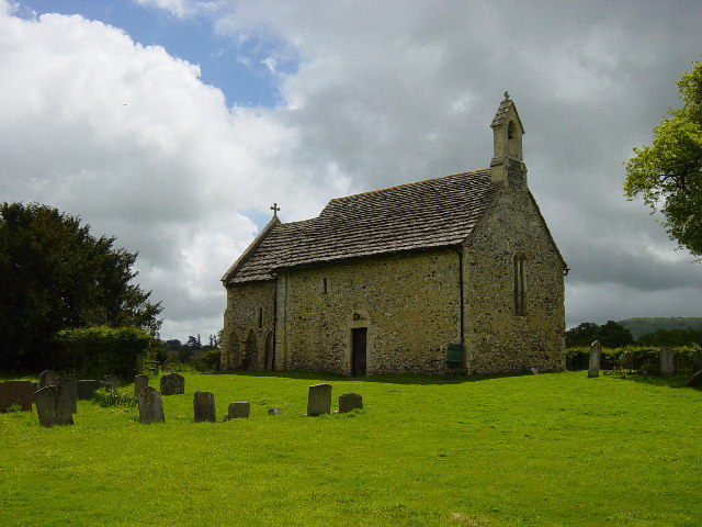
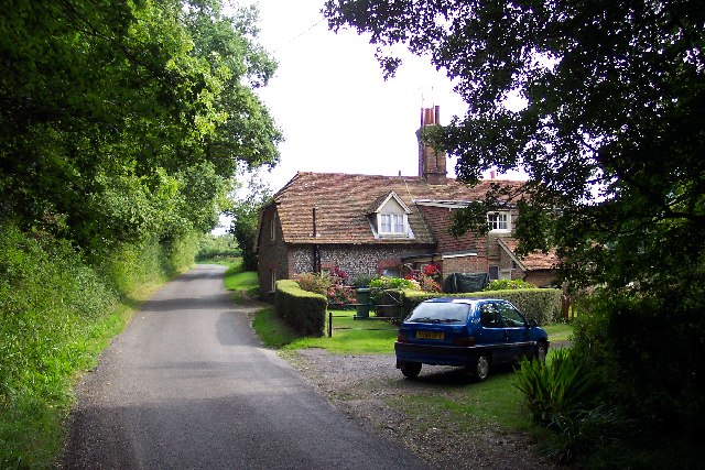
Hanby's Ghyll Images

Images are sourced within 2km of 50.905139/-0.37304525 or Grid Reference TQ1413. Thanks to Geograph Open Source API. All images are credited.

South Downs Way Climbing towards Chanctonbury Ring on the South Downs Way.
South Downs Way
Climbing towards Chanctonbury Ring on the South Downs Way.
South Downs Way On the South Downs Way near Chanctonbury Hill.
South Downs Way
On the South Downs Way near Chanctonbury Hill.
Trig Point on Chanctonbury Hill The South Downs at this point provides extensive views across the Low Weald towards the distant North Downs and the Surrey Hills. The trig point marks a height of 238 metres above sea level.
Trig Point on Chanctonbury Hill
The South Downs at this point provides extensive views across the Low Weald towards the distant North Downs and the Surrey Hills. The trig point marks a height of 238 metres above sea level.
Approaching Chanctonbury Ring The site is a Scheduled Monument. It was used as a hill fort dating from the early Iron Age and was reused later on during the Roman period as a temple precinct. For more details see <span class="nowrap"><a title="https://historicengland.org.uk/listing/the-list/list-entry/1015114" rel="nofollow ugc noopener" href="https://historicengland.org.uk/listing/the-list/list-entry/1015114">Link</a><img style="margin-left:2px;" alt="External link" title="External link - shift click to open in new window" src="https://s1.geograph.org.uk/img/external.png" width="10" height="10"/></span>
Approaching Chanctonbury Ring
The site is a Scheduled Monument. It was used as a hill fort dating from the early Iron Age and was reused later on during the Roman period as a temple precinct. For more details see LinkExternal link
The view eastwards at Chanctonbury Ring Looking eastwards the South Downs dominate the skyline.
The view eastwards at Chanctonbury Ring
Looking eastwards the South Downs dominate the skyline.
Chanctonbury Ring The defensive remains of the Iron Age hill fort can be clearly seen.
Chanctonbury Ring
The defensive remains of the Iron Age hill fort can be clearly seen.
Trees on the edge of Chanctonbury Ring The Great Storm of 1987 did a lot of damage to these trees and wrecked the cap-like shape of the clump. The Ring has recovered some of its former shape since then, however. This is a cross-grid shot. The camera was in the square to the south.
Trees on the edge of Chanctonbury Ring
The Great Storm of 1987 did a lot of damage to these trees and wrecked the cap-like shape of the clump. The Ring has recovered some of its former shape since then, however. This is a cross-grid shot. The camera was in the square to the south.
Chanctonbury Ring Fort: Off the South Downs Way This ring at the top of the hill, is situated in the  far south eastern corner of the grid square.
Chanctonbury Ring Fort: Off the South Downs Way
This ring at the top of the hill, is situated in the far south eastern corner of the grid square.
Fascinating Tree en route to Chanctonbury Ring Fort This tree is in the section of woods near the reservoir near the car park in the extreme south and centre of the grid square.
Fascinating Tree en route to Chanctonbury Ring Fort
This tree is in the section of woods near the reservoir near the car park in the extreme south and centre of the grid square.
Long Way round to Chanctonbury The bridleway meets up with the South Downs Way and is definitely a long way round to the Chanctonbury ring and passes through Chalkpit Wood in the middle of the grid square.
Long Way round to Chanctonbury
The bridleway meets up with the South Downs Way and is definitely a long way round to the Chanctonbury ring and passes through Chalkpit Wood in the middle of the grid square.
Intersection of South Downs Way and Wiston Bostal  Bridleway Having walked all this way, still a way to go. The view from this point is magnificent. This intersection is in the lower half of the grid square. The bridleway cuts through Chalk Pit Wood.
Intersection of South Downs Way and Wiston Bostal Bridleway
Having walked all this way, still a way to go. The view from this point is magnificent. This intersection is in the lower half of the grid square. The bridleway cuts through Chalk Pit Wood.
All Saints Church, Buncton 12th Century Church in the tiny Parish of Wiston with Buncton.
All Saints Church, Buncton
12th Century Church in the tiny Parish of Wiston with Buncton.
Chanctonbury Ring Looking east from Trig Point (S4060) towards Chanctonbury Ring.
Chanctonbury Ring
Looking east from Trig Point (S4060) towards Chanctonbury Ring.
Disused Chalk Pits
Disused Chalk Pits
Bushovel Farm, Wiston Formerly called Bush Hovel Farm, it is seen slightly left of centre in this picture taken from Chanctonbury Ring. What is interesting is the circular shape of the field to the right of the farmhouse and buildings (with an extension on the right). This betrays it as having been an early clearing in the vast, heavily wooded Sussex Weald from which the farm was created. There are several farms along the foot of the downs here. At first sight it appears not to be the best situation for a farm, the southern sun being blocked by the bulk of the downs for much of the year (although not at Bushovel), but it is along this line that the chalk of the downs gives way to the gault clay of the Weald and it is here that numerous springs rise, providing a plentiful supply of water.
Bushovel Farm, Wiston
Formerly called Bush Hovel Farm, it is seen slightly left of centre in this picture taken from Chanctonbury Ring. What is interesting is the circular shape of the field to the right of the farmhouse and buildings (with an extension on the right). This betrays it as having been an early clearing in the vast, heavily wooded Sussex Weald from which the farm was created. There are several farms along the foot of the downs here. At first sight it appears not to be the best situation for a farm, the southern sun being blocked by the bulk of the downs for much of the year (although not at Bushovel), but it is along this line that the chalk of the downs gives way to the gault clay of the Weald and it is here that numerous springs rise, providing a plentiful supply of water.
Great Barn Farm, Wiston The farm, which lies at the northern foot of the South Downs, close to Chanctonbury Ring, is named after the substantial barn which is seen through the trees, under repair, in this picture. The farm sits alongside an old east-west track which was, throughout the Middle Ages and until 1778, the main road between Steyning and Washington. It was superseded when a road roughly along the line of the modern Steyning-Washington road further north was improved and partly realigned, and the southern road was closed to traffic. This coincided with the period when Wiston Park was enlarged and the village moved from its old location close to Wiston House to its present location further north. Taken from Chanctonbury Ring Road at TQ145124 looking east.
Great Barn Farm, Wiston
The farm, which lies at the northern foot of the South Downs, close to Chanctonbury Ring, is named after the substantial barn which is seen through the trees, under repair, in this picture. The farm sits alongside an old east-west track which was, throughout the Middle Ages and until 1778, the main road between Steyning and Washington. It was superseded when a road roughly along the line of the modern Steyning-Washington road further north was improved and partly realigned, and the southern road was closed to traffic. This coincided with the period when Wiston Park was enlarged and the village moved from its old location close to Wiston House to its present location further north. Taken from Chanctonbury Ring Road at TQ145124 looking east.
The fields of Great Barn Farm, Wiston The ornamental trees in the fields of Great Barn Farm alongside Chanctonbury Ring Road show that they were once part of Wiston Park. The ancient manor of Wiston passed, by marriage, into the Goring family in 1740 and by the mid 19th century they owned most of the parish, as well as large estates in other parishes. In 1760 Charles Goring planted the famous beech trees on Chanctonbury Ring - they were blown down in the severe storm of October 1987. After the second world war most of the park was converted to agriculture. The house itself is now a conference centre run by the Foreign Office.
The fields of Great Barn Farm, Wiston
The ornamental trees in the fields of Great Barn Farm alongside Chanctonbury Ring Road show that they were once part of Wiston Park. The ancient manor of Wiston passed, by marriage, into the Goring family in 1740 and by the mid 19th century they owned most of the parish, as well as large estates in other parishes. In 1760 Charles Goring planted the famous beech trees on Chanctonbury Ring - they were blown down in the severe storm of October 1987. After the second world war most of the park was converted to agriculture. The house itself is now a conference centre run by the Foreign Office.
Fastings Cottage, Chanctonbury Ring Road
Show me another place!

Hanby's Ghyll is located at Grid Ref: TQ1413 (Lat: 50.905139, Lng: -0.37304525)

Administrative County: West Sussex

District: Horsham

Police Authority: Sussex

What 3 Words

///among.outbound.options. Near Washington, West Sussex

Related Wikis

South Downs National Park

The South Downs National Park is England's newest national park, designated on 31 March 2010. The park, covering an area of 1,627 square kilometres (628...

All Saints Church, Buncton

All Saints Church is an Anglican church in the hamlet of Buncton in the district of Horsham, one of seven local government districts in the English county...

Buncton

Buncton () is a small village in the Horsham District of West Sussex, England, part of the civil parish of Wiston 0.5 miles (0.80 km) north. It lies to...
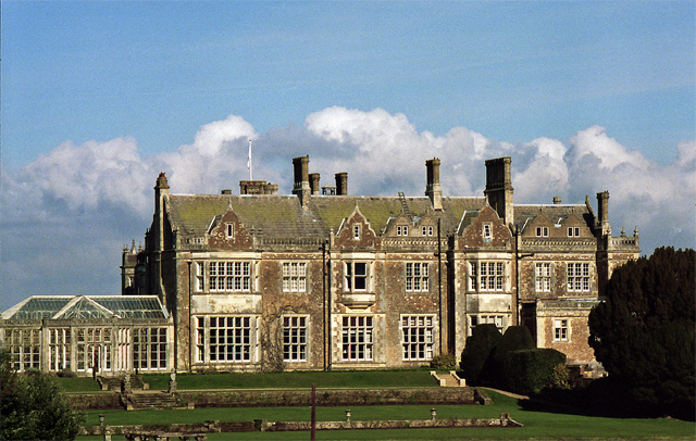
Wiston House

Wiston House is a 16th-century Grade I listed building set in the South Downs National Park on the south coast of England, surrounded by over 6,000 acres...
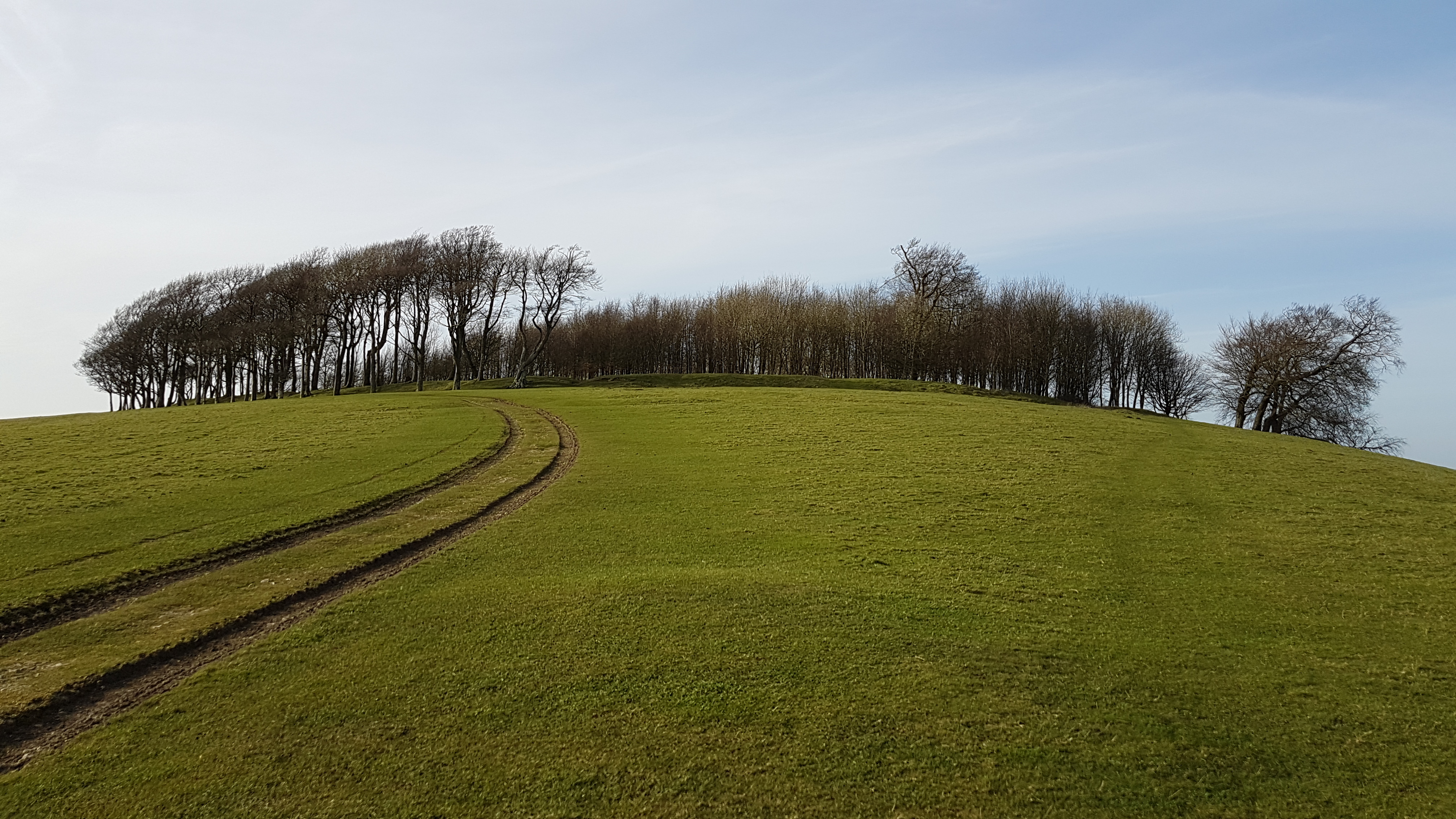
Chanctonbury Ring

Chanctonbury Ring is a prehistoric hill fort atop Chanctonbury Hill on the South Downs, on the border of the civil parishes of Washington and Wiston in...

Wiston, West Sussex

Wiston is a scattered village and civil parish in the Horsham District of West Sussex, England. It lies on the A283 road 2.8 miles (4.5 km) northwest of...

Chanctonbury Hill

Chanctonbury Hill is an 82.7-hectare (204-acre) biological Site of Special Scientific Interest west of Steyning in West Sussex. Part of it is Chanctonbury...

Rock Mill, Washington

Rock Mill is a Grade II listed smock mill at Washington, West Sussex, England, which has been converted to residential use. == History == Rock Mill was...

Nearby Amenities

Located within 500m of 50.905139,-0.37304525
Passing Place
Lat/Long: 50.9021593/-0.3710445
Bus Stop
Buncton Crossroads
Naptan AtcoCode: 4400HR0212
Naptan Bearing: W
Naptan CommonName: Buncton Crossroads
Naptan Indicator: adj Chanctonbury Ring Road
Naptan Landmark: Chanctonbury Ring Road
Naptan NaptanCode: wsxatpwg
Naptan Street: Washington Road
Naptan Verified: no
Source: naptan_import
Lat/Long: 50.9095271/-0.3737515
Chanctonbury Ring Picnic Site
Source: local knowledge
Tourism: picnic_site
Lat/Long: 50.900888/-0.3711866
The data included in this document is from www.openstreetmap.org. The data is made available under ODbL.

Have you been to Hanby's Ghyll?

Leave your review of Hanby's Ghyll below (or comments, questions and feedback).