Copyhold Wood

Wood, Forest in Sussex Horsham

England

Copyhold Wood

Pressure Reducing Station The Southern Water site beside the South Downs Way near Washington.
Pressure Reducing Station Credit: Chris Thomas-Atkin

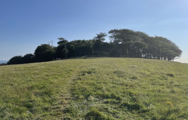
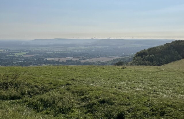
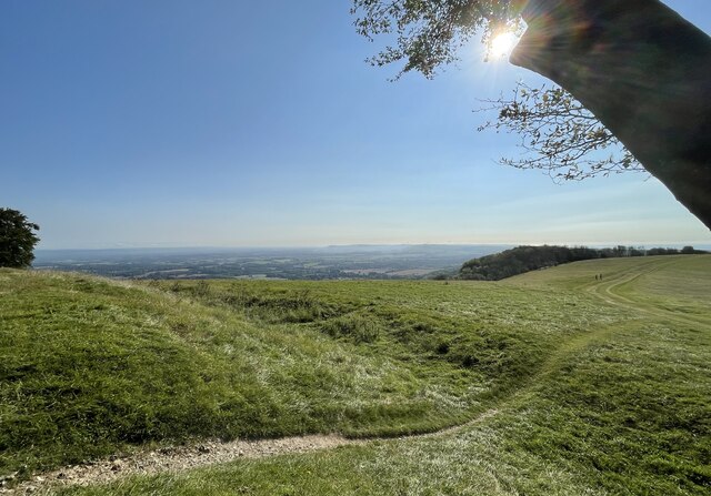
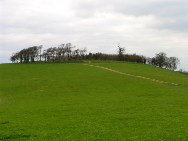
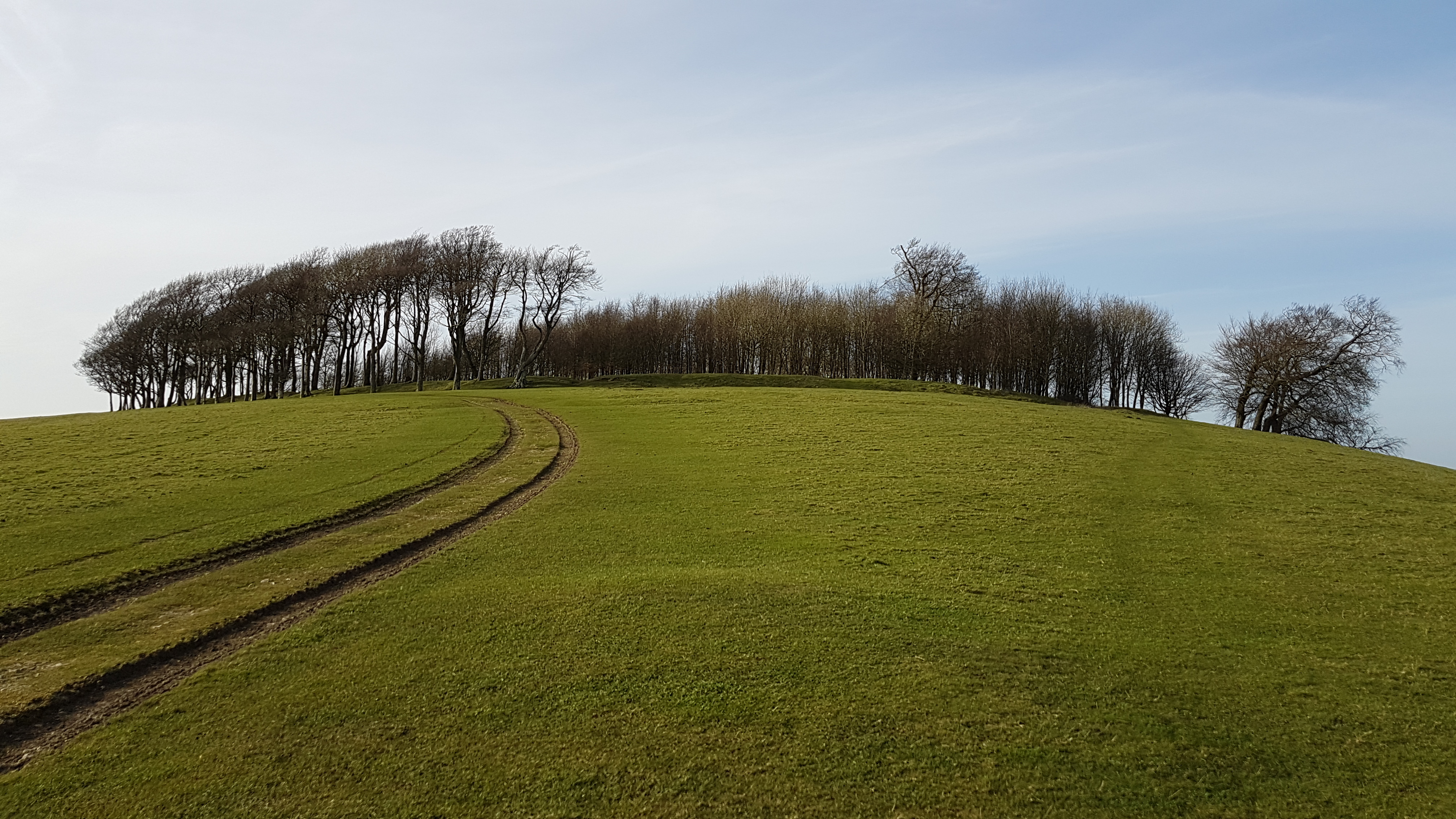
Copyhold Wood is a picturesque woodland located in the county of Sussex, England. Situated near the town of Haywards Heath, this forested area covers a vast expanse of approximately 60 acres. The wood is part of the wider Ashdown Forest, a designated Area of Outstanding Natural Beauty.

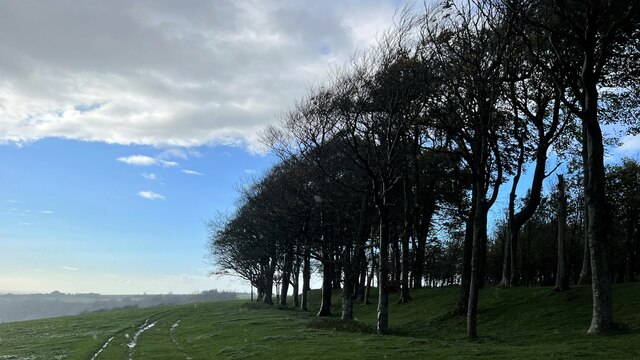
The woodland is predominantly composed of oak and beech trees, which tower over a diverse undergrowth of ferns, bluebells, and other native flora. This rich biodiversity makes Copyhold Wood an important habitat for a variety of wildlife, including deer, badgers, and a wide range of bird species.

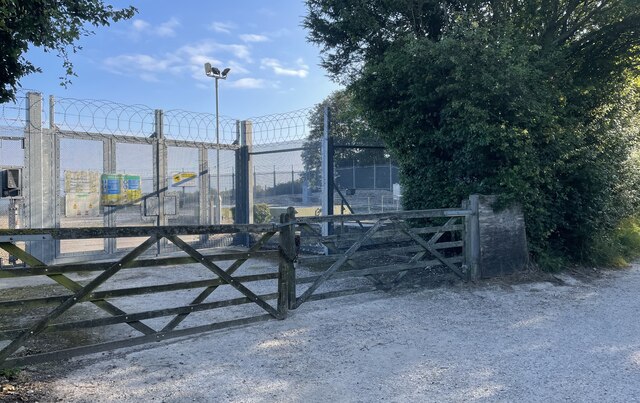
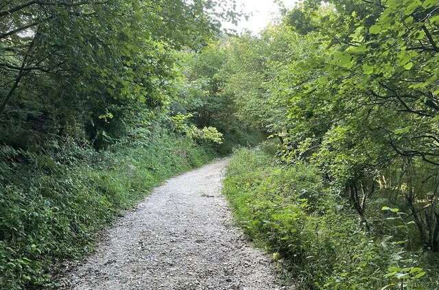
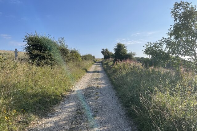
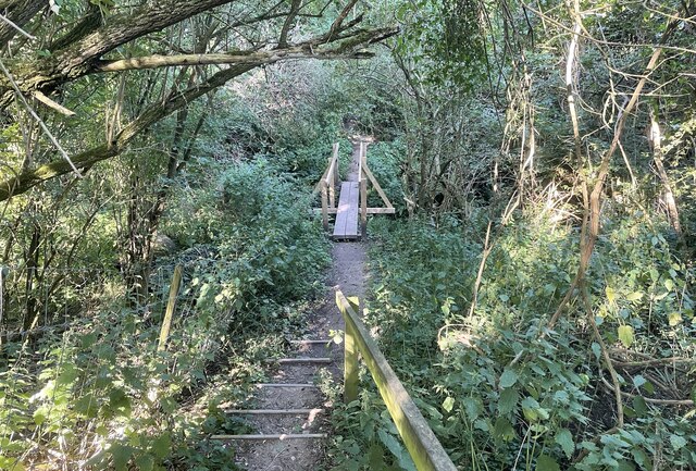
Visitors to Copyhold Wood can enjoy a network of well-maintained footpaths and trails that wind through the forest, providing ample opportunities for walking, hiking, and nature watching. The peaceful and tranquil atmosphere invites visitors to immerse themselves in the natural surroundings and escape the hustle and bustle of everyday life.

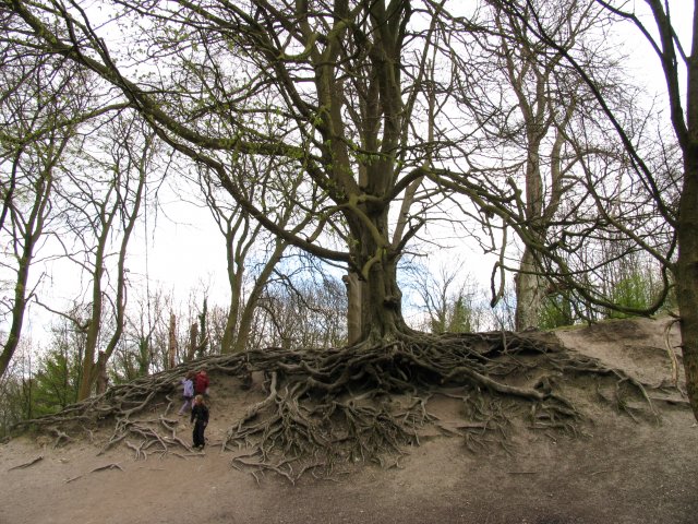
The wood is also home to several historical features, including remnants of ancient boundary banks and ditches dating back to medieval times. These archaeological remains offer a glimpse into the area's rich past and provide an added layer of interest for history enthusiasts.

Copyhold Wood is easily accessible, with ample parking facilities available nearby. Its proximity to Haywards Heath and other nearby towns makes it a popular destination for both locals and tourists seeking a serene and enchanting natural environment within easy reach.

If you have any feedback on the listing, please let us know in the comments section below.

Copyhold Wood Images

Images are sourced within 2km of 50.905761/-0.37895463 or Grid Reference TQ1413. Thanks to Geograph Open Source API. All images are credited.

Pressure Reducing Station The Southern Water site beside the South Downs Way near Washington.
Pressure Reducing Station
The Southern Water site beside the South Downs Way near Washington.
South Downs Way Climbing towards Chanctonbury Ring on the South Downs Way.
South Downs Way
Climbing towards Chanctonbury Ring on the South Downs Way.
South Downs Way On the South Downs Way near Chanctonbury Hill.
South Downs Way
On the South Downs Way near Chanctonbury Hill.
Trig Point on Chanctonbury Hill The South Downs at this point provides extensive views across the Low Weald towards the distant North Downs and the Surrey Hills. The trig point marks a height of 238 metres above sea level.
Trig Point on Chanctonbury Hill
The South Downs at this point provides extensive views across the Low Weald towards the distant North Downs and the Surrey Hills. The trig point marks a height of 238 metres above sea level.
Approaching Chanctonbury Ring The site is a Scheduled Monument. It was used as a hill fort dating from the early Iron Age and was reused later on during the Roman period as a temple precinct. For more details see <span class="nowrap"><a title="https://historicengland.org.uk/listing/the-list/list-entry/1015114" rel="nofollow ugc noopener" href="https://historicengland.org.uk/listing/the-list/list-entry/1015114">Link</a><img style="margin-left:2px;" alt="External link" title="External link - shift click to open in new window" src="https://s1.geograph.org.uk/img/external.png" width="10" height="10"/></span>
Approaching Chanctonbury Ring
The site is a Scheduled Monument. It was used as a hill fort dating from the early Iron Age and was reused later on during the Roman period as a temple precinct. For more details see LinkExternal link
The view eastwards at Chanctonbury Ring Looking eastwards the South Downs dominate the skyline.
The view eastwards at Chanctonbury Ring
Looking eastwards the South Downs dominate the skyline.
Chanctonbury Ring The defensive remains of the Iron Age hill fort can be clearly seen.
Chanctonbury Ring
The defensive remains of the Iron Age hill fort can be clearly seen.
Footbridge near Washington Crossing a small unnamed stream public footpath number 2089_2 shortly meets Washington Bostal.
Footbridge near Washington
Crossing a small unnamed stream public footpath number 2089_2 shortly meets Washington Bostal.
Trees on the edge of Chanctonbury Ring The Great Storm of 1987 did a lot of damage to these trees and wrecked the cap-like shape of the clump. The Ring has recovered some of its former shape since then, however. This is a cross-grid shot. The camera was in the square to the south.
Trees on the edge of Chanctonbury Ring
The Great Storm of 1987 did a lot of damage to these trees and wrecked the cap-like shape of the clump. The Ring has recovered some of its former shape since then, however. This is a cross-grid shot. The camera was in the square to the south.
Chanctonbury Ring Fort: Off the South Downs Way This ring at the top of the hill, is situated in the  far south eastern corner of the grid square.
Chanctonbury Ring Fort: Off the South Downs Way
This ring at the top of the hill, is situated in the far south eastern corner of the grid square.
Fascinating Tree en route to Chanctonbury Ring Fort This tree is in the section of woods near the reservoir near the car park in the extreme south and centre of the grid square.
Fascinating Tree en route to Chanctonbury Ring Fort
This tree is in the section of woods near the reservoir near the car park in the extreme south and centre of the grid square.
Long Way round to Chanctonbury The bridleway meets up with the South Downs Way and is definitely a long way round to the Chanctonbury ring and passes through Chalkpit Wood in the middle of the grid square.
Long Way round to Chanctonbury
The bridleway meets up with the South Downs Way and is definitely a long way round to the Chanctonbury ring and passes through Chalkpit Wood in the middle of the grid square.
Intersection of South Downs Way and Wiston Bostal  Bridleway Having walked all this way, still a way to go. The view from this point is magnificent. This intersection is in the lower half of the grid square. The bridleway cuts through Chalk Pit Wood.
Intersection of South Downs Way and Wiston Bostal Bridleway
Having walked all this way, still a way to go. The view from this point is magnificent. This intersection is in the lower half of the grid square. The bridleway cuts through Chalk Pit Wood.
The Frankland Arms: Washington (West Sussex) Taken from the west side of the pub, the building is situated on the west side of the road, south of the A283 and in the top of the grid square west of the centre.
The Frankland Arms: Washington (West Sussex)
Taken from the west side of the pub, the building is situated on the west side of the road, south of the A283 and in the top of the grid square west of the centre.
All Saints Church, Buncton 12th Century Church in the tiny Parish of Wiston with Buncton.
All Saints Church, Buncton
12th Century Church in the tiny Parish of Wiston with Buncton.
Chanctonbury Ring Looking east from Trig Point (S4060) towards Chanctonbury Ring.
Chanctonbury Ring
Looking east from Trig Point (S4060) towards Chanctonbury Ring.
Disused Chalk Pits
Disused Chalk Pits
The South Downs Way Looking east. The South Downs Way is 161 kilometres long and follows old routes along the chalk escarpment and ridges of the South Downs. The Trail is used by walkers, cyclists, and horse riders.
The South Downs Way
Looking east. The South Downs Way is 161 kilometres long and follows old routes along the chalk escarpment and ridges of the South Downs. The Trail is used by walkers, cyclists, and horse riders.
Show me another place!

Copyhold Wood is located at Grid Ref: TQ1413 (Lat: 50.905761, Lng: -0.37895463)

Administrative County: West Sussex

District: Horsham

Police Authority: Sussex

What 3 Words

///submerged.passports.brambles. Near Washington, West Sussex

Related Wikis

All Saints Church, Buncton

All Saints Church is an Anglican church in the hamlet of Buncton in the district of Horsham, one of seven local government districts in the English county...

Buncton

Buncton () is a small village in the Horsham District of West Sussex, England, part of the civil parish of Wiston 0.5 miles (0.80 km) north. It lies to...

South Downs National Park

The South Downs National Park is England's newest national park, designated on 31 March 2010. The park, covering an area of 1,627 square kilometres (628...

Chanctonbury Ring

Chanctonbury Ring is a prehistoric hill fort atop Chanctonbury Hill on the South Downs, on the border of the civil parishes of Washington and Wiston in...

Chanctonbury Hill

Chanctonbury Hill is an 82.7-hectare (204-acre) biological Site of Special Scientific Interest west of Steyning in West Sussex. Part of it is Chanctonbury...

Wiston, West Sussex

Wiston is a scattered village and civil parish in the Horsham District of West Sussex, England. It lies on the A283 road 2.8 miles (4.5 km) northwest of...

Rock Mill, Washington

Rock Mill is a Grade II listed smock mill at Washington, West Sussex, England, which has been converted to residential use. == History == Rock Mill was...
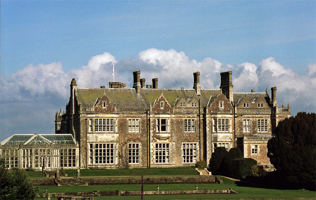
Wiston House

Wiston House is a 16th-century Grade I listed building set in the South Downs National Park on the south coast of England, surrounded by over 6,000 acres...

Nearby Amenities

Located within 500m of 50.905761,-0.37895463
Naptan AtcoCode: 4400HR0753
Naptan Bearing: E
Naptan BusStopType: CUS
Naptan CommonName: The Pike
Naptan Indicator: HAR
Naptan Landmark: Hail & Ride
Naptan NaptanCode: wsxdwgam
Naptan Street: The Pike
Naptan Verified: no
Lat/Long: 50.909228/-0.3832924
The Pike
Naptan AtcoCode: 4400HR0754
Naptan Bearing: W
Naptan BusStopType: CUS
Naptan CommonName: The Pike
Naptan Indicator: HAR
Naptan Landmark: Hail & Ride
Naptan NaptanCode: wsxdwgap
Naptan Street: The Pike
Naptan Verified: no
Source: naptan_import
Lat/Long: 50.909165/-0.3832988
The data included in this document is from www.openstreetmap.org. The data is made available under ODbL.

Have you been to Copyhold Wood?

Leave your review of Copyhold Wood below (or comments, questions and feedback).