Bins Dale
Valley in Yorkshire
England
Bins Dale

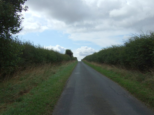
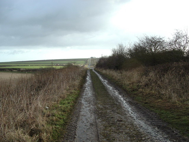
Bins Dale is a picturesque valley located in the heart of Yorkshire, England. Situated in the Yorkshire Dales National Park, this tranquil and idyllic location is known for its stunning natural beauty and rich history. The valley is surrounded by rolling hills, verdant meadows, and limestone cliffs, creating a breathtaking landscape that attracts visitors from far and wide.
Bins Dale is renowned for its diverse wildlife, with a wide range of species calling this valley home. Nature enthusiasts can spot various birds, including peregrine falcons and curlews, as well as mammals such as badgers and foxes. The valley is also adorned with vibrant wildflowers during the spring and summer months, adding to its charm.
For those interested in history and archaeology, Bins Dale offers a wealth of ancient sites and landmarks. The valley is scattered with prehistoric burial mounds and stone circles, providing glimpses into the region's past. There are also remnants of old lead mines, reminding visitors of the area's industrial heritage.
Outdoor activities abound in Bins Dale, with numerous walking and hiking trails that cater to all skill levels. The valley is intersected by a meandering river, offering opportunities for fishing and canoeing. Cyclists can enjoy the scenic routes that wind through the valley, while rock climbers can challenge themselves on the limestone cliffs.
In summary, Bins Dale is a captivating destination for nature lovers, history enthusiasts, and adventure seekers alike. Its stunning scenery, diverse wildlife, and rich heritage make it a must-visit location in Yorkshire.
If you have any feedback on the listing, please let us know in the comments section below.
Bins Dale Images
Images are sourced within 2km of 54.097954/-0.27721864 or Grid Reference TA1268. Thanks to Geograph Open Source API. All images are credited.


Bins Dale is located at Grid Ref: TA1268 (Lat: 54.097954, Lng: -0.27721864)
Division: East Riding
Unitary Authority: East Riding of Yorkshire
Police Authority: Humberside
What 3 Words
///grin.refreshed.hung. Near Boynton, East Yorkshire
Nearby Locations
Related Wikis

Boynton, East Riding of Yorkshire
Boynton is a village and civil parish in the East Riding of Yorkshire, England. It is situated approximately 3 miles (5 km) west of the town of Bridlington...

Boynton Hall
Boynton Hall is a country house in the village of Boynton near Bridlington, East Riding of Yorkshire, England. It is a Grade I listed building.Originally...

Bridlington Rural District
Bridlington was a rural district in the East Riding of Yorkshire in England from 1894 to 1974. It covered a coastal area, and surrounded the municipal...
Woldgate
Woldgate is a minor road in the East Riding of Yorkshire, England, which follows the line of a Roman road. It runs for a distance of 10 miles (16 km)...

Rudston Monolith
The Rudston Monolith at over 25 feet (7.6 m) is the tallest megalith (standing stone) in the United Kingdom. It is situated in the churchyard in the village...

Grindale
Grindale is a village and civil parish in the East Riding of Yorkshire, England. It is situated approximately 4 miles (6 km) north-west of Bridlington...

Rudston
Rudston is a small village and civil parish in the East Riding of Yorkshire, England. It is situated between Driffield and Bridlington approximately 6...

Argam
Argam, or Argham (sometimes Ergam, or Ergham), was a civil parish and village in the East Riding of Yorkshire, England. The site is listed in many historical...
Nearby Amenities
Located within 500m of 54.097954,-0.27721864Have you been to Bins Dale?
Leave your review of Bins Dale below (or comments, questions and feedback).