Flat Cliff Gill

Valley in Yorkshire Scarborough

England

Flat Cliff Gill

Reighton Sands Looking NE from on the cliffs above Reighton Sands.
Reighton Sands Credit: Stephen Horncastle

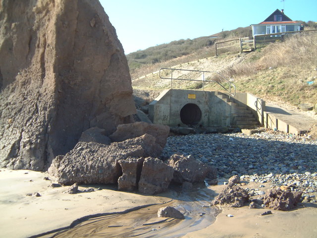
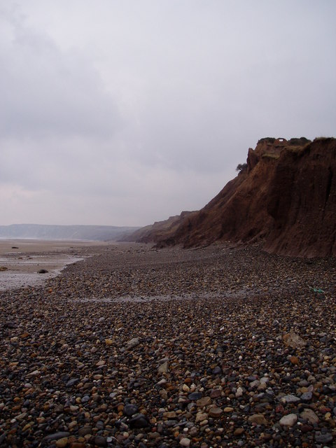
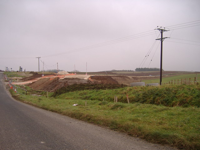
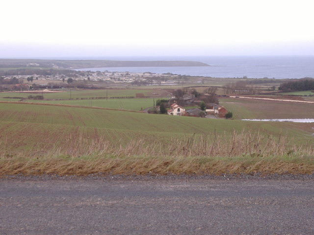
Flat Cliff Gill is a picturesque valley located in Yorkshire, England. Nestled amidst the rolling hills and lush greenery, this valley offers a serene and tranquil environment for visitors to enjoy. The gill, or ravine, is carved by a small stream that meanders through the valley, adding to the beauty of the landscape.

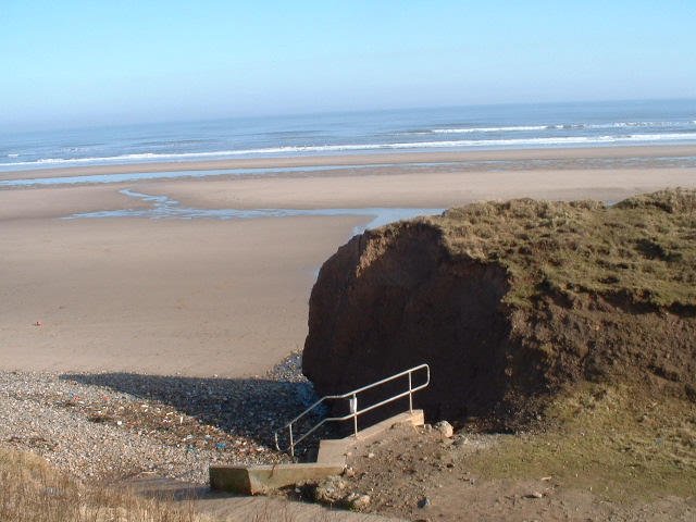
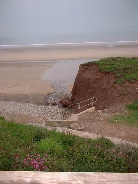
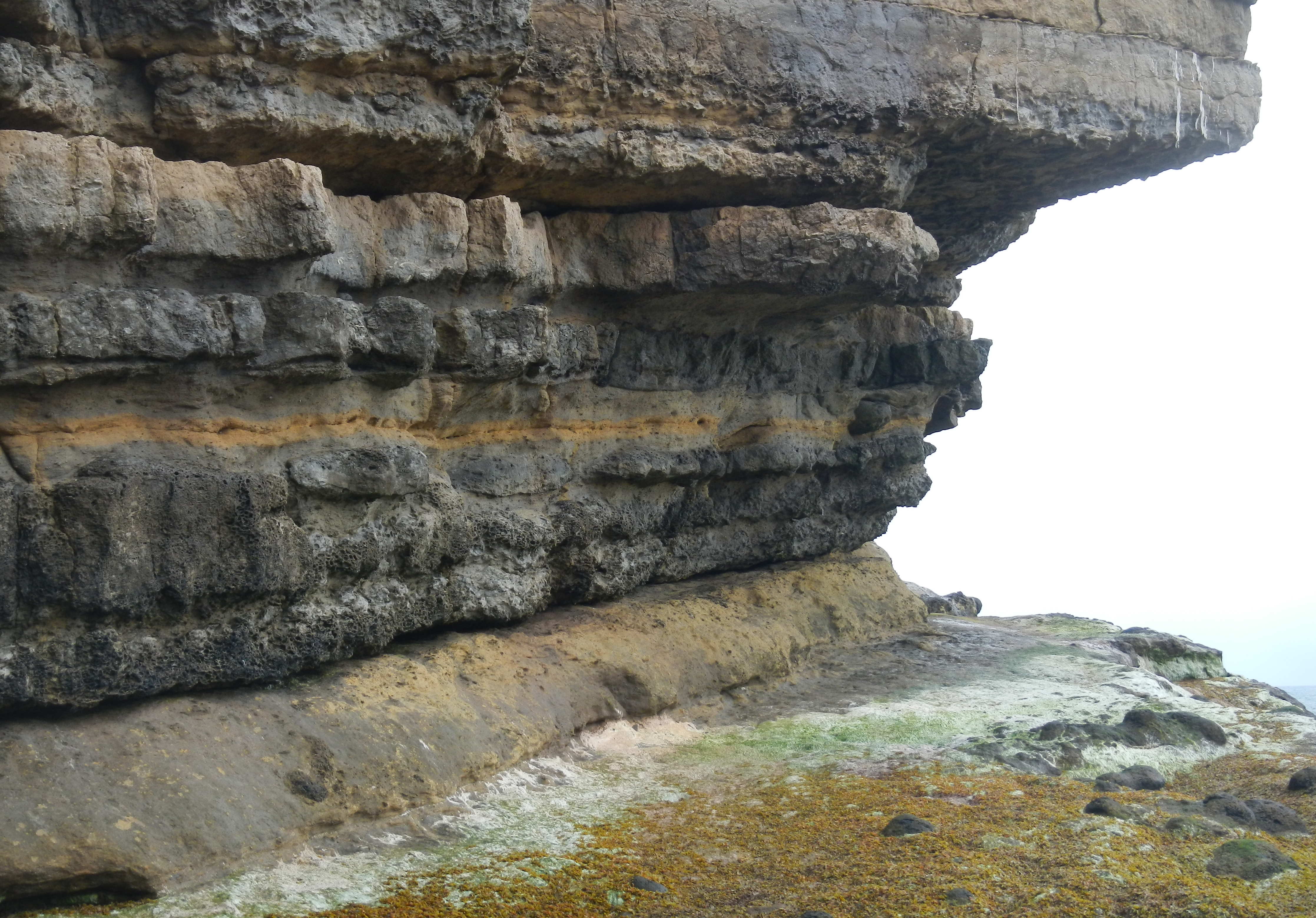
The valley is characterized by its flat, cliff-like sides that give it its name. These cliffs are made of limestone, showcasing unique geological formations and adding to the charm of the area. The limestone also contributes to the presence of various plant species that thrive in this particular type of soil.

Flat Cliff Gill boasts a diverse ecosystem, making it a haven for wildlife enthusiasts and nature lovers. Visitors can expect to spot a variety of bird species, such as kestrels and buzzards, soaring overhead. The valley is also home to small mammals like rabbits and voles, as well as several species of butterflies and insects.

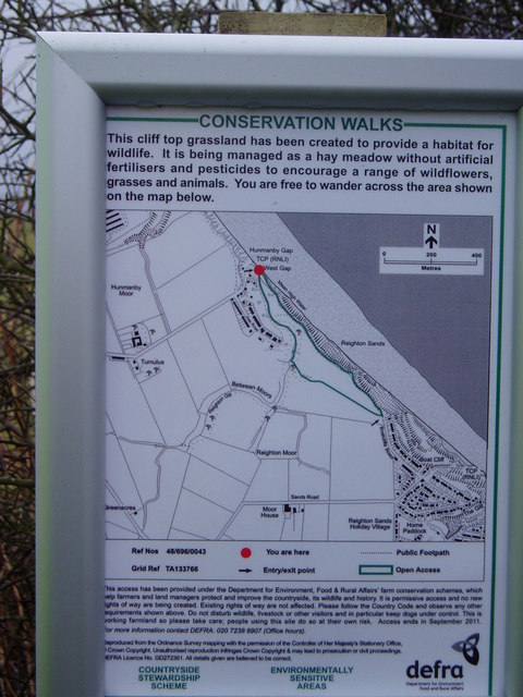
The area offers a range of recreational activities for visitors to engage in. Hiking trails crisscross the valley, allowing visitors to explore the natural beauty at their own pace. The stream that runs through the gill presents opportunities for fishing and paddling, adding to the appeal for outdoor enthusiasts.

Overall, Flat Cliff Gill is a hidden gem in Yorkshire, offering a peaceful retreat and an opportunity to connect with nature. Whether it's enjoying a leisurely walk, observing wildlife, or simply taking in the breathtaking scenery, this valley has something to offer for everyone.

If you have any feedback on the listing, please let us know in the comments section below.

Flat Cliff Gill Images

Images are sourced within 2km of 54.181467/-0.27593996 or Grid Reference TA1277. Thanks to Geograph Open Source API. All images are credited.

Reighton Sands Looking NE from on the cliffs above Reighton Sands.
Reighton Sands
Looking NE from on the cliffs above Reighton Sands.
Hunmanby Gap Cliff Erosion Cliff erosion at Hunmanby Gap before collapse.
Hunmanby Gap Cliff Erosion
Cliff erosion at Hunmanby Gap before collapse.
Hunmanby Gap Cliff Erosion Cliff erosion at Hunmanby Gap after collapse.
Hunmanby Gap Cliff Erosion
Cliff erosion at Hunmanby Gap after collapse.
Hunmanby Gap Cliff Erosion Cliff erosion at Hunmanby Gap after collapse. Looking towards Hunmanby Gap Road and showing Reighton Gill culverted outfall.
Hunmanby Gap Cliff Erosion
Cliff erosion at Hunmanby Gap after collapse. Looking towards Hunmanby Gap Road and showing Reighton Gill culverted outfall.
Conservation Area Description of Environmentally Sensitive Area at Hunmanby Gap.
Conservation Area
Description of Environmentally Sensitive Area at Hunmanby Gap.
Beach at Hunmanby Gap Cliff and beach view looking towards Reighton Sands.
Beach at Hunmanby Gap
Cliff and beach view looking towards Reighton Sands.
Hunmanby Gap Car Park Hunmanby Gap car park and view across bay.
Hunmanby Gap Car Park
Hunmanby Gap car park and view across bay.
Gap Road Gap Road at Hunmanby Gap looking towards the South and Reighton.
Gap Road
Gap Road at Hunmanby Gap looking towards the South and Reighton.
Sands Road This minor road runs from the A165 to Hunmanby Gap.  This view is from outside Moor Farm towards the A165.
Sands Road
This minor road runs from the A165 to Hunmanby Gap. This view is from outside Moor Farm towards the A165.
Royal Oak The Royal Oak pub near to Hunmanby.
Royal Oak
The Royal Oak pub near to Hunmanby.
Reighton Bypass Construction. The view from Sands Road towards the junction with the A165.  Construction of the new Reighton Bypass is well under way.
Reighton Bypass Construction.
The view from Sands Road towards the junction with the A165. Construction of the new Reighton Bypass is well under way.
Holiday Park Entrance The entrance to a popular Holiday Park.
Holiday Park Entrance
The entrance to a popular Holiday Park.
View towards Filey Bay Viewed from Hunmanby Road.  Filey Brigg can be clearly seen.  The construction of the Reighton Bypass can also be seen in the middle distance at the far right and left of the picture.
View towards Filey Bay
Viewed from Hunmanby Road. Filey Brigg can be clearly seen. The construction of the Reighton Bypass can also be seen in the middle distance at the far right and left of the picture.
Hunmanby Sands A typical view of the East Coast with its crumbling clay cliffs.
Hunmanby Sands
A typical view of the East Coast with its crumbling clay cliffs.
Hunmanby Sands
Hunmanby Sands
Hunmanby Sands
Hunmanby Sands
Muston Sands, Filey Bay
Reighton Sands A family take shelter on Reighton Sands as a thunderstorm passes by.
Reighton Sands
A family take shelter on Reighton Sands as a thunderstorm passes by.
Show me another place!

Flat Cliff Gill is located at Grid Ref: TA1277 (Lat: 54.181467, Lng: -0.27593996)

Division: East Riding

Administrative County: North Yorkshire

District: Scarborough

Police Authority: North Yorkshire

What 3 Words

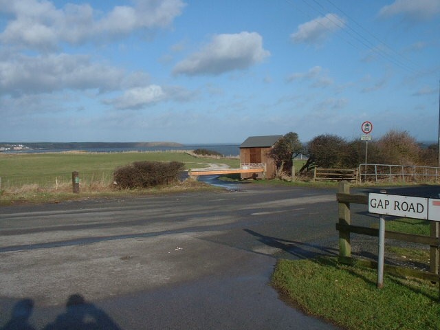
///galleries.ballparks.snowballs. Near Hunmanby, North Yorkshire

Related Wikis

RAF Hunmanby Moor

RAF Hunmanby Moor, (also known as RAF Filey), was a Royal Air Force training camp during the Second World War in Hunmanby, East Riding of Yorkshire, England...

Butlin's Filey

Filey Holiday Camp was a Butlin's holiday camp near Filey, North Yorkshire, England, built for Billy Butlin's holiday organisation. Construction of the...

Primrose Valley

Primrose Valley is a coastal village south of Filey, North Yorkshire, England. It was historically part of the East Riding of Yorkshire until 1974 and...

Filey Holiday Camp railway station

Filey Holiday Camp railway station was a railway station built by the London and North Eastern Railway to serve Butlin's Filey Holiday Camp just south...

Royal Oak, North Yorkshire

Royal Oak is an area in North Yorkshire, England, between Scarborough and Bridlington, next to Filey and Hunmanby. The place itself is marked by a public...

Reighton

Reighton is a village and civil parish, in North Yorkshire, England. From the mediaeval era until the 19th century Reighton was part of Dickering Wapentake...

Passage Beds

The Passage Beds is a member of the Corallian Oolite Formation, a geologic formation in England. The subtidal to marine sandstone preserves fossils of...

Hunmanby railway station

Hunmanby railway station serves the large village of Hunmanby in North Yorkshire, England. It is located on the Yorkshire Coast Line and is operated by...

Nearby Amenities

Located within 500m of 54.181467,-0.27593996
Source: PGS
Lat/Long: 54.1797461/-0.2694137
Source: PGS
Lat/Long: 54.1801197/-0.269919
Source: PGS
Lat/Long: 54.1803194/-0.2701738
Source: PGS
Lat/Long: 54.1809667/-0.2710654
Source: PGS
Lat/Long: 54.181348/-0.2715829
Source: PGS
Lat/Long: 54.1817186/-0.2720711
Source: PGS
Lat/Long: 54.1819032/-0.2724282
Source: PGS
Lat/Long: 54.1821528/-0.2727235
Source: PGS
Lat/Long: 54.1826186/-0.273335
Source: PGS
Lat/Long: 54.1828959/-0.2737247
Source: PGS
Lat/Long: 54.1833766/-0.2742852
Source: PGS
Lat/Long: 54.183827/-0.2747693
Source: PGS
Lat/Long: 54.1852823/-0.2761991
Source: PGS
Lat/Long: 54.1855368/-0.2763693
Crossing
Lat/Long: 54.1840136/-0.2802262
Recycling
Recycling Glass: yes
Recycling Type: container
Source: survey;gps
Lat/Long: 54.1822403/-0.2816957
Recycling
Recycling Glass: yes
Recycling Type: container
Source: survey;gps
Lat/Long: 54.1832498/-0.2813583
Recycling
Recycling Glass: yes
Recycling Type: container
Source: survey;gps
Lat/Long: 54.1839217/-0.2812763
Crossing
Crossing: marked
Crossing Island: no
Kerb: flush
Tactile Paving: no
Lat/Long: 54.1834346/-0.2817327
Crossing
Crossing: marked
Crossing Island: no
Kerb: flush
Tactile Paving: no
Lat/Long: 54.1835992/-0.2814928
Fountain
Source: local knowledge
Lat/Long: 54.1829599/-0.2824744
Bench
Source: survey;gps
Lat/Long: 54.1846531/-0.2776922
Bench
Source: survey;gps
Lat/Long: 54.1848373/-0.2777548
Bench
Source: survey;gps
Lat/Long: 54.1848966/-0.2777634
Bench
Source: survey;gps
Lat/Long: 54.1844135/-0.2766963
Bench
Source: survey;gps
Lat/Long: 54.184281/-0.2768192
Turning Circle
Lat/Long: 54.1822045/-0.2809892
Barrier: bollard
Bollard: rising
Lat/Long: 54.1819397/-0.2794296
Waste Disposal
Lat/Long: 54.1814406/-0.2794034
Leisure: amusement_arcade
Lat/Long: 54.1806149/-0.2806061
The Shop
Shop: convenience
Lat/Long: 54.1805726/-0.2807689
Waste Disposal
Lat/Long: 54.1796852/-0.2813496
Waste Disposal
Lat/Long: 54.1805708/-0.2800857
Waste Disposal
Lat/Long: 54.1802871/-0.2811228
Waste Disposal
Lat/Long: 54.1801499/-0.2806661
Waste Disposal
Lat/Long: 54.1796748/-0.2822883
Waste Disposal
Lat/Long: 54.1799001/-0.2816266
Waste Disposal
Lat/Long: 54.1801449/-0.2821989
Waste Disposal
Lat/Long: 54.1800976/-0.2817738
Waste Disposal
Lat/Long: 54.1802729/-0.2827702
Waste Disposal
Lat/Long: 54.1793134/-0.2816907
Waste Disposal
Lat/Long: 54.1794101/-0.2823304
Waste Disposal
Lat/Long: 54.1794593/-0.2821313
Crossing
Lat/Long: 54.1828307/-0.2807749
The data included in this document is from www.openstreetmap.org. The data is made available under ODbL.

Have you been to Flat Cliff Gill?

Leave your review of Flat Cliff Gill below (or comments, questions and feedback).