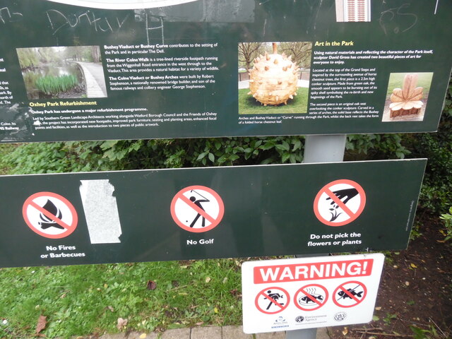
The Dell

Valley in Hertfordshire Watford

England

The Dell

The Peace Hospice
The Peace Hospice Credit: Tim Glover

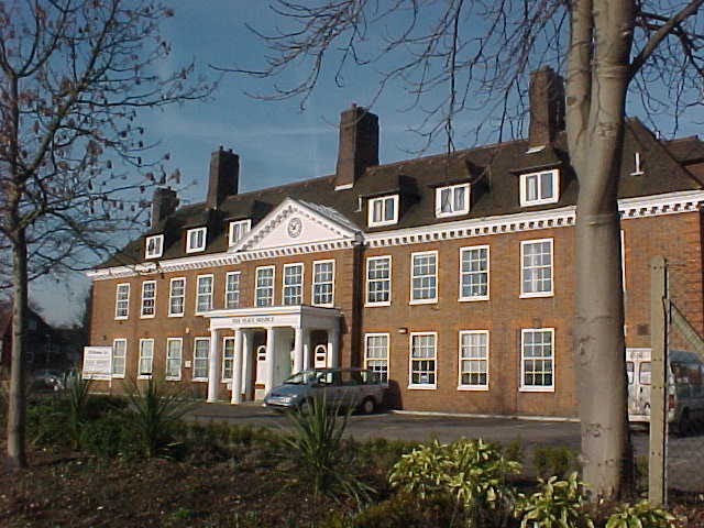
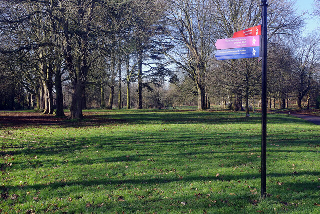
The Dell, located in Hertfordshire, England, is a picturesque valley situated in the heart of the county. The Dell is known for its natural beauty, with rolling hills, lush greenery, and a tranquil atmosphere that attracts visitors from near and far.

The valley is nestled between two small villages, creating a sense of seclusion and providing an escape from the hustle and bustle of city life. It is easily accessible by car or public transport, making it a popular destination for day trips and weekend getaways.

The Dell is renowned for its diverse wildlife and rich biodiversity. The area is home to a variety of plant species, including rare orchids, wildflowers, and ancient woodland. Birdwatchers can spot a wide range of avian species, such as buzzards, woodpeckers, and owls.

Walking and hiking trails crisscross the valley, allowing visitors to explore the stunning landscape at their own pace. The Dell also offers opportunities for cycling, horseback riding, and picnicking, catering to a range of outdoor enthusiasts.

For those seeking cultural experiences, The Dell is located in close proximity to several historic sites and attractions. Nearby, visitors can explore stately homes, medieval castles, and charming market towns, providing a well-rounded experience for all who visit.

Overall, The Dell in Hertfordshire is a hidden gem, offering a peaceful retreat in a natural setting. Whether visitors are seeking outdoor adventures, wildlife encounters, or a serene escape, The Dell provides an idyllic destination for nature lovers and history enthusiasts alike.

If you have any feedback on the listing, please let us know in the comments section below.
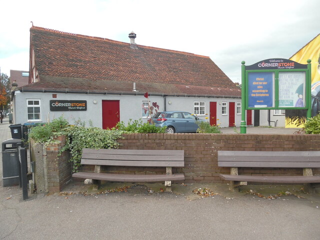
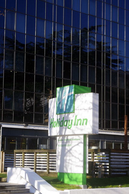
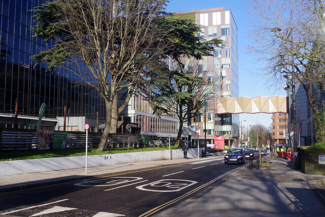
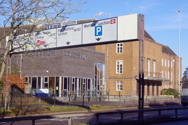
The Dell Images

Images are sourced within 2km of 51.646577/-0.38665052 or Grid Reference TQ1195. Thanks to Geograph Open Source API. All images are credited.

The Peace Hospice
The Peace Hospice
Notice by the pond in The Parade, High Street This notice has been erected by Watford Borough Council in front of the pond in The Parade, High Street. It has the following wording:

          Please don't feed the ducks

      Bread is not their natural diet and makes them ill.
      It drives them quackers and turns the water green.

  That wording may have been written tongue-in-cheek, but is still important to 
  note all the same.
Notice by the pond in The Parade, High Street
This notice has been erected by Watford Borough Council in front of the pond in The Parade, High Street. It has the following wording: Please don't feed the ducks Bread is not their natural diet and makes them ill. It drives them quackers and turns the water green. That wording may have been written tongue-in-cheek, but is still important to note all the same.
The Ebury Way Information Board near Riverside Park This information board is at the east end of the Ebury Way track by Riverside Park and has the same wording and photos as the one at the west end at Batchworth, <a title="https://www.geograph.org.uk/photo/7033096" href="https://www.geograph.org.uk/photo/7033096">Link</a> refers.
The Ebury Way Information Board near Riverside Park
This information board is at the east end of the Ebury Way track by Riverside Park and has the same wording and photos as the one at the west end at Batchworth, Link refers.
Black Signpost on the Ebury Way near Riverside Park This black signpost is on the National Cycle Network 6 which runs from London to the Lake District via the East Midlands and Manchester. The left pointer shows 3 miles to Rickmansworth whilst the right pointer shows 1 mile to Watford.
Black Signpost on the Ebury Way near Riverside Park
This black signpost is on the National Cycle Network 6 which runs from London to the Lake District via the East Midlands and Manchester. The left pointer shows 3 miles to Rickmansworth whilst the right pointer shows 1 mile to Watford.
Blue Signpost by Riverside Park This signpost is by Riverside Park and points towards Westfield Community Technology College (TQ0995) 1¼ miles and Rickmansworth (TQ0694) 3½ miles. It also indicates The Ebury Way foot and cycle path, and national cycle routes 6 (London to Lake District) and 61 (Maidenhead to Hoddesdon). For SatNav purposes, the postcode of this signpost is WD19 4HU.
Blue Signpost by Riverside Park
This signpost is by Riverside Park and points towards Westfield Community Technology College (TQ0995) 1¼ miles and Rickmansworth (TQ0694) 3½ miles. It also indicates The Ebury Way foot and cycle path, and national cycle routes 6 (London to Lake District) and 61 (Maidenhead to Hoddesdon). For SatNav purposes, the postcode of this signpost is WD19 4HU.
Information Board at west end of Oxhey Park This information board erected by Watford Borough Council, is by the River Colne in Wiggenhall Road. It shows a map of the park with the following wording above it:
              Welcome to Oxhey Park

  Points of Interest (in blue)
  1) River Colne
  2) The Dell
  3) The Terrace
  4) Grand Steps
  5) Art Piece (Conker Sculpture)
  6) Art Piece (Carved Oak Seat)
 
  Facilities (in red)
  1) Children's Play Area
  2) 'Kick About' Area
  3) Cycle Route
  4) Seating Areas
  5) Outdoor Gym
  6) Picnic Area

 Below the map is detailed information on
 i) Oxhey Park
 ii) How Oxhey Park came to be
 iii) Places of interest
 iv) Oxhey Park Refurbishment
 v) Art  in the Park

 Below that detailed information panel is a panel with the 
 following road signs from left to right:
 i) No Dropping Litter
 ii) No Dog Fouling
 iii) No Fires or Barbecues
 iv) No  Golf
 v) Do not pick the flowers or plants

 There is another identical information board at the east end of Oxhey Park near
 Bushey Arches, and two similar boards at the entrances to Oxhey Park in 
 Eastbury Road.
Information Board at west end of Oxhey Park
This information board erected by Watford Borough Council, is by the River Colne in Wiggenhall Road. It shows a map of the park with the following wording above it: Welcome to Oxhey Park Points of Interest (in blue) 1) River Colne 2) The Dell 3) The Terrace 4) Grand Steps 5) Art Piece (Conker Sculpture) 6) Art Piece (Carved Oak Seat) Facilities (in red) 1) Children's Play Area 2) 'Kick About' Area 3) Cycle Route 4) Seating Areas 5) Outdoor Gym 6) Picnic Area Below the map is detailed information on i) Oxhey Park ii) How Oxhey Park came to be iii) Places of interest iv) Oxhey Park Refurbishment v) Art in the Park Below that detailed information panel is a panel with the following road signs from left to right: i) No Dropping Litter ii) No Dog Fouling iii) No Fires or Barbecues iv) No Golf v) Do not pick the flowers or plants There is another identical information board at the east end of Oxhey Park near Bushey Arches, and two similar boards at the entrances to Oxhey Park in Eastbury Road.
Detailed Information on the Information Board at Oxhey Park (1) This photo shows detailed information below the map on the Information Board in 
 Wiggenhall Road. It has the following wording:

 Oxhey Park
 Oxhey Park is situated on land originally part of the Wiggen Hall Estate, with 
 a history which goes back hundreds of years.
 In the 15th Century the manor of Wiggenhall cum Oxhey was owned by St Alban's 
 Abbey (now Cathedral). After the dissolution of the Church during the reign of
 Henry VIII the land then passed to private ownership. During the 16th and 17th
 Centuries Sir William Bucknall and his heirs owned the Oxhey/Wiggen Hall Estate
 (living at Oxhey Place). Wiggen Hall Manor was leased to the Deacon family who
 lived there until the mid-19th Century. In 1826 Wiggen Hall and the Estate were
 bought by Jonathon King passing to his nephew Joseph Gutteridge Smith in 1881.
 Ordnance Survey records from the 1870s show the Wiggen Hall as a large country
 house overlooking the River Colne, with elaborate gardens, a walled garden,
 woodland pleasure grounds and landscaped parklands. During World War I a large
 proportion of the land was requisitioned for food production. By 1929 Wiggen 
 Hall was unoccupied and then eventually demolished in 1955.

 How Oxhey Park came to be
 In 1920 Watford Borough Council (with help from a Government Grant) bought 85
 acres of the Estate for £14,000 in order that they could build a housing
 development and provide recreational space for the local community.
 In January 1924 the Estates Committee at the Council recommended that the newly
 allocated public park be known as Oxhey Park. In the 1920s, as now, a walk 
 along the river was one of the main attractions of the park. By the 1930s
 refreshments were being sold from a boathouse to the north of the River Colne
 and fishing, boating and swimming were all allowed. The first children's
 playground was built in 1930.
 
 The two images show the Colne Viaduct or Bushey Arches.
Detailed Information on the Information Board at Oxhey Park (1)
This photo shows detailed information below the map on the Information Board in Wiggenhall Road. It has the following wording: Oxhey Park Oxhey Park is situated on land originally part of the Wiggen Hall Estate, with a history which goes back hundreds of years. In the 15th Century the manor of Wiggenhall cum Oxhey was owned by St Alban's Abbey (now Cathedral). After the dissolution of the Church during the reign of Henry VIII the land then passed to private ownership. During the 16th and 17th Centuries Sir William Bucknall and his heirs owned the Oxhey/Wiggen Hall Estate (living at Oxhey Place). Wiggen Hall Manor was leased to the Deacon family who lived there until the mid-19th Century. In 1826 Wiggen Hall and the Estate were bought by Jonathon King passing to his nephew Joseph Gutteridge Smith in 1881. Ordnance Survey records from the 1870s show the Wiggen Hall as a large country house overlooking the River Colne, with elaborate gardens, a walled garden, woodland pleasure grounds and landscaped parklands. During World War I a large proportion of the land was requisitioned for food production. By 1929 Wiggen Hall was unoccupied and then eventually demolished in 1955. How Oxhey Park came to be In 1920 Watford Borough Council (with help from a Government Grant) bought 85 acres of the Estate for £14,000 in order that they could build a housing development and provide recreational space for the local community. In January 1924 the Estates Committee at the Council recommended that the newly allocated public park be known as Oxhey Park. In the 1920s, as now, a walk along the river was one of the main attractions of the park. By the 1930s refreshments were being sold from a boathouse to the north of the River Colne and fishing, boating and swimming were all allowed. The first children's playground was built in 1930. The two images show the Colne Viaduct or Bushey Arches.
Detailed Information on the Information Board at Oxhey Park (2) This photo shows detailed information below the map on the information board in Wiggenhall Road. It has the following wording:

 Places of interest
 The Dell is a densely wooded area with steep banks falling away from the 
 Eastbury Road down to the River Colne. Its distinct woodland character provides 
 an ideal home for a variety of wildlife. Built in 1912, the magnificent LMS 
 Bushey Viaduct or Bushey Curve contributes to the setting of the Park and in 
 particular The Dell.
 The River Colne Walk is a tree-lined riverside footpath running from the
 Wiggenhall Road entrance in the west through to the Viaduct. This area provides
 a natural habitat for a variety of wildlife.
 The Colne Viaduct or Bushey Arches were built by Robert Stephenson, a 
 nationally renowned bridge builder, and son of the famous railways and colliery
 engineer George Stephenson.
 Image of the River Colne Walk

 Oxhey Park Refurbishment
 Oxhey park has undergone a major refurbishment programme.
 Led by Southern Green Landscape Architects working alongside Watford Borough
 Council and the Friends of Oxhey Park, the project has incorporated new
 footpaths, improved park furniture, seating and planting areas, enhanced focal
 points and facilities, as well as the introduction to two pieces of public
 artwork.

 Art in the Park
 Using natural materials and reflecting the character of the Park itself,
 sculptor David Gross has created two beautiful pieces of art for everyone to 
 enjoy.
 Located at the top of the Grand Steps and inspired by the surrounding avenue of
 horse chestnut trees, the first piece is a 2.5m high conker sculpture. Made 
 from green oak, the smooth seed appears to be bursting out of its spiky shell
 symbolising the re-birth and new beginnings of the Park.
 The second piece is an original oak seat overlooking the conker sculpture.
 Carved in a series of arches, the solid base reflects the Bushey Arches and 
 Bushey Viaduct or "Curve" running through the Park, whilst the back rest takes
 the form of a folded horse chestnut leaf.
 Images of the conker and oak seat sculptures.
Detailed Information on the Information Board at Oxhey Park (2)
This photo shows detailed information below the map on the information board in Wiggenhall Road. It has the following wording: Places of interest The Dell is a densely wooded area with steep banks falling away from the Eastbury Road down to the River Colne. Its distinct woodland character provides an ideal home for a variety of wildlife. Built in 1912, the magnificent LMS Bushey Viaduct or Bushey Curve contributes to the setting of the Park and in particular The Dell. The River Colne Walk is a tree-lined riverside footpath running from the Wiggenhall Road entrance in the west through to the Viaduct. This area provides a natural habitat for a variety of wildlife. The Colne Viaduct or Bushey Arches were built by Robert Stephenson, a nationally renowned bridge builder, and son of the famous railways and colliery engineer George Stephenson. Image of the River Colne Walk Oxhey Park Refurbishment Oxhey park has undergone a major refurbishment programme. Led by Southern Green Landscape Architects working alongside Watford Borough Council and the Friends of Oxhey Park, the project has incorporated new footpaths, improved park furniture, seating and planting areas, enhanced focal points and facilities, as well as the introduction to two pieces of public artwork. Art in the Park Using natural materials and reflecting the character of the Park itself, sculptor David Gross has created two beautiful pieces of art for everyone to enjoy. Located at the top of the Grand Steps and inspired by the surrounding avenue of horse chestnut trees, the first piece is a 2.5m high conker sculpture. Made from green oak, the smooth seed appears to be bursting out of its spiky shell symbolising the re-birth and new beginnings of the Park. The second piece is an original oak seat overlooking the conker sculpture. Carved in a series of arches, the solid base reflects the Bushey Arches and Bushey Viaduct or "Curve" running through the Park, whilst the back rest takes the form of a folded horse chestnut leaf. Images of the conker and oak seat sculptures.
Wall Mural of Graham Taylor in Vicarage Road This photo is on the side wall of 119 Vicarage Road WD18 0EY and shows a mural of Graham Taylor (1944-2017) who was manager of Watford Football Club between 1977 and 1987. He was later Manager of the England football team between 1990 and 1993, then in 2009, he was chairman of the Watford Football Club until 2012. The wording on the mural says "Make sure your footsteps are left at the club for others to follow". The Watford football ground can just be seen to the right of the photo.
Wall Mural of Graham Taylor in Vicarage Road
This photo is on the side wall of 119 Vicarage Road WD18 0EY and shows a mural of Graham Taylor (1944-2017) who was manager of Watford Football Club between 1977 and 1987. He was later Manager of the England football team between 1990 and 1993, then in 2009, he was chairman of the Watford Football Club until 2012. The wording on the mural says "Make sure your footsteps are left at the club for others to follow". The Watford football ground can just be seen to the right of the photo.
Cornerstone Church, Vicarage Road This photo shows the Cornerstone Church at 119a Vicarage Road WD18 0EY. Originally, it opened in August 1893 as a Wesleyan Mission Church under the jurisdiction of the former Methodist Church in Queen's Road, Watford but became independent in 1898. More recently, the West Watford Christian Fellowship used it for their services, but this has changed to Cornerstone. Services are held here each Sunday at 10.30am and 5.00pm with activities taking place during the week. Banbury Street can just be seen to the left of the photo.
Cornerstone Church, Vicarage Road
This photo shows the Cornerstone Church at 119a Vicarage Road WD18 0EY. Originally, it opened in August 1893 as a Wesleyan Mission Church under the jurisdiction of the former Methodist Church in Queen's Road, Watford but became independent in 1898. More recently, the West Watford Christian Fellowship used it for their services, but this has changed to Cornerstone. Services are held here each Sunday at 10.30am and 5.00pm with activities taking place during the week. Banbury Street can just be seen to the left of the photo.
Holiday Inn - Watford Junction The distinctive Holiday Inn sign stands outside the black building on Clarendon Road, a short walk from Watford Junction station. Until its re-incarnation as a hotel, this was an office block occupied in the early 1990s by various British Rail departments. It was then called Melton House.
Holiday Inn - Watford Junction
The distinctive Holiday Inn sign stands outside the black building on Clarendon Road, a short walk from Watford Junction station. Until its re-incarnation as a hotel, this was an office block occupied in the early 1990s by various British Rail departments. It was then called Melton House.
Clarendon Road, Watford Clarendon Road connects Watford town centre with Watford Junction station and is mostly lined with office blocks. In this view the Holiday Inn is on the left; the bridge connecting two parts of the TJX headquarters is a relatively new feature having appeared in 2020.
Clarendon Road, Watford
Clarendon Road connects Watford town centre with Watford Junction station and is mostly lined with office blocks. In this view the Holiday Inn is on the left; the bridge connecting two parts of the TJX headquarters is a relatively new feature having appeared in 2020.
Watford Colosseum and Town Hall Watford Town Hall was completed in 1939 and incorporated the Town Hall Assembly Rooms. In 1995 the assembly rooms were renamed the Colosseum and the building can be seen here from across Rickmansworth Road. The grey brick and glass facade is part of an extension completed in 2011.
Watford Colosseum and Town Hall
Watford Town Hall was completed in 1939 and incorporated the Town Hall Assembly Rooms. In 1995 the assembly rooms were renamed the Colosseum and the building can be seen here from across Rickmansworth Road. The grey brick and glass facade is part of an extension completed in 2011.
Cassiobury Park Cassiobury Park extends close to Watford town centre and this is the view from the entrance on Rickmansworth Road with its colourful direction signs. The park covers 190 acres and was part of the estate of the Earl of Essex.
Cassiobury Park
Cassiobury Park extends close to Watford town centre and this is the view from the entrance on Rickmansworth Road with its colourful direction signs. The park covers 190 acres and was part of the estate of the Earl of Essex.
Hagden Lane, Watford Looking along Hagden Lane from the junction with Kelmscott Crescent. This is a stretch of the A4145.
Hagden Lane, Watford
Looking along Hagden Lane from the junction with Kelmscott Crescent. This is a stretch of the A4145.
Queens Avenue, Watford  A line of terraced houses occupies the north-east side of Queens Avenue between Chester Road and Whippendell Road.
Queens Avenue, Watford
A line of terraced houses occupies the north-east side of Queens Avenue between Chester Road and Whippendell Road.
Capital Tyres, Watford On the Queens Avenue side of the premises belonging to Capital Tyres, a West Watford tyre replacement and fitting company, is this simple but eye-catching display.
Capital Tyres, Watford
On the Queens Avenue side of the premises belonging to Capital Tyres, a West Watford tyre replacement and fitting company, is this simple but eye-catching display.
Church Car Park, Watford Multi-storey car parks are seldom things of beauty but the curves of the access ramp here have a certain style.
Church Car Park, Watford
Multi-storey car parks are seldom things of beauty but the curves of the access ramp here have a certain style.
Show me another place!

The Dell is located at Grid Ref: TQ1195 (Lat: 51.646577, Lng: -0.38665052)

Administrative County: Hertfordshire

District: Watford

Police Authority: Hertfordshire

What 3 Words

///bake.grapes.manual. Near Watford, Hertfordshire

Related Wikis

Bushey railway station

Bushey is a railway station in Hertfordshire which serves Bushey and Oxhey. It is situated on the West Coast Main Line, 5 miles (8 km) north of Harrow...

Watford Museum

Watford Museum is a local museum in Watford, Hertfordshire, in the United Kingdom. It is owned by Watford Borough Council and is located on the Lower High...

Croxley Green Light Maintenance Depot

Croxley Green Light Maintenance Depot was a traction maintenance depot located in Croxley, Watford, England that provided storage and light maintenance...

A4008 road

The A4008 is a local road in south east England. == Route == It starts at Hatch End in the London Borough of Harrow at a roundabout on the A410. It runs...

Nearby Amenities

Located within 500m of 51.646577,-0.38665052
Colne Junction
Railway: junction
Lat/Long: 51.6475559/-0.3922034
Traffic Signals
Lat/Long: 51.6453752/-0.3836157
Traffic Signals
Traffic Signals: signal
Lat/Long: 51.6499452/-0.3875716
Traffic Signals
Lat/Long: 51.6479987/-0.388747
Crossing
Crossing: traffic_signals
Crossing Island: no
Crossing Ref: puffin
Lat/Long: 51.6463714/-0.3858417
Traffic Calming: table
Lat/Long: 51.6450237/-0.3811601
Power: tower
Lat/Long: 51.6508267/-0.3859511
Power: tower
Lat/Long: 51.6485636/-0.3885861
Power: tower
Lat/Long: 51.6472047/-0.392379
Crossing
Crossing: unmarked
Crossing Island: no
Crossing Markings: no
Tactile Paving: yes
Lat/Long: 51.6487673/-0.3891627
Crossing
Crossing: unmarked
Crossing Island: no
Crossing Markings: no
Tactile Paving: yes
Lat/Long: 51.6489128/-0.3891587
Speed Camera
Direction: 30
Lat/Long: 51.645443/-0.3871746
Speed Camera
Direction: 80
Lat/Long: 51.6448572/-0.3897667
Addr City: Watford
Operator: HSS
Phone: +44 1923 223258
Shop: plant_hire
Lat/Long: 51.6473901/-0.3845874
Bus Stop
Hillside Road
Bin: yes
Bus: yes
Naptan AtcoCode: 210021005500
Naptan Bearing: S
Naptan CommonName: Hillside Road
Naptan Crossing: Vale Road
Naptan Indicator: nr
Naptan Landmark: Vale Road
Naptan NaptanCode: hrtgmtpm
Naptan PlusbusZoneRef: WATFDJ
Naptan ShortCommonName: NA
Naptan Street: Aldenham Road
Naptan Verified: no
Public Transport: platform
Shelter: no
Source: naptan_import
Lat/Long: 51.6486847/-0.380415
Bus Stop
Watford Field Road
Bench: yes
Bin: yes
Bus: yes
Lit: yes
Naptan AtcoCode: 210021902110
Naptan Bearing: SE
Naptan CommonName: Tesco
Naptan Crossing: New Road
Naptan Indicator: nr
Naptan Landmark: New Road
Naptan NaptanCode: hrtadwam
Naptan PlusbusZoneRef: WATFDJ
Naptan ShortCommonName: NA
Naptan Street: Lower High Street
Naptan Verified: no
Public Transport: platform
Ref: 48090
Shelter: yes
Source: naptan_import
Tactile Paving: yes
Lat/Long: 51.6507717/-0.3885485
Bus Stop
Dalton Way
Bench: no
Bin: no
Bus: yes
Lit: yes
Naptan AtcoCode: 210021902120
Naptan Bearing: S
Naptan CommonName: Waterfields Way
Naptan Crossing: Retail Park
Naptan Indicator: nr
Naptan Landmark: Retail Park
Naptan NaptanCode: hrtadwat
Naptan PlusbusZoneRef: WATFDJ
Naptan ShortCommonName: NA
Naptan Street: Lower High Street
Naptan Verified: no
Public Transport: platform
Ref: 72290
Shelter: no
Source: naptan_import
Tactile Paving: no
Lat/Long: 51.6493624/-0.3871584
Bus Stop
Bushey Station
Bus: yes
Local Ref: E
Naptan AtcoCode: 210021902160
Naptan Bearing: SW
Naptan CommonName: Bushey Railway Station
Naptan Crossing: Kingsfield Road
Naptan Indicator: Stop E
Naptan Landmark: Kingsfield Road
Naptan NaptanCode: hrtadwdj
Naptan PlusbusZoneRef: WATFDJ
Naptan ShortCommonName: NA
Naptan Street: Eastbury Road
Naptan Verified: no
Public Transport: platform
Source: naptan_import
Lat/Long: 51.6458815/-0.3864051
Bus Stop
Bushey Station
Bench: no
Bin: no
Bus: yes
Lit: yes
Local Ref: C
Naptan AtcoCode: 210021902220
Naptan Bearing: S
Naptan CommonName: Bushey Railway Station
Naptan Crossing: Capel Road
Naptan Indicator: Stop C
Naptan Landmark: Capel Road
Naptan NaptanCode: hrtadtpw
Naptan PlusbusZoneRef: WATFDJ
Naptan ShortCommonName: NA
Naptan Street: Bushey Station
Naptan Verified: no
Public Transport: platform
Shelter: no
Source: naptan_import
Tactile Paving: yes
Lat/Long: 51.6452479/-0.3834516
Bus Stop
Oxhey Avenue
Naptan AtcoCode: 210021902240
Naptan Bearing: N
Naptan CommonName: Oxhey Avenue
Naptan Crossing: Grover Road
Naptan Indicator: opp
Naptan Landmark: Grover Road
Naptan NaptanCode: hrtadtwa
Naptan PlusbusZoneRef: WATFDJ
Naptan ShortCommonName: NA
Naptan Street: Pinner Road
Naptan Verified: no
Public Transport: platform
Source: naptan_import
Lat/Long: 51.6434719/-0.3830702
Bus Stop
Bushey Station
Bench: yes
Bin: yes
Bus: yes
Lit: yes
Local Ref: A
Naptan AtcoCode: 210021902300
Naptan Bearing: N
Naptan CommonName: Bushey Railway Station
Naptan Indicator: Stop A
Naptan Landmark: Unknown
Naptan NaptanCode: hrtadtwj
Naptan PlusbusZoneRef: WATFDJ
Naptan ShortCommonName: NA
Naptan Street: Pinner Road
Naptan Verified: no
Public Transport: platform
Ref: 75055
Shelter: yes
Source: naptan_import
Tactile Paving: no
Lat/Long: 51.6459913/-0.384155
Bus Stop
Oxhey Avenue
Bench: no
Naptan AtcoCode: 210021903480
Naptan Bearing: N
Naptan CommonName: Oxhey Avenue
Naptan Crossing: Grover Road
Naptan Indicator: nr
Naptan Landmark: Grover Road
Naptan NaptanCode: hrtadpgm
Naptan PlusbusZoneRef: WATFDJ
Naptan ShortCommonName: NA
Naptan Street: Pinner Road
Naptan Verified: no
Public Transport: platform
Shelter: no
Source: naptan_import
Lat/Long: 51.6436724/-0.383244
Bus Stop
Bushey Station
Bench: yes
Bin: yes
Bus: yes
Lit: yes
Local Ref: B
Naptan AtcoCode: 210021903500
Naptan Bearing: N
Naptan CommonName: Bushey Railway Station
Naptan Indicator: Stop B
Naptan Landmark: Unknown
Naptan NaptanCode: hrtadmwp
Naptan PlusbusZoneRef: WATFDJ
Naptan ShortCommonName: NA
Naptan Street: Pinner Road
Naptan Verified: no
Public Transport: platform
Ref: 56543
Shelter: yes
Source: naptan_import
Tactile Paving: no
Lat/Long: 51.6458519/-0.3840637
Bus Stop
Bushey Station
Bus: yes
Local Ref: D
Naptan AtcoCode: 210021903580
Naptan Bearing: NE
Naptan CommonName: Bushey Railway Station
Naptan Crossing: Lower High Street
Naptan Indicator: Stop D
Naptan Landmark: Lower High Street
Naptan NaptanCode: hrtadpap
Naptan PlusbusZoneRef: WATFDJ
Naptan ShortCommonName: NA
Naptan Street: Eastbury Road
Naptan Verified: no
Public Transport: platform
Shelter: no
Source: naptan_import
Lat/Long: 51.6463608/-0.3859894
Bus Stop
Bushey Arches
Bench: yes
Bin: no
Bus: yes
Lit: yes
Local Ref: F
Naptan AtcoCode: 210021903600
Naptan Bearing: NW
Naptan CommonName: Bushey Arches
Naptan Crossing: Wickes
Naptan Indicator: Stop F
Naptan Landmark: Wickes
Naptan NaptanCode: hrtadpat
Naptan PlusbusZoneRef: WATFDJ
Naptan ShortCommonName: NA
Naptan Street: Lower High Street
Naptan Verified: no
Public Transport: platform
Ref: 56547
Shelter: yes
Source: naptan_import
Tactile Paving: no
Lat/Long: 51.64757/-0.3852054
Bus Stop
Dalton Way
Bench: no
Bin: no
Bus: yes
Lit: yes
Naptan AtcoCode: 210021903630
Naptan Bearing: NE
Naptan CommonName: Dalton Way
Naptan Crossing: Century Park
Naptan Indicator: NE-bound
Naptan Landmark: Century Park
Naptan NaptanCode: hrtadpaw
Naptan PlusbusZoneRef: WATFDJ
Naptan ShortCommonName: NA
Naptan Street: Dalton Way
Naptan Verified: no
Public Transport: platform
Ref: 50736
Shelter: no
Source: naptan_import
Tactile Paving: yes
Lat/Long: 51.6493444/-0.3886981
Mini Roundabout
Direction: clockwise
Lat/Long: 51.6486485/-0.3896957
Halfords
Addr City: Watford
Brand: Halfords
Brand Wikidata: Q3398786
Brand Wikipedia: en:Halfords
Opening Hours: Mo-Fr 08:00-20:00; Sa 08:00-18:00; Su 10:00-17:00
Operator: Halfords
Service Bicycle Repair: yes
Service Bicycle Retail: yes
Shop: car_parts
Website: https://www.halfords.com/locations/watford-store/
Lat/Long: 51.6493078/-0.3897991
Bushey
Check Date Wheelchair: 2022-11-10
Naptan AtcoCode: 9100BUSHEY
Network: National Rail;London Overground
Network Website: https://www.nationalrail.co.uk/stations/bsh/
Network Wikidata: Q26334
Old Name: Bushey & Oxhey
Operator: London Overground
Public Transport: station
Railway: station
Ref Crs: BSH
Ref Tiploc: BSH
Source: OS_OpenData_StreetView;Bing
Source Network: Sign
Source Ref: http://en.wikipedia.org/wiki/List_of_London_railway_stations;http://en.wikipedia.org/wiki/London_Overground#Stations
Train: yes
Wheelchair: no
Wikidata: Q19817
Wikipedia: en:Bushey railway station
Lat/Long: 51.6454831/-0.3849194
Crossing
Lat/Long: 51.6484979/-0.3867313
Traffic Signals
Lat/Long: 51.6499074/-0.3873006
Traffic Signals
Lat/Long: 51.649662/-0.3876821
Crossing
Crossing: uncontrolled
Crossing Ref: zebra
Tactile Paving: yes
Lat/Long: 51.6498358/-0.387356
Traffic Signals
Traffic Signals Direction: forward
Lat/Long: 51.648215/-0.3863722
Traffic Signals
Traffic Signals Direction: forward
Lat/Long: 51.648139/-0.3862
Crossing
Lat/Long: 51.648065/-0.3884635
Glyn Hopkin Nissan
Brand: Nissan
Brand Wikidata: Q20165
Brand Wikipedia: ja:日産自動車
Shop: car
Lat/Long: 51.650075/-0.3881925
Bushey
Public Transport: stop_position
Railway: stop
Train: yes
Lat/Long: 51.6460533/-0.3853453
Bushey
Public Transport: stop_position
Railway: stop
Train: yes
Lat/Long: 51.6455781/-0.3851405
Crossing
Crossing: unmarked
Lat/Long: 51.6479629/-0.3856594
Barrier: kerb
Kerb: flush
Tactile Paving: yes
Lat/Long: 51.6498038/-0.3872883
Crossing
Button Operated: yes
Crossing: traffic_signals
Tactile Paving: yes
Traffic Signals Sound: no
Traffic Signals Vibration: yes
Lat/Long: 51.6500033/-0.3874722
Traffic Signals
Lat/Long: 51.6498087/-0.3878333
Crossing
Crossing: unmarked
Crossing Island: no
Tactile Paving: yes
Lat/Long: 51.6477782/-0.3858186
Crossing
Crossing: unmarked
Crossing Island: no
Tactile Paving: yes
Lat/Long: 51.6490481/-0.3867608
Noexit: yes
Lat/Long: 51.6496663/-0.3855416
Fast Food
Eat-Well Takeaway
Addr City: Bushey
Addr Housenumber: 73
Addr Postcode: WD23 2LX
Addr Street: Aldenham Road
Cuisine: chinese
Phone: +44 1923 233388
Lat/Long: 51.6486429/-0.380355
Post Office
Aldenham Road Post Office
Addr City: Bushey
Addr Postcode: WD23 2LX
Brand: Post Office
Brand Wikidata: Q1783168
Collection Times: Mo-Fr 17:00; Sa 12:00
Contact Website: https://www.postoffice.co.uk/branch-finder/0520330/aldenham-road
Ref Pol Id: 17995
Lat/Long: 51.6486821/-0.3803397
Post Box
Collection Times: Mo-Fr 17:00; Sa 12:00
Operator: Royal Mail
Lat/Long: 51.648678/-0.380382
Car Wash
arc car wash
Automated: yes
Check Date: 2015-07-19
Self Service: no
Lat/Long: 51.6449344/-0.3836079
Oxhey Angling Centre
Phone: +44 1923 441110
Shop: fishing
Lat/Long: 51.6450077/-0.3831886
Crossing
Crossing: unmarked
Crossing Island: no
Tactile Paving: yes
Traffic Calming: table
Lat/Long: 51.6450932/-0.3832779
Crossing
Button Operated: no
Crossing: traffic_signals
Kerb: flush
Tactile Paving: yes
Traffic Signals: signal
Traffic Signals Sound: no
Traffic Signals Vibration: no
Lat/Long: 51.6481989/-0.3863711
Crossing
Button Operated: no
Crossing: traffic_signals
Kerb: lowered
Tactile Paving: yes
Traffic Signals Sound: no
Traffic Signals Vibration: no
Lat/Long: 51.6481415/-0.3862916
Crossing
Bicycle: yes
Crossing: unmarked
Lat/Long: 51.6470397/-0.3889233
Crossing
Crossing: traffic_signals
Lat/Long: 51.6500689/-0.3875323
Crossing
Button Operated: yes
Crossing: traffic_signals
Tactile Paving: yes
Traffic Signals Sound: no
Traffic Signals Vibration: no
Lat/Long: 51.649828/-0.3878005
Crossing
Lat/Long: 51.6487017/-0.3869043
Crossing
Bicycle: yes
Crossing: unmarked
Lat/Long: 51.6471076/-0.3889248
Bus Stop
Bushey Arches
Bench: no
Bin: yes
Bus: yes
Lit: yes
Local Ref: G
Naptan AtcoCode: 210021902140
Naptan Bearing: SE
Naptan CommonName: Bushey Arches
Naptan Crossing: Chalk Hill
Naptan Indicator: Stop G
Naptan Landmark: Chalk Hill
Naptan NaptanCode: hrtadwda
Naptan PlusbusZoneRef: WATFDJ
Naptan ShortCommonName: NA
Naptan Street: Lower High Street
Naptan Verified: no
Public Transport: platform
Ref: 47288
Shelter: yes
Source: naptan_import
Tactile Paving: no
Lat/Long: 51.6475596/-0.384952
Bicycle Parking
Lat/Long: 51.6470103/-0.3812117
Parking Entrance
Lat/Long: 51.6492788/-0.3866291
Entrance: shop
Level: 0
Lat/Long: 51.6497693/-0.3870305
Post Box
Check Date Collection Times: 2021-12-08
Collection Times: Mo-Fr 16:00; Sa 10:30
Drive Through: no
Operator: Royal Mail
Ref: WD19 68
Royal Cypher: GR
Royal Cypher Wikidata: Q33102273
Lat/Long: 51.6456167/-0.3842593
Charging Station
B&Q Car Park
Access: yes
Capacity: 7
Operator: Pod Point
Operator Wikidata: Q42888154
Lat/Long: 51.6484002/-0.3876266
Direction: 205
Generator Method: photovoltaic
Generator Output Electricity: yes
Generator Solar Modules: 48
Generator Source: solar
Generator Type: solar_photovoltaic_panel
Location: roof
Power: generator
Lat/Long: 51.6459871/-0.3838498
Direction: 160
Generator Method: photovoltaic
Generator Output Electricity: yes
Generator Solar Modules: 16
Generator Source: solar
Generator Type: solar_photovoltaic_panel
Location: roof
Power: generator
Lat/Long: 51.648018/-0.3834152
Direction: 190
Generator Method: photovoltaic
Generator Output Electricity: yes
Generator Solar Modules: 12
Generator Source: solar
Generator Type: solar_photovoltaic_panel
Location: roof
Power: generator
Lat/Long: 51.6481004/-0.3825755
Direction: both
Traffic Calming: bump
Lat/Long: 51.6488761/-0.3844618
Traffic Calming: bump
Lat/Long: 51.6492988/-0.3844509
Traffic Calming: bump
Lat/Long: 51.6495158/-0.3844473
Traffic Calming: hump
Lat/Long: 51.6429871/-0.3906721
Traffic Calming: hump
Lat/Long: 51.6433067/-0.3896791
Traffic Calming: hump
Lat/Long: 51.6442773/-0.3868833
Direction: 150
Generator Method: photovoltaic
Generator Output Electricity: yes
Generator Solar Modules: 12
Generator Source: solar
Generator Type: solar_photovoltaic_panel
Location: roof
Power: generator
Lat/Long: 51.6433343/-0.3889661
Crossing
Crossing: unmarked
Crossing Island: yes
Tactile Paving: yes
Lat/Long: 51.6432166/-0.3831327
Crossing
Tactile Paving: yes
Traffic Calming: hump
Lat/Long: 51.6439313/-0.383287
Crossing
Crossing: unmarked
Crossing Island: no
Tactile Paving: yes
Traffic Calming: table
Lat/Long: 51.646433/-0.3810318
Traffic Calming: hump
Lat/Long: 51.6460784/-0.3810656
Traffic Calming: hump
Lat/Long: 51.6455303/-0.3811129
Traffic Calming: hump
Lat/Long: 51.6449919/-0.3802685
Traffic Calming: hump
Lat/Long: 51.6450619/-0.3823335
Crossing
Button Operated: yes
Crossing: traffic_signals
Lat/Long: 51.6498668/-0.3875194
Crossing
Button Operated: yes
Crossing: traffic_signals
Tactile Paving: yes
Lat/Long: 51.6496526/-0.3876471
Crossing
Crossing: uncontrolled
Crossing Island: yes
Crossing Ref: zebra
Tactile Paving: yes
Lat/Long: 51.6477722/-0.3854322
Traffic Calming: island
Lat/Long: 51.6480061/-0.380816
Noexit: yes
Lat/Long: 51.648482/-0.3831415
Noexit: yes
Lat/Long: 51.6490667/-0.3831305
ALDI
Addr City: Watford
Brand: ALDI
Brand Wikidata: Q41171672
Brand Wikipedia: en:Aldi
Contact Website: https://stores.aldi.co.uk/watford/u-8century-parkdalton-way
Opening Hours: Mo-Sa 08:00-22:00; Su 11:00-17:00; PH 08:00-20:00
Shop: supermarket
Lat/Long: 51.6495129/-0.3893533
Fast Food
KFC
Addr City: Watford
Addr Housename: Century Park
Addr Postcode: WD17 2SF
Addr Street: Dalton Way
Addr Suburb: Watford Heath
Addr Unit: Unit 7
Alt Name: Kentucky Fried Chicken
Brand: KFC
Brand Wikidata: Q524757
Brand Wikipedia: en:KFC
Contact Website: https://www.kfc.co.uk/kfc-near-me/watford-century-retail-park
Cuisine: chicken
Fhrs Id: 1221472
Indoor Seating: yes
Opening Hours: Mo-Su 11:00-23:00
Outdoor Seating: no
Takeaway: yes
Lat/Long: 51.6494267/-0.3895299
Hobbycraft
Brand: Hobbycraft
Brand Wikidata: Q16984508
Brand Wikipedia: en:Hobbycraft
Shop: craft
Wheelchair: yes
Lat/Long: 51.6491812/-0.3900764
Bicycle Rental
Aldenham Road
Bicycle Rental: dropoff_point
Capacity: 4
Email: support@beryl.cc
Fee: yes
Name Signed: no
Network: Beryl - Watford
Official Name: Aldenham Road
Operator: Beryl
Operator Wikidata: Q106575369
Payment App: yes
Payment App Android: cc.beryl.basis
Payment App Ios: 1386768364
Payment Cash: no
Payment Credit Cards: no
Payment Cryptocurrencies: no
Payment Debit Cards: no
Payment Electronic Purses: no
Phone: +44 20 3003 5044
Ref Gbfs: beryl_watford:1678
Rental: city_bike;ebike
Website: https://beryl.cc/scheme/watford
Lat/Long: 51.6466064/-0.381911
Bicycle Rental
Oxhey Activity Park
Capacity: 8
Email: support@beryl.cc
Fee: yes
Name Signed: no
Network: Beryl - Watford
Official Name: Oxhey Activity Park
Operator: Beryl
Operator Wikidata: Q106575369
Payment App: yes
Payment App Android: cc.beryl.basis
Payment App Ios: 1386768364
Payment Cash: no
Payment Credit Cards: no
Payment Cryptocurrencies: no
Payment Debit Cards: no
Payment Electronic Purses: no
Phone: +44 20 3003 5044
Ref Gbfs: beryl_watford:1969
Rental: city_bike;ebike
Website: https://beryl.cc/scheme/watford
Lat/Long: 51.6465721/-0.391179
Traffic Signals
Traffic Signals Direction: backward
Lat/Long: 51.6463863/-0.3858158
Traffic Signals
Traffic Signals Direction: forward
Lat/Long: 51.6463588/-0.385864
Shelter
Lat/Long: 51.6465939/-0.3900342
Barrier: bollard
Bollard Count: 2
Height: 1.2
Material: wood
Lat/Long: 51.6469977/-0.3891054
TK Maxx
Brand: TK Maxx
Brand Wikidata: Q23823668
Brand Wikipedia: en:TK Maxx
Opening Hours: Mo-Sa 09:00-20:00; Su 11:00-17:00
Shop: department_store
Toilets: no
Lat/Long: 51.6496356/-0.3891236
Noexit: yes
Lat/Long: 51.6495434/-0.3876486
C.Loveday & Son Bakery
Shop: bakery
Lat/Long: 51.6451192/-0.3812766
Anytime Fitness Bushey
Addr City: Watford
Addr Housenumber: 26-28
Addr Postcode: WD19 4AA
Addr Street: Aldenham Road
Addr Suburb: Watford Heath
Brand: Anytime Fitness
Leisure: fitness_centre
Opening Hours: 24/7
Phone: +44 1923 918501
Website: https://www.anytimefitness.co.uk/gyms/uk-0416/bushey-greater-london-wd19-4aa/
Lat/Long: 51.6460948/-0.3827017
Currys
Addr City: Watford
Addr Housenumber: Unit 4
Addr Postcode: WD17 2SF
Addr Street: Lower High Street
Brand: currys
Brand Wikidata: Q3246464
Brand Wikipedia: en:Currys
Contact Website: https://www.currys.co.uk/store-finder/watford-2377.html
Shop: electronics
Lat/Long: 51.6489343/-0.3904587
Waste Basket
Lat/Long: 51.6465352/-0.3896982
Waste Basket
Lat/Long: 51.6465423/-0.3899547
Bench
Backrest: yes
Material: metal
Lat/Long: 51.6461919/-0.3895549
Waste Basket
Lat/Long: 51.6462311/-0.38945
Addr Housenumber: 2
Addr Street: Local Board Road
Lat/Long: 51.6504232/-0.3889893
Addr Housenumber: 4A
Addr Street: Local Board Road
Lat/Long: 51.6503639/-0.3891024
Addr Housenumber: 3
Addr Street: Local Board Road
Lat/Long: 51.6503704/-0.3890826
Costcutter
Brand: Costcutter
Brand Wikidata: Q5175072
Check Date: 2024-03-24
Shop: convenience
Lat/Long: 51.6456664/-0.3835888
Iceland
Addr City: Watford
Addr Housename: The Range
Brand: Iceland
Brand Wikidata: Q721810
Shop: frozen_food
Lat/Long: 51.6477874/-0.3875058
Waste Basket
Lat/Long: 51.6462584/-0.3896615
Barrier: bollard
Bollard Count: 1
Height: 1.2
Material: metal
Lat/Long: 51.6462536/-0.3895367
Bench
Backrest: yes
Material: metal
Lat/Long: 51.6462044/-0.3894742
Information: guidepost
Tourism: information
Lat/Long: 51.6465698/-0.3880801
Bench
Backrest: yes
Direction: SW
Material: metal
Lat/Long: 51.6460929/-0.3880553
Bench
Backrest: yes
Direction: NE
Length: 1.9
Material: metal
Lat/Long: 51.6462136/-0.3938764
Bench
Backrest: yes
Direction: N
Length: 1.9
Material: metal
Lat/Long: 51.6461179/-0.3930469
Waste Basket
Lat/Long: 51.6461104/-0.3916213
Bench
Backrest: yes
Direction: N
Length: 1.9
Material: metal
Lat/Long: 51.6461121/-0.3915609
Information: guidepost
Tourism: information
Lat/Long: 51.6465481/-0.3896311
Barrier: bollard
Bollard: fixed
Bollard Count: 1
Colour: green
Height: 1.2
Locked: yes
Material: metal
Note: One of the 2 bollards (the southerly one) is fixed
Lat/Long: 51.6465321/-0.3896584
Waste Basket
Lat/Long: 51.6463979/-0.3920893
Bench
Backrest: yes
Direction: N
Length: 1.6
Material: metal;wood
Lat/Long: 51.6463659/-0.3921859
Bench
Backrest: yes
Direction: N
Material: metal;wood
Lat/Long: 51.6463584/-0.3925668
Bench
Backrest: no
Direction: E
Material: wood
Lat/Long: 51.6464233/-0.3931931
Barrier: cycle_barrier
Lat/Long: 51.6480078/-0.388633
Charging Station
Lat/Long: 51.6485044/-0.3903791
Restaurant
Cuisine: chinese
Lat/Long: 51.6468587/-0.3820059
Crossing
Crossing: unmarked
Crossing Island: yes
Tactile Paving: yes
Lat/Long: 51.6462451/-0.3858852
Crossing
Crossing: traffic_signals
Tactile Paving: yes
Lat/Long: 51.6454701/-0.383685
Crossing
Crossing: unmarked
Tactile Paving: yes
Lat/Long: 51.6468059/-0.3847343
Crossing
Crossing: unmarked
Tactile Paving: yes
Lat/Long: 51.6468914/-0.3848021
Traffic Calming: bump
Lat/Long: 51.6470728/-0.3815791
Direction: backward
Traffic Calming: table
Lat/Long: 51.6499154/-0.3830608
Direction: forward
Traffic Calming: table
Lat/Long: 51.6494483/-0.3825519
Give Way
Direction: backward
Lat/Long: 51.6464633/-0.3810299
Crossing
Crossing: traffic_signals
Tactile Paving: yes
Lat/Long: 51.6465077/-0.3820371
Give Way
Lat/Long: 51.6466146/-0.3842493
Traffic Signals
Direction: forward
Lat/Long: 51.6453681/-0.3837316
Traffic Signals
Direction: forward
Lat/Long: 51.6452435/-0.3835233
Traffic Signals
Lat/Long: 51.6455316/-0.3835492
Crossing
Crossing: traffic_signals
Tactile Paving: yes
Lat/Long: 51.6455312/-0.3836169
Traffic Signals
Lat/Long: 51.6454896/-0.383513
Crossing
Crossing: traffic_signals
Tactile Paving: yes
Lat/Long: 51.6454584/-0.3835727
Crossing
Crossing: traffic_signals
Tactile Paving: yes
Lat/Long: 51.6465072/-0.3822805
Crossing
Crossing: traffic_signals
Crossing Island: no
Tactile Paving: yes
Lat/Long: 51.6465766/-0.3820888
Crossing
Crossing: traffic_signals
Tactile Paving: yes
Lat/Long: 51.6464681/-0.3820404
Crossing
Crossing: traffic_signals
Tactile Paving: yes
Lat/Long: 51.6464065/-0.3822229
Traffic Signals
Direction: forward
Lat/Long: 51.6466448/-0.3820407
Traffic Signals
Direction: forward
Lat/Long: 51.6464707/-0.3819828
Traffic Signals
Lat/Long: 51.6465053/-0.3823314
Crossing
Crossing: traffic_signals
Tactile Paving: yes
Lat/Long: 51.646405/-0.3823831
Traffic Signals
Lat/Long: 51.6464304/-0.3824166
Noexit: yes
Lat/Long: 51.6487076/-0.3815784
Crossing
Button Operated: yes
Crossing: traffic_signals
Crossing Island: yes
Crossing Ref: puffin
Kerb: flush
Tactile Paving: yes
Lat/Long: 51.6473322/-0.3847143
Crossing
Button Operated: yes
Crossing: traffic_signals
Crossing Island: yes
Crossing Ref: puffin
Kerb: flush
Tactile Paving: yes
Lat/Long: 51.6473041/-0.3847848
Give Way
Lat/Long: 51.6468014/-0.384
Traffic Signals
Lat/Long: 51.6500754/-0.3875719
Traffic Signals
Lat/Long: 51.650017/-0.3876272
Give Way
Lat/Long: 51.6479368/-0.3851883
Noexit: yes
Lat/Long: 51.6475326/-0.384726
Give Way
Direction: backward
Lat/Long: 51.6447631/-0.3833762
Give Way
Direction: backward
Lat/Long: 51.6450864/-0.3833379
Give Way
Direction: backward
Lat/Long: 51.6439334/-0.3832334
Give Way
Direction: backward
Lat/Long: 51.6432431/-0.3831013
Give Way
Direction: forward
Lat/Long: 51.6450256/-0.3812155
Give Way
Direction: backward
Lat/Long: 51.6450215/-0.381099
Traffic Calming: hump
Lat/Long: 51.6442255/-0.3812324
Traffic Calming: hump
Lat/Long: 51.6435845/-0.3812904
The data included in this document is from www.openstreetmap.org. The data is made available under ODbL.

Have you been to The Dell?

Leave your review of The Dell below (or comments, questions and feedback).