The Valley
Valley in Lincolnshire South Kesteven
England
The Valley

The Valley, Lincolnshire, commonly known as Valley, is a small village located in the East Lindsey district of Lincolnshire, England. Situated approximately 7 miles north of the town of Louth, the village is nestled in a beautiful rural setting, surrounded by picturesque countryside.
With a population of around 450 residents, the Valley maintains a close-knit, community-oriented atmosphere. The village is characterized by its charming thatched-roof cottages, quaint church, and traditional village green, all of which contribute to its timeless and idyllic appeal.
Despite its small size, the Valley offers a range of amenities and services to its residents. These include a local pub, a primary school, a village hall, and a post office. The village is also well-connected, with regular bus services providing links to nearby towns and cities.
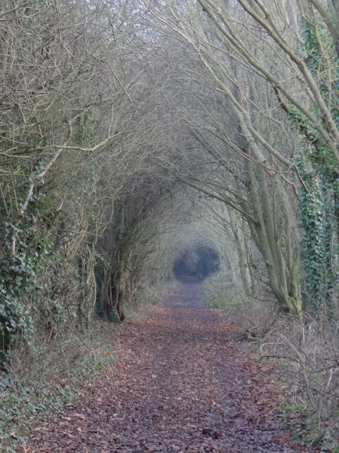
Nature lovers will find plenty to explore in the surrounding area, as the Valley is situated close to the Lincolnshire Wolds, an Area of Outstanding Natural Beauty. This presents ample opportunities for outdoor activities such as hiking, cycling, and birdwatching.
The Valley is steeped in history, with evidence of Roman occupation found in the nearby archaeological site of Barton-on-Humber. Additionally, the village is known for its annual summer fete, which showcases local arts, crafts, and produce.
In conclusion, the Valley, Lincolnshire, is a charming and tight-knit village with a rich history and an abundance of natural beauty. It offers a peaceful and picturesque setting for residents and visitors alike, making it an ideal place to experience the tranquil charm of rural England.
If you have any feedback on the listing, please let us know in the comments section below.
The Valley Images
Images are sourced within 2km of 52.975848/-0.53212186 or Grid Reference SK9843. Thanks to Geograph Open Source API. All images are credited.


The Valley is located at Grid Ref: SK9843 (Lat: 52.975848, Lng: -0.53212186)
Administrative County: Lincolnshire
District: South Kesteven
Police Authority: Lincolnshire
What 3 Words
///towels.flock.shared. Near Ancaster, Lincolnshire
Nearby Locations
Related Wikis
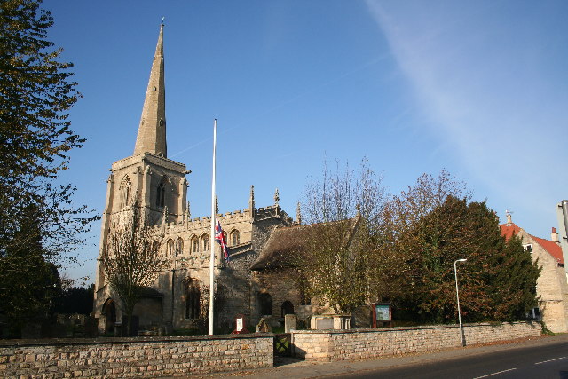
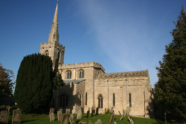
St Martin's Church, Ancaster
St Martin's Church is a Grade I listed Anglican church, dedicated to Martin of Tours, in Ancaster, Lincolnshire, England. The church is 6 miles (10 km...

Ancaster (Roman town)
Ancaster was a small town in the Roman province of Britannia. It is sited on the Roman road known as the Ermine Street and is situated in the county of...
Ancaster, Lincolnshire
Ancaster is a village and civil parish in the South Kesteven district of Lincolnshire, England, on the site of a Roman town. The population of the civil...
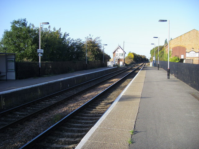
Ancaster railway station
Ancaster railway station serves the village of Ancaster in Lincolnshire, England. The station is 11.5 miles (19 km) north of Grantham on the Nottingham...
Wilsford, Lincolnshire
Wilsford is a village and civil parish in the North Kesteven district of Lincolnshire, England. The population of the civil parish was 400 at the 2011...

Sudbrook, Lincolnshire
Sudbrook is a hamlet in the South Kesteven district of Lincolnshire, England. It is situated 12 miles (19 km) south-east of Newark-on-Trent, 6 miles (10...

Kelby
Kelby is a hamlet in the North Kesteven district of Lincolnshire, England. It lies 5 miles (8 km) south-west from Sleaford, 9 miles (14 km) north-east...

RAF Barkston Heath
Royal Air Force Barkston Heath or RAF Barkston Heath (ICAO: EGYE) is a Royal Air Force Relief Landing Ground under the command of RAF Cranwell near Grantham...
Nearby Amenities
Located within 500m of 52.975848,-0.53212186Have you been to The Valley?
Leave your review of The Valley below (or comments, questions and feedback).