Birch Bottom

Valley in Hampshire Hart

England

Birch Bottom

The A30, Hartfordbridge A fairly regular stopping point if you click this spot on my map.
The A30, Hartfordbridge Credit: David Howard

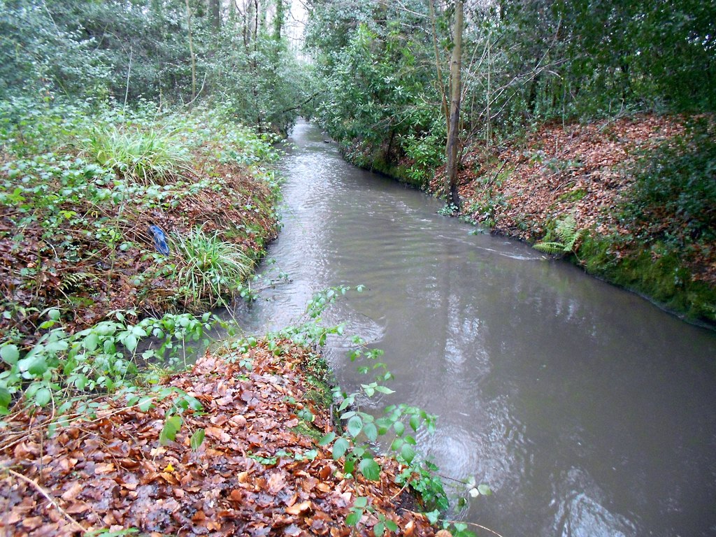
Birch Bottom, Hampshire (Valley) is a charming and picturesque rural area located in the county of Hampshire, England. Situated in the southern part of the country, Birch Bottom is renowned for its breathtaking natural beauty and tranquil surroundings.

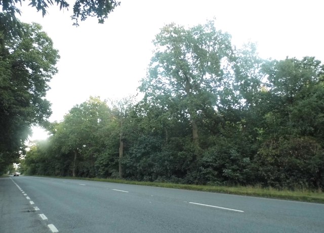
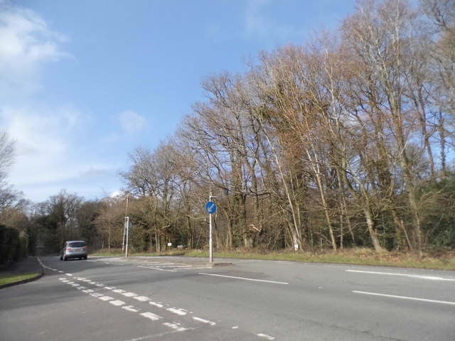
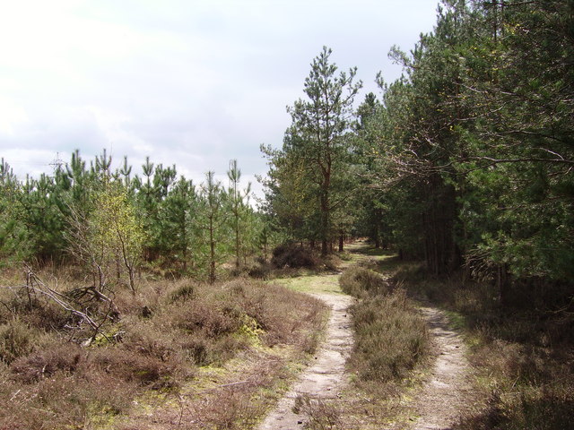
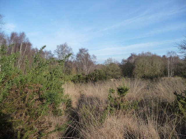
The valley is named after the abundance of birch trees that populate the landscape, providing a stunning backdrop for the area. Rolling hills and meandering streams complete the idyllic scenery, making it a popular destination for nature enthusiasts and outdoor lovers alike.

The small community of Birch Bottom is comprised of a handful of traditional, well-preserved cottages, giving it a quaint and timeless feel. The village is known for its close-knit community spirit, with residents taking pride in maintaining the area's charm and character.

The valley offers a range of outdoor activities, making it an ideal location for those seeking adventure. Hiking and walking trails crisscross the area, providing visitors with the opportunity to explore the scenic countryside and discover hidden gems along the way. The nearby streams are also perfect for fishing, offering anglers the chance to catch a variety of freshwater fish.

For those seeking a more leisurely experience, Birch Bottom is home to a number of charming country pubs and tea rooms, where visitors can sample traditional English fare and relax in a warm and inviting atmosphere.

Overall, Birch Bottom, Hampshire (Valley) is a picturesque and peaceful area, offering visitors a chance to escape the hustle and bustle of city life and immerse themselves in the beauty of the English countryside.

If you have any feedback on the listing, please let us know in the comments section below.
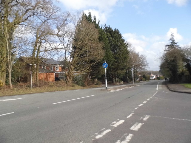
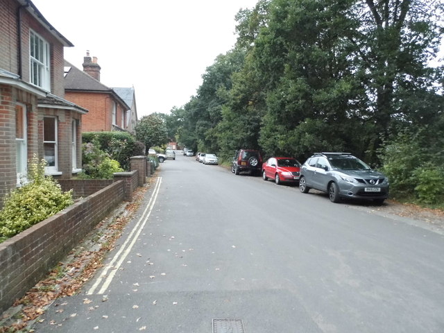
Birch Bottom Images

Images are sourced within 2km of 51.325197/-0.89547238 or Grid Reference SU7759. Thanks to Geograph Open Source API. All images are credited.

The A30, Hartfordbridge A fairly regular stopping point if you click this spot on my map.
The A30, Hartfordbridge
A fairly regular stopping point if you click this spot on my map.
Hartley Wintney: The Baptist Church The church dates from 1807 and is a Grade II Listed Building. The English Heritage website describes it thus:-

"Plain rectangular building with slate roof, painted brick walls at the long sides containing 2 round-headed windows. Symmetrical front with pediment gables having a cornice on coupled brackets, 4 pilasters with moulded caps, the central 2 joined by an arched architrave above on upper window. At ground floor a central window flanked by 2 recessed arched frames. Set back on the east side is a plain porch with a fanlight above double doors."
Hartley Wintney: The Baptist Church
The church dates from 1807 and is a Grade II Listed Building. The English Heritage website describes it thus:- "Plain rectangular building with slate roof, painted brick walls at the long sides containing 2 round-headed windows. Symmetrical front with pediment gables having a cornice on coupled brackets, 4 pilasters with moulded caps, the central 2 joined by an arched architrave above on upper window. At ground floor a central window flanked by 2 recessed arched frames. Set back on the east side is a plain porch with a fanlight above double doors."
Hartley Wintney: Offices of getmapping Virginia Villas, on the High Street, the building to the left, is the address of the offices of getmapping <span class="nowrap"><a title="http://www.getmapping.com/" rel="nofollow ugc noopener" href="http://www.getmapping.com/">Link</a><img style="margin-left:2px;" alt="External link" title="External link - shift click to open in new window" src="https://s1.geograph.org.uk/img/external.png" width="10" height="10"/></span> The smaller building on the right looks as if it ought to merit Grade II Listing, but evidently does not.
Hartley Wintney: Offices of getmapping
Virginia Villas, on the High Street, the building to the left, is the address of the offices of getmapping LinkExternal link The smaller building on the right looks as if it ought to merit Grade II Listing, but evidently does not.
New water features At the time of submitting this photo, these flooded gravel pits are not shown on the Ordnance Survey maps.
New water features
At the time of submitting this photo, these flooded gravel pits are not shown on the Ordnance Survey maps.
Bracknell Lane, Hartley Wintney
Bracknell Lane, Hazeley Heath
Park Corner Road, Hartley Wintney As you can see, it's at the corner of the park
Park Corner Road, Hartley Wintney
As you can see, it's at the corner of the park
Junction on the B3011, Hazeley Heath
Antiques and Collectables, Hartfordbridge Formerly the White Lion pub.
Antiques and Collectables, Hartfordbridge
Formerly the White Lion pub.
Heather on Hazeley Heath On one of the higher parts.
Heather on Hazeley Heath
On one of the higher parts.
Path, Hazeley Heath An extensive heath, part of which (not this part) is an RSPB nature reserve.
Path, Hazeley Heath
An extensive heath, part of which (not this part) is an RSPB nature reserve.
Power pole, Hazeley Heath Only a lightweight single phase supply.
Power pole, Hazeley Heath
Only a lightweight single phase supply.
Wasp spider, Hazeley Heath This looks like a female Argiope bruennichi, an underside view. More usual are views of the top side, so identification is not so easy. It is head up, more usually they are shown head down, but this one seemed to be manoeuvring. It appears to be missing the end part of its hind leg on the right.
Wasp spider, Hazeley Heath
This looks like a female Argiope bruennichi, an underside view. More usual are views of the top side, so identification is not so easy. It is head up, more usually they are shown head down, but this one seemed to be manoeuvring. It appears to be missing the end part of its hind leg on the right.
Hartfordbridge: Eastbound A30 This is the eastbound A30 on the approach to Hartford Bridge that takes the road over the River Hart. This is the original single carriageway road. When it was made into a dual carriageway the westbound road went over a new bridge.
Hartfordbridge: Eastbound A30
This is the eastbound A30 on the approach to Hartford Bridge that takes the road over the River Hart. This is the original single carriageway road. When it was made into a dual carriageway the westbound road went over a new bridge.
Old Milestone by the A30, London Road, Hartley Wintney Carved stone post by the A30, in parish of HARTLEY WINTNEY (HART District), London Road, East of Hartley Wintney, on wide well cut grass verge, in front of high garden wall, on South side of road. Hartford limestone diamond, erected by the Basingstoke, Hartfordbridge & Blackwater (and Odiham) turnpike trust in the 19th century. 

Inscription reads:-
: (BASINGSTOKE / 9½) : : Parish / of / Hartley Wintney : : LONDON / 36 : : Hartford / bridge / ¼ / (BAGSHOT / 9¾) :  

Grade II listed.  
List Entry Number: 1339877 <span class="nowrap"><a title="https://historicengland.org.uk/listing/the-list/list-entry/1339877" rel="nofollow ugc noopener" href="https://historicengland.org.uk/listing/the-list/list-entry/1339877">Link</a><img style="margin-left:2px;" alt="External link" title="External link - shift click to open in new window" src="https://s1.geograph.org.uk/img/external.png" width="10" height="10"/></span>
 
Milestone Society National ID: HA_LE36.
Old Milestone by the A30, London Road, Hartley Wintney
Carved stone post by the A30, in parish of HARTLEY WINTNEY (HART District), London Road, East of Hartley Wintney, on wide well cut grass verge, in front of high garden wall, on South side of road. Hartford limestone diamond, erected by the Basingstoke, Hartfordbridge & Blackwater (and Odiham) turnpike trust in the 19th century. Inscription reads:- : (BASINGSTOKE / 9½) : : Parish / of / Hartley Wintney : : LONDON / 36 : : Hartford / bridge / ¼ / (BAGSHOT / 9¾) : Grade II listed. List Entry Number: 1339877 LinkExternal link Milestone Society National ID: HA_LE36.
White Lion Antiques Situated at Hartford Bridge on London Road, the former coaching inn is now playing host to over 100 sellers of antiques, collectibles and other goods.
White Lion Antiques
Situated at Hartford Bridge on London Road, the former coaching inn is now playing host to over 100 sellers of antiques, collectibles and other goods.
Gravel pit scenery, Eversley Common Much the same view as in: <a title="https://www.geograph.org.uk/photo/4848127" href="https://www.geograph.org.uk/photo/4848127">Link</a>   Although these gravel workings seem to have been abandoned for quite some years, at the time of submitting this item the OS  still mapped this area as conifer plantation.
Gravel pit scenery, Eversley Common
Much the same view as in: Link Although these gravel workings seem to have been abandoned for quite some years, at the time of submitting this item the OS still mapped this area as conifer plantation.
Show me another place!

Birch Bottom is located at Grid Ref: SU7759 (Lat: 51.325197, Lng: -0.89547238)

Administrative County: Hampshire

District: Hart

Police Authority: Hampshire

What 3 Words

///tenure.trout.oasis. Near Hartley Wintney, Hampshire

Related Wikis

Hartfordbridge

Hartfordbridge is a small village in the Hart District of Hampshire, England. The village sits on the A30 road and is 2 miles (2.5 km) from Hartley Wintney...

Bramshill House

Bramshill House, in Bramshill, northeast Hampshire, England, is one of the largest and most important Jacobean prodigy house mansions in England. It was...

Police Staff College, Bramshill

The Police Staff College, Bramshill, Bramshill House, Bramshill, (near Hook) Hampshire, England, was until 2015 the principal police staff training establishment...

Bramshill SSSI

Bramshill is a 673.3-hectare (1,664-acre) biological Site of Special Scientific Interest near Bramshill, northeast of Basingstoke in Hampshire. It is part...

Hazeley Heath

Hazeley Heath is a 180.8-hectare (447-acre) biological Site of Special Scientific Interest west of Farnborough in Hampshire. It is part of Thames Basin...

1957 Blackbushe Viking accident

The 1957 Blackbushe Viking accident occurred on 1 May 1957 when an Eagle Aviation twin-engined Vickers VC.1 Viking 1B registered G-AJBO named "John Benbow...

Fleet Brook

Fleet Brook is a small river in northern Hampshire, England and tributary of the River Hart. == Route == The source is somewhere near the town of Fleet...

Hartley Wintney

Hartley Wintney is a large village and civil parish in the Hart district of Hampshire, England. It lies about 3 miles (5 km) northwest of Fleet and 8 miles...

Related Videos

West Green House Garden / Day Trip Vlog / Days Out in Hampshire / Beautiful English Gardens

Join us in the first of our new series exploring days out and visitor attractions throughout South East England. In this video we visit ...

理想のアンティークカップを探して🇬🇧

お久しぶりです。3週間の日本への一時帰国を終え、無事イギリスに戻ってきました。久しぶりのアンティークハンティング。

Nearby Amenities

Located within 500m of 51.325197,-0.89547238
Power: tower
Lat/Long: 51.3279345/-0.8987569
Power: tower
Source: bing
Lat/Long: 51.322001/-0.8974051
Power: tower
Lat/Long: 51.3251992/-0.8981132
The data included in this document is from www.openstreetmap.org. The data is made available under ODbL.

Have you been to Birch Bottom?

Leave your review of Birch Bottom below (or comments, questions and feedback).