Bramshill Forest

Wood, Forest in Hampshire Hart

England

Bramshill Forest

The A30, Hartfordbridge A fairly regular stopping point if you click this spot on my map.
The A30, Hartfordbridge Credit: David Howard

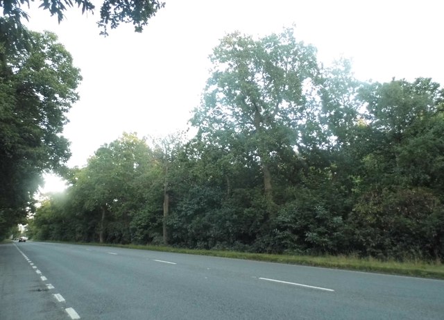
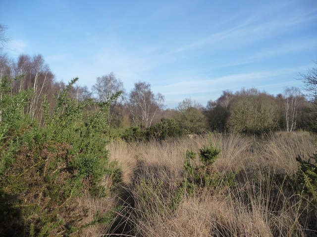
Bramshill Forest, located in Hampshire, England, is a picturesque woodland that covers an area of approximately 370 hectares. It is situated near the town of Hook, and its proximity to the bustling urban areas of Reading and Basingstoke makes it a popular destination for nature enthusiasts and locals seeking a tranquil escape.

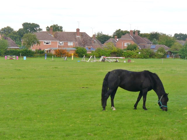
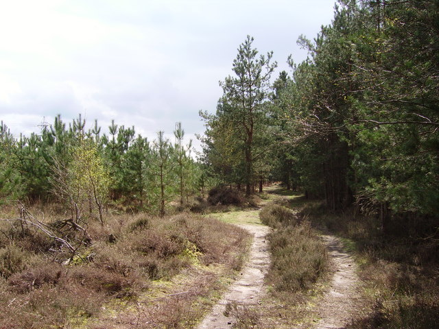
The forest is predominantly composed of oak and birch trees, creating a diverse and vibrant ecosystem. The dense canopy provides shelter for a variety of wildlife, including deer, badgers, and numerous bird species. Bramshill Forest is also home to several rare and protected species, such as the lesser spotted woodpecker and the silver-washed fritillary butterfly, making it a significant conservation site.

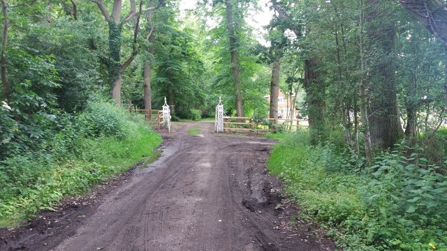
Visitors to Bramshill Forest can explore a network of well-maintained footpaths and bridleways, allowing them to fully immerse themselves in the natural beauty of the area. The forest is a haven for walkers, cyclists, and horse riders, who can enjoy the peaceful atmosphere while taking in the stunning surroundings.

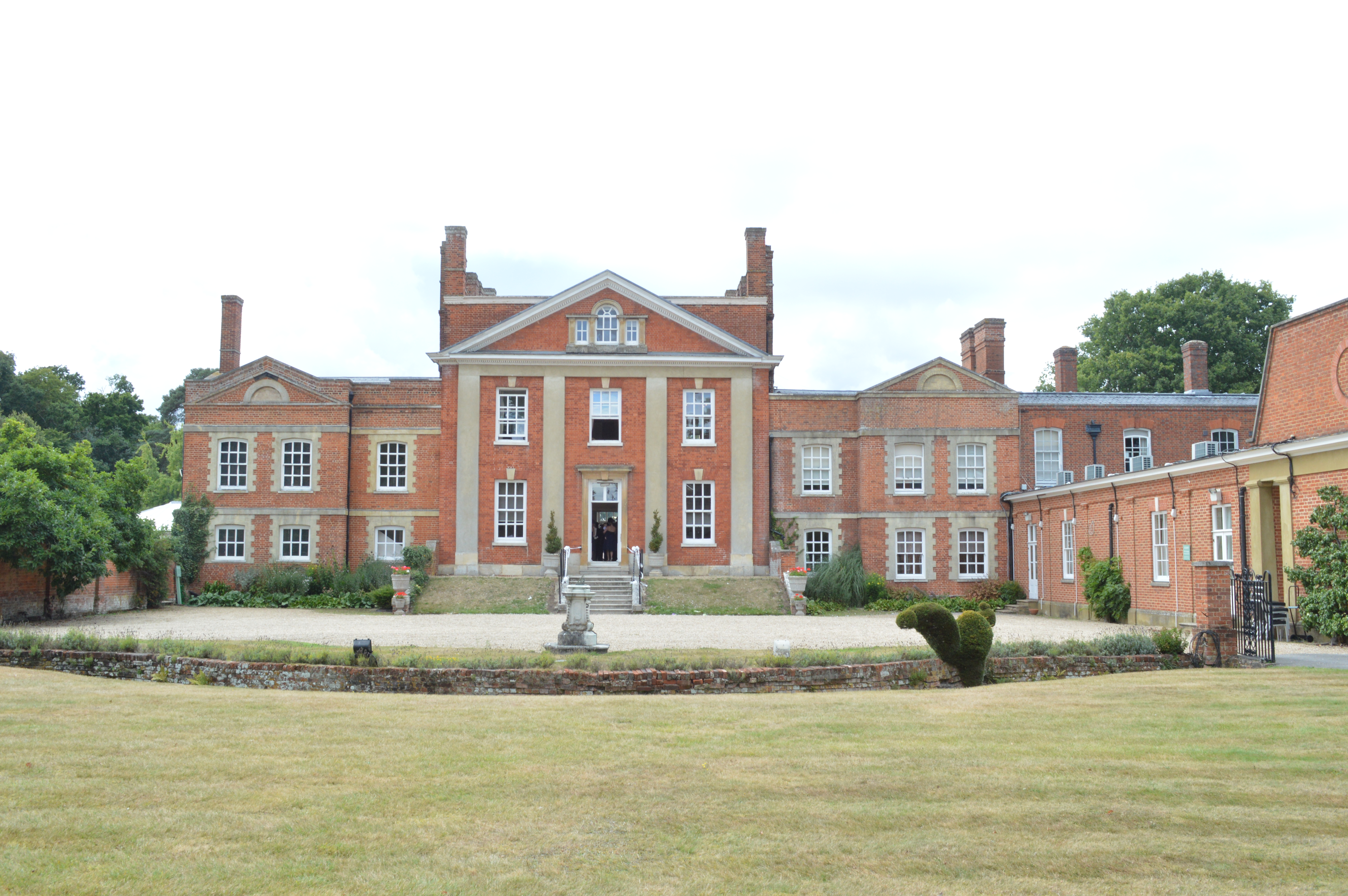
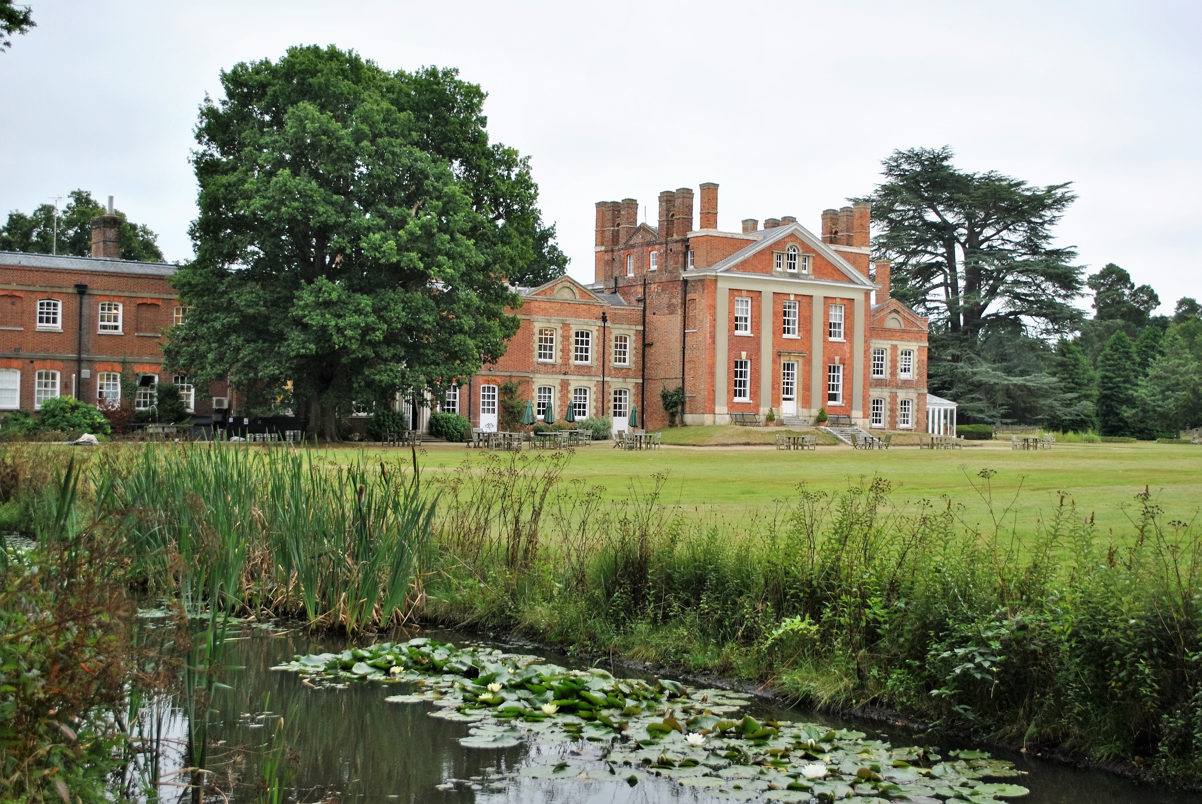
In addition to its natural charm, Bramshill Forest has a rich historical background. It was once part of the Bramshill Estate, a grand mansion that dates back to the 17th century. The estate has since been converted into a police training college, but remnants of its past can still be seen in the forest, including the beautiful Georgian gardens and a picturesque lake.

Overall, Bramshill Forest in Hampshire offers a perfect blend of natural beauty, wildlife, and historical significance, making it a cherished destination for both locals and visitors alike.

If you have any feedback on the listing, please let us know in the comments section below.

Bramshill Forest Images

Images are sourced within 2km of 51.331221/-0.89537074 or Grid Reference SU7759. Thanks to Geograph Open Source API. All images are credited.

The A30, Hartfordbridge A fairly regular stopping point if you click this spot on my map.
The A30, Hartfordbridge
A fairly regular stopping point if you click this spot on my map.
New water features At the time of submitting this photo, these flooded gravel pits are not shown on the Ordnance Survey maps.
New water features
At the time of submitting this photo, these flooded gravel pits are not shown on the Ordnance Survey maps.
Heather on Hazeley Heath On one of the higher parts.
Heather on Hazeley Heath
On one of the higher parts.
Path, Hazeley Heath An extensive heath, part of which (not this part) is an RSPB nature reserve.
Path, Hazeley Heath
An extensive heath, part of which (not this part) is an RSPB nature reserve.
Power pole, Hazeley Heath Only a lightweight single phase supply.
Power pole, Hazeley Heath
Only a lightweight single phase supply.
Wasp spider, Hazeley Heath This looks like a female Argiope bruennichi, an underside view. More usual are views of the top side, so identification is not so easy. It is head up, more usually they are shown head down, but this one seemed to be manoeuvring. It appears to be missing the end part of its hind leg on the right.
Wasp spider, Hazeley Heath
This looks like a female Argiope bruennichi, an underside view. More usual are views of the top side, so identification is not so easy. It is head up, more usually they are shown head down, but this one seemed to be manoeuvring. It appears to be missing the end part of its hind leg on the right.
Hartfordbridge: Eastbound A30 This is the eastbound A30 on the approach to Hartford Bridge that takes the road over the River Hart. This is the original single carriageway road. When it was made into a dual carriageway the westbound road went over a new bridge.
Hartfordbridge: Eastbound A30
This is the eastbound A30 on the approach to Hartford Bridge that takes the road over the River Hart. This is the original single carriageway road. When it was made into a dual carriageway the westbound road went over a new bridge.
Gravel pit scenery, Eversley Common Much the same view as in: <a title="https://www.geograph.org.uk/photo/4848127" href="https://www.geograph.org.uk/photo/4848127">Link</a>   Although these gravel workings seem to have been abandoned for quite some years, at the time of submitting this item the OS  still mapped this area as conifer plantation.
Gravel pit scenery, Eversley Common
Much the same view as in: Link Although these gravel workings seem to have been abandoned for quite some years, at the time of submitting this item the OS still mapped this area as conifer plantation.
St Richards Ride St Richards Ride heading to Hawkers Lodge
St Richards Ride
St Richards Ride heading to Hawkers Lodge
Path heading up to Warren Heath Path from Hulford's Copse heading up to Warren Heath
Path heading up to Warren Heath
Path from Hulford's Copse heading up to Warren Heath
Path heading to footbridge over the River Hart Path from Warren Hill Farm heading to footbridge over the River Hart
Path heading to footbridge over the River Hart
Path from Warren Hill Farm heading to footbridge over the River Hart
Former pub, Hartfordbridge Fine rambling Georgian coaching inn by the A30, originally the White Lion. Grade II listed.
Now White Lion Antiques.
Former pub, Hartfordbridge
Fine rambling Georgian coaching inn by the A30, originally the White Lion. Grade II listed. Now White Lion Antiques.
A327 heading north Entering a litter free parish - Eversley.
A327 heading north
Entering a litter free parish - Eversley.
View of The Mount
View of The Mount
Eversley Church St Mary's Church is noted for a former rector, Charles Kingsley, who wrote "The Water Babies". He is buried in the churchyard.
Eversley Church
St Mary's Church is noted for a former rector, Charles Kingsley, who wrote "The Water Babies". He is buried in the churchyard.
Eversley "Horsieculture" in the NE corner of Hampshire.
Eversley
"Horsieculture" in the NE corner of Hampshire.
Path nearing the A327 Path from Up Green nearing the A327 at Church Farm
Path nearing the A327
Path from Up Green nearing the A327 at Church Farm
Path at the end of Church Lane Path at the end of Church Lane cuts off to the left at the gateposts
Path at the end of Church Lane
Path at the end of Church Lane cuts off to the left at the gateposts
Show me another place!

Bramshill Forest is located at Grid Ref: SU7759 (Lat: 51.331221, Lng: -0.89537074)

Administrative County: Hampshire

District: Hart

Police Authority: Hampshire

What 3 Words

///sprouted.steepest.lordship. Near Eversley, Hampshire

Related Wikis

Bramshill SSSI

Bramshill is a 673.3-hectare (1,664-acre) biological Site of Special Scientific Interest near Bramshill, northeast of Basingstoke in Hampshire. It is part...

Police Staff College, Bramshill

The Police Staff College, Bramshill, Bramshill House, Bramshill, (near Hook) Hampshire, England, was until 2015 the principal police staff training establishment...

Bramshill House

Bramshill House, in Bramshill, northeast Hampshire, England, is one of the largest and most important Jacobean prodigy house mansions in England. It was...

Hartfordbridge

Hartfordbridge is a small village in the Hart District of Hampshire, England. The village sits on the A30 road and is 2 miles (2.5 km) from Hartley Wintney...

Warbrook House Hotel, Eversley

Warbrook House is a building of historical significance and is listed as Grade I in the English Heritage Register. It was built in 1724 by the architect...

Hazeley Heath

Hazeley Heath is a 180.8-hectare (447-acre) biological Site of Special Scientific Interest west of Farnborough in Hampshire. It is part of Thames Basin...

1957 Blackbushe Viking accident

The 1957 Blackbushe Viking accident occurred on 1 May 1957 when an Eagle Aviation twin-engined Vickers VC.1 Viking 1B registered G-AJBO named "John Benbow...

Eversley

Eversley is a village and civil parish in the Hart district of Hampshire, England. The village is located around 11 miles (18 km) northeast of Basingstoke...

Nearby Amenities

Located within 500m of 51.331221,-0.89537074
Power: tower
Lat/Long: 51.3305691/-0.8993148
Power: tower
Lat/Long: 51.3279345/-0.8987569
Power: tower
Lat/Long: 51.3331835/-0.8999693
The data included in this document is from www.openstreetmap.org. The data is made available under ODbL.

Have you been to Bramshill Forest?

Leave your review of Bramshill Forest below (or comments, questions and feedback).