Bagdale
Valley in Yorkshire Scarborough
England
Bagdale
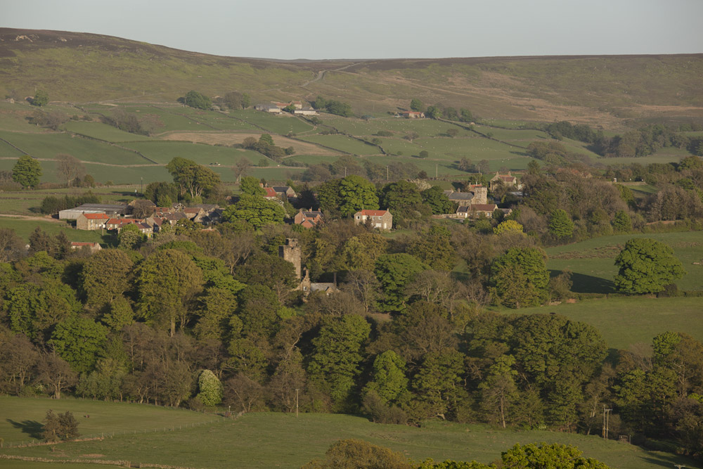
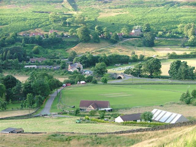
Bagdale is a small picturesque village nestled in the heart of Yorkshire Valley, England. Located in the district of Scarborough, it is surrounded by breathtaking natural beauty and is a popular destination for nature lovers and outdoor enthusiasts. The village is situated on the banks of the River Esk, which adds to its charm and tranquility.
Bagdale is known for its rich history, dating back to medieval times. It is home to several historic buildings, including Bagdale Hall, a 16th-century manor house that has been converted into a hotel. The village's architecture reflects its heritage, with a mix of traditional stone houses and cottages lining its streets.
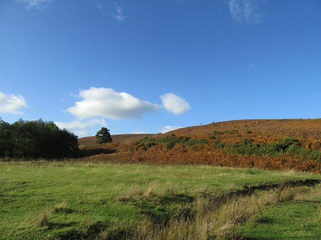
One of the main attractions in Bagdale is its stunning countryside, which offers countless opportunities for hiking, cycling, and exploring. The surrounding area is characterized by rolling hills, lush meadows, and dense woodlands, making it a perfect destination for nature walks and picnics.
For history enthusiasts, Bagdale is also a gateway to the famous Whitby Abbey, a ruined Benedictine abbey that dates back to the 7th century. The abbey is perched on a cliff overlooking the village and provides stunning views of the surrounding landscape.
Bagdale offers a quiet and peaceful retreat away from the hustle and bustle of city life. Its idyllic setting, rich history, and natural beauty make it a hidden gem in Yorkshire Valley, attracting visitors from far and wide.
If you have any feedback on the listing, please let us know in the comments section below.
Bagdale Images
Images are sourced within 2km of 54.443983/-0.97820713 or Grid Reference NZ6605. Thanks to Geograph Open Source API. All images are credited.
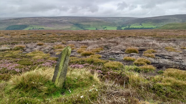
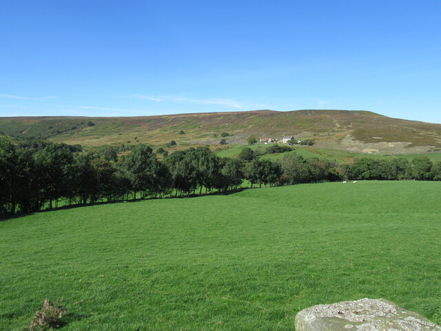
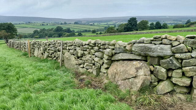
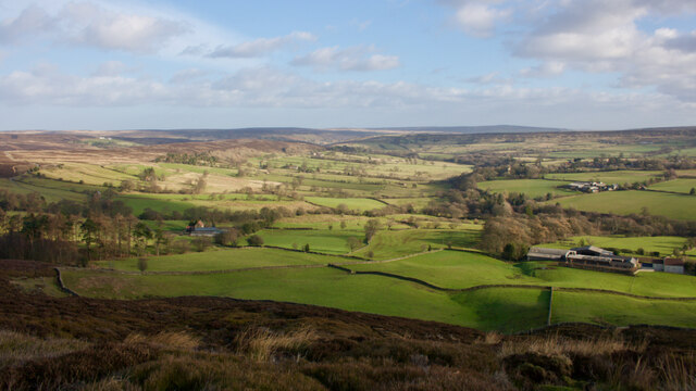
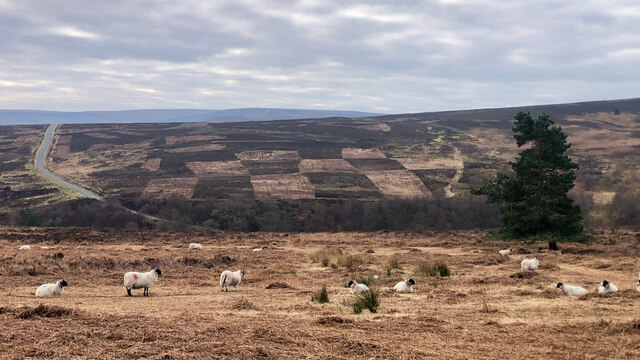
![Round Hill Iron Age hillfort Although a much brandied term, believe it or not there are only a handful of prehistoric fortified sites recorded within the North York Moors. All, with one exception, are ‘Promontory Forts‘, the exception being Round Hill in Westerdale.
These Promontory Forts are generally located on the Cleveland and Hambleton Hills: Eston Nab, Roulston Scar, Boltby Scar, Live Moor. They date from the Late Bronze Age to the Iron Age, at various times in the millennium before the Romans came. Their position on the cliff edges and promontories suggest there primary purpose was defensive, a place of protection for a community at night and in times of emergency.
Round Hill is technically a mutivallate hillfort, which means having two or more lines of earthwork ditches. Although it’s on a hill, it is in the upper reaches of a spur of Westerdale and is surrounded by higher moors. It resembles a little brother to the well-known Maiden Castle in Dorset, and would have been clearly visible from within the surrounding dale. A high status residence and statement of local power.
The site is entirely on private farmland so an opportunity to visit was not to be missed. Like Maiden Castle, the best photographed would be from above using a drone. Furthermore a band of trees covers most of the ditches. On the north east side these are discontinuous which can be partially explained by a staggered, more defendable, entrance.
The defences would be expected to have consisted of a series of imposing ramparts as well as the deep ditches. A palisade would have topped the ramparts. Today, there is no evidence of these ramparts on the inside of the ditches but the fortified area has been well ploughed over the millennia. This morning, a large bull and his cows and calves protected this central plateau. Within this fortified area there would likely have been dwellings, shelters for livestock and storage areas for food and weaponry. The site is located on the main ironstone seam and field walking has produced evidence of low temperature slag, a characteristic of early iron smelting.
No archaeological exploration has ever been done. A 16th-century document refers to the hill as ‘Burnt Oak Hill’. The same document also names the collection of farmsteads along the upper east side of the dale as ‘Trowsdale’. Both names have now been lost to history.
From my blog <span class="nowrap"><a title="http://www.fhithich.uk/?p=26305" rel="nofollow ugc noopener" href="http://www.fhithich.uk/?p=26305">Link</a><img style="margin-left:2px;" alt="External link" title="External link - shift click to open in new window" src="https://s1.geograph.org.uk/img/external.png" width="10" height="10"/></span>
Sources:
The official blog for the North York Moors National Park. Available at: <span class="nowrap"><a title="https://northyorkmoorsnationalpark.wordpress.com/2019/01/21/fortifying-the-landscape/" rel="nofollow ugc noopener" href="https://northyorkmoorsnationalpark.wordpress.com/2019/01/21/fortifying-the-landscape/">Link</a><img style="margin-left:2px;" alt="External link" title="External link - shift click to open in new window" src="https://s1.geograph.org.uk/img/external.png" width="10" height="10"/></span> [Accessed 26 Aug. 2021]
Wilson, Carol M. &quot;Westerdale: the origins and development of a medieval settlement&quot;. ISBN 978-0-9565779-2-4 2013](https://s3.geograph.org.uk/geophotos/06/97/52/6975227_d1034395.jpg)
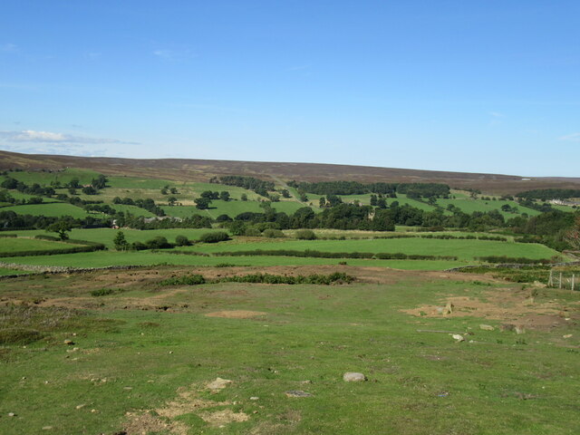
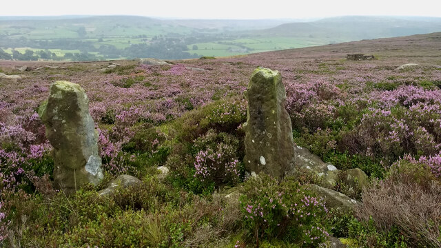
![Round Hill Iron Age hillfort Although a much brandied term, believe it or not there are only a handful of prehistoric fortified sites recorded within the North York Moors. All, with one exception, are ‘Promontory Forts‘, the exception being Round Hill in Westerdale.
These Promontory Forts are generally located on the Cleveland and Hambleton Hills: Eston Nab, Roulston Scar, Boltby Scar, Live Moor. They date from the Late Bronze Age to the Iron Age, at various times in the millennium before the Romans came. Their position on the cliff edges and promontories suggest there primary purpose was defensive, a place of protection for a community at night and in times of emergency.
Round Hill is technically a mutivallate hillfort, which means having two or more lines of earthwork ditches. Although it’s on a hill, it is in the upper reaches of a spur of Westerdale and is surrounded by higher moors. It resembles a little brother to the well-known Maiden Castle in Dorset, and would have been clearly visible from within the surrounding dale. A high status residence and statement of local power.
The site is entirely on private farmland so an opportunity to visit was not to be missed. Like Maiden Castle, the best photographed would be from above using a drone. Furthermore a band of trees covers most of the ditches. On the north east side these are discontinuous which can be partially explained by a staggered, more defendable, entrance.
The defences would be expected to have consisted of a series of imposing ramparts as well as the deep ditches. A palisade would have topped the ramparts. Today, there is no evidence of these ramparts on the inside of the ditches but the fortified area has been well ploughed over the millennia. This morning, a large bull and his cows and calves protected this central plateau. Within this fortified area there would likely have been dwellings, shelters for livestock and storage areas for food and weaponry. The site is located on the main ironstone seam and field walking has produced evidence of low temperature slag, a characteristic of early iron smelting.
No archaeological exploration has ever been done. A 16th-century document refers to the hill as ‘Burnt Oak Hill’. The same document also names the collection of farmsteads along the upper east side of the dale as ‘Trowsdale’. Both names have now been lost to history.
From my blog <span class="nowrap"><a title="http://www.fhithich.uk/?p=26305" rel="nofollow ugc noopener" href="http://www.fhithich.uk/?p=26305">Link</a><img style="margin-left:2px;" alt="External link" title="External link - shift click to open in new window" src="https://s1.geograph.org.uk/img/external.png" width="10" height="10"/></span>
Sources:
The official blog for the North York Moors National Park. Available at: <span class="nowrap"><a title="https://northyorkmoorsnationalpark.wordpress.com/2019/01/21/fortifying-the-landscape/" rel="nofollow ugc noopener" href="https://northyorkmoorsnationalpark.wordpress.com/2019/01/21/fortifying-the-landscape/">Link</a><img style="margin-left:2px;" alt="External link" title="External link - shift click to open in new window" src="https://s1.geograph.org.uk/img/external.png" width="10" height="10"/></span> [Accessed 26 Aug. 2021]
Wilson, Carol M. &quot;Westerdale: the origins and development of a medieval settlement&quot;. ISBN 978-0-9565779-2-4 2013](https://s1.geograph.org.uk/geophotos/06/97/52/6975229_7985d6d0.jpg)
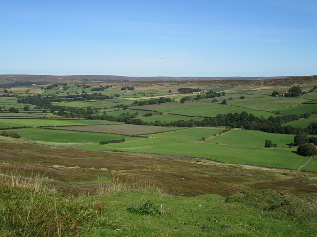
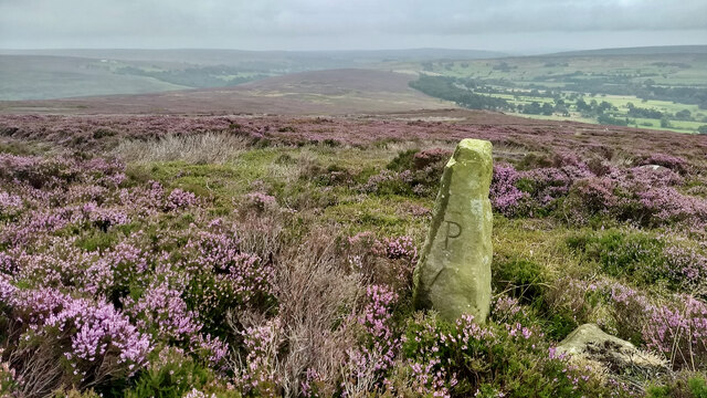
![Round Hill Iron Age hillfort Although a much brandied term, believe it or not there are only a handful of prehistoric fortified sites recorded within the North York Moors. All, with one exception, are ‘Promontory Forts‘, the exception being Round Hill in Westerdale.
These Promontory Forts are generally located on the Cleveland and Hambleton Hills: Eston Nab, Roulston Scar, Boltby Scar, Live Moor. They date from the Late Bronze Age to the Iron Age, at various times in the millennium before the Romans came. Their position on the cliff edges and promontories suggest there primary purpose was defensive, a place of protection for a community at night and in times of emergency.
Round Hill is technically a mutivallate hillfort, which means having two or more lines of earthwork ditches. Although it’s on a hill, it is in the upper reaches of a spur of Westerdale and is surrounded by higher moors. It resembles a little brother to the well-known Maiden Castle in Dorset, and would have been clearly visible from within the surrounding dale. A high status residence and statement of local power.
The site is entirely on private farmland so an opportunity to visit was not to be missed. Like Maiden Castle, the best photographed would be from above using a drone. Furthermore a band of trees covers most of the ditches. On the north east side these are discontinuous which can be partially explained by a staggered, more defendable, entrance.
The defences would be expected to have consisted of a series of imposing ramparts as well as the deep ditches. A palisade would have topped the ramparts. Today, there is no evidence of these ramparts on the inside of the ditches but the fortified area has been well ploughed over the millennia. This morning, a large bull and his cows and calves protected this central plateau. Within this fortified area there would likely have been dwellings, shelters for livestock and storage areas for food and weaponry. The site is located on the main ironstone seam and field walking has produced evidence of low temperature slag, a characteristic of early iron smelting.
No archaeological exploration has ever been done. A 16th-century document refers to the hill as ‘Burnt Oak Hill’. The same document also names the collection of farmsteads along the upper east side of the dale as ‘Trowsdale’. Both names have now been lost to history.
From my blog <span class="nowrap"><a title="http://www.fhithich.uk/?p=26305" rel="nofollow ugc noopener" href="http://www.fhithich.uk/?p=26305">Link</a><img style="margin-left:2px;" alt="External link" title="External link - shift click to open in new window" src="https://s1.geograph.org.uk/img/external.png" width="10" height="10"/></span>
Sources:
The official blog for the North York Moors National Park. Available at: <span class="nowrap"><a title="https://northyorkmoorsnationalpark.wordpress.com/2019/01/21/fortifying-the-landscape/" rel="nofollow ugc noopener" href="https://northyorkmoorsnationalpark.wordpress.com/2019/01/21/fortifying-the-landscape/">Link</a><img style="margin-left:2px;" alt="External link" title="External link - shift click to open in new window" src="https://s1.geograph.org.uk/img/external.png" width="10" height="10"/></span> [Accessed 26 Aug. 2021]
Wilson, Carol M. &quot;Westerdale: the origins and development of a medieval settlement&quot;. ISBN 978-0-9565779-2-4 2013](https://s0.geograph.org.uk/geophotos/06/97/52/6975232_bf826c26.jpg)
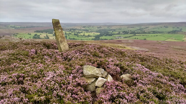
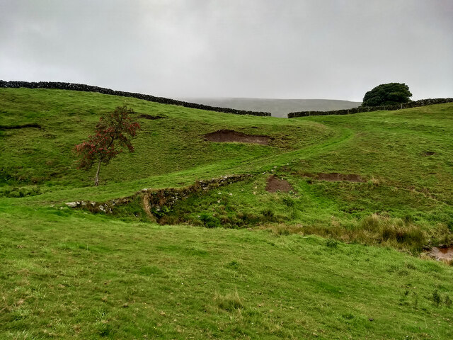
![Round Hill Iron Age hillfort Although a much brandied term, believe it or not there are only a handful of prehistoric fortified sites recorded within the North York Moors. All, with one exception, are ‘Promontory Forts‘, the exception being Round Hill in Westerdale.
These Promontory Forts are generally located on the Cleveland and Hambleton Hills: Eston Nab, Roulston Scar, Boltby Scar, Live Moor. They date from the Late Bronze Age to the Iron Age, at various times in the millennium before the Romans came. Their position on the cliff edges and promontories suggest there primary purpose was defensive, a place of protection for a community at night and in times of emergency.
Round Hill is technically a mutivallate hillfort, which means having two or more lines of earthwork ditches. Although it’s on a hill, it is in the upper reaches of a spur of Westerdale and is surrounded by higher moors. It resembles a little brother to the well-known Maiden Castle in Dorset, and would have been clearly visible from within the surrounding dale. A high status residence and statement of local power.
The site is entirely on private farmland so an opportunity to visit was not to be missed. Like Maiden Castle, the best photographed would be from above using a drone. Furthermore a band of trees covers most of the ditches. On the north east side these are discontinuous which can be partially explained by a staggered, more defendable, entrance.
The defences would be expected to have consisted of a series of imposing ramparts as well as the deep ditches. A palisade would have topped the ramparts. Today, there is no evidence of these ramparts on the inside of the ditches but the fortified area has been well ploughed over the millennia. This morning, a large bull and his cows and calves protected this central plateau. Within this fortified area there would likely have been dwellings, shelters for livestock and storage areas for food and weaponry. The site is located on the main ironstone seam and field walking has produced evidence of low temperature slag, a characteristic of early iron smelting.
No archaeological exploration has ever been done. A 16th-century document refers to the hill as ‘Burnt Oak Hill’. The same document also names the collection of farmsteads along the upper east side of the dale as ‘Trowsdale’. Both names have now been lost to history.
From my blog <span class="nowrap"><a title="http://www.fhithich.uk/?p=26305" rel="nofollow ugc noopener" href="http://www.fhithich.uk/?p=26305">Link</a><img style="margin-left:2px;" alt="External link" title="External link - shift click to open in new window" src="https://s1.geograph.org.uk/img/external.png" width="10" height="10"/></span>
Sources:
The official blog for the North York Moors National Park. Available at: <span class="nowrap"><a title="https://northyorkmoorsnationalpark.wordpress.com/2019/01/21/fortifying-the-landscape/" rel="nofollow ugc noopener" href="https://northyorkmoorsnationalpark.wordpress.com/2019/01/21/fortifying-the-landscape/">Link</a><img style="margin-left:2px;" alt="External link" title="External link - shift click to open in new window" src="https://s1.geograph.org.uk/img/external.png" width="10" height="10"/></span> [Accessed 26 Aug. 2021]
Wilson, Carol M. &quot;Westerdale: the origins and development of a medieval settlement&quot;. ISBN 978-0-9565779-2-4 2013](https://s1.geograph.org.uk/geophotos/06/97/52/6975233_2bd45db8.jpg)
Bagdale is located at Grid Ref: NZ6605 (Lat: 54.443983, Lng: -0.97820713)
Division: North Riding
Administrative County: North Yorkshire
District: Scarborough
Police Authority: North Yorkshire
What 3 Words
///depravity.octagon.agreeable. Near Danby, North Yorkshire
Nearby Locations
Related Wikis

Westerdale Preceptory
Westerdale Preceptory was a priory in Westerdale, North Yorkshire, England. The land was donated to the Knights Templar by Guido de Bovingcourt in 1203...
Westerdale
Westerdale is a village, civil parish and dale within the Scarborough district of North Yorkshire, England. The Esk Valley Walk runs through part of the...
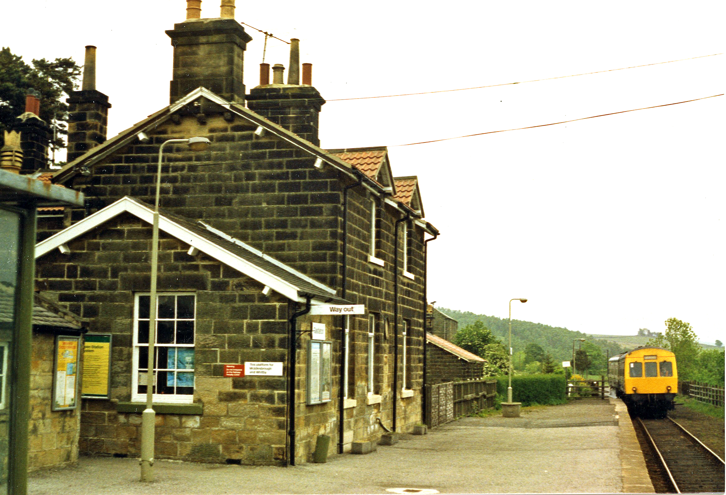
Castleton Moor railway station
Castleton Moor is a railway station on the Esk Valley Line, which runs between Middlesbrough and Whitby via Nunthorpe. The station, situated 16 miles 45...
Castleton, North Yorkshire
Castleton is a village on the River Esk, part of the civil parish of Danby in the county of North Yorkshire in England. It can be found 7.1 miles (11.5...
Nearby Amenities
Located within 500m of 54.443983,-0.97820713Have you been to Bagdale?
Leave your review of Bagdale below (or comments, questions and feedback).