Gill Wath

Valley in Yorkshire Ryedale

England

Gill Wath

Near Long Causeway Looking east towards Farndale Moor.
Near Long Causeway Credit: T Eyre

Gill Wath is a picturesque valley located in Yorkshire, England. Nestled in the heart of the Yorkshire Dales National Park, it is surrounded by rolling hills, lush green meadows, and scenic landscapes. The valley is renowned for its outstanding natural beauty and is a popular destination for outdoor enthusiasts and nature lovers.

The name "Gill Wath" is derived from the Old Norse language, meaning "narrow valley," which is an apt description of the area. The valley is formed by the Gill Beck, a small river that meanders through the landscape, creating a tranquil and serene atmosphere.

Gill Wath is home to a diverse range of flora and fauna, including rare species of wildflowers and various bird species. The valley is particularly famous for its vibrant display of bluebells in the spring, attracting visitors from far and wide.

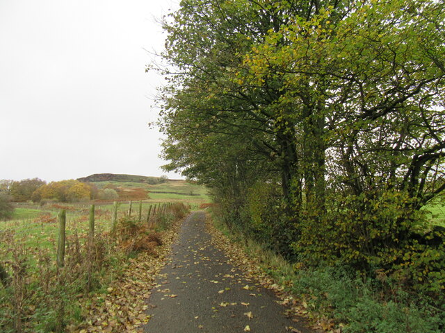
Walking and hiking trails crisscross the valley, offering visitors the opportunity to explore its natural wonders. The paths lead to breathtaking viewpoints, cascading waterfalls, and hidden caves, making it an ideal destination for adventure seekers.

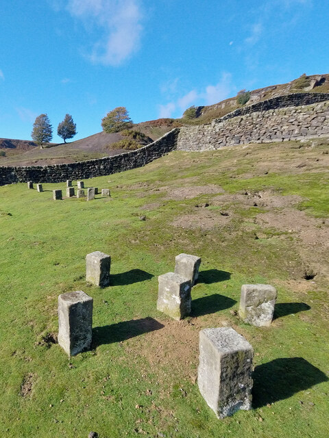
In addition to its natural beauty, Gill Wath has a rich cultural heritage. The valley is dotted with historic landmarks, including ancient ruins, stone circles, and traditional Yorkshire stone-built farmhouses.

Overall, Gill Wath is a hidden gem in Yorkshire, offering visitors a chance to escape the hustle and bustle of everyday life and immerse themselves in the tranquility of nature. Whether it's a leisurely hike, a picnic by the river, or simply enjoying the breathtaking views, Gill Wath is a must-visit destination for anyone seeking solace in the beauty of the Yorkshire countryside.

If you have any feedback on the listing, please let us know in the comments section below.

Gill Wath Images

Images are sourced within 2km of 54.39963/-1.0106102 or Grid Reference NZ6400. Thanks to Geograph Open Source API. All images are credited.

Near Long Causeway Looking east towards Farndale Moor.
Near Long Causeway
Looking east towards Farndale Moor.
Near Middle Head Near the ruined Middle Head at the top of Farndale, there has been signs of a recent landslip ahead.
Near Middle Head
Near the ruined Middle Head at the top of Farndale, there has been signs of a recent landslip ahead.
Middle Head ruin The remains of Middle Head, at the top of Farndale.
Middle Head ruin
The remains of Middle Head, at the top of Farndale.
View from Middle Head Looking south from Middle Head at the top of Farndale.
View from Middle Head
Looking south from Middle Head at the top of Farndale.
Barn near Middle Head This barn has a stone trod going to it.
Barn near Middle Head
This barn has a stone trod going to it.
The remains of Middle Head Not much remains of Middle Head.
The remains of Middle Head
Not much remains of Middle Head.
Saw-pit A whip-saw, a two-handled saw, would be worked by two men, one on top and one below — the ‘underdog‘,  who would be an apprentice or worker.  The skilled joiner would control the cut from the top. The underdog would be constantly showered by sawdust.

Along the top of each wall, there would be a wood ‘stringer‘ and heavier ‘transomes’, or ‘dogs‘ in naval slang, laid across to support the tree. A plumbline let down into the pit helped guide the bottom sawyer.

It may seem somewhat surprising that a saw-pit was located at the uppermost farmstead in the dale, but many farms had their own saw-horse which was used when required by the dale’s joiner or wheelwright.

It was not only planks that were cut but shaped sections such as plough beams also. Planks were typically laid out on drying shelves for five years before using.

For references see my blog <span class="nowrap"><a title="http://www.fhithich.uk/?p=30363" rel="nofollow ugc noopener" href="http://www.fhithich.uk/?p=30363">Link</a><img style="margin-left:2px;" alt="External link" title="External link - shift click to open in new window" src="https://s1.geograph.org.uk/img/external.png" width="10" height="10"/></span>
Saw-pit
A whip-saw, a two-handled saw, would be worked by two men, one on top and one below — the ‘underdog‘, who would be an apprentice or worker. The skilled joiner would control the cut from the top. The underdog would be constantly showered by sawdust. Along the top of each wall, there would be a wood ‘stringer‘ and heavier ‘transomes’, or ‘dogs‘ in naval slang, laid across to support the tree. A plumbline let down into the pit helped guide the bottom sawyer. It may seem somewhat surprising that a saw-pit was located at the uppermost farmstead in the dale, but many farms had their own saw-horse which was used when required by the dale’s joiner or wheelwright. It was not only planks that were cut but shaped sections such as plough beams also. Planks were typically laid out on drying shelves for five years before using. For references see my blog LinkExternal link
Staddle stones Used to raise haystacks and the like off the ground. See NYM HER No: 13393.
Staddle stones
Used to raise haystacks and the like off the ground. See NYM HER No: 13393.
Staddle stones Used to raise haystacks and the like off the ground. See NYM HER No: 13393.
Staddle stones
Used to raise haystacks and the like off the ground. See NYM HER No: 13393.
Ruined sheep fold at Middle Heads See NYM HER No: 13394.
Ruined sheep fold at Middle Heads
See NYM HER No: 13394.
Ruined farmstead at Middle Heads See NYM HER No: 10778.
Ruined farmstead at Middle Heads
See NYM HER No: 10778.
Daleside Road near Esk House Looking north.
Daleside Road near Esk House
Looking north.
Near Sonley Wood Looking SW across Farndale near Sonley Wood.
Near Sonley Wood
Looking SW across Farndale near Sonley Wood.
Looking across to Spring House Looking across Farndale towards Spring House.
Looking across to Spring House
Looking across Farndale towards Spring House.
Daleside Road near Elm House Daleside Road is a muddy bridleway at this point and beyond.
Daleside Road near Elm House
Daleside Road is a muddy bridleway at this point and beyond.
River Dove ford Deep ford on the River Dove, there is a bridge to the right.
River Dove ford
Deep ford on the River Dove, there is a bridge to the right.
Daleside Road west The top end of the Daleside Road on the west side of Farndale although it is just a bridleway.
Daleside Road west
The top end of the Daleside Road on the west side of Farndale although it is just a bridleway.
Show me another place!

Gill Wath is located at Grid Ref: NZ6400 (Lat: 54.39963, Lng: -1.0106102)

Division: North Riding

Administrative County: North Yorkshire

District: Ryedale

Police Authority: North Yorkshire

What 3 Words

///skid.quack.spun. Near Bilsdale, North Yorkshire

Nearby Locations

Gill Wath

Related Wikis

Cockayne, North Yorkshire

Cockayne is an isolated hamlet in North Yorkshire, England. It is the largest settlement in the civil parish of Bransdale, in the North York Moors national...

Bransdale Mill

Bransdale Mill is a historic building in Bransdale, a village in North Yorkshire, in England. There has been a watermill on Hodge Beck since the medieval...

Lion Inn

The Lion Inn is a public house at Blakey Ridge, near Kirkbymoorside, in North Yorkshire, England. The building was completed between 1553 and 1558 (dates...

Bransdale

Bransdale is a valley running south through North Yorkshire, England, and part of the North York Moors National Park. Sandwiched between Bilsdale to the...

Nearby Amenities

Located within 500m of 54.39963,-1.0106102
Ford: yes
Lat/Long: 54.399695/-1.0096551
Ford: yes
Lat/Long: 54.3988939/-1.0104334
The data included in this document is from www.openstreetmap.org. The data is made available under ODbL.

Have you been to Gill Wath?

Leave your review of Gill Wath below (or comments, questions and feedback).