Sleddale

Valley in Yorkshire Hambleton

England

Sleddale

Fence Corner, Wayworth Moor Percy Rigg Farm in the distance (<a href="https://www.geograph.org.uk/gridref/NZ6210">NZ6210</a>).
Fence Corner, Wayworth Moor Credit: Mick Garratt

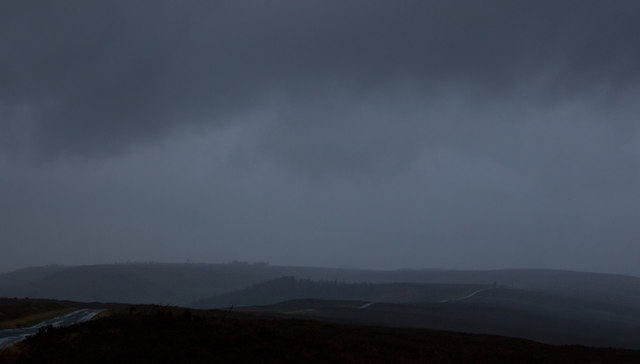
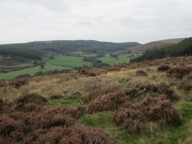
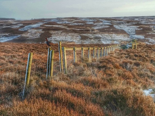
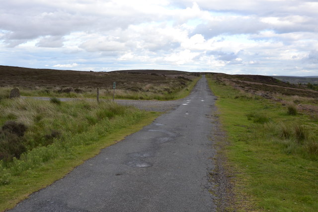
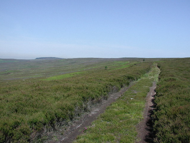
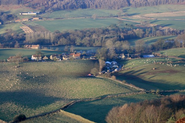
Sleddale is a picturesque valley located in Yorkshire, England. Situated in the northern part of the county, Sleddale is known for its stunning natural beauty and tranquil atmosphere. The valley is nestled amidst rolling hills and offers breathtaking views of the surrounding countryside.

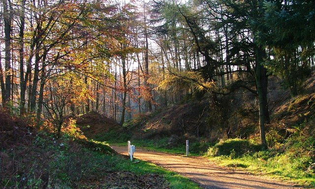
One of the main features of Sleddale is its charming river, which meanders through the valley. The river is lined with lush greenery, including willow and alder trees, creating a peaceful and idyllic environment. The gentle sound of the flowing water adds to the serenity of the place.

Sleddale is also home to a variety of wildlife, making it a popular destination for nature enthusiasts. The valley provides a habitat for numerous bird species, such as kingfishers, herons, and dippers. It is not uncommon to spot deer, rabbits, and other small mammals in the area as well.

The valley is dotted with traditional stone-built farmhouses and cottages, adding to its rustic charm. These buildings, some of which date back centuries, are a testament to the area's rich history and agricultural heritage.

Visitors to Sleddale can enjoy various outdoor activities, including hiking, cycling, and picnicking. The valley offers a range of walking trails, allowing visitors to explore its scenic beauty at their own pace.

Overall, Sleddale is a hidden gem in Yorkshire, offering a peaceful retreat from the hustle and bustle of everyday life. Its natural beauty, wildlife, and historic charm make it a must-visit destination for those seeking tranquility and a connection with nature.

If you have any feedback on the listing, please let us know in the comments section below.

Sleddale Images

Images are sourced within 2km of 54.493994/-1.0380846 or Grid Reference NZ6211. Thanks to Geograph Open Source API. All images are credited.

Fence Corner, Wayworth Moor Percy Rigg Farm in the distance (<a href="https://www.geograph.org.uk/gridref/NZ6210">NZ6210</a>).
Fence Corner, Wayworth Moor
Percy Rigg Farm in the distance (NZ6210).
Ruined Wall, Wayworth Moor Consisting of large orthostats, evidence that the wall is of some antiquity.
Ruined Wall, Wayworth Moor
Consisting of large orthostats, evidence that the wall is of some antiquity.
Guisborough Moor The public bridleway across Guisborough Moor.
Guisborough Moor
The public bridleway across Guisborough Moor.
Cod Hill Slack from Percy Rigg
Sleddale and Codhill Heights
Rain squall on Brown Hill It was well forecast, but still quite a surprise when about 3pm it became very dark and the moor was lashed with wind and rain for maybe five minutes.
The temperature fell from 12°C to 6°C as a cold front moved through.
A short video can be found here. <span class="nowrap"><a title="http://www.youtube.com/watch?v=ylsmuJd-ALQ" rel="nofollow ugc noopener" href="http://www.youtube.com/watch?v=ylsmuJd-ALQ">Link</a><img style="margin-left:2px;" alt="External link" title="External link - shift click to open in new window" src="https://s1.geograph.org.uk/img/external.png" width="10" height="10"/></span>
Rain squall on Brown Hill
It was well forecast, but still quite a surprise when about 3pm it became very dark and the moor was lashed with wind and rain for maybe five minutes. The temperature fell from 12°C to 6°C as a cold front moved through. A short video can be found here. LinkExternal link
Summit shelter, Gisborough Moor Shelter protects against westerly wind-no use in today's biting easterly.
Summit shelter, Gisborough Moor
Shelter protects against westerly wind-no use in today's biting easterly.
Track by North Ings Slack
Track on North Ings Moor
Commondale Moor Looking NW along the shooters track.
Commondale Moor
Looking NW along the shooters track.
View from Percy Cross Rigg Looking west to Lonsdale.
View from Percy Cross Rigg
Looking west to Lonsdale.
Codhill Heights From Percy Cross.
Codhill Heights
From Percy Cross.
Guisborough Moor Near the summit of Guisborough Moor.
Guisborough Moor
Near the summit of Guisborough Moor.
Great Ayton Moor Entrance and track across Great Ayton Moor near to Kildale, North Yorkshire.
Great Ayton Moor
Entrance and track across Great Ayton Moor near to Kildale, North Yorkshire.
Percy Cross Rigg Footpath off Percy Cross Rig near to Kildale, North Yorkshire.
Percy Cross Rigg
Footpath off Percy Cross Rig near to Kildale, North Yorkshire.
North Ings Moor Looking towards Commondale.
North Ings Moor
Looking towards Commondale.
Sleddale Stone Circle On Waywoth Moor. One of only two remaining on the  North York Moors.

See <span class="nowrap"><a title="http://www.themodernantiquarian.com/site/255/commondale.html" rel="nofollow ugc noopener" href="http://www.themodernantiquarian.com/site/255/commondale.html">Link</a><img style="margin-left:2px;" alt="External link" title="External link - shift click to open in new window" src="https://s1.geograph.org.uk/img/external.png" width="10" height="10"/></span>
Sleddale Stone Circle
On Waywoth Moor. One of only two remaining on the North York Moors. See LinkExternal link
Lonsdale Vale Ironstone Mine The ironstone mine at Lonsdale is another example of the feeding frenzy that followed the discovery of ironstone in the Eston Hills in the 1850s. And as with the Warren Moor Mine (see <span class="nowrap"><a title="https://fhithich.wordpress.com/2016/01/13/boom-and-bust-on-the-north-york-moors/" rel="nofollow ugc noopener" href="https://fhithich.wordpress.com/2016/01/13/boom-and-bust-on-the-north-york-moors/">Link</a><img style="margin-left:2px;" alt="External link" title="External link - shift click to open in new window" src="https://s1.geograph.org.uk/img/external.png" width="10" height="10"/></span> ) it was a royalty let by the Kildale Estate which failed to live up to expectations. The main man is again John Watson, a Fellow of the Geological Society from Essex. who must have had powers of persuasion to match Arthur Daley. In 1865 he leased the whole of the royalties of the Kildale Estate and persuaded his wealthy London friends to invest in ironstone. Together they formed the Lonsdale Vale Ironstone Mine which sub-leased the 2,000 acre royalty in Lonsdale from Watson.

So far so good. A shaft was sunk to reach the Main Seam, 145′ deep. Plans were made to built a furnace in the valley. But the quality of the ironstone again was poor. It is doubtful if any ore from the Main Seam was actually gained. A small drift mine half a mile to the south east into the outcropping Dogger seam did produce almost 48,000 tons but by 1868 the Kildale Estate was owed a year’s rent and forced the company into liquidation.

The stone arch of the engine house is the most visible reminder of ironstone mining Lonsdale. The outlines of other buildings and the railway extension can be traced in the fields beyond the arch.
Lonsdale Vale Ironstone Mine
The ironstone mine at Lonsdale is another example of the feeding frenzy that followed the discovery of ironstone in the Eston Hills in the 1850s. And as with the Warren Moor Mine (see LinkExternal link ) it was a royalty let by the Kildale Estate which failed to live up to expectations. The main man is again John Watson, a Fellow of the Geological Society from Essex. who must have had powers of persuasion to match Arthur Daley. In 1865 he leased the whole of the royalties of the Kildale Estate and persuaded his wealthy London friends to invest in ironstone. Together they formed the Lonsdale Vale Ironstone Mine which sub-leased the 2,000 acre royalty in Lonsdale from Watson. So far so good. A shaft was sunk to reach the Main Seam, 145′ deep. Plans were made to built a furnace in the valley. But the quality of the ironstone again was poor. It is doubtful if any ore from the Main Seam was actually gained. A small drift mine half a mile to the south east into the outcropping Dogger seam did produce almost 48,000 tons but by 1868 the Kildale Estate was owed a year’s rent and forced the company into liquidation. The stone arch of the engine house is the most visible reminder of ironstone mining Lonsdale. The outlines of other buildings and the railway extension can be traced in the fields beyond the arch.
Show me another place!

Sleddale is located at Grid Ref: NZ6211 (Lat: 54.493994, Lng: -1.0380846)

Division: North Riding

Administrative County: North Yorkshire

District: Hambleton

Police Authority: North Yorkshire

What 3 Words

///reliving.budgeted.followers. Near Guisborough, North Yorkshire

Nearby Locations

Sleddale Kildale Moor

Related Wikis

Gisborough Moor

Gisborough Moor is a moor in England's North York Moors, lying to the south of the town of Guisborough. The summit is a broad flat ridge, with the highest...

Kildale

Kildale is a village and civil parish in Hambleton district of North Yorkshire, England. It lies approximately 3 miles (4.8 km) south-east from Great Ayton...

Warren Moor Mine

The Warren Moor Mine, was a short-lived mining concern south of Kildale, North Yorkshire, England. Activity at the site was limited to drift mining, and...

Kildale railway station

Kildale is a railway station on the Esk Valley Line, which runs between Middlesbrough and Whitby via Nunthorpe. The station, situated 12 miles 65 chains...

Hutton Village

Hutton Village is a settlement in the Hutton Lowcross area of Guisborough in North Yorkshire, England. Whilst the area itself is mentioned in the Domesday...

Easby Moor

Easby Moor is a hill located in the civil parish of Little Ayton in the North York Moors national park within the Cleveland Hills, North Yorkshire, England...

Commondale

Commondale is a village and civil parish in the Scarborough district of North Yorkshire, England that lies within the North York Moors National Park....

Hutton Hall, Guisborough

Hutton Hall is a grade II listed country house in the Hutton Lowcross area to the south west of Guisborough, North Yorkshire, England. == History == The...

Nearby Amenities

Located within 500m of 54.493994,-1.0380846
Power: pole
Lat/Long: 54.4961475/-1.0387186
Power: pole
Lat/Long: 54.4976592/-1.0409762
Power: pole
Lat/Long: 54.4926076/-1.0349136
Power: pole
Lat/Long: 54.4916775/-1.034372
Power: pole
Lat/Long: 54.4968827/-1.0398142
Power: pole
Lat/Long: 54.4953905/-1.0375631
Power: pole
Lat/Long: 54.4945313/-1.0363103
Power: pole
Lat/Long: 54.4935943/-1.0354751
Power: pole
Lat/Long: 54.4906983/-1.0338213
Tumulus
Archaeological Site: tumulus
Historic: archaeological_site
Lat/Long: 54.493335/-1.0399874
Tumulus
Archaeological Site: tumulus
Historic: archaeological_site
Lat/Long: 54.4923878/-1.0374768
Tumulus
Archaeological Site: tumulus
Historic: archaeological_site
Lat/Long: 54.4924751/-1.0370477
The data included in this document is from www.openstreetmap.org. The data is made available under ODbL.

Have you been to Sleddale?

Leave your review of Sleddale below (or comments, questions and feedback).