The Dale

Valley in Shetland

Scotland

The Dale

Moo Wick, Lambhoga Stony beach at the end of Lambhoga.
Moo Wick, Lambhoga Credit: Mike Pennington

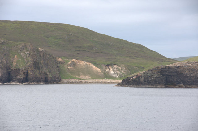
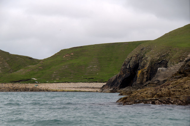
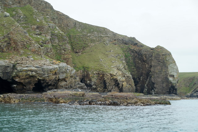
The Dale, located in the Shetland Islands, is a picturesque valley situated on the east side of the island of Mainland. Nestled between the hills of Scalloway and Tingwall, this tranquil valley offers breathtaking views and a serene atmosphere.

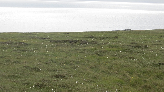
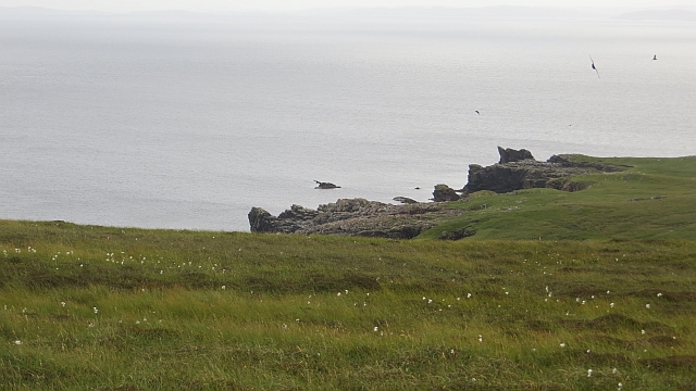
The Dale is known for its lush greenery, with rolling hills covered in heather and wildflowers. The valley is dotted with charming croft houses, which are traditional Shetland cottages, adding to the area's quaint and rural charm. The landscape is dominated by the meandering Dale Burn, a small river that winds its way through the valley, creating a peaceful and idyllic setting.

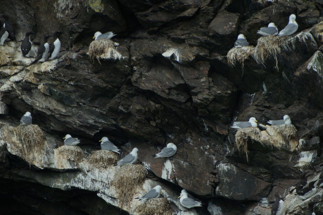
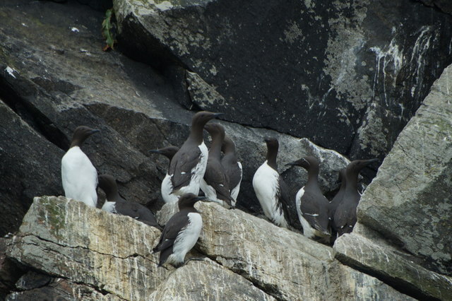
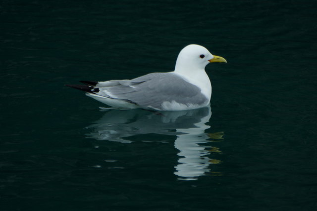
Walking through The Dale, visitors can enjoy the tranquility of the surroundings and take in the stunning vistas. The valley provides numerous opportunities for outdoor activities such as hiking, birdwatching, and photography. The area is home to a variety of wildlife, including otters, seals, and numerous bird species, making it a haven for nature enthusiasts.

The Dale also has historical significance, with remains of an Iron Age broch, a circular stone tower, located nearby. This ancient structure is a testament to the area's rich history and offers a glimpse into Shetland's past.

With its natural beauty and peaceful ambiance, The Dale is a hidden gem in the Shetland Islands, offering visitors a chance to escape the hustle and bustle of everyday life and immerse themselves in the tranquility of nature.

If you have any feedback on the listing, please let us know in the comments section below.

The Dale Images

Images are sourced within 2km of 60.580952/-0.88877313 or Grid Reference HU6089. Thanks to Geograph Open Source API. All images are credited.

Moo Wick, Lambhoga Stony beach at the end of Lambhoga.
Moo Wick, Lambhoga
Stony beach at the end of Lambhoga.
Big Holm and the cliffs below Gillis Field On the east side of the Lambhoga peninsula, from the Wick of Tresta.
Big Holm and the cliffs below Gillis Field
On the east side of the Lambhoga peninsula, from the Wick of Tresta.
Outer Dale, Lambhoga, Fetlar
North of Hoganeap, Lambhoga, Fetlar
Three Geos, Hoganeap, Fetlar Although this area seems to be named Three Stacks on the OS 1:10000 map, I am informed by Andrew Leaper of Fetlar that the area in the photo is named Three Geos and that Three Stacks is further north along the coast.
Three Geos, Hoganeap, Fetlar
Although this area seems to be named Three Stacks on the OS 1:10000 map, I am informed by Andrew Leaper of Fetlar that the area in the photo is named Three Geos and that Three Stacks is further north along the coast.
South Geo of Heoganeap, Fetlar
Seabirds, Hillidin, Lambhoga, Fetlar Common Guillemots (Uria aalge) and Black-legged Kittiwakes (Rissa tridactyla).
Seabirds, Hillidin, Lambhoga, Fetlar
Common Guillemots (Uria aalge) and Black-legged Kittiwakes (Rissa tridactyla).
Black-legged Kittiwakes (Rissa tridactyla), Hillidin, Lambhoga, Fetlar
Common Guillemots (Uria aalge), Hillidin, Lambhoga, Fetlar
Black-legged Kittiwake (Rissa tridactyla), Hillidin, Lambhoga, Fetlar
Moo Wick, Lambhoga, Fetlar
Ruir Taing, Lambhoga, Fetlar
Looking north from path up to Lamb Hoga There is a very good track from the car park beside Fetlar Kirk up onto Lamb Hoga with views to Out Skerries, Bressay and across the whole of Fetlar.  I had assumed that Lamb Hoga would be pronounced as written but oh no, it's pronounced as a single word "Lahmuga" with the stress on the first sylable "Lahm".
Looking north from path up to Lamb Hoga
There is a very good track from the car park beside Fetlar Kirk up onto Lamb Hoga with views to Out Skerries, Bressay and across the whole of Fetlar. I had assumed that Lamb Hoga would be pronounced as written but oh no, it's pronounced as a single word "Lahmuga" with the stress on the first sylable "Lahm".
The Peat Road The bogs of Lamb Hoga provided Fetlar with high quality fuel. Every year, islanders would move to the peninsula to cast and dry peats. The fuel was then taken off via this road or by boat across to Aith for the eastern side of the island.
 The beach at Tresta is in the background along with Vord Hill.
The Peat Road
The bogs of Lamb Hoga provided Fetlar with high quality fuel. Every year, islanders would move to the peninsula to cast and dry peats. The fuel was then taken off via this road or by boat across to Aith for the eastern side of the island. The beach at Tresta is in the background along with Vord Hill.
Peat Road, Lamb Hoga The route which was used to carry winter fuel off the bogs of Lamb Hoga up to the 1950s.
Peat Road, Lamb Hoga
The route which was used to carry winter fuel off the bogs of Lamb Hoga up to the 1950s.
Bog, Lamb Hoga The west side of Gillis Field which was the source of Fetlar's peat. The moorland is now home to many bonxies and they were pretty mean today.
Bog, Lamb Hoga
The west side of Gillis Field which was the source of Fetlar's peat. The moorland is now home to many bonxies and they were pretty mean today.
Bog, Lamb Hoga Above Rams Ness on the southwest corner of Fetlar. This was the source of much of the island's peat and folk moved here to peat houses for two weeks every year to gather the winter fuel. The peat houses were simple bothies.
Bog, Lamb Hoga
Above Rams Ness on the southwest corner of Fetlar. This was the source of much of the island's peat and folk moved here to peat houses for two weeks every year to gather the winter fuel. The peat houses were simple bothies.
Shore of Lamb Hoga Near Rams Ness, Fetlar.
Shore of Lamb Hoga
Near Rams Ness, Fetlar.
Show me another place!

The Dale is located at Grid Ref: HU6089 (Lat: 60.580952, Lng: -0.88877313)

Unitary Authority: Shetland Islands

Police Authority: Highlands and Islands

What 3 Words

///motive.robots.texts. Near Houbie, Shetland Islands

Related Wikis

Fetlar

Fetlar (Scots: Fetlar) is one of the North Isles of Shetland, Scotland, with a usually resident population of 61 at the time of the 2011 census. Its main...

Haltadans

Haltadans, also known as Fairy Ring or Haltadans stone circle, is a stone circle on the island of Fetlar in Shetland, Scotland. This site is a ring of...

Brough Lodge

Brough Lodge is a 19th-century Gothic mansion on Fetlar, one of the Shetland Islands, in northern Scotland. Built by the Nicolson family, who were responsible...

Funzie Girt

Funzie Girt (; Scots: Funyie Girt "Finns' dyke") is an ancient dividing wall that was erected from north to south across the island of Fetlar in Shetland...

Urie Lingey

For other islands with similar names, see Linga (disambiguation) Urie Lingey is one of the Shetland Islands. It is between Fetlar and Unst, and Yell is...

Hamars Ness

Hamars Ness is a headland on the island of Fetlar in Shetland, Scotland. The name is from the Old Norse Hamarsnes meaning "craggy headland". A ro-ro ferry...

Hascosay

Hascosay (Scots: Hascosay; Old Norse "Hafskotsey") is a small island lying between Yell and Fetlar in the Shetland Islands, Scotland. == Geography and... ==

Sound Gruney

For other islands with similar names, see Gruney (disambiguation) Sound Gruney is one of the Shetland islands. It lies about 1.5 kilometres (0.93 mi)...

Have you been to The Dale?

Leave your review of The Dale below (or comments, questions and feedback).