Cottage Field Slack

Valley in Yorkshire Ryedale

England

Cottage Field Slack

View towards 'Tom Smiths' Trig Point
View towards 'Tom Smiths' Trig Point Credit: thejackrustles

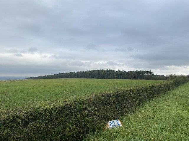
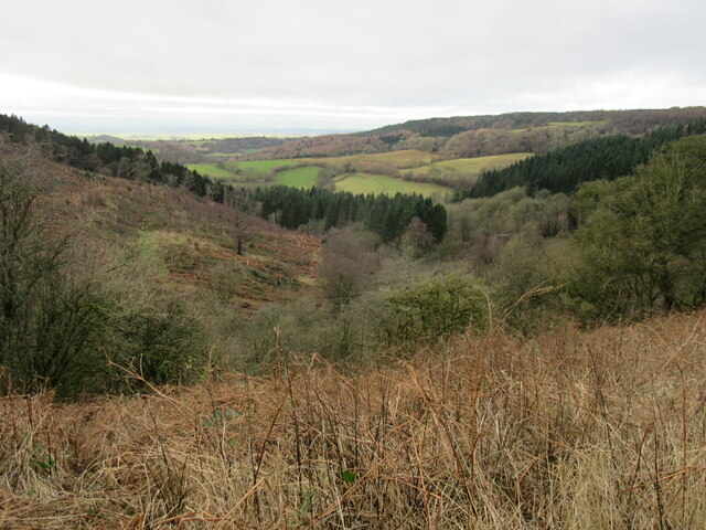
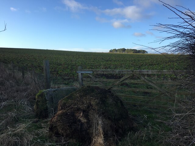
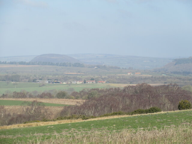
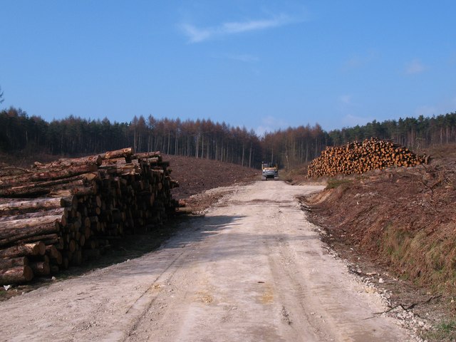
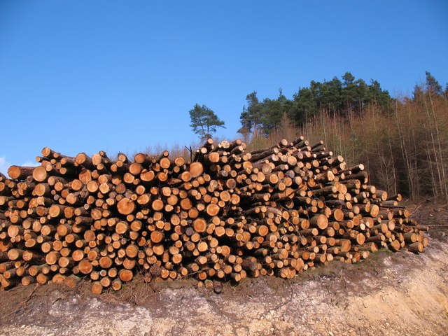
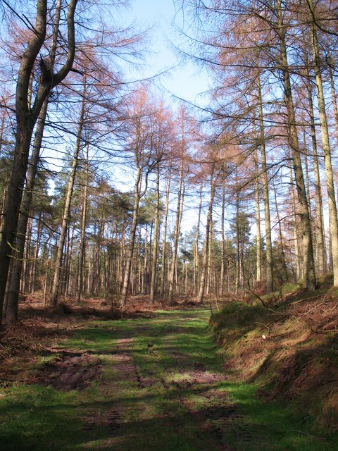
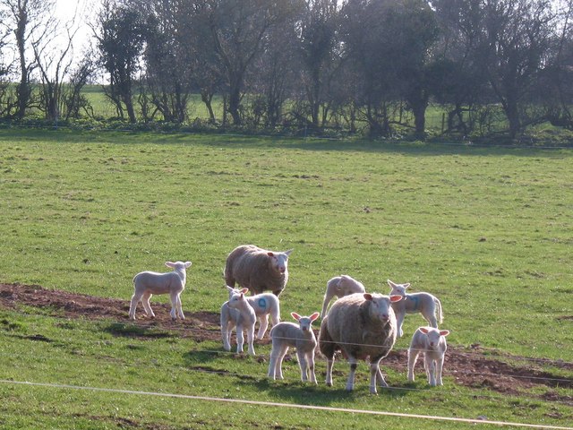
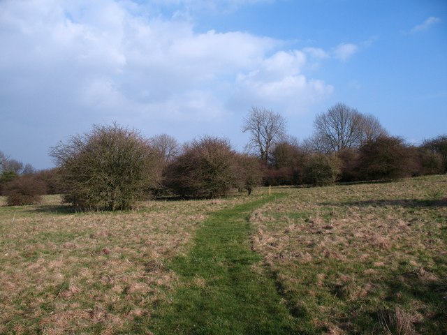
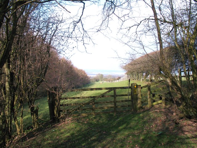
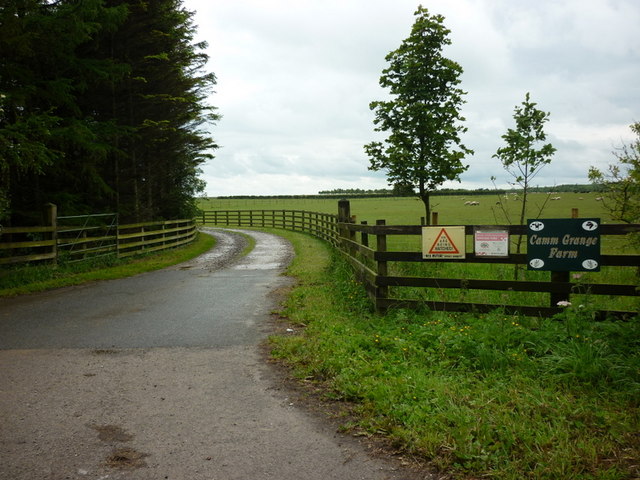
Cottage Field Slack is a picturesque valley located in Yorkshire, England. Situated amidst the rolling hills and lush green countryside, this tranquil valley offers breathtaking views and a peaceful escape from the hustle and bustle of city life.

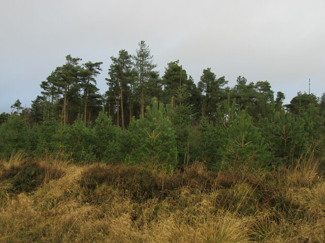
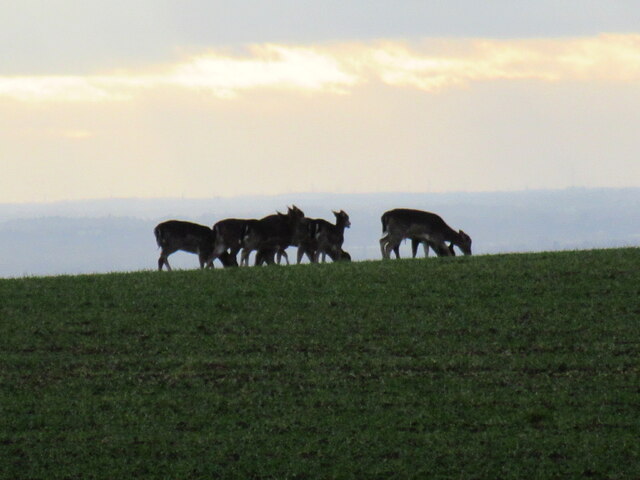
The valley is characterized by its idyllic landscapes, featuring meandering streams, verdant meadows, and charming cottages dotted along the hillside. The area is known for its rich biodiversity, with a variety of flora and fauna thriving in the valley, including wildflowers, birds, and butterflies.

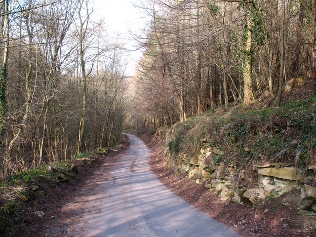
Cottage Field Slack is a popular destination for outdoor enthusiasts and nature lovers, offering numerous opportunities for hiking, walking, and exploring the countryside. The valley is crisscrossed by a network of footpaths and trails, allowing visitors to discover the beauty of the surrounding area at their own pace.

In addition to its natural beauty, Cottage Field Slack is also steeped in history. The valley is dotted with historic landmarks, including ancient stone walls, remnants of old mining operations, and traditional Yorkshire cottages. These remnants of the past provide a glimpse into the region's rich heritage and add to the charm of the area.

Whether you are seeking a peaceful retreat or an adventure in the great outdoors, Cottage Field Slack in Yorkshire offers a serene setting and a chance to connect with nature. With its scenic landscapes and historical significance, this valley is a must-visit destination for anyone looking to experience the beauty and tranquility of the Yorkshire countryside.

If you have any feedback on the listing, please let us know in the comments section below.

Cottage Field Slack Images

Images are sourced within 2km of 54.234071/-1.1587882 or Grid Reference SE5482. Thanks to Geograph Open Source API. All images are credited.

View towards 'Tom Smiths' Trig Point
Byland Moor Plantation Conifers in Byland Moor Plantation.
Byland Moor Plantation
Conifers in Byland Moor Plantation.
Deer on Byland Moor Seven Deer on Byland Moor.
Deer on Byland Moor
Seven Deer on Byland Moor.
Cockerdale Looking down Cockerdale
Cockerdale
Looking down Cockerdale
Gate at the field edge near Cam Farm
Scawton Moor Looking NW from the path that goes from the A170 to Rievaulx.
Scawton Moor
Looking NW from the path that goes from the A170 to Rievaulx.
Old milepost The Thirsk 7 milepost on the A170 is easy to spot on a wide verge opposite Scawton Moor Plantation.   It is in line with a new fence across a field to a farm.   The refurbishment done to the mileposts along this route in 2005 by Cleveland Corrosion at Staithes has stood up well to weathering and passing traffic.  F Mattison & Co. Bedale, the foundry name inside the back lhs is where these posts were cast at the end of the 19C.   This post is Grade II listed 1149192.
Old milepost
The Thirsk 7 milepost on the A170 is easy to spot on a wide verge opposite Scawton Moor Plantation. It is in line with a new fence across a field to a farm. The refurbishment done to the mileposts along this route in 2005 by Cleveland Corrosion at Staithes has stood up well to weathering and passing traffic. F Mattison & Co. Bedale, the foundry name inside the back lhs is where these posts were cast at the end of the 19C. This post is Grade II listed 1149192.
Old milepost This NRYCC milepost on the A170 is opposite a bungalow and the farm buildings of High Lodge.  On its side of the road there is a footpath into Wass Moor Woods.   The posts on this road were dug up and taken to the Cleveland Corrosion works at Staithes where they were refurbished in a dry, clean atmosphere.   18 years later they have stood up well to the weather on this route.  The foundry name where they were cast in the late 19C, F Mattison & Co. Bedale, is inside the lhs.   Grade II listed 11911336.
Old milepost
This NRYCC milepost on the A170 is opposite a bungalow and the farm buildings of High Lodge. On its side of the road there is a footpath into Wass Moor Woods. The posts on this road were dug up and taken to the Cleveland Corrosion works at Staithes where they were refurbished in a dry, clean atmosphere. 18 years later they have stood up well to the weather on this route. The foundry name where they were cast in the late 19C, F Mattison & Co. Bedale, is inside the lhs. Grade II listed 11911336.
Recently felled area, Wass Moor A large area of larch and pine has recently been clear felled in this area.
Recently felled area, Wass Moor
A large area of larch and pine has recently been clear felled in this area.
Log Pile, Wass Moor Enough logs here to keep the average fire going through the winter months. Clear felled area on Wass Moor.
Log Pile, Wass Moor
Enough logs here to keep the average fire going through the winter months. Clear felled area on Wass Moor.
Forest track, Wass Moor Track through mature larch and pine plantation. Such an area is far more pleasant than gloomy blocks of norway spruce, and here one can hear chaffinches, robins and coal tits calling.
Forest track, Wass Moor
Track through mature larch and pine plantation. Such an area is far more pleasant than gloomy blocks of norway spruce, and here one can hear chaffinches, robins and coal tits calling.
Lambing time at Scawton Sheep with lambs at Scawton.
Lambing time at Scawton
Sheep with lambs at Scawton.
Access land at Scawton An area of access land to the east of the village, mostly rough grazing with hawthorn trees.
Access land at Scawton
An area of access land to the east of the village, mostly rough grazing with hawthorn trees.
Footpath into the field The point at which the public footpath emerges from scrubby woodland into open pastures close to Bungdale Head Farm.
Footpath into the field
The point at which the public footpath emerges from scrubby woodland into open pastures close to Bungdale Head Farm.
Bungdale Head farm road At this point the road is also the line of a public footpath. On the right are outcrops of limestone, whilst to the left the ground drops rapidly into the narrow Waterfall Gill which is choked with trees and undergrowth. The name seems entirely inappropriate as the gill is completely dry.
Bungdale Head farm road
At this point the road is also the line of a public footpath. On the right are outcrops of limestone, whilst to the left the ground drops rapidly into the narrow Waterfall Gill which is choked with trees and undergrowth. The name seems entirely inappropriate as the gill is completely dry.
Village Hall, Scawton A small hall for a tiny village. This little 'tin' structure dates from the 1920's when it was brought here in sections from Helmsley station by horse and cart.
Village Hall, Scawton
A small hall for a tiny village. This little 'tin' structure dates from the 1920's when it was brought here in sections from Helmsley station by horse and cart.
Upside down Union Flag #20 On the A170 at High Lodge
Upside down Union Flag #20
On the A170 at High Lodge
The entrance to Camm Grange Farm, on the A170
Show me another place!

Cottage Field Slack is located at Grid Ref: SE5482 (Lat: 54.234071, Lng: -1.1587882)

Division: North Riding

Administrative County: North Yorkshire

District: Ryedale

Police Authority: North Yorkshire

What 3 Words

///spouting.surprises.winter. Near Helmsley, North Yorkshire

Related Wikis

Battle of Old Byland

The Battle of Old Byland (also known as the Battle of Byland Abbey, the Battle of Byland Moor and the Battle of Scotch Corner) was a significant encounter...

Scawton

Scawton is a village and former civil parish in North Yorkshire, England. The hamlet lies just east of Sutton Bank, north of the A170 road, and 5 miles...

Old Byland and Scawton

Old Byland and Scawton is a civil parish in the Ryedale district, in the county of North Yorkshire, England. The parish includes the villages of Old Byland...

Cold Kirby

Cold Kirby is a village and civil parish in the Ryedale district of North Yorkshire, England. The population at the 2011 census (including Angram Grange...

Hambleton, Ryedale

Hambleton is a hamlet on the A170 road between Thirsk and Pickering in North Yorkshire, England. It lies on the Hambleton Hills 1 mile east of Sutton Bank...

Stocking Abbey

Stocking Abbey was an abbey in the village of Oldstead, North Yorkshire, England.The abbey at Stocking was built in 1147, originally for Savigniac monks...

Oldstead

Oldstead is a village and a civil parish in Ryedale district, North Yorkshire, England, within the North York Moors National Park, off the A170 road between...

Stanbrook Abbey

Stanbrook Abbey is a Catholic contemplative Benedictine Monastery with the status of an abbey, located at Wass, North Yorkshire, England. The community...

Nearby Amenities

Located within 500m of 54.234071,-1.1587882
tumuli
Historic: archaeological_site
Source: NPE
Lat/Long: 54.2332337/-1.1558672
The data included in this document is from www.openstreetmap.org. The data is made available under ODbL.

Have you been to Cottage Field Slack?

Leave your review of Cottage Field Slack below (or comments, questions and feedback).