Hartshill Gully

Valley in Berkshire

England

Hartshill Gully

Before the hunt, Bucklebury, Berkshire
Before the hunt, Bucklebury, Berkshire Credit: Oswald Bertram

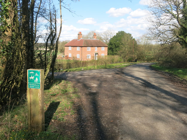
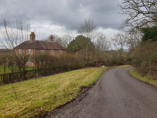
Hartshill Gully, located in Berkshire, England, is a picturesque valley that offers a serene and tranquil environment for visitors. The gully is nestled amidst the stunning countryside, making it a popular destination for nature enthusiasts and hikers alike.

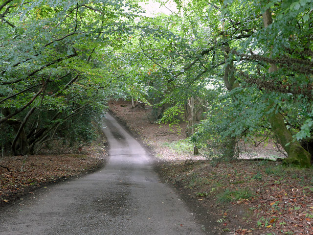
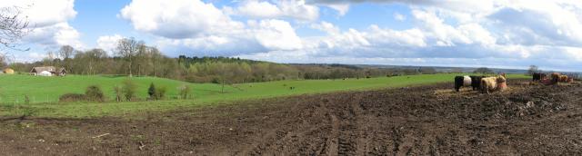
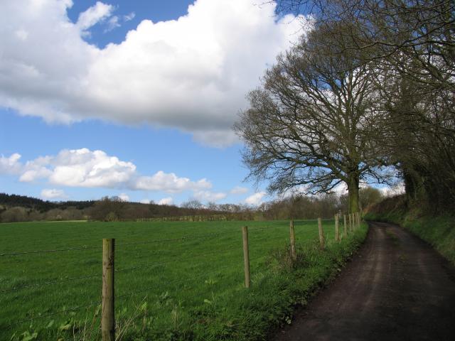
Stretching over a considerable distance, Hartshill Gully is characterized by its gently sloping sides and lush greenery. The valley is home to a variety of flora and fauna, including native trees such as oak, beech, and birch, which further add to its natural charm.

One of the notable features of Hartshill Gully is the small stream that meanders through it, providing a soothing soundtrack as it cascades over rocks and through the valley. The stream also attracts a range of wildlife, including ducks and other water birds, making it a delightful spot for birdwatchers.

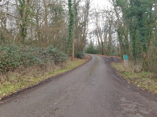
For those seeking outdoor adventures, Hartshill Gully offers several walking trails that wind through the valley, providing stunning views of the surrounding countryside. These trails cater to different levels of fitness and provide opportunities for both leisurely strolls and more challenging hikes.

In addition to its natural beauty, Hartshill Gully is also steeped in history. The valley has remnants of ancient settlements, including archaeological sites and old stone walls, which serve as a reminder of the area's rich heritage.

Overall, Hartshill Gully in Berkshire is an idyllic destination that combines natural beauty with historical significance. Whether visitors are looking for a peaceful retreat or an opportunity to explore the outdoors, the gully offers a memorable experience for all who venture into its enchanting embrace.

If you have any feedback on the listing, please let us know in the comments section below.

Hartshill Gully Images

Images are sourced within 2km of 51.411284/-1.2413206 or Grid Reference SU5268. Thanks to Geograph Open Source API. All images are credited.

Before the hunt, Bucklebury, Berkshire
Excited hounds, Bucklebury, Berkshire
All Quiet down Holly Lane Well, there's nothing like a good rant, and these absurd Quiet Lane bollards are always a good excuse.
There's a much higher than normal number of them infesting the roads around here. 
It's not just that they're unsightly, it's that you know they've shut two and a half schools and a hospital to pay for them....
End of Rant.
Holly Farm House in the background. You could be really noisy in a house like that, if only it wasn't a quiet lane....
All Quiet down Holly Lane
Well, there's nothing like a good rant, and these absurd Quiet Lane bollards are always a good excuse. There's a much higher than normal number of them infesting the roads around here. It's not just that they're unsightly, it's that you know they've shut two and a half schools and a hospital to pay for them.... End of Rant. Holly Farm House in the background. You could be really noisy in a house like that, if only it wasn't a quiet lane....
Holly Lane This is signed as a 'Quiet Lane'.
Holly Lane
This is signed as a 'Quiet Lane'.
Holly Lane A view up Holly Lane from near to Holly Farm House.
Holly Lane
A view up Holly Lane from near to Holly Farm House.
Holly Farm House Holly Farm House on Holly Lane.
Holly Farm House
Holly Farm House on Holly Lane.
Thatcham Town Centre This is the intersection in the middle of the town centre and is in the south eastern section of the grid square.
Thatcham Town Centre
This is the intersection in the middle of the town centre and is in the south eastern section of the grid square.
Cold Ash Post Office The Post office is situated in the south western section of the square.
Cold Ash Post Office
The Post office is situated in the south western section of the square.
Farmland in the Bucklebury/Midgham Area The view of the farmland in this photograph was taken from Kiln's Farm on the east side of Cox's Lane looking towards Midgham Wood, which is just visible. It is situated in the south eastern corner of the square.
Farmland in the Bucklebury/Midgham Area
The view of the farmland in this photograph was taken from Kiln's Farm on the east side of Cox's Lane looking towards Midgham Wood, which is just visible. It is situated in the south eastern corner of the square.
Thatcham Station and the Kennet and Avon Canal The station and bridge over the canal are situated in the south eastern quadrant of the grid square.
Thatcham Station and the Kennet and Avon Canal
The station and bridge over the canal are situated in the south eastern quadrant of the grid square.
Ouzel Gulley and Manor Farm Taken from the west side of Cox's Lane overlooking Ouzel Gulley and Manor Farm, this view is situated in the centre and west side of the square.
Ouzel Gulley and Manor Farm
Taken from the west side of Cox's Lane overlooking Ouzel Gulley and Manor Farm, this view is situated in the centre and west side of the square.
Cox's Lane This is the spot from where the photo of Ouzel Gulley was taken (more or less at the number 101 on the grid) and the only passing place in this square!
Cox's Lane
This is the spot from where the photo of Ouzel Gulley was taken (more or less at the number 101 on the grid) and the only passing place in this square!
Dunstan Park This photo is taken from Floral Way looking NNE. The area is due to be built on in the next few years so a photo from this location will look completely different. Exact photo co-ords were N51°24.592 W001°14.853.
Dunstan Park
This photo is taken from Floral Way looking NNE. The area is due to be built on in the next few years so a photo from this location will look completely different. Exact photo co-ords were N51°24.592 W001°14.853.
Thatcham The clock at Thatcham Memorial Hall, with the Catholic Church to the right.
Thatcham
The clock at Thatcham Memorial Hall, with the Catholic Church to the right.
Thatcham This building was erected in 1304 as the Chapel of St Thomas and was used for worship until about 1550. After a long period of neglect, it was occupied as the Winchcombe Charity School 1707-30 and as a Blue Coat School 1794-1914. Since then it has served as a cooking depot, a classroom and as an antiques shop. It is still known as the Blue Coat School and is owned by Newbury District Council.
Thatcham
This building was erected in 1304 as the Chapel of St Thomas and was used for worship until about 1550. After a long period of neglect, it was occupied as the Winchcombe Charity School 1707-30 and as a Blue Coat School 1794-1914. Since then it has served as a cooking depot, a classroom and as an antiques shop. It is still known as the Blue Coat School and is owned by Newbury District Council.
Thatcham Looking west across the square in the direction of Siege Cross Farm. Most of the square is farmland. The distant buildings are part of the industrial estate beside the A4 road.
Thatcham
Looking west across the square in the direction of Siege Cross Farm. Most of the square is farmland. The distant buildings are part of the industrial estate beside the A4 road.
Thatcham Thatcham seen from the top of the hill by the trig point.
Thatcham
Thatcham seen from the top of the hill by the trig point.
Ploughed Field on old fort ground This square is largely farmland and woodland. This field, next to the high bank in the centre of the square is where an old fort is marked on the map. The picture was taken looking west towards the edge of the square from the intersection of Holly Lane and the Bucklebury road.
Ploughed Field on old fort ground
This square is largely farmland and woodland. This field, next to the high bank in the centre of the square is where an old fort is marked on the map. The picture was taken looking west towards the edge of the square from the intersection of Holly Lane and the Bucklebury road.
Show me another place!

Hartshill Gully is located at Grid Ref: SU5268 (Lat: 51.411284, Lng: -1.2413206)

Unitary Authority: West Berkshire

Police Authority: Thames Valley

What 3 Words

///commuting.crossings.tinted. Near Thatcham, Berkshire

Related Wikis

Old Bluecoat School, Thatcham

Old Bluecoat School, or the St Thomas’ Chapel is a Grade I listed building in the town of Thatcham in the English county of Berkshire. It is located on...

Kennet School

Kennet School is an academy secondary school in Thatcham, Berkshire, England. In 2011, Kennet was the highest achieving state school in West Berkshire...

Colthrop

Colthrop is a suburb of the town of Thatcham in the English county of Berkshire, England. == Geography == Colthrop is part of the civil parish of Thatcham...

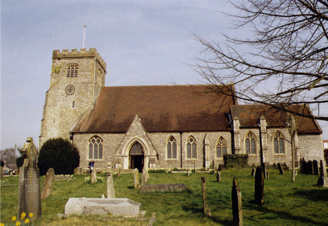
St Mary's Church, Thatcham

The St Mary's Church is a Church of England parish church at Thatcham in the English county of Berkshire. It is dedicated to the Virgin Mary and is a Grade...

Nearby Amenities

Located within 500m of 51.411284,-1.2413206
Post Box
Note: there is no visible ref
Lat/Long: 51.4084976/-1.2467288
The Co-operative Food
Addr City: Thatcham
Addr Postcode: RG18 4QH
Addr Street: Bradley Moore Square
Brand: The Co-operative Food
Brand Wikidata: Q3277439
Brand Wikipedia: en:Co-op Food
Fhrs Id: 202793
Operator: The Co-operative Group
Operator Wikidata: Q117202
Shop: supermarket
Website: https://www.coop.co.uk/store-finder/RG18-4NU/harts-hill-road
Lat/Long: 51.4085215/-1.246947
Defibrillator
Access: yes
Emergency: defibrillator
Indoor: no
Opening Hours: 24/7
Lat/Long: 51.4089478/-1.2472435
Iron Age settlement
Historic: archaeological_site
Lat/Long: 51.4144695/-1.238205
Traffic Calming: chicane
Lat/Long: 51.4082961/-1.2464587
West Berkshire Therapy Centre
Healthcare: physiotherapist
Website: https://www.westberkshiretherapycentre.org.uk/
Lat/Long: 51.4090567/-1.2472802
The data included in this document is from www.openstreetmap.org. The data is made available under ODbL.

Have you been to Hartshill Gully?

Leave your review of Hartshill Gully below (or comments, questions and feedback).