Migga Dale

Valley in Shetland

Scotland

Migga Dale

Boggy moorland by the Cada Burn Looking down to Hamma Voe.
Boggy moorland by the Cada Burn Credit: Oliver Dixon

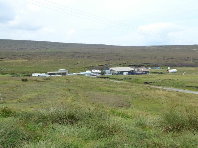
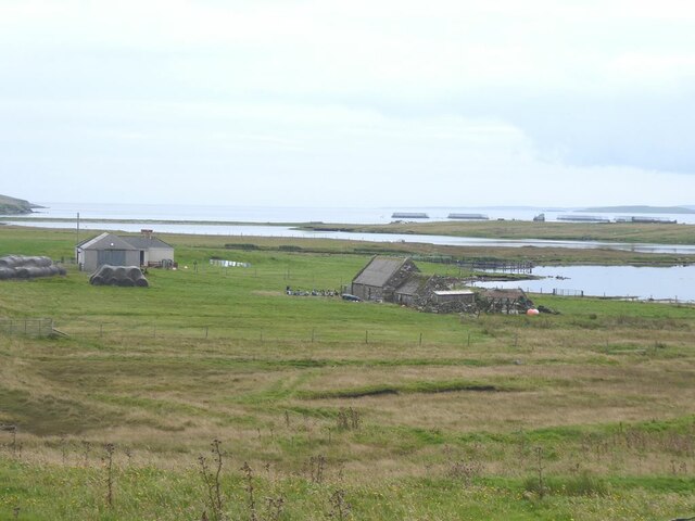
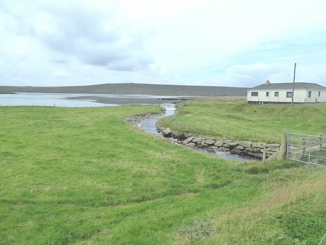
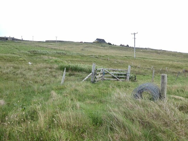
Migga Dale is a picturesque valley located in the Shetland Islands, an archipelago in Scotland, United Kingdom. Nestled amidst rolling hills and lush greenery, this valley is a haven for nature enthusiasts and those seeking tranquility away from the bustling city life.

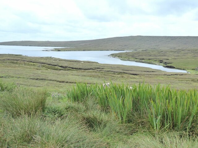
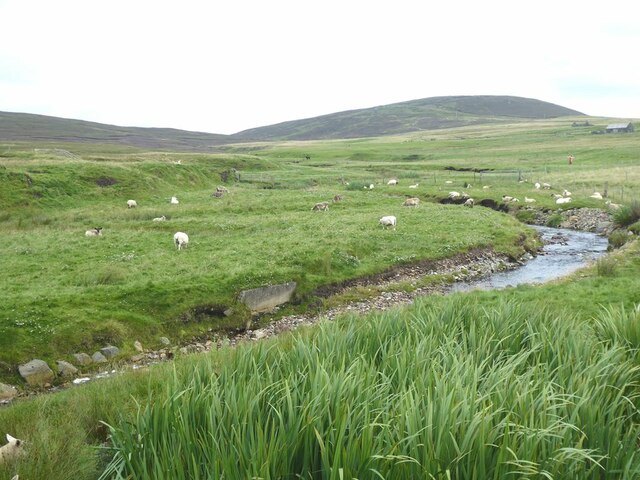
The valley is situated on the mainland of Shetland, just a short distance from the village of Scalloway. It offers breathtaking views of the surrounding landscape, with its deep, narrow gorge carved by a meandering stream. The valley's unique geological formations, with steep cliffs and rock formations, make it a sight to behold.

Migga Dale is also renowned for its diverse flora and fauna. The valley is home to a variety of plant species, including heather, mosses, and wildflowers that paint the landscape in vibrant colors. It is a sanctuary for numerous bird species, making it a haven for birdwatchers. Visitors can spot a range of avian species, such as puffins, oystercatchers, and skuas.

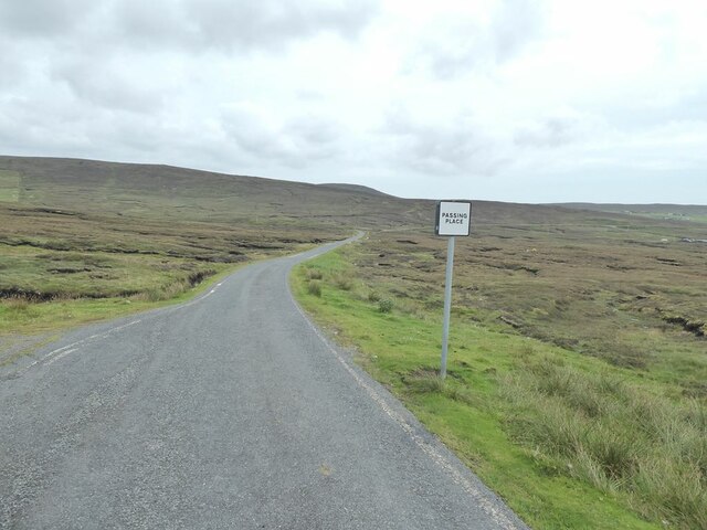
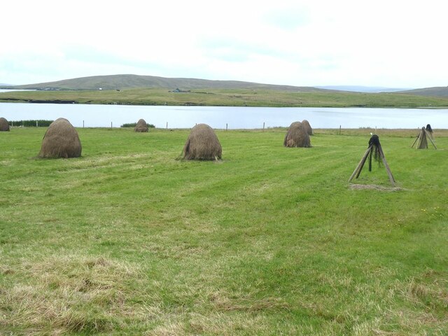
The valley's serene atmosphere and unspoiled natural beauty make it an ideal destination for hiking and exploring. There are several walking trails that lead through the valley, allowing visitors to immerse themselves in the stunning surroundings. Additionally, Migga Dale is a popular spot for picnicking and photography, as the valley's enchanting vistas provide ample opportunities for capturing the perfect shot.

In conclusion, Migga Dale in Shetland is a captivating valley that offers a peaceful retreat in the midst of awe-inspiring natural scenery. Whether one is a nature lover, hiker, photographer, or simply seeking solace, this valley is sure to leave a lasting impression on all who visit.

If you have any feedback on the listing, please let us know in the comments section below.

Migga Dale Images

Images are sourced within 2km of 60.514972/-1.1116653 or Grid Reference HU4881. Thanks to Geograph Open Source API. All images are credited.

Boggy moorland by the Cada Burn Looking down to Hamma Voe.
Boggy moorland by the Cada Burn
Looking down to Hamma Voe.
Boggy moorland above the road to Burravoe
Fish farm on the Burn of Arisdale
Mouth of the Burn of Arisdale At high tide.
Mouth of the Burn of Arisdale
At high tide.
The road to Burravoe B9081 above Arisdale.
The road to Burravoe
B9081 above Arisdale.
Loch of Galtagarth Arm of the sea cut off at low tide by tidal flats at this end, and by a causeway at the far end. Fish farms out in the bay.
Loch of Galtagarth
Arm of the sea cut off at low tide by tidal flats at this end, and by a causeway at the far end. Fish farms out in the bay.
Mouth of the Burn of Hamnavoe
Welcome to Burravoe! Scarecrow beside the road.
Welcome to Burravoe!
Scarecrow beside the road.
The Burn of Hamnavoe
Stooks of hay at Houlland Loch of Galtagarth and Ness of Galtagarth <a href="https://www.geograph.org.uk/gridref/HU4979">HU4979</a> beyond, with Ness of Copister <a href="https://www.geograph.org.uk/gridref/HU4978">HU4978</a> on the skyline.
Stooks of hay at Houlland
Loch of Galtagarth and Ness of Galtagarth HU4979 beyond, with Ness of Copister HU4978 on the skyline.
Hillside at Houlland
Beaw Field in snow Snow this early in the autumn in Shetland is very rare, but heavy rain at sea-level fell as snow over 50m asl.
Beaw Field in snow
Snow this early in the autumn in Shetland is very rare, but heavy rain at sea-level fell as snow over 50m asl.
Hamars of Houlland and 'Loch' of Hamnavoe The hill is the Hamars of Houlland and the mire in front of it is named the Loch of Hamnavoe on the 1:25000 map; whether this is an allusion to its dampness or evidence of a drained loch I'm not sure. Lunna peninsula is in the distance.
Hamars of Houlland and 'Loch' of Hamnavoe
The hill is the Hamars of Houlland and the mire in front of it is named the Loch of Hamnavoe on the 1:25000 map; whether this is an allusion to its dampness or evidence of a drained loch I'm not sure. Lunna peninsula is in the distance.
Hamnavoe: the kirk A small church in Hamnavoe, with a disused postbox (see <a href="https://www.geograph.org.uk/photo/2651301">HU4980 : Hamnavoe: disused postbox</a>) in the wall.
Hamnavoe: the kirk
A small church in Hamnavoe, with a disused postbox (see HU4980 : Hamnavoe: disused postbox) in the wall.
Hamnavoe: disused postbox This Edward VII-reign postbox is set into the churchyard wall of <a href="https://www.geograph.org.uk/photo/2651298">HU4980 : Hamnavoe: the kirk</a>. A modern replacement box is just behind us.
Hamnavoe: disused postbox
This Edward VII-reign postbox is set into the churchyard wall of HU4980 : Hamnavoe: the kirk. A modern replacement box is just behind us.
Hamnavoe: postbox № ZE2 4 This modern postbox is a replacement for its predecessor which still stands in the churchyard wall: see <a href="https://www.geograph.org.uk/photo/2651301">HU4980 : Hamnavoe: disused postbox</a>. It is emptied at 9:30 each morning except Sunday.
Hamnavoe: postbox № ZE2 4
This modern postbox is a replacement for its predecessor which still stands in the churchyard wall: see HU4980 : Hamnavoe: disused postbox. It is emptied at 9:30 each morning except Sunday.
Hill of Ulsta Looking towards the hill across the wetlands
Hill of Ulsta
Looking towards the hill across the wetlands
Small Bridge A small bridge in Migga Dale
Small Bridge
A small bridge in Migga Dale
Show me another place!

Migga Dale is located at Grid Ref: HU4881 (Lat: 60.514972, Lng: -1.1116653)

Unitary Authority: Shetland Islands

Police Authority: Highlands and Islands

What 3 Words

///bottom.amaze.unlocking. Near Ulsta, Shetland Islands

Nearby Locations

Migga Dale

Related Wikis

Copister

Copister is a village in Yell. It is a former centre for haaf fishing, and has a shingle beach. == References == Blackadder, Jill Slee (2003). Shetland...

Ulsta

Ulsta is a village in the south-west of the island of Yell, Shetland, Scotland. North Ness Hall is the local community facility. The car ferry to Toft...

Burravoe

Burravoe is a community on the north shore of Burra Voe, in the south-east part of the island of Yell in the Shetland Islands, Scotland. The name Burravoe...

Old Haa Museum

The Old Haa of Brough in located in Burravoe, Yell, Shetland, Scotland. Built for Robert Tyrie, a merchant, in 1672, houses the local museum for Burravoe...

Nearby Amenities

Located within 500m of 60.514972,-1.1116653
Power: pole
Lat/Long: 60.517597/-1.1188138
Power: pole
Lat/Long: 60.5169885/-1.1185616
Power: pole
Lat/Long: 60.5163562/-1.1183926
Power: pole
Lat/Long: 60.5157515/-1.1182076
Power: pole
Lat/Long: 60.5148129/-1.1179018
Power: pole
Lat/Long: 60.513997/-1.1176765
Power: pole
Lat/Long: 60.5131151/-1.1174029
Power: pole
Lat/Long: 60.5126834/-1.1172983
Power: pole
Lat/Long: 60.5120695/-1.1170971
Power: pole
Lat/Long: 60.511503/-1.1169067
Passing Place
Lat/Long: 60.5114269/-1.1169652
The data included in this document is from www.openstreetmap.org. The data is made available under ODbL.

Have you been to Migga Dale?

Leave your review of Migga Dale below (or comments, questions and feedback).