Thorpe Bulmer Dene

Valley in Durham

England

Thorpe Bulmer Dene

The Ship Inn, High Heselden Village pub along Mickle Hill Road.
The Ship Inn, High Heselden Credit: Des Blenkinsopp

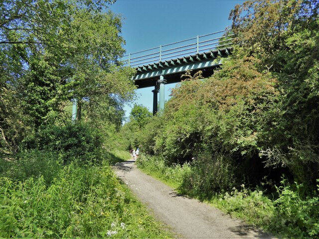
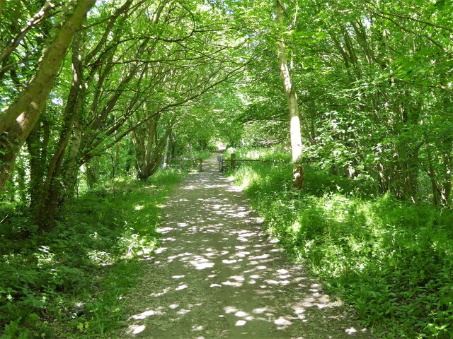
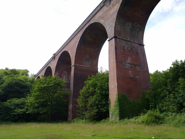
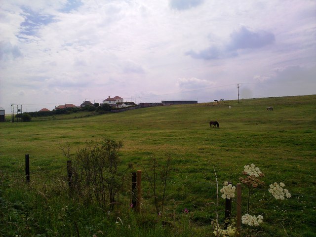
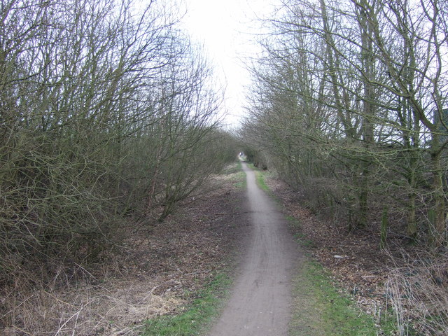
Thorpe Bulmer Dene is a picturesque valley located in Durham, England. Situated in the North Pennines Area of Outstanding Natural Beauty, it offers stunning views and a serene environment for visitors. The dene is named after the nearby village of Thorpe Bulmer and is characterized by its lush greenery, meandering stream, and diverse wildlife.

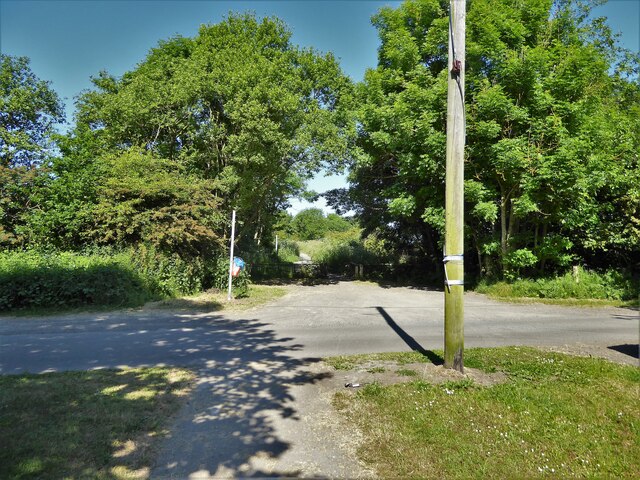
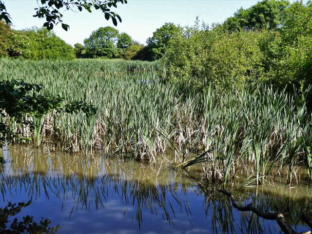
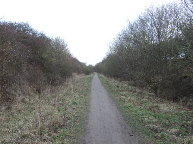
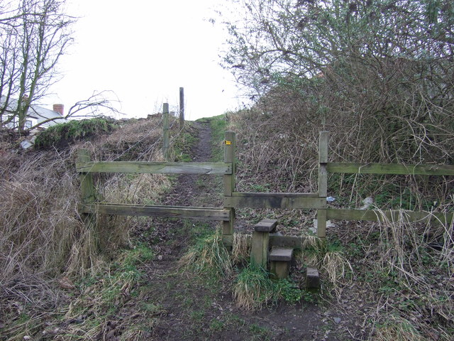
The valley is home to an array of flora and fauna, with wildflowers, ancient woodlands, and moss-covered rocks dotting the landscape. The tranquil stream that runs through the dene adds to its charm, providing a peaceful ambiance for those seeking solitude in nature. Visitors can enjoy leisurely walks along the numerous footpaths that wind through the valley, taking in the beauty of the surroundings and listening to the soothing sounds of the running water.

Thorpe Bulmer Dene is also a haven for wildlife enthusiasts. The valley is home to a variety of bird species, including the elusive kingfisher and the colorful dipper. Otters can also occasionally be spotted in the stream, adding to the dene's natural diversity.

The dene offers a range of recreational activities, such as picnicking, photography, and nature walks. It is a popular spot for both locals and tourists looking to escape the hustle and bustle of city life and immerse themselves in the tranquility of nature.

Overall, Thorpe Bulmer Dene is a hidden gem in Durham, offering a peaceful retreat amidst stunning natural surroundings. Whether it's for a leisurely stroll, birdwatching, or simply enjoying the beauty of the landscape, this valley is a must-visit destination for nature lovers.

If you have any feedback on the listing, please let us know in the comments section below.

Thorpe Bulmer Dene Images

Images are sourced within 2km of 54.720438/-1.285588 or Grid Reference NZ4636. Thanks to Geograph Open Source API. All images are credited.

The Ship Inn, High Heselden Village pub along Mickle Hill Road.
The Ship Inn, High Heselden
Village pub along Mickle Hill Road.
Mickle Hill Road, High Heselden With some old buildings belonging to High Heselden Farm.
Mickle Hill Road, High Heselden
With some old buildings belonging to High Heselden Farm.
Cycle path following route of former railway The Hart to Haswell route crossing the road to Monk Heselden. The road previously crossed the railway on a bridge, so there have been earthworks to make now the crossing of the routes on the level.
Cycle path following route of former railway
The Hart to Haswell route crossing the road to Monk Heselden. The road previously crossed the railway on a bridge, so there have been earthworks to make now the crossing of the routes on the level.
Former reservoir By the side of the Hart to Haswell Walkway
Former reservoir
By the side of the Hart to Haswell Walkway
Farm access bridge A high level bridge across the Hart to Haswell Walkway (a former railway). The bridge allows access to Middlethorpe Farm and has been named tractor bridge.
Farm access bridge
A high level bridge across the Hart to Haswell Walkway (a former railway). The bridge allows access to Middlethorpe Farm and has been named tractor bridge.
Cycle path following route of former railway Approaching the municipal boundary between Hartlepool & Easington districts at the embankment across Crimdon Beck on the Hart to Haswell route
Cycle path following route of former railway
Approaching the municipal boundary between Hartlepool & Easington districts at the embankment across Crimdon Beck on the Hart to Haswell route
Collapse of the poultry industry? Former poultry sheds viewed from the Hart to Haswell Walkway
Collapse of the poultry industry?
Former poultry sheds viewed from the Hart to Haswell Walkway
Railway Bridge Across the access road from Crimdon Dene beach car park (Crimdon Park)
Railway Bridge
Across the access road from Crimdon Dene beach car park (Crimdon Park)
Railway viaduct at Crimdon Dene
View of houses at Crimdon View of houses from the roadside to the North.
View of houses at Crimdon
View of houses from the roadside to the North.
Haswell to Hart Walkway
A1086 towards Easington
Park home, Evergreen Park
Coast Road towards Easington
Viaduct over road, Crimdon Park
Haswell to Hart railway path heading east
Footpath to Nesbitt Dene
Haswell to Hart railway path
Show me another place!

Thorpe Bulmer Dene is located at Grid Ref: NZ4636 (Lat: 54.720438, Lng: -1.285588)

Unitary Authority: County Durham

Police Authority: Durham

What 3 Words

///delays.stars.credible. Near Elwick, Co. Durham

Related Wikis

Monk Hesleden

Monk Hesleden is a village and civil parish in County Durham, England. The population of the parish at the 2011 Census was 5,722. The parish is situated...

Hart Bog

Hart Bog (grid reference NZ452354) is a 1.79 hectare biological Site of Special Scientific Interest in County Durham, England notified in 1968. SSSIs are...

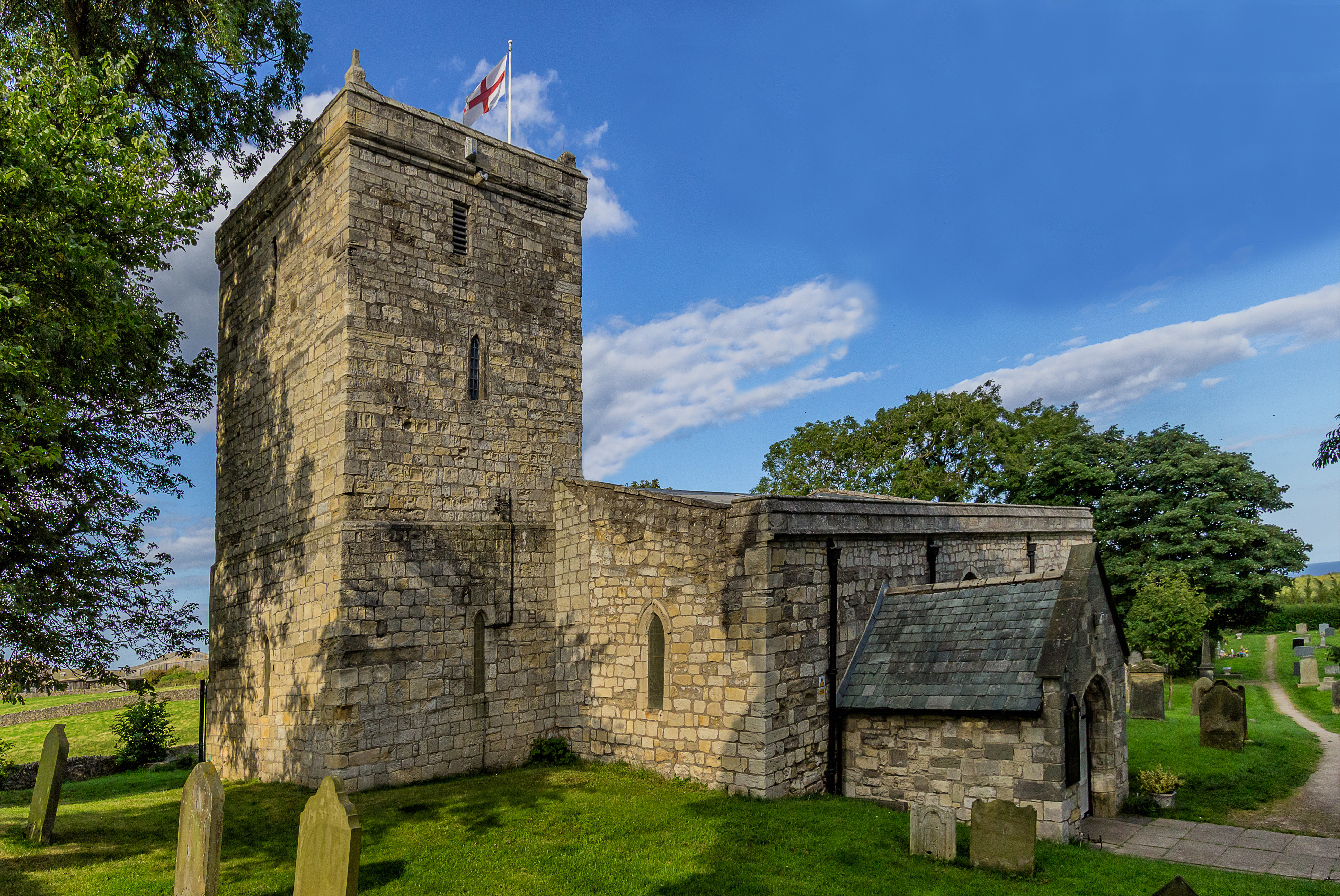
St Mary Magdalene Church, Hart

St Mary Magdalene Church is a Church of England parish church in the village of Hart, County Durham, England. It was founded in 675 AD and is the oldest...

Hart, County Durham

Hart is a village and civil parish in County Durham, England, northwest of Hartlepool. == History == Evidence of occupation in Hart can be seen from 6000...

Nearby Amenities

Located within 500m of 54.720438,-1.285588
Power: pole
Lat/Long: 54.7175314/-1.2899628
Power: pole
Lat/Long: 54.7190744/-1.2906669
Power: pole
Lat/Long: 54.7221177/-1.2913348
Power: pole
Lat/Long: 54.7219822/-1.2905315
Power: pole
Lat/Long: 54.7193455/-1.2905677
Power: pole
Lat/Long: 54.7199807/-1.2903222
Power: pole
Lat/Long: 54.7209241/-1.289987
Power: pole
Lat/Long: 54.7218319/-1.2896517
Power: pole
Lat/Long: 54.7225151/-1.2894103
Power: pole
Lat/Long: 54.7232664/-1.2891367
Power: pole
Lat/Long: 54.7240517/-1.2888443
The data included in this document is from www.openstreetmap.org. The data is made available under ODbL.

Have you been to Thorpe Bulmer Dene?

Leave your review of Thorpe Bulmer Dene below (or comments, questions and feedback).