Hardwick Dene

Valley in Durham

England

Hardwick Dene

Mickle Hill Road The urban developments along the Coast Road are soon left behind as the road heads out into the country.
Mickle Hill Road Credit: Des Blenkinsopp

Hardwick Dene is a picturesque valley located in Durham, England. This natural beauty spot is nestled between the villages of Belmont and Pittington, just a short distance from Durham city center. Known for its stunning scenery and tranquil atmosphere, Hardwick Dene offers visitors a unique opportunity to explore and appreciate the natural wonders of the region.

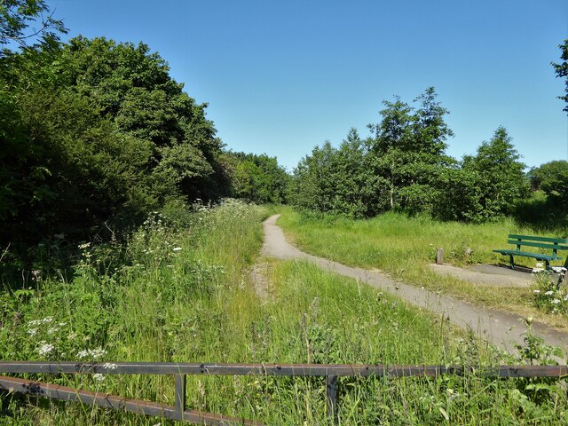
The valley is characterized by its gently sloping hills, dense woodlands, and meandering streams. It is home to a rich variety of flora and fauna, making it a popular destination for nature enthusiasts and wildlife lovers. The diverse range of plant life includes ancient oak trees, wildflowers, and ferns, creating a vibrant and colorful landscape throughout the seasons.

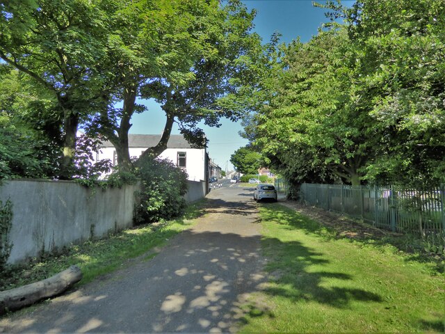
Hardwick Dene also boasts several well-maintained walking trails that allow visitors to explore the area at their own pace. These paths wind through the valley, providing panoramic views of the surrounding countryside and glimpses of the local wildlife. The peaceful ambiance of the dene makes it an ideal spot for a relaxing stroll or a picnic with family and friends.

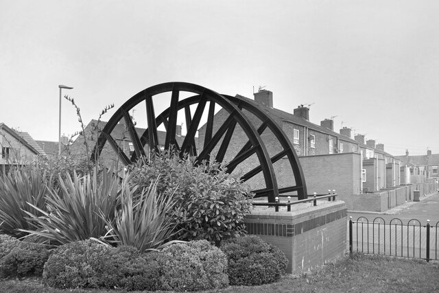
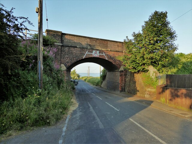
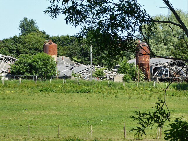
In addition to its natural beauty, Hardwick Dene holds historical significance. The valley was once home to a thriving coal mining industry, and remnants of this industrial past can still be seen in the form of old mine shafts and railway tracks. These remnants serve as a reminder of the area's heritage and provide insight into its economic importance in the past.

Overall, Hardwick Dene is a hidden gem in Durham, offering visitors a peaceful retreat in the midst of nature. With its stunning scenery, diverse wildlife, and historical charm, it is a must-visit destination for anyone seeking a tranquil escape in the heart of England.

If you have any feedback on the listing, please let us know in the comments section below.

Hardwick Dene Images

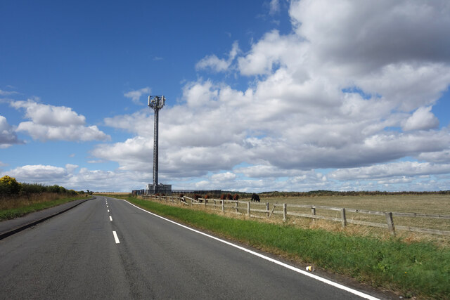
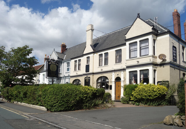
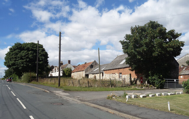
Images are sourced within 2km of 54.749373/-1.2991079 or Grid Reference NZ4539. Thanks to Geograph Open Source API. All images are credited.

Mickle Hill Road The urban developments along the Coast Road are soon left behind as the road heads out into the country.
Mickle Hill Road
The urban developments along the Coast Road are soon left behind as the road heads out into the country.
The Ship Inn, High Heselden Village pub along Mickle Hill Road.
The Ship Inn, High Heselden
Village pub along Mickle Hill Road.
Mickle Hill Road, High Heselden With some old buildings belonging to High Heselden Farm.
Mickle Hill Road, High Heselden
With some old buildings belonging to High Heselden Farm.
On the beach in the mist Starting as a dark line on the horizon, within minutes a sea mist came billowing in turning a bright sunny morning into hazy gloom.
On the beach in the mist
Starting as a dark line on the horizon, within minutes a sea mist came billowing in turning a bright sunny morning into hazy gloom.
Mine Wheel Memorial, Blackhall Colliery One of several similar monuments in this area commemorating the former mining industry.
A sea mist has blown in making colour photography rather unrewarding, but this looks ok in B&W.
Mine Wheel Memorial, Blackhall Colliery
One of several similar monuments in this area commemorating the former mining industry. A sea mist has blown in making colour photography rather unrewarding, but this looks ok in B&W.
Eighth Street, Blackhall Colliery Making it easy for the postman, a group of adjacent streets are named from First to Eleventh. I think that's right. I can't see any more on the map.
Eighth Street, Blackhall Colliery
Making it easy for the postman, a group of adjacent streets are named from First to Eleventh. I think that's right. I can't see any more on the map.
Middle Street, Blackhall Colliery A town with very logical street naming. This is Middle Street, the main road, with East and West Streets running parallel. In between are First to Eleventh Streets. Easy.
Further along, it's poets.
Middle Street, Blackhall Colliery
A town with very logical street naming. This is Middle Street, the main road, with East and West Streets running parallel. In between are First to Eleventh Streets. Easy. Further along, it's poets.
Railway Bridge Over Station Road
Railway Bridge
Over Station Road
Path to the beach View from the Coastal Path north of Blackhall Rocks
Path to the beach
View from the Coastal Path north of Blackhall Rocks
Rocks off the beach View from a path off the viewing platform on the Coastal Path
Rocks off the beach
View from a path off the viewing platform on the Coastal Path
Hardwicke Hall Manor Hotel car park Shared with Manor Motors and hopefully the car stock does not get mixed up.
Hardwicke Hall Manor Hotel car park
Shared with Manor Motors and hopefully the car stock does not get mixed up.
Hesleden WMC On Front Street
Hesleden WMC
On Front Street
Bridleway approaching Church Street The bridleway enters Hesleden by the side of Hesleden House
Bridleway approaching Church Street
The bridleway enters Hesleden by the side of Hesleden House
Cycle path following route of former railway The Hart to Haswell route has just crossed the end of East Terrace
Cycle path following route of former railway
The Hart to Haswell route has just crossed the end of East Terrace
Collapse of the poultry industry? Former poultry sheds viewed from the Hart to Haswell Walkway
Collapse of the poultry industry?
Former poultry sheds viewed from the Hart to Haswell Walkway
Drive to Hardwicke Hall Manor Hotel Passing the entrance to Wood Cottage, screened by trees
Drive to Hardwicke Hall Manor Hotel
Passing the entrance to Wood Cottage, screened by trees
Train at Horden train station A northern (Northern Trains Limited) class 156 train at Horden train station
Train at Horden train station
A northern (Northern Trains Limited) class 156 train at Horden train station
Co-operative Buildings, Cotsford Lane Presumably all a co-op store at one time, but now only partly retained as a co-op funeral parlour at the far end.
Co-operative Buildings, Cotsford Lane
Presumably all a co-op store at one time, but now only partly retained as a co-op funeral parlour at the far end.
Show me another place!

Hardwick Dene is located at Grid Ref: NZ4539 (Lat: 54.749373, Lng: -1.2991079)

Unitary Authority: County Durham

Police Authority: Durham

What 3 Words

///masts.noise.eager. Near Peterlee, Co. Durham

Related Wikis

Blackhall Colliery railway station

Blackhall Colliery railway station served the village of Blackhall Colliery in County Durham, North East England. It was located on the Durham Coast Line...

Blackhall Colliery

Blackhall Colliery is a village on the North Sea coast of County Durham, in England. It is situated on the A1086 between Horden and Hartlepool. To the...

Dene Academy

Dene Academy (formerly Dene Community School) is a coeducational secondary school located in Peterlee, County Durham, England.Established in 1962, in November...

High Hesleden

High Hesleden is a village in Monk Hesleden parish, County Durham, in England. It is situated a few miles north of Hartlepool, between Blackhall Rocks...

Nearby Amenities

Located within 500m of 54.749373,-1.2991079
Bus Stop
Blackhall Bank
Bus: yes
Naptan AtcoCode: 13003333D
Naptan Bearing: SE
Naptan CommonName: Blackhall Bank
Naptan Indicator: south east bound
Naptan Landmark: 411m N of Shaftesbury Cresc
Naptan NaptanCode: duraptjw
Naptan Street: A1086 Coast Road
Naptan Verified: no
Public Transport: platform
Source: naptan_import
Lat/Long: 54.7529961/-1.2989328
Bus Stop
Blackhall Bank
Bus: yes
Naptan AtcoCode: 13003333H
Naptan Bearing: NW
Naptan CommonName: Blackhall Bank
Naptan Indicator: north west bound
Naptan Landmark: 486m N of Shatesbury Cresc
Naptan NaptanCode: duraptma
Naptan Street: A1086 Coast Road
Naptan Verified: no
Public Transport: platform
Source: naptan_import
Lat/Long: 54.7534425/-1.2999816
Bus Stop
Welfare Park
Bus: yes
Mapillary: 282596274621531
Naptan AtcoCode: 13003334D
Naptan Bearing: SE
Naptan CommonName: Welfare Park
Naptan Indicator: south east bound
Naptan Landmark: opposite N edge of Eleventh Street
Naptan NaptanCode: duraptmd
Naptan Street: A1086 Coast Road
Naptan Verified: no
Public Transport: platform
Shelter: yes
Source: naptan_import
Lat/Long: 54.7503186/-1.2941694
Bus Stop
Schools
Bus: yes
Naptan AtcoCode: 13003335H
Naptan Bearing: NW
Naptan CommonName: Schools
Naptan Indicator: north west bound
Naptan Landmark: 9m S of S edge of Eigth Street
Naptan NaptanCode: duraptmg
Naptan Street: A1086 Coast Road
Naptan Verified: no
Public Transport: platform
Source: naptan_import
Lat/Long: 54.7492291/-1.2925037
Bus Stop
Yoden Hall Nursing Home
Bus: yes
Naptan AtcoCode: 13003920A
Naptan Bearing: NW
Naptan CommonName: Yoden Hall Nursing Home
Naptan Indicator: north west bound
Naptan Landmark: Outside entrance to Yohden Hall Care Home
Naptan NaptanCode: durawagm
Naptan Street: Hesleden Road
Naptan Verified: no
Public Transport: platform
Source: naptan_import
Lat/Long: 54.7453913/-1.2955222
Mini Roundabout
Lat/Long: 54.7459694/-1.2947903
Blackhall War Memorial
Historic: memorial
Memorial: war_memorial
Wikidata: Q26677949
Lat/Long: 54.7502959/-1.2961024
Noexit: yes
Lat/Long: 54.7498613/-1.2949889
Noexit: yes
Lat/Long: 54.7497727/-1.2951335
Fast Food
Pizza Amore
Addr City: Hartlepool
Addr Country: GB
Addr Housenumber: 60
Addr Postcode: TS27 4EA
Addr Street: Middle Street
Cuisine: pizza
Fhrs Id: 1703597
Outdoor Seating: no
Website: https://www.pizza-amore.uk/
Lat/Long: 54.7486376/-1.2914997
Fast Food
Golden Wok
Addr City: Hartlepool
Addr Country: GB
Addr Housenumber: 64
Addr Postcode: TS27 4EA
Addr Street: Middle Street
Cuisine: chinese
Fhrs Id: 747805
Outdoor Seating: no
Takeaway: yes
Lat/Long: 54.7487049/-1.2916285
JCM Cable Installations
Addr City: Hartlepool
Addr Country: GB
Addr Housenumber: 67A
Addr Postcode: TS27 4ED
Addr Street: Middle Street
Office: company
Website: https://jcmcableinstallation.com/
Lat/Long: 54.7488234/-1.291377
Headhouse
Fixme: Check operating
Mapillary: 8496717423680118
Shop: hairdresser
Lat/Long: 54.7487401/-1.2916929
Defibrillator
Access: yes
Emergency: defibrillator
Indoor: no
Mapillary: 854414152555829
Opening Hours: 24/7
Ref GB The Circuit: 9F5BFAA1-0778-4926-BDA1-ADB300ADE872
Lat/Long: 54.7488683/-1.291908
Fast Food
Kira's Place
Addr City: Hartlepool
Addr Country: GB
Addr Housenumber: 75
Addr Postcode: TS27 4ED
Addr Street: Middle Street
Cuisine: pizza
Fhrs Id: 1703598
Outdoor Seating: no
Takeaway: yes
Website: https://kirasplace.co.uk/
Lat/Long: 54.7491964/-1.2920643
Studio 31
Contact Facebook: https://www.facebook.com/p/Studio-31-100050309773434/
Female: yes
Shop: hairdresser
Lat/Long: 54.7492297/-1.2921213
Crossing
Crossing: unmarked
Crossing Island: yes
Lat/Long: 54.7494811/-1.2928512
Desmond Mcauliffe Hairdressing
Fixme: Check operating
Shop: hairdresser
Lat/Long: 54.7494252/-1.2925391
Rays Stores
Addr City: Hartlepool
Addr Country: GB
Addr Housenumber: 91
Addr Postcode: TS27 4ED
Addr Street: Middle Street
Contact Facebook: raysstoresofficial
Fhrs Id: 305282
Mapillary: 699513
Shop: alcohol
Lat/Long: 54.7495312/-1.2926799
Fast Food
Riley's Fish Bar
Addr City: Hartlepool
Addr Country: GB
Addr Housenumber: 93
Addr Postcode: TS27 4ED
Addr Street: Middle Street
Cuisine: fish_and_chips
Fhrs Id: 699513
Fixme: Check operating
Mapillary: 310462344913373
Outdoor Seating: no
Takeaway: yes
Lat/Long: 54.7495684/-1.2927523
Crossing
Crossing: unmarked
Crossing Island: yes
Crossing Markings: no
Lat/Long: 54.7502992/-1.2944043
Parking
Parking: surface
Lat/Long: 54.7501643/-1.2946419
Tourism: artwork
Lat/Long: 54.748983/-1.2916558
The data included in this document is from www.openstreetmap.org. The data is made available under ODbL.

Have you been to Hardwick Dene?

Leave your review of Hardwick Dene below (or comments, questions and feedback).