Dale

Valley in Shetland

Scotland

Dale

Loch of Tingwall and Hill of Burradale from the air
Loch of Tingwall and Hill of Burradale from the air Credit: Mike Pennington

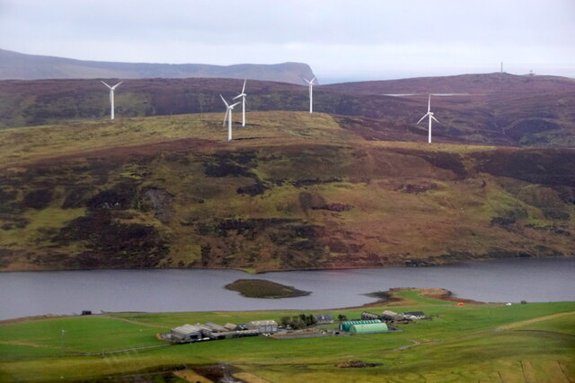
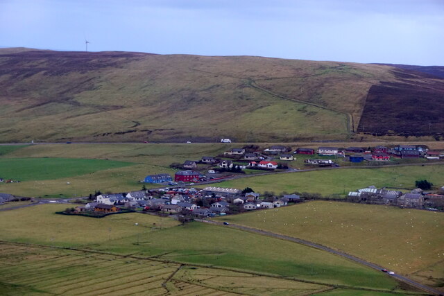
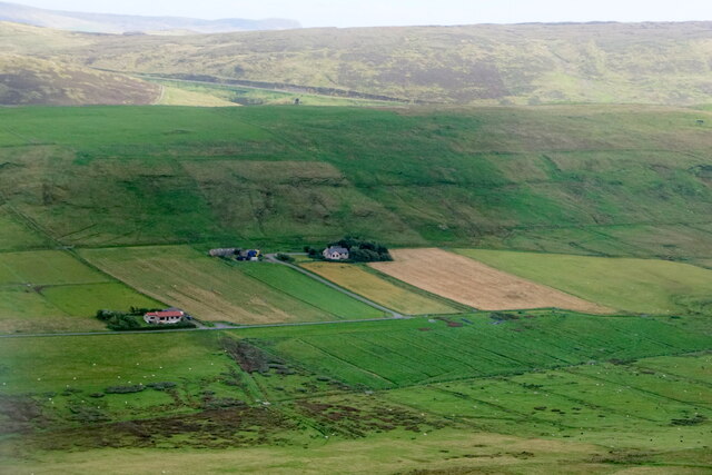
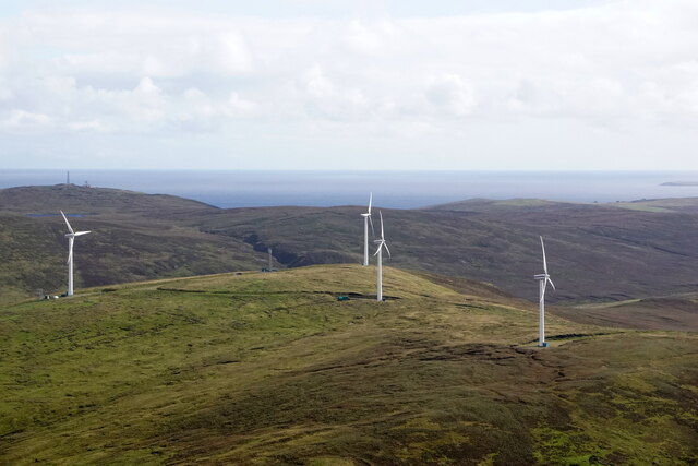
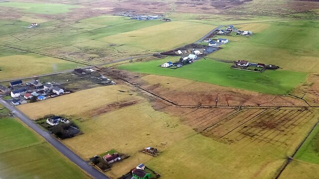
Dale, Shetland (Valley) is a small settlement located on the eastern coast of the Shetland Islands, an archipelago situated off the northeast coast of Scotland. It is situated in the Tingwall Valley, surrounded by lush green hills and picturesque landscapes.

The settlement is named after the valley it is nestled in. Dale is a peaceful and close-knit community, with a population of around 200 residents. It is primarily an agricultural area, with farming and crofting being the main sources of livelihood for the locals.

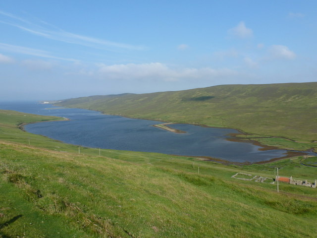
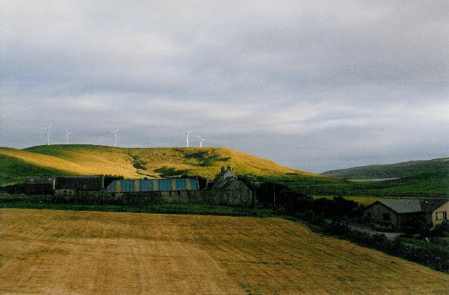
The natural beauty of Dale is a major attraction for both residents and visitors. The valley is dotted with small farms and crofts, creating a charming rural setting. The scenic surroundings offer ample opportunities for outdoor activities such as hiking, nature walks, and birdwatching.

Dale is also home to a primary school, providing education for the local children. It has a strong community spirit, evident through various community events and gatherings organized throughout the year.

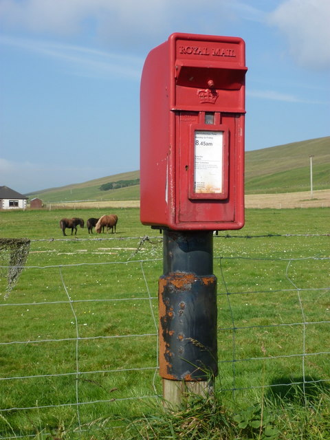
Although small in size, Dale has a few amenities to cater to its residents' needs. These include a local grocery store, a post office, and a community center. For other services and facilities, residents often travel to nearby towns like Lerwick, the main administrative center of the Shetland Islands.

Overall, Dale, Shetland (Valley) is a quaint and picturesque settlement, offering a tranquil and scenic lifestyle amidst the natural beauty of the Tingwall Valley.

If you have any feedback on the listing, please let us know in the comments section below.

Dale Images

Images are sourced within 2km of 60.167694/-1.2211367 or Grid Reference HU4342. Thanks to Geograph Open Source API. All images are credited.

Loch of Tingwall and Hill of Burradale from the air
Veensgarth from the air
Tingwall kirk and graveyard, from the air
Tingaholm, Tingwall Taken from our coach as we passed along the B9074, this is the small promontory at the north end of Tingwall Loch known Tingaholm which was the site of Shetland’s local parliament until the late 16th century. Tingwall, Shetland.
Tingaholm, Tingwall
Taken from our coach as we passed along the B9074, this is the small promontory at the north end of Tingwall Loch known Tingaholm which was the site of Shetland’s local parliament until the late 16th century. Tingwall, Shetland.
Tingwall Church from the air
Veensgarth from the air
Burra Dale windfarm from the air
Veensgarth from the air
Transporting parts of the turbines for the Viking Wind Farm, near Brig of Fitch
Law Ting Holm, Tingwall This is the Loch of Tingwall and the promotory was the site of Shetland’s parliament, known as Tingaholm (or Lawting Holm). (<span class="nowrap"><a title="https://www.shetland-heritage.co.uk/tinga_holm_tingwall)" rel="nofollow ugc noopener" href="https://www.shetland-heritage.co.uk/tinga_holm_tingwall)">Link</a><img style="margin-left:2px;" alt="External link" title="External link - shift click to open in new window" src="https://s1.geograph.org.uk/img/external.png" width="10" height="10"/></span>
Law Ting Holm, Tingwall
This is the Loch of Tingwall and the promotory was the site of Shetland’s parliament, known as Tingaholm (or Lawting Holm). (LinkExternal link
Burra Dale: a wind turbine and a half A thick mist descends over mid-Shetland as we look towards two of the wind turbines at Burra Dale, the top of one of them lost in the mist.
Burra Dale: a wind turbine and a half
A thick mist descends over mid-Shetland as we look towards two of the wind turbines at Burra Dale, the top of one of them lost in the mist.
Loch of Tingwall
Loch of Tingwall
Veensgarth: postbox № ZE2 6 A post-1994 postbox on a very bizarre metal post, possibly slotted over the wooden post which previously had the box attached to it. The postbox is emptied at 8:45 on weekday and Saturday mornings.
Veensgarth: postbox № ZE2 6
A post-1994 postbox on a very bizarre metal post, possibly slotted over the wooden post which previously had the box attached to it. The postbox is emptied at 8:45 on weekday and Saturday mornings.
Lerwick: Dales Voe Looking down from a viewpoint lay-by on the A970.
Lerwick: Dales Voe
Looking down from a viewpoint lay-by on the A970.
Lerwick: viewpoint parking sign above Dales Voe A parking lay-by on the A970 is embellished with a 'Viewpoint' sign in addition to the usual 'P'. The view is slightly better appreciated here: <a href="https://www.geograph.org.uk/photo/2757024">HU4343 : Lerwick: Dales Voe</a>
Lerwick: viewpoint parking sign above Dales Voe
A parking lay-by on the A970 is embellished with a 'Viewpoint' sign in addition to the usual 'P'. The view is slightly better appreciated here: HU4343 : Lerwick: Dales Voe
Lerwick: Dale Golf Club The golf course is laid out on the slopes above the head of Dales Voe (see <a href="https://www.geograph.org.uk/photo/2757024">HU4343 : Lerwick: Dales Voe</a>), which is to our left. The A970 swings round it - the road can be seen cutting across the face of Hill of Dale, in the distance, before it swings to the right and passes just behind the camera.
Lerwick: Dale Golf Club
The golf course is laid out on the slopes above the head of Dales Voe (see HU4343 : Lerwick: Dales Voe), which is to our left. The A970 swings round it - the road can be seen cutting across the face of Hill of Dale, in the distance, before it swings to the right and passes just behind the camera.
Burradale windfarm (aerial 2007) Up here they call them "aerogenerators" and give them names such as Sally and Karen. Now, in 2012, in Lincolnshire we have hundreds of these wind turbines, and many more being planned. The names we call them are not so complimentary!
Burradale windfarm (aerial 2007)
Up here they call them "aerogenerators" and give them names such as Sally and Karen. Now, in 2012, in Lincolnshire we have hundreds of these wind turbines, and many more being planned. The names we call them are not so complimentary!
Newly ploughed field at Veensgarth
Show me another place!

Dale is located at Grid Ref: HU4342 (Lat: 60.167694, Lng: -1.2211367)

Unitary Authority: Shetland Islands

Police Authority: Highlands and Islands

What 3 Words

///entitle.spinners.dial. Near Lerwick, Shetland Islands

Nearby Locations

Dale

Related Wikis

Tingwall, Shetland

Tingwall, (Old Norse: Þingvǫllr = Field of the Thing assembly) is a parish in Shetland, Scotland. Located mostly on the Shetland Mainland, the centre lies...

Law Ting Holm

Law Ting Holm (also known as Tingaholm) is a small promontory at the north end of the freshwater Loch of Tingwall, Mainland Shetland, Scotland. It was...

Veensgarth

Veensgarth (Old Norse: Vikingsgarðr, Viking farm, or Vingarðr, Meadow Farm), is a village in the Tingwall valley west of Lerwick on Mainland in Shetland...

Tingwall Airport

Tingwall Airport (IATA: LWK, ICAO: EGET), also known as Lerwick/Tingwall Airport, is located in the Tingwall valley, near the village of Gott, 4 NM (7...

Nearby Amenities

Located within 500m of 60.167694,-1.2211367
Power: pole
Lat/Long: 60.1691203/-1.2255428
Power: pole
Source: bing
Lat/Long: 60.1695617/-1.2246554
Power: pole
Source: bing
Lat/Long: 60.1696397/-1.213512
Power: pole
Source: bing
Lat/Long: 60.1698716/-1.2147886
Power: pole
Source: bing
Lat/Long: 60.1699334/-1.223871
Power: pole
Source: bing
Lat/Long: 60.1701179/-1.2161871
Power: pole
Source: bing
Lat/Long: 60.1702293/-1.2144506
Power: pole
Source: bing
Lat/Long: 60.1703536/-1.2174819
Power: pole
Source: bing
Lat/Long: 60.1703747/-1.2157295
Power: pole
Source: bing
Lat/Long: 60.1705555/-1.2231051
Power: pole
Source: bing
Lat/Long: 60.17053/-1.2170757
Power: pole
Source: bing
Lat/Long: 60.1705275/-1.218468
Power: pole
Source: bing
Lat/Long: 60.1706401/-1.218093
Power: pole
Source: bing
Lat/Long: 60.1707812/-1.2198594
Power: pole
Source: bing
Lat/Long: 60.170937/-1.2188632
Power: pole
Lat/Long: 60.1710674/-1.2214557
Power: pole
Lat/Long: 60.1712652/-1.2197065
Power: pole
Lat/Long: 60.1710757/-1.2224436
Power: pole
Lat/Long: 60.1717524/-1.2215865
Power: pole
Lat/Long: 60.1719668/-1.2199495
Power: pole
Source: Bing
Lat/Long: 60.1679371/-1.2129264
Power: pole
Source: Bing
Lat/Long: 60.1679439/-1.2142253
Power: pole
Lat/Long: 60.1670716/-1.2271265
Power: pole
Lat/Long: 60.1676852/-1.2266591
Power: pole
Lat/Long: 60.1684086/-1.2260993
Golf: pin
Lat/Long: 60.1695448/-1.2236783
Golf: pin
Lat/Long: 60.1704211/-1.2223791
Golf: pin
Lat/Long: 60.1694721/-1.2166159
Golf: pin
Lat/Long: 60.1663518/-1.2182762
Golf: pin
Lat/Long: 60.1687482/-1.221012
Golf: pin
Lat/Long: 60.1666794/-1.2198426
Golf: pin
Lat/Long: 60.1663065/-1.2249442
Golf: pin
Lat/Long: 60.1651036/-1.2256058
Golf: pin
Lat/Long: 60.1656764/-1.2203715
Golf: pin
Lat/Long: 60.1654193/-1.2191913
Golf: pin
Lat/Long: 60.1690273/-1.218966
Golf: pin
Lat/Long: 60.1694963/-1.2213074
Golf: pin
Lat/Long: 60.1667809/-1.2250745
Natural: shrub
Lat/Long: 60.1666766/-1.2266845
Natural: shrub
Lat/Long: 60.1664297/-1.2268244
Power: pole
Lat/Long: 60.1663243/-1.2155581
Power: pole
Lat/Long: 60.1667382/-1.2151999
Power: pole
Lat/Long: 60.1673222/-1.2147353
The data included in this document is from www.openstreetmap.org. The data is made available under ODbL.

Have you been to Dale?

Leave your review of Dale below (or comments, questions and feedback).