Royl Dale

Valley in Shetland

Scotland

Royl Dale

The Haas on Houss Ness A curving bay on the east coast of Houss Ness.
The Haas on Houss Ness Credit: Julian Paren

Royl Dale is a picturesque valley located in the heart of the Shetland Islands, Scotland. Nestled between rolling hills and surrounded by stunning landscapes, it offers visitors a tranquil and idyllic setting to escape from the hustle and bustle of everyday life.

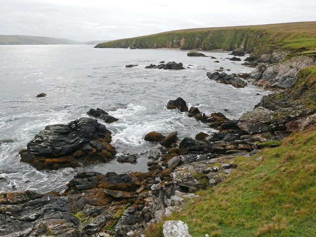
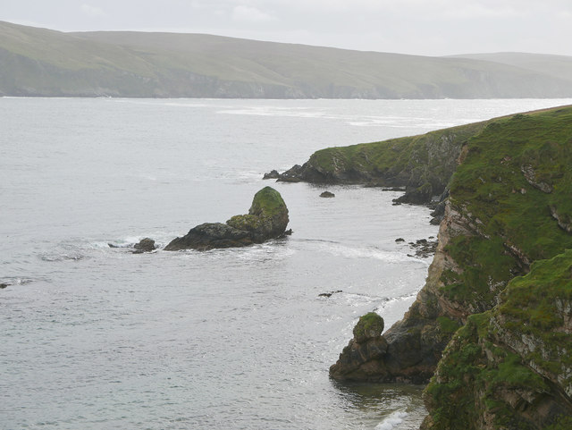
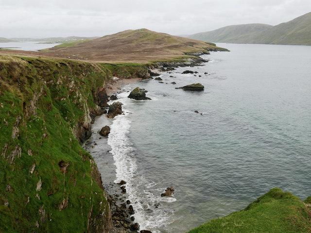
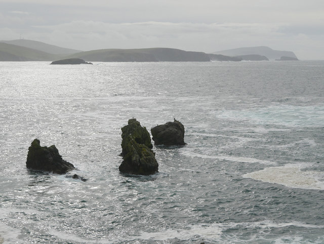
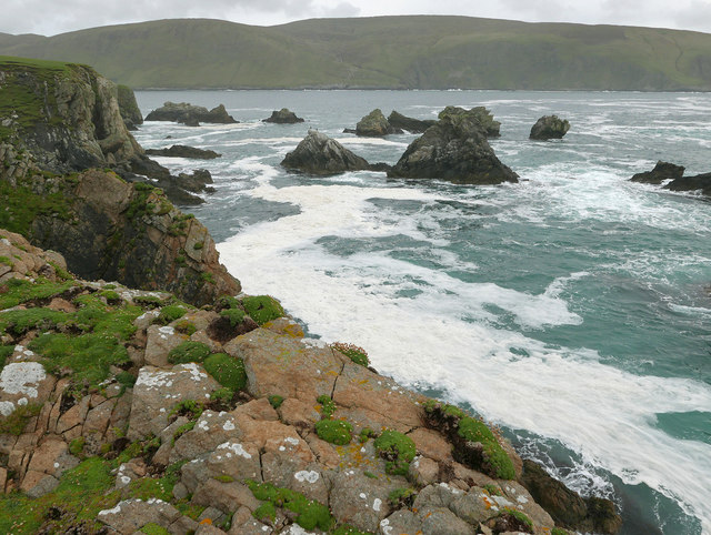
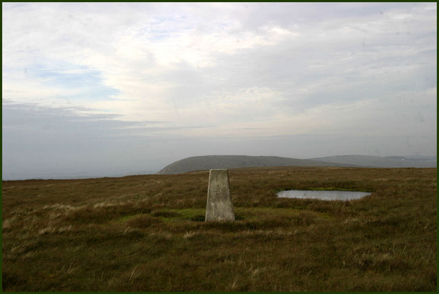
The valley is renowned for its natural beauty, with lush green meadows, vibrant wildflowers, and a meandering river flowing through its heart. The landscape is dotted with traditional stone cottages, adding to the charm and character of the area. The valley is also home to a variety of wildlife, including otters, seals, and a wide array of bird species, making it a paradise for nature enthusiasts and birdwatchers.

Royl Dale is a popular destination for outdoor activities such as hiking, cycling, and fishing. There are several well-marked trails that wind through the valley, offering breathtaking views of the surrounding countryside. The river provides excellent opportunities for anglers, with its abundance of salmon and trout.

In addition to its natural attractions, Royl Dale is steeped in history. The valley is home to several ancient archaeological sites, including standing stones and burial mounds, which offer insights into the area's rich past.

Visitors to Royl Dale can also enjoy a warm and welcoming community. The valley is home to a small population of locals who take pride in their heritage and are always eager to share their knowledge and stories with visitors.

In conclusion, Royl Dale is a truly remarkable destination in the Shetland Islands, offering a perfect blend of natural beauty, outdoor activities, and a rich cultural heritage. Whether you are seeking relaxation or adventure, this valley has something to offer for everyone.

If you have any feedback on the listing, please let us know in the comments section below.

Royl Dale Images

Images are sourced within 2km of 60.041186/-1.298415 or Grid Reference HU3928. Thanks to Geograph Open Source API. All images are credited.

The Haas on Houss Ness A curving bay on the east coast of Houss Ness.
The Haas on Houss Ness
A curving bay on the east coast of Houss Ness.
Stack of Oila, Houss Ness
View over the Haas, Houss Ness Beyond the bay (the Haas) rises the Ward of Symbister, the highest point on Houss Ness.
View over the Haas, Houss Ness
Beyond the bay (the Haas) rises the Ward of Symbister, the highest point on Houss Ness.
Stacks of Houssness, East Burra Part of the group of rocks known as the Stacks of Houssness.  Fitful Head is in the far distance.
Stacks of Houssness, East Burra
Part of the group of rocks known as the Stacks of Houssness. Fitful Head is in the far distance.
At the Point of Stakka Skerries and stacks litter the south coast off Houss Ness.
At the Point of Stakka
Skerries and stacks litter the south coast off Houss Ness.
Small fishing boat and salmon cages off Teisti Geo Teisti Geo is a prominent indentation in the otherwise smooth coastline of Clift Sound.
Small fishing boat and salmon cages off Teisti Geo
Teisti Geo is a prominent indentation in the otherwise smooth coastline of Clift Sound.
Gunk-holing among the stacks of Houssness With a decent swell running from the southwest, we'd given the more exposed stacks of Houssness a wide berth (half a kilometre or so from the breaking surf) but had now ducked into the shelter of East Burra to explore the skerries, stacks and sea caves. There was still enough swell here to make the game quite playful, timing your run through the smaller and shallower gaps to use the waves, but no chance of being picked up and smashed about. Gunk-holing is a very American term for this sort of thing, sorry, but there's no good English equivalent word - rock-hopping tends to mean narrower gaps and more chance of getting stuck whilst that term doesn't really include poking into dark caves.
Gunk-holing among the stacks of Houssness
With a decent swell running from the southwest, we'd given the more exposed stacks of Houssness a wide berth (half a kilometre or so from the breaking surf) but had now ducked into the shelter of East Burra to explore the skerries, stacks and sea caves. There was still enough swell here to make the game quite playful, timing your run through the smaller and shallower gaps to use the waves, but no chance of being picked up and smashed about. Gunk-holing is a very American term for this sort of thing, sorry, but there's no good English equivalent word - rock-hopping tends to mean narrower gaps and more chance of getting stuck whilst that term doesn't really include poking into dark caves.
Trig point Trig point on top of Royl Field
Trig point
Trig point on top of Royl Field
Moorland bog A small stream merges from the peat covering this side of Royl Field.
Moorland bog
A small stream merges from the peat covering this side of Royl Field.
Moorland under low cloud Near the top of the Royl Field there is a view south to Channer Wick. But on this day the cloud came down to hill, darkening the view.
Moorland under low cloud
Near the top of the Royl Field there is a view south to Channer Wick. But on this day the cloud came down to hill, darkening the view.
Mosquito Memorial This stone marks the site of a wartime crash. The inscription reads:

This memorial commemorates de Havilland Mosquito Mk VII "DZ642" of 627 Squadron, Royal Air Force.

Pilot - F/Lt John A Reid RAF 48900
Navigator - F/O Wesley D Irwin RCAF J16115

Returning from target marking an ill-fated raid on U-Boat pens at Tronheim, Norway, short of fuel and in bad visibility the aircraft hit Royl Hill on 22nd November 1944 at 23:00 hours.
Mosquito Memorial
This stone marks the site of a wartime crash. The inscription reads: This memorial commemorates de Havilland Mosquito Mk VII "DZ642" of 627 Squadron, Royal Air Force. Pilot - F/Lt John A Reid RAF 48900 Navigator - F/O Wesley D Irwin RCAF J16115 Returning from target marking an ill-fated raid on U-Boat pens at Tronheim, Norway, short of fuel and in bad visibility the aircraft hit Royl Hill on 22nd November 1944 at 23:00 hours.
Mosquito engine Several parts of the aircraft are scattered around the crash site. This is one of the engines.
Mosquito engine
Several parts of the aircraft are scattered around the crash site. This is one of the engines.
Mosquito remains Several parts of the Mosquito aircraft are still visible at the crash site.
Mosquito remains
Several parts of the Mosquito aircraft are still visible at the crash site.
Holm Field Climbed after Royl Field with Tricky Speirs still windy. Walked around the various peat hags.
Name:Holm Field
Hill number:4908
Height:290m / 951ft
Area:22: Shetland Islands
Class:Hu
Grid ref:HU395306 (est)
Drop:104m
Col:186m HU394298
Holm Field
Climbed after Royl Field with Tricky Speirs still windy. Walked around the various peat hags. Name:Holm Field Hill number:4908 Height:290m / 951ft Area:22: Shetland Islands Class:Hu Grid ref:HU395306 (est) Drop:104m Col:186m HU394298
Royl Field Following in the tracks of Jen and Rick but at least we continued to Holmfield and Scroo with Tricky Speirs.
Name:Royl Field
Hill number:1529
Height:293m / 961ft
Area:22: Shetland Islands
Class:Ma
Grid ref:HU 39591 28506
Summit feature:trig point in flat area
Drop:287m
Col:6m HU340683
Royl Field
Following in the tracks of Jen and Rick but at least we continued to Holmfield and Scroo with Tricky Speirs. Name:Royl Field Hill number:1529 Height:293m / 961ft Area:22: Shetland Islands Class:Ma Grid ref:HU 39591 28506 Summit feature:trig point in flat area Drop:287m Col:6m HU340683
View Towards Holm Field Relatively fast going on the dry moorland between Royl Field and Holm Field with occasional views to the coast.
View Towards Holm Field
Relatively fast going on the dry moorland between Royl Field and Holm Field with occasional views to the coast.
Scroo Summit Peat Hags Last TuMP of the day with Tricky Speirs, over peat hags from Holmfield and Royl Field.
Name:Scroo
Hill number:103802
Height:248m / 814ft
Area:22: Shetland Islands
Class:2
Grid ref: HU406297 (est)
Drop:39m
Col:209m
Scroo Summit Peat Hags
Last TuMP of the day with Tricky Speirs, over peat hags from Holmfield and Royl Field. Name:Scroo Hill number:103802 Height:248m / 814ft Area:22: Shetland Islands Class:2 Grid ref: HU406297 (est) Drop:39m Col:209m
Heading for Royl Field Walking on dry moorland today towards Royl Field to the right of Burn of the Run having recently cross a waterfall.
Heading for Royl Field
Walking on dry moorland today towards Royl Field to the right of Burn of the Run having recently cross a waterfall.
Show me another place!

Royl Dale is located at Grid Ref: HU3928 (Lat: 60.041186, Lng: -1.298415)

Unitary Authority: Shetland Islands

Police Authority: Highlands and Islands

What 3 Words

///accusing.fragment.perfumed. Near Sandwick, Shetland Islands

Nearby Locations

Royl Dale Royl Field

Related Wikis

South Mainland

The South Mainland of the Shetland Islands is the southern peninsula of Mainland island. It lies south of Hellister (60° 14′N). The greater southern part...

South Havra

South Havra (Scots: Sooth Haevra; Old Norse: Hafrey), formerly Hevera, is an uninhabited island in the Scalloway Islands, Shetland, Scotland. == Geography... ==

Catpund

Catpund is a quarry site in Shetland, Scotland, where steatite vessels were cut from the rock from prehistory onwards. The quarrying marks are still visible...

Bremirehoull

Bremirehoull is a settlement on the island of Mainland, in Shetland, Scotland. Bremirehoull is situated on the A970 in the Cunningsburgh area. == References... ==

Nearby Amenities

Located within 500m of 60.041186,-1.298415
Royl Field
Corbett: no
Ele: 293
Graham: no
Marilyn: yes
Munro: no
Natural: peak
Prominence: 287
Lat/Long: 60.0399039/-1.2907662
Man Made: survey_point
Lat/Long: 60.0395054/-1.291127
Memorial to Crew of Mosquito DZ642 (WW2)
Historic: memorial
Lat/Long: 60.0398216/-1.2973094
The data included in this document is from www.openstreetmap.org. The data is made available under ODbL.

Have you been to Royl Dale?

Leave your review of Royl Dale below (or comments, questions and feedback).