Netherton Bottom

Valley in Hampshire Test Valley

England

Netherton Bottom

A343 descending towards Hurstbourne Tarrant
A343 descending towards Hurstbourne Tarrant Credit: David Martin

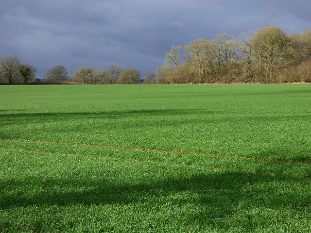
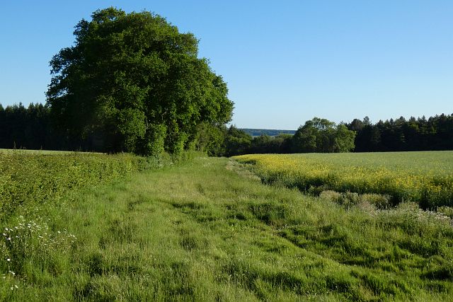
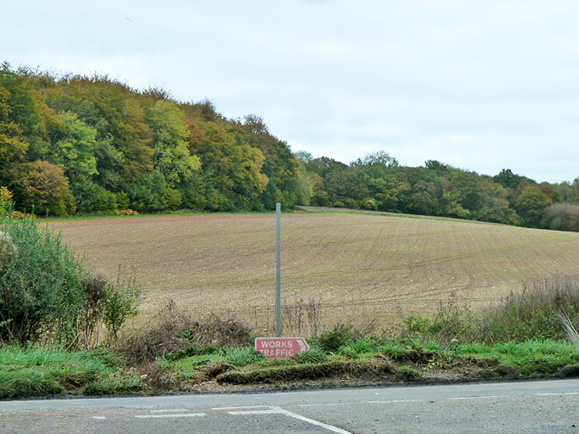
Netherton Bottom is a picturesque valley located in the county of Hampshire, in southern England. Situated near the village of Netherton, the valley is known for its stunning natural beauty and tranquil atmosphere. It is surrounded by rolling green hills and dense woodland, creating a sense of seclusion and serenity.

The valley is intersected by a gentle stream that flows through its center, adding to its charm and providing a soothing backdrop to the landscape. The stream is lined with a variety of plants and trees, creating a vibrant and diverse ecosystem that is home to various species of flora and fauna.

Netherton Bottom is a popular destination for nature enthusiasts and hikers, who flock to the area to explore its numerous walking trails and enjoy its peaceful surroundings. The valley offers breathtaking views from various vantage points, with opportunities to spot wildlife such as deer, rabbits, and a variety of birds.

In addition to its natural beauty, Netherton Bottom also boasts historical significance. The valley is dotted with remnants of ancient settlements and archaeological sites, providing glimpses into the area's rich past. Visitors can discover ancient burial mounds, stone circles, and other intriguing landmarks that offer a glimpse into the valley's historical significance.

Overall, Netherton Bottom in Hampshire is a hidden gem that offers a perfect blend of natural beauty, tranquility, and historical interest. It is a place where visitors can escape the hustle and bustle of everyday life and immerse themselves in the peaceful embrace of nature.

If you have any feedback on the listing, please let us know in the comments section below.

Netherton Bottom Images

Images are sourced within 2km of 51.302548/-1.4532604 or Grid Reference SU3856. Thanks to Geograph Open Source API. All images are credited.

A343 descending towards Hurstbourne Tarrant
Track and barn, Hurstbourne Tarrant The Test Way above Ibthorpe as in <a title="https://www.geograph.org.uk/photo/1790469" href="https://www.geograph.org.uk/photo/1790469">Link</a> .
Track and barn, Hurstbourne Tarrant
The Test Way above Ibthorpe as in Link .
Restricted byway, Hurstbourne Tarrant The Test Way above Ibthorpe.
Restricted byway, Hurstbourne Tarrant
The Test Way above Ibthorpe.
Farmland, Hurstbourne Tarrant Sawyer's Wood viewed across an arable field from the Test Way.
Farmland, Hurstbourne Tarrant
Sawyer's Wood viewed across an arable field from the Test Way.
Farmland, Hurstbourne Tarrant A crop of oil-seed rape and hedgerow trees viewed from the Test Way.
Farmland, Hurstbourne Tarrant
A crop of oil-seed rape and hedgerow trees viewed from the Test Way.
Woodland, Faccombe Faccombe Wood is a large area of mixed forestry to the south of the village.
Woodland, Faccombe
Faccombe Wood is a large area of mixed forestry to the south of the village.
Farmland, Hurstbourne Tarrant The valley of the River Swift viewed from the Test Way above Ibthorpe.
Farmland, Hurstbourne Tarrant
The valley of the River Swift viewed from the Test Way above Ibthorpe.
Farmland, Hurstbourne Tarrant A crop of barley beside the Test Way above Ibthorpe.
Farmland, Hurstbourne Tarrant
A crop of barley beside the Test Way above Ibthorpe.
Farmland, Hurstbourne Tarrant Spring-sown cereals in fields to the north-west of Ibthorpe.
Farmland, Hurstbourne Tarrant
Spring-sown cereals in fields to the north-west of Ibthorpe.
Abandoned "Clinchorn Farm" Abandoned farm buildings some distance from anywhere.
Shown on the 1894 OS map, it is probably 50-100 years older than that.
Most recent use seen on Google Maps seems to have been 2008.

Evidence of squatters using the barn recently. There is also a significant quantity of machinery beneath the shrub and buildings, potentially a house in the future?
Abandoned "Clinchorn Farm"
Abandoned farm buildings some distance from anywhere. Shown on the 1894 OS map, it is probably 50-100 years older than that. Most recent use seen on Google Maps seems to have been 2008. Evidence of squatters using the barn recently. There is also a significant quantity of machinery beneath the shrub and buildings, potentially a house in the future?
Farmland, Faccombe Arable land beside the road between Netherton and Faccombe.
Farmland, Faccombe
Arable land beside the road between Netherton and Faccombe.
Farmland, Faccombe Oil-seed rape and the southern edge of Faccombe Wood. Aerial imagery shows evidence of the field system once present here.
Farmland, Faccombe
Oil-seed rape and the southern edge of Faccombe Wood. Aerial imagery shows evidence of the field system once present here.
Farmland, Faccombe Oil-seed rape above the northern edge of Faccombe Wood.
Farmland, Faccombe
Oil-seed rape above the northern edge of Faccombe Wood.
Track and farmland, Hurstbourne Tarrant A restricted byway climbing to the north of Ibthorpe.
Track and farmland, Hurstbourne Tarrant
A restricted byway climbing to the north of Ibthorpe.
T-junction on the edge of Faccombe
Lane between Fairway and The Warren
Junction with the lane to Faccombe There are two extra items for the sharp eyed in this picture. Firstly; the small sign advertising The Jack Russell Inn in Faccombe. Secondly; the squashed pheasant on the road ahead. There were a large number of these unfortunate birds evident as road-kill between here and Walbury Hill but hundreds of their living kind intent on presenting themselves as targets to feckless, speeding drivers. On the plus side, the local buzzards and kites were well fed and numerous.
Junction with the lane to Faccombe
There are two extra items for the sharp eyed in this picture. Firstly; the small sign advertising The Jack Russell Inn in Faccombe. Secondly; the squashed pheasant on the road ahead. There were a large number of these unfortunate birds evident as road-kill between here and Walbury Hill but hundreds of their living kind intent on presenting themselves as targets to feckless, speeding drivers. On the plus side, the local buzzards and kites were well fed and numerous.
Lane through Netherton Bottom
Show me another place!

Netherton Bottom is located at Grid Ref: SU3856 (Lat: 51.302548, Lng: -1.4532604)

Administrative County: Hampshire

District: Test Valley

Police Authority: Hampshire

What 3 Words

///gazes.released.crockery. Near Highclere, Hampshire

Nearby Locations

Netherton Bottom

Related Wikis

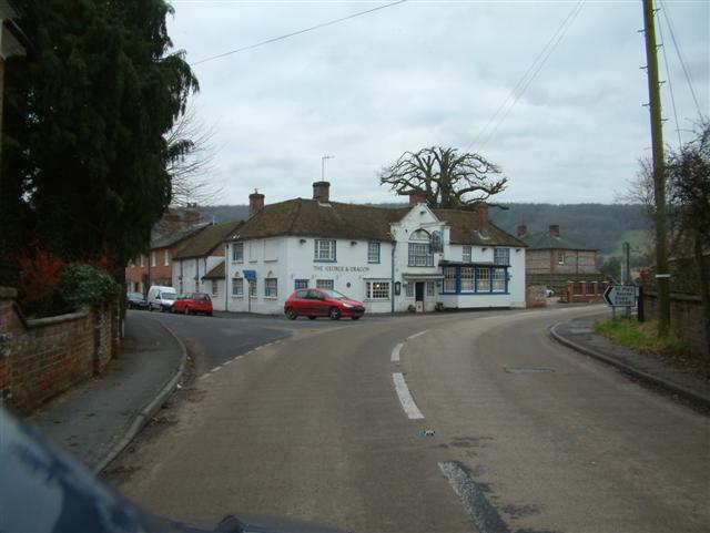
Netherton, Hampshire

Netherton is a hamlet in northwest Hampshire, England. According to the Post Office the population of the 2011 Census was included in the civil parish...

Faccombe

Faccombe is a village and civil parish in Hampshire, England. The village lies on the Hampshire-Berkshire border and is situated on the North Downs. Its...

Sidley Wood

Sidley Wood is a 11.7-hectare (29-acre) biological Site of Special Scientific Interest north of Andover in Hampshire.This south-facing secondary wood on...

Upton, north Test Valley

Upton is a hamlet in Hampshire, located approximately 7 miles north of Andover. It has a population of approximately 250. The River Swift, a winterbourne...

Ibthorpe

Ibthorpe is a village in Hampshire, England. Ibthorpe is in the civil parish of Hurstbourne Tarrant. == Name == Ibthorpe is named after "Ibbaprop" which...

Linkenholt

Linkenholt is a village near Andover in Hampshire, England with about 40 inhabitants. It is in the civil Parish of Faccombe. The Domesday Book of 1086...

Hurstbourne Tarrant

Hurstbourne Tarrant is a village and civil parish in Hampshire, England. It lies to the north of the county in the Test Valley. The Tarrant part of the...

Vernham Street

Vernham Street is a small village in the civil parish of Vernhams Dean situated in the North Wessex Downs Area of Outstanding Natural Beauty in the Test...

Have you been to Netherton Bottom?

Leave your review of Netherton Bottom below (or comments, questions and feedback).