Douna Dale

Valley in Shetland

Scotland

Douna Dale

Old Post Office, Brae
Old Post Office, Brae Credit: Mike Pennington

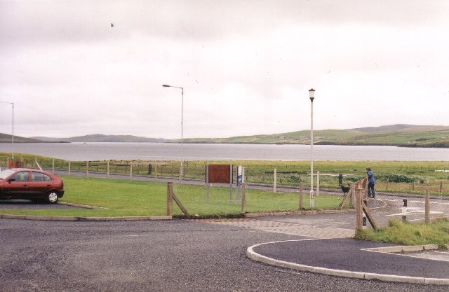
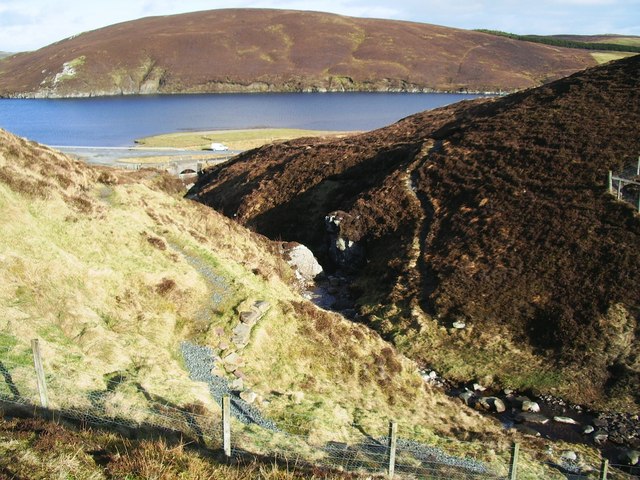
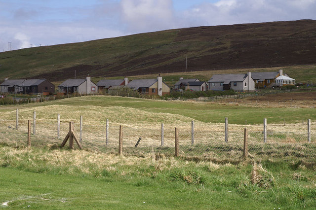
Douna Dale, also known as Doo Dale or Doo Dale Valley, is a picturesque location situated in the Shetland Islands, an archipelago in Scotland. This valley is located on the mainland of Shetland, near the village of Sandwick. It is known for its stunning natural beauty and tranquil atmosphere.

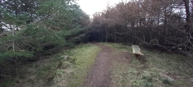
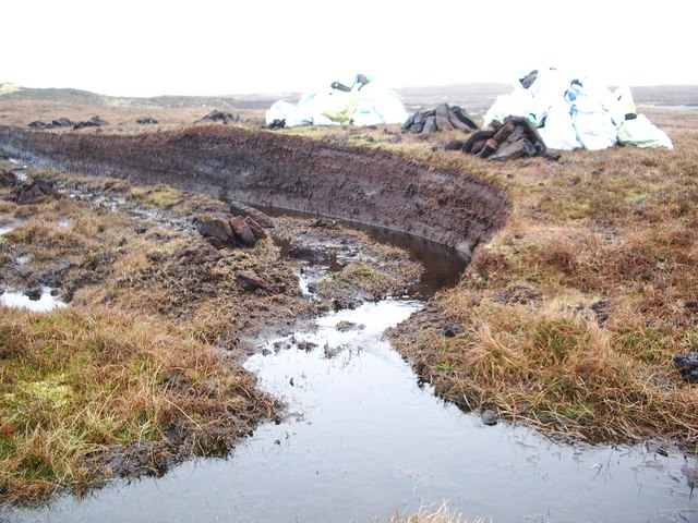
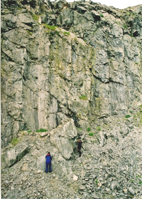
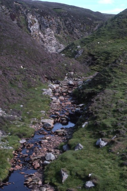
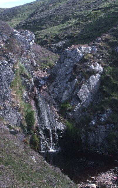
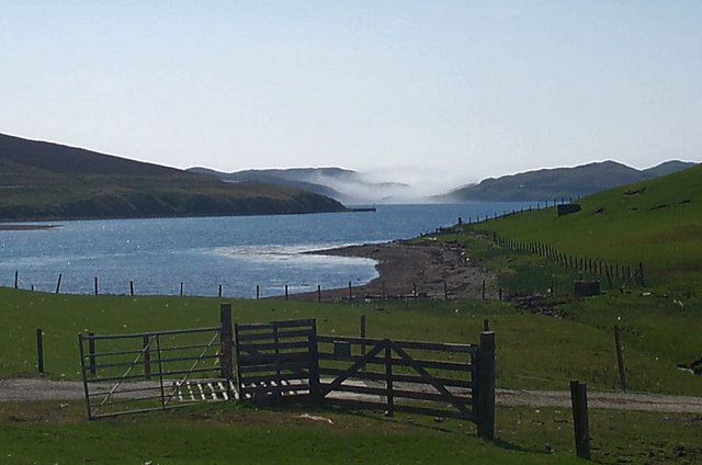
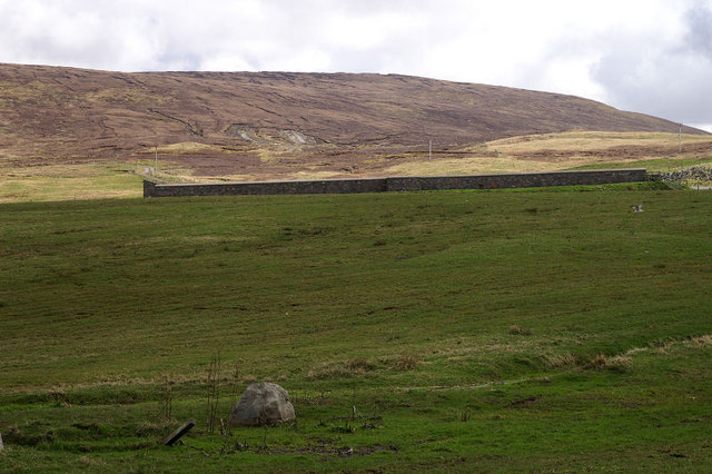
Douna Dale is a narrow valley flanked by steep hills on either side, which gives it a secluded and intimate feel. The valley is carpeted with lush green grass, dotted with wildflowers, and crisscrossed by small streams. These streams eventually flow into the nearby Loch of Spiggie, adding to the valley's charm.

The area around Douna Dale is home to a variety of wildlife, including birds such as curlews, lapwings, and meadow pipits. It is also not uncommon to spot otters and seals along the coastline, which adds to the natural appeal of the valley.

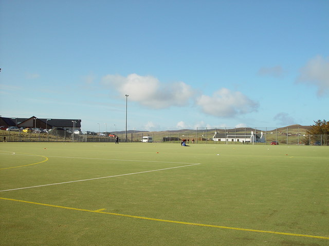
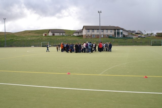
The valley is popular among locals and tourists alike for its scenic walks and hiking trails. The surrounding hills offer stunning panoramic views of the valley and the coastline. Visitors can explore the area on foot, taking in the fresh air and enjoying the peaceful ambiance.

Douna Dale is a hidden gem in the Shetland Islands, offering a serene escape from the hustle and bustle of everyday life. Its natural beauty and tranquility make it a must-visit destination for nature lovers and those seeking a peaceful retreat amidst breathtaking scenery.

If you have any feedback on the listing, please let us know in the comments section below.
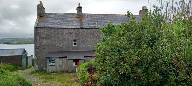
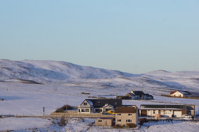
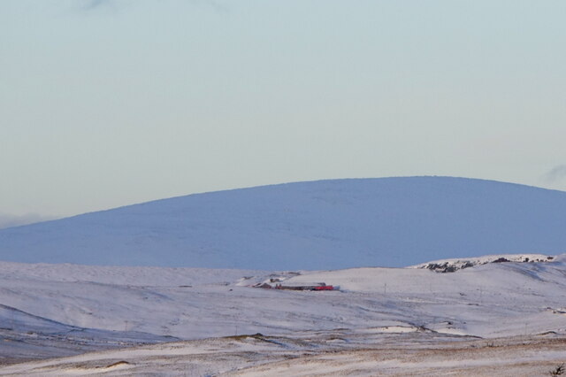
Douna Dale Images

Images are sourced within 2km of 60.401225/-1.3239134 or Grid Reference HU3768. Thanks to Geograph Open Source API. All images are credited.

Old Post Office, Brae
Brae in the snow
Brae in the snow
Brae in the snow
Brae in the snow
View to Ronas Hill in the snow from Brae
Brae Community Woodland
Bus Stop at Trondavoe The B9076 is a link road towards the northern end of Shetland Mainland. It links the A970 at Brae with the A968 near Mossbank. The primarily serves the Sullom Voe oil terminal and also passes the Scatsta Airfield. It is a good quality road which has benefited from the “oil boom” in the 1970s and 80s, being upgraded to serve the oil terminal (which was built between 1975 and 1981) and former alignments can often be seen alongside the current road.
Bus Stop at Trondavoe
The B9076 is a link road towards the northern end of Shetland Mainland. It links the A970 at Brae with the A968 near Mossbank. The primarily serves the Sullom Voe oil terminal and also passes the Scatsta Airfield. It is a good quality road which has benefited from the “oil boom” in the 1970s and 80s, being upgraded to serve the oil terminal (which was built between 1975 and 1981) and former alignments can often be seen alongside the current road.
View from Brae Junior High school across Busta Voe View from Brae Junior High school car park across Busta Voe to the Ward of Runafirth and Muckle Roe on the right with the tip of Hevden Ness on the left above the red car.
View from Brae Junior High school across Busta Voe
View from Brae Junior High school car park across Busta Voe to the Ward of Runafirth and Muckle Roe on the right with the tip of Hevden Ness on the left above the red car.
Astroturf Sports Pitch, Brae, Shetland At Midway, Brae, the first synthetic all weather pitch constructed in Shetland. in the background on the left is the Brae Health Centre with the Mid Brae Inn just right of centre in the background.
Astroturf Sports Pitch, Brae, Shetland
At Midway, Brae, the first synthetic all weather pitch constructed in Shetland. in the background on the left is the Brae Health Centre with the Mid Brae Inn just right of centre in the background.
Burn of Valayre, Shetland Photo taken looking northwest down the gorge towards the waters of Voxter Voe
Burn of Valayre, Shetland
Photo taken looking northwest down the gorge towards the waters of Voxter Voe
Peat Cutting, Shetland Cutting peat for domestic heating used to be widespread, but less so now.  The photo shows the face that is being worked, the stacked peats set out to drain and dry and the bagged peat ready to be taken away.
Peat Cutting, Shetland
Cutting peat for domestic heating used to be widespread, but less so now. The photo shows the face that is being worked, the stacked peats set out to drain and dry and the bagged peat ready to be taken away.
Valayre Quarry The quarry takes its name from the adjacent burn, and contains an outcrop of the Valayre gneiss. This curious rock can be traced intermittently for 75 km through Mainland and the island of Yell. See also <a href="https://www.geograph.org.uk/gridref/HU5070">HU5070</a>.
Valayre Quarry
The quarry takes its name from the adjacent burn, and contains an outcrop of the Valayre gneiss. This curious rock can be traced intermittently for 75 km through Mainland and the island of Yell. See also HU5070.
Burn of Valayre
Burn of Valayre
Burn of Valayre Not the most impressive waterfall ever!
Burn of Valayre
Not the most impressive waterfall ever!
Brae The small area of saltmarsh at the head of Busta Voe, with the Mid Brae Inn behind.
Brae
The small area of saltmarsh at the head of Busta Voe, with the Mid Brae Inn behind.
Brae Astroturf Pitch
Voxter Looking down the voe towards mist over Mavis Grind.
Voxter
Looking down the voe towards mist over Mavis Grind.
'Toy Town', Brae The uppermost buildings in the housing estate known locally as 'Toy Town'.
'Toy Town', Brae
The uppermost buildings in the housing estate known locally as 'Toy Town'.
Brae cemetery The wall marks the cemetery and the hill beyond is Gallow Hill.
Brae cemetery
The wall marks the cemetery and the hill beyond is Gallow Hill.
Show me another place!

Douna Dale is located at Grid Ref: HU3768 (Lat: 60.401225, Lng: -1.3239134)

Unitary Authority: Shetland Islands

Police Authority: Highlands and Islands

What 3 Words

///securing.dragon.toasters. Near Brae, Shetland Islands

Related Wikis

Brae

"Brae" is also the Lowland Scots language word for the slope or brow of a hill.Brae (Old Norse: Breiðeið, meaning "the wide isthmus") is a village on the...

Delting

Delting is a civil parish and community council area on Mainland, Shetland, Scotland. It includes the Sullom Voe oil terminal and its main settlements...

Busta Voe

Busta Voe, (HU665350), in the north central Mainland, Shetland, is a sea inlet lying between the village of Brae and the island of Muckle Roe. At the head...

Mavis Grind

Mavis Grind (Old Norse: Mæfeiðs grind or Mæveiðs grind, meaning "gate of the narrow isthmus") is a narrow isthmus joining the Northmavine peninsula to...
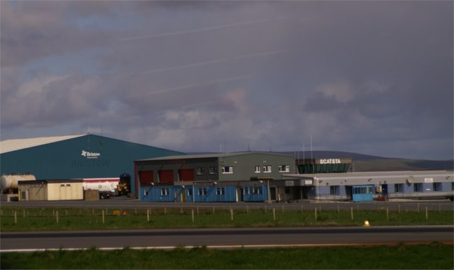
Scatsta Airport

Scatsta Airport (IATA: SCS, ICAO: EGPM), was a commercial airport on the island of Mainland, Shetland in Scotland located 17 nautical miles (31 km; 20...

North Mainland

The North Mainland of the Shetland Islands, Scotland is the part of the Mainland lying north of Voe (60° 21′N). == Geography == Notable places in North...

Sullom

Sullom is a village on the Shetland peninsula of Northmavine, between Haggrister and Bardister. It lies on the northwest side of Sullom Voe, to which it...

Linga, Busta Voe

Linga is a small, uninhabited island, 1 km (0.62 mi) east of Muckle Roe in the Shetland Islands. The island is roughly circular in shape and its highest...

Have you been to Douna Dale?

Leave your review of Douna Dale below (or comments, questions and feedback).