Radley Bottom

Valley in Berkshire

England

Radley Bottom

North Clapton Lane and Cottages near Winding Wood
North Clapton Credit: Chris Shaw

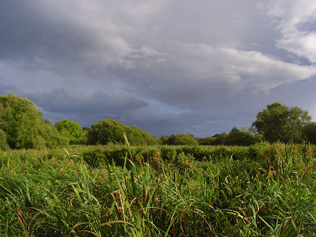
Radley Bottom is a small valley located in Berkshire, England. Situated in the southern part of the county, it is surrounded by lush green countryside and rolling hills, making it a picturesque and idyllic location.

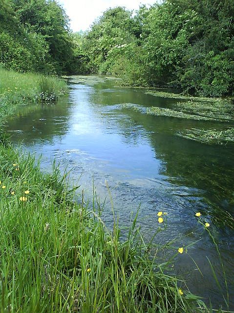
The valley is known for its natural beauty, with meandering streams and abundant wildlife. The area is home to a variety of flora and fauna, including several species of birds, butterflies, and wildflowers. The tranquil atmosphere and scenic views make Radley Bottom a popular destination for nature lovers and hikers.

The valley is also renowned for its historical significance. It is believed to have been inhabited since ancient times, with evidence of human presence dating back to the Neolithic period. Archaeological finds such as pottery shards and tools have been discovered in the area, providing insights into the lives of early settlers.

In addition to its natural and historical attractions, Radley Bottom offers recreational opportunities for visitors. The valley is dotted with walking trails, allowing visitors to explore the stunning landscape at their own pace. There are also picnic areas and benches where visitors can relax and enjoy the peaceful surroundings.

Overall, Radley Bottom, Berkshire is a charming and enchanting valley that offers a harmonious blend of natural beauty, historical significance, and recreational opportunities. Whether it's for a leisurely stroll, a picnic with loved ones, or a deep dive into the region's history, this valley has something to offer for everyone who appreciates the tranquility and charm of the English countryside.

If you have any feedback on the listing, please let us know in the comments section below.

Radley Bottom Images

Images are sourced within 2km of 51.431293/-1.4752304 or Grid Reference SU3670. Thanks to Geograph Open Source API. All images are credited.

North Clapton Lane and Cottages near Winding Wood
North Clapton
Lane and Cottages near Winding Wood
Radley Farm Looking East to West across the square
Radley Farm
Looking East to West across the square
Heath Hanger Copse Viewed from the East
Heath Hanger Copse
Viewed from the East
Hungerford Newtown Church Near the junction with the A338 at the village centre.
Hungerford Newtown Church
Near the junction with the A338 at the village centre.
Hungerford Newtown Farmland Looking NE across farmland
Hungerford Newtown Farmland
Looking NE across farmland
Farmland, Hungerford Newtown The footpath crosses the western end of this field. It's the narrow stripe across the stubble.
Farmland, Hungerford Newtown
The footpath crosses the western end of this field. It's the narrow stripe across the stubble.
Farmland, Hungerford Newtown With Norbin's Wood on the right.
Farmland, Hungerford Newtown
With Norbin's Wood on the right.
Farmland beside Wickfield Copse The trees on the left line Windingwood Lane as it approaches the copse.
Farmland beside Wickfield Copse
The trees on the left line Windingwood Lane as it approaches the copse.
Windingwood Bottom Looking across the top of the shallow valley from the southern end of Wickfield Copse.
Windingwood Bottom
Looking across the top of the shallow valley from the southern end of Wickfield Copse.
Pigs near Hungerford Newtown Pigs forage in the large field to the south of Norbin's Wood and west of Wickfield Copse.
Pigs near Hungerford Newtown
Pigs forage in the large field to the south of Norbin's Wood and west of Wickfield Copse.
Farmland, Hungerford Newtown Beside Dunkin's Copse to the north of Great Hidden Farm. The footpath runs to the right of the fence.
Farmland, Hungerford Newtown
Beside Dunkin's Copse to the north of Great Hidden Farm. The footpath runs to the right of the fence.
Hungerford Newtown A view across the village from the east. It sits in a valley that descends from Lambourn Woodlands to the Kennet at Kintbury.
Hungerford Newtown
A view across the village from the east. It sits in a valley that descends from Lambourn Woodlands to the Kennet at Kintbury.
Farmland and cottages, Clapton The cottages are just east of the road junction at the northern end of the hamlet. The field contains stubble.
Farmland and cottages, Clapton
The cottages are just east of the road junction at the northern end of the hamlet. The field contains stubble.
Footpath to Radley Farm The footpath passing alongside the edge of a copse shortly after having left the road from Clapton.
Footpath to Radley Farm
The footpath passing alongside the edge of a copse shortly after having left the road from Clapton.
Stibbs Wood, Radley The deciduous woodland is crossed by the public footpath west of Radley Farm. This is the view to the north. To the south are pheasant pens.
Stibbs Wood, Radley
The deciduous woodland is crossed by the public footpath west of Radley Farm. This is the view to the north. To the south are pheasant pens.
The Tally Ho and the A338, Hungerford Newtown A Wadworths pub at the village's crossroads.
The Tally Ho and the A338, Hungerford Newtown
A Wadworths pub at the village's crossroads.
St Mary, Hungerford Newtown Built in 1869.
St Mary, Hungerford Newtown
Built in 1869.
Field of sheep, south-east of Hungerford Newtown The sheep are grazing peacefully in the complete absence of any disturbance from intercontinental aircraft since UK airspace is effectively closed following the emission of vast amounts of ash from the Eyjafjallajökull volcano in Iceland a few days earlier. Not that there would be much disturbance anyway since such aircraft would be at about 30,000 feet hereabouts. It does mean that there are no condensation trails.
Field of sheep, south-east of Hungerford Newtown
The sheep are grazing peacefully in the complete absence of any disturbance from intercontinental aircraft since UK airspace is effectively closed following the emission of vast amounts of ash from the Eyjafjallajökull volcano in Iceland a few days earlier. Not that there would be much disturbance anyway since such aircraft would be at about 30,000 feet hereabouts. It does mean that there are no condensation trails.
Show me another place!

Radley Bottom is located at Grid Ref: SU3670 (Lat: 51.431293, Lng: -1.4752304)

Unitary Authority: West Berkshire

Police Authority: Thames Valley

What 3 Words

///panning.shifters.opposites. Near Hungerford, Berkshire

Related Wikis

Upper Denford

Upper Denford is a hamlet in Berkshire, England, and part of the civil parish of Kintbury. The settlement lies north of the A4 road, and is located approximately...

Denford Park

Denford Park is a country house and surrounding estate in the English county of Berkshire, within the civil parish of Kintbury. The estate lies near to...

Kennet and Lambourn Floodplain

Kennet and Lambourn Floodplain is a 23.4-hectare (58-acre) biological Site of Special Scientific Interest in six widely separated areas in the floodplains...

Winding Wood, Berkshire

Winding Wood is a hamlet and a wood in the West Berkshire district, in the English county of Berkshire. It is south of the M4 motorway and north of the...

Hungerford police murders

On 11 December 1876, Inspector Joseph Drewitt and PC Thomas Shorter were murdered near Hungerford in Berkshire, United Kingdom. The officers were in the...
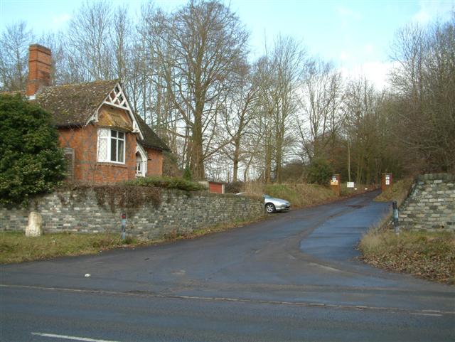
Lower Denford

Lower Denford is a hamlet in the civil parish of Kintbury in the English county of Berkshire. The settlement lies adjacent to the A4 road, and is located...
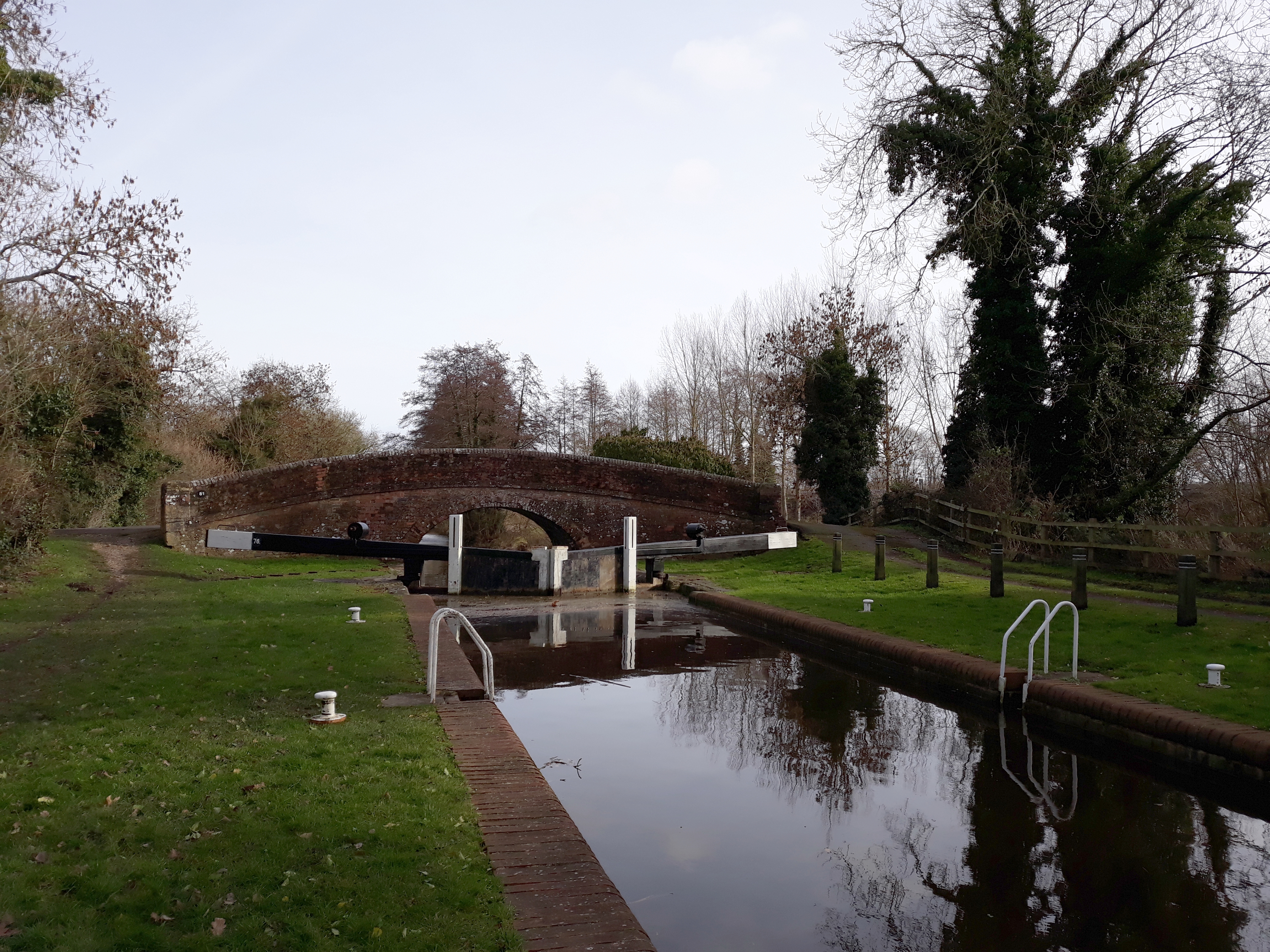
Wire Lock

Wire Lock is a lock on the Kennet and Avon Canal, near Hungerford, Berkshire, England. It is a grade II listed building. == References == == See also... ==

River Dun (River Kennet)

The River Dun (historically known as Bedwyn Brook) is a tributary of the River Kennet, flowing through Wiltshire and Berkshire in England. Its main source...

Have you been to Radley Bottom?

Leave your review of Radley Bottom below (or comments, questions and feedback).