Cockcrow Bottom

Valley in Berkshire Vale of White Horse

England

Cockcrow Bottom

East Garston Down From the RUPP/bridleway junction, far north of the grid-square.
East Garston Down Credit: Andrew Smith

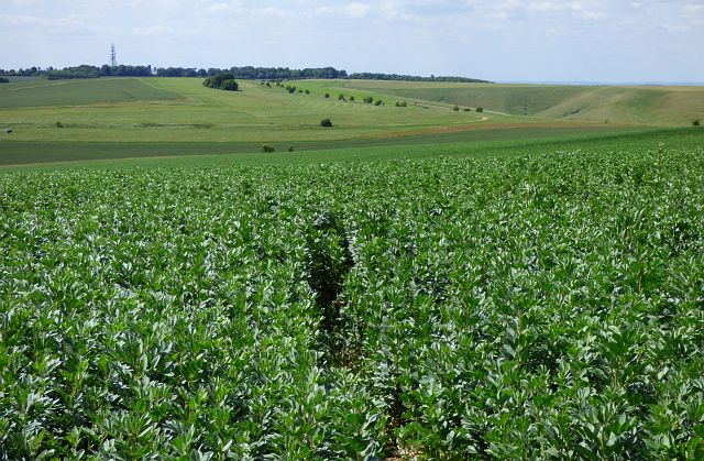
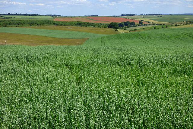
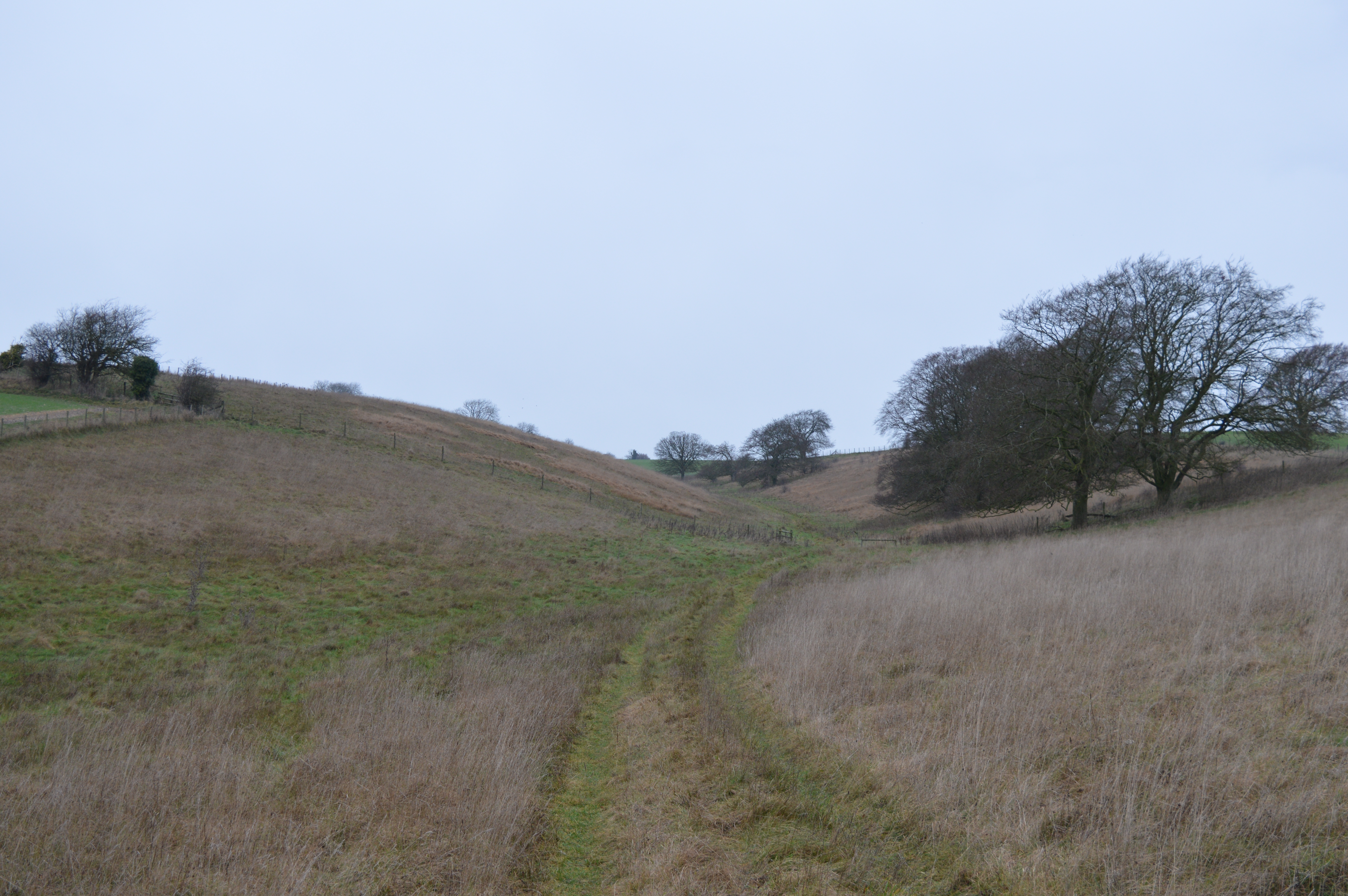
Cockcrow Bottom is a picturesque valley located in the county of Berkshire, England. Nestled within the rolling hills of the Berkshire Downs, this rural area is renowned for its natural beauty and tranquil ambiance.

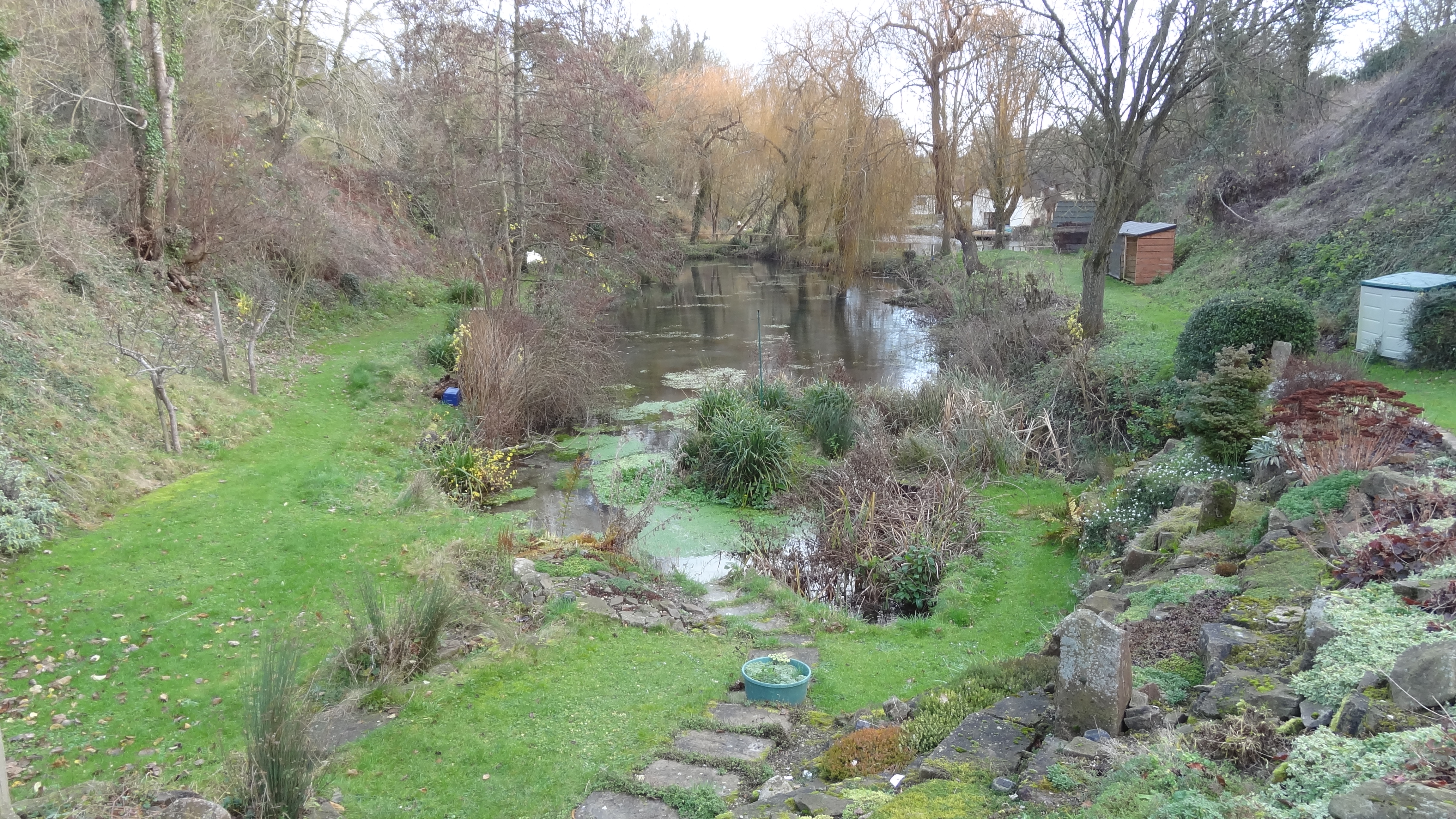
The valley is characterized by its lush green meadows, dotted with clusters of trees and hedgerows, creating a patchwork of colors throughout the seasons. The Cockcrow Brook meanders through the valley, adding to its charm and providing a habitat for a diverse range of wildlife.

Cockcrow Bottom is a popular destination for nature lovers and outdoor enthusiasts. The valley offers numerous walking trails that wind through its scenic landscapes, allowing visitors to immerse themselves in the peaceful surroundings. These trails provide breathtaking views of the surrounding countryside, including the nearby White Horse Hill and Uffington Castle.

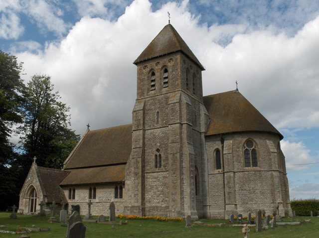
The area is also rich in history, with evidence of human habitation dating back to prehistoric times. Archaeological finds, such as ancient burial mounds and earthworks, give insights into the valley's past and add to its cultural significance.

Despite its rural setting, Cockcrow Bottom is not far from the bustling towns of Wantage and Faringdon, offering convenient access to amenities and services. The valley is a hidden gem, providing a serene escape from the hustle and bustle of modern life while offering a glimpse into the rich natural and historical heritage of Berkshire.

If you have any feedback on the listing, please let us know in the comments section below.

Cockcrow Bottom Images

Images are sourced within 2km of 51.534413/-1.4781838 or Grid Reference SU3681. Thanks to Geograph Open Source API. All images are credited.

East Garston Down From the RUPP/bridleway junction, far north of the grid-square.
East Garston Down
From the RUPP/bridleway junction, far north of the grid-square.
Dew Pond in the Valley This small pond retains water in the bottom of a dry chalk valley.
Dew Pond in the Valley
This small pond retains water in the bottom of a dry chalk valley.
Downland Farming Scenery at Warren Farm This land is part of Sheepdrove Organic Farm. Typical chalk downs scenery, big open fields with not much shelter.
Downland Farming Scenery at Warren Farm
This land is part of Sheepdrove Organic Farm. Typical chalk downs scenery, big open fields with not much shelter.
Ornamental Garden, Warren Farm This is all now part of Sheepdrove Organic Farm visitor centre. The organic farm business operates on a large tract of the surrounding downland, but at the farm buildings a lot of money has been spent on making a smart visitor centre with meeting rooms, lecture halls, restaurant, gardens and play areas.
The words on the column say "The nature of God is a circle of which the Centre is Everywhere and the Circumference is Nowhere."
Well, there's something to think about...
Ornamental Garden, Warren Farm
This is all now part of Sheepdrove Organic Farm visitor centre. The organic farm business operates on a large tract of the surrounding downland, but at the farm buildings a lot of money has been spent on making a smart visitor centre with meeting rooms, lecture halls, restaurant, gardens and play areas. The words on the column say "The nature of God is a circle of which the Centre is Everywhere and the Circumference is Nowhere." Well, there's something to think about...
Tractor Rides at Sheepdrove Farm Sheepdrove Farm is a large organic farm enterprise on the Downs.
Today they were having an open day, and doing tractor rides around the estate.
Tractor Rides at Sheepdrove Farm
Sheepdrove Farm is a large organic farm enterprise on the Downs. Today they were having an open day, and doing tractor rides around the estate.
Tractors at Sheepdrove Farm This is outside the visitor centre at Sheepdrove Farm, a large organic farming business. They were having an open day today and amongst other things had these vintage tractors on display.
Tractors at Sheepdrove Farm
This is outside the visitor centre at Sheepdrove Farm, a large organic farming business. They were having an open day today and amongst other things had these vintage tractors on display.
Farm Road on Warren Down This is a private road to Sheepdrove Farm. It's in good condition all the way and would no doubt be a handy short cut for traffic if it wasn't controlled by bollards at either end.
Farm Road on Warren Down
This is a private road to Sheepdrove Farm. It's in good condition all the way and would no doubt be a handy short cut for traffic if it wasn't controlled by bollards at either end.
Trees in a Field On their own in the middle of a crop. Probably on an old hedge line.
Trees in a Field
On their own in the middle of a crop. Probably on an old hedge line.
Patched up barn, Eastbury Grange A bit worse for wear but still carrying on, like so many farm buildings.
Patched up barn, Eastbury Grange
A bit worse for wear but still carrying on, like so many farm buildings.
Old Log Seat, Eastbury Grange Rotted a bit since this one from eight years ago. <a href="https://www.geograph.org.uk/photo/2206253">SU3580 : Byway Junction</a>
Old Log Seat, Eastbury Grange
Rotted a bit since this one from eight years ago. SU3580 : Byway Junction
Restricted Byway (with restrictions) The Downs have tracks and paths all over the place, with varying rights of access, footpaths, bridleways and restricted byways, which is what is seen here. An ongoing problem for farmers is the use of these routes by vehicles which have no right to be there., 
The restricted byway status is one that off road enthusiasts frequently claim to misunderstand. These routes are open to walkers, horses and bicycles, but only to vehicles by permission.
The farm here has obviously found it necessary to install these bollards on a byway over their land.
For more on all this, including BOATs and RUPPs, see 
<span class="nowrap"><a title="http://naturenet.net/row/rowdefinitions.html" rel="nofollow ugc noopener" href="http://naturenet.net/row/rowdefinitions.html">Link</a><img style="margin-left:2px;" alt="External link" title="External link - shift click to open in new window" src="https://s1.geograph.org.uk/img/external.png" width="10" height="10"/></span>
Restricted Byway (with restrictions)
The Downs have tracks and paths all over the place, with varying rights of access, footpaths, bridleways and restricted byways, which is what is seen here. An ongoing problem for farmers is the use of these routes by vehicles which have no right to be there., The restricted byway status is one that off road enthusiasts frequently claim to misunderstand. These routes are open to walkers, horses and bicycles, but only to vehicles by permission. The farm here has obviously found it necessary to install these bollards on a byway over their land. For more on all this, including BOATs and RUPPs, see LinkExternal link
Farmland, Letcombe Bassett A crop of beans with the mast at Sparsholt Firs on the skyline.
Farmland, Letcombe Bassett
A crop of beans with the mast at Sparsholt Firs on the skyline.
Farmland, Fawley Looking up over a large field of cut grass from the footpath to the north of Old Warren.
Farmland, Fawley
Looking up over a large field of cut grass from the footpath to the north of Old Warren.
Farmland, East Garston A footpath descending through rye to the south of Old Warren.
Farmland, East Garston
A footpath descending through rye to the south of Old Warren.
Farmland, Letcombe Regis Acres of wheat on the rolling landscape of the dip slope of the Berkshire Downs.
Farmland, Letcombe Regis
Acres of wheat on the rolling landscape of the dip slope of the Berkshire Downs.
Track and farmland, Letcombe Bassett A crop of wheat beside a restricted byway approaching woodland to the south of Cockleberry Farm.
Track and farmland, Letcombe Bassett
A crop of wheat beside a restricted byway approaching woodland to the south of Cockleberry Farm.
Farmland, Letcombe Bassett A crop of wheat to the north of Stancombe Farm.
Farmland, Letcombe Bassett
A crop of wheat to the north of Stancombe Farm.
Farmland, Lambourn A crop of oats descending from the byway on Bockhampton Down.
Farmland, Lambourn
A crop of oats descending from the byway on Bockhampton Down.
Show me another place!

Cockcrow Bottom is located at Grid Ref: SU3681 (Lat: 51.534413, Lng: -1.4781838)

Administrative County: Oxfordshire

District: Vale of White Horse

Police Authority: Thames Valley

What 3 Words

///backpacks.truly.overhear. Near Lambourn, Berkshire

Related Wikis

Sheepdrove Organic Farm

Sheepdrove Organic Farm is a farm near Lambourn, West Berkshire, England. The farm gained a public profile when Juliet and Peter Kindersley took the UK...

Hackpen, Warren & Gramp's Hill Downs

Hackpen, Warren & Gramp's Hill Downs is a 71.4-hectare (176-acre) biological Site of Special Scientific Interest in Letcombe Bassett in Oxfordshire.The...

Highlands Farm Pit

Highlands Farm Pit is a 0.6-hectare (1.5-acre) geological Site of Special Scientific Interest in Henley-on-Thames in Oxfordshire. It is a Geological Conservation...

Seven Barrows

Seven Barrows is a Bronze Age bowl barrow cemetery, 4-hectare (9.9-acre) of which are designated a biological Site of Special Scientific Interest, at Upper...

Letcombe Bassett

Letcombe Bassett is a village and civil parish about 2 miles (3 km) southwest of the market town of Wantage in the Vale of White Horse. It was part of...

Segsbury Camp

Segsbury Camp or Segsbury Castle is an Iron Age hillfort on the crest of the Berkshire Downs, near the Ridgeway above Wantage, in the Vale of White Horse...

Fawley, Berkshire

Fawley is a village and civil parish in West Berkshire, England. The hub of the village is centred 3.5 miles (5.6 km) east of Lambourn and has a sub-community...

Croker's Hole

Croker's Hole is a 4.4-hectare (11-acre) biological Site of Special Scientific Interest north of Upper Lambourn in Berkshire.The site is a narrow grassland...

Nearby Amenities

Located within 500m of 51.534413,-1.4781838
Events Venue
Sheepdrove Organic Farm
Lat/Long: 51.5338171/-1.4849735
The data included in this document is from www.openstreetmap.org. The data is made available under ODbL.

Have you been to Cockcrow Bottom?

Leave your review of Cockcrow Bottom below (or comments, questions and feedback).