Cassop Vale

Valley in Durham

England

Cassop Vale

Ice, mud and ruts at field entrance Fields north-west of the small village at Quarrington Hill accessed from a gate on minor road.
Ice, mud and ruts at field entrance Credit: Trevor Littlewood

Cassop Vale, located in County Durham, England, is a picturesque valley renowned for its natural beauty and historical significance. Nestled between the villages of Cassop and Haswell Plough, this tranquil valley is a haven for nature enthusiasts and history buffs alike.

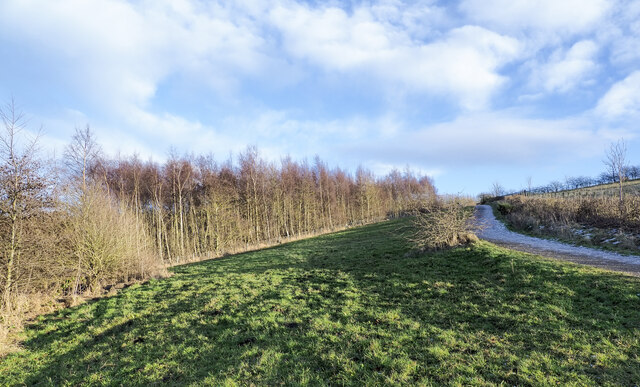
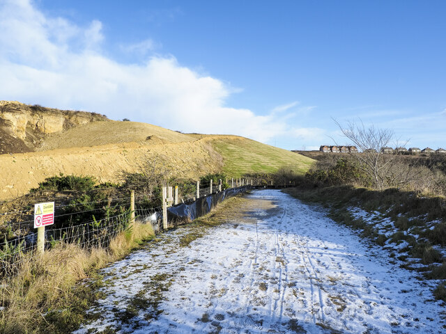
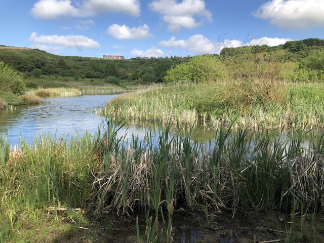
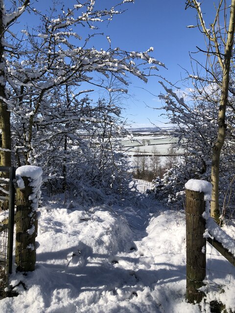
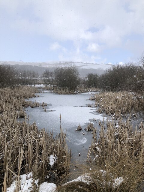
The valley is characterized by its lush greenery, rolling hills, and meandering streams, creating a captivating landscape that attracts visitors throughout the year. Walking trails wind through the valley, offering breathtaking views of the surrounding countryside and providing the perfect opportunity to spot local wildlife, such as rabbits, foxes, and a variety of bird species.

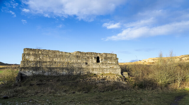
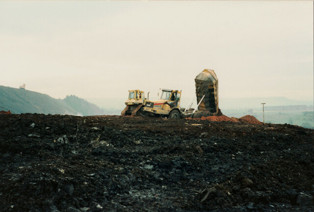
Cassop Vale also holds historical importance, with evidence of human settlement dating back to the Bronze Age. The remains of a Roman fort can be found in the valley, emphasizing its significance as a strategic location in ancient times. Additionally, remnants of the industrial revolution can be seen in the form of former coal mining sites, which played a crucial role in Durham's industrial past.

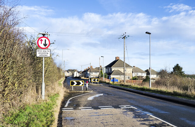
The valley offers various recreational activities, including picnicking, hiking, and birdwatching. Visitors can explore the nearby Cassop and Haswell Plough villages, which boast charming architecture and traditional pubs. The valley's proximity to the city of Durham also allows for easy access to cultural attractions, such as Durham Cathedral and Durham Castle.

Overall, Cassop Vale is a captivating destination that seamlessly blends natural beauty with rich history. Whether it's exploring its scenic trails, immersing oneself in its historical significance, or simply enjoying the tranquility of the countryside, Cassop Vale offers a memorable experience for all who visit.

If you have any feedback on the listing, please let us know in the comments section below.
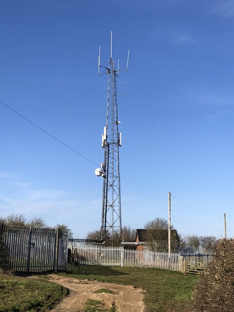
Cassop Vale Images

Images are sourced within 2km of 54.742614/-1.4832935 or Grid Reference NZ3338. Thanks to Geograph Open Source API. All images are credited.

Ice, mud and ruts at field entrance Fields north-west of the small village at Quarrington Hill accessed from a gate on minor road.
Ice, mud and ruts at field entrance
Fields north-west of the small village at Quarrington Hill accessed from a gate on minor road.
Grassy slope rising to birch woodland The grass, trees and the road all appear to be within the Crow Trees Nature Reserve, close to the village of Quarrington Hill. The reserve is important for its  magnesian limestone grassland.
The surrounding area has been extensively quarried and mined in the past and extraction continues at Tarmac's Quarrington Quarry to the north of the reserve.
Grassy slope rising to birch woodland
The grass, trees and the road all appear to be within the Crow Trees Nature Reserve, close to the village of Quarrington Hill. The reserve is important for its magnesian limestone grassland. The surrounding area has been extensively quarried and mined in the past and extraction continues at Tarmac's Quarrington Quarry to the north of the reserve.
Unmade road east of Old Quarrington The tarmacked road reaching Old Quarrington ends there as a public road but continues as an unmade one to the east of the village where it joins another road. OS mapping differs according to its age and source in how access along the routes applies. Some maps including paper ones in the possession of the photographer show the upper road as a bridleway continuing to Quarrington Hill. Others show the bridleway ending east of Quarrington Farm.
The County Durham definitive map, (January 2022), now shows the lower, southern road to be the route of the bridleway and that must be considered to be the actual current situation. The explanation is that the upper, northern road is now in use by Tarmac as a quarry access road and is a private way.
Part of Tarmac's Quarrington Quarry can be seen in the image.
Unmade road east of Old Quarrington
The tarmacked road reaching Old Quarrington ends there as a public road but continues as an unmade one to the east of the village where it joins another road. OS mapping differs according to its age and source in how access along the routes applies. Some maps including paper ones in the possession of the photographer show the upper road as a bridleway continuing to Quarrington Hill. Others show the bridleway ending east of Quarrington Farm. The County Durham definitive map, (January 2022), now shows the lower, southern road to be the route of the bridleway and that must be considered to be the actual current situation. The explanation is that the upper, northern road is now in use by Tarmac as a quarry access road and is a private way. Part of Tarmac's Quarrington Quarry can be seen in the image.
Bridleway heading towards Quarrington Hill The bridleway, presumably an old industrial / mining route, connects Old Quarrington with Quarrington Hill. The route is in use a s a bridleway which has replaced another bridleway route running above to the left. That is now a private road used for quarry access by the Tarmac company.
OS mapping has not, (January 2022), caught up with the changed route situation; an explanation is given here: <a title="https://www.geograph.org.uk/photo/7063932" href="https://www.geograph.org.uk/photo/7063932">Link</a> .
Bridleway heading towards Quarrington Hill
The bridleway, presumably an old industrial / mining route, connects Old Quarrington with Quarrington Hill. The route is in use a s a bridleway which has replaced another bridleway route running above to the left. That is now a private road used for quarry access by the Tarmac company. OS mapping has not, (January 2022), caught up with the changed route situation; an explanation is given here: Link .
Industrial ruin in Crow Trees Nature Reserve This might be the remains of an engine house mentioned in the County Durham leaflet about the Crow Trees Reserve but it's made largely from coarse concrete and the document talks of, "using stonework".
Whatever the case, it's clearly an old industrial feature, presumably from coal mining or earlier quarrying operations. Quarrying still goes on nearby; distantly, to the right of the ruin, there's an active quarry in view.
Industrial ruin in Crow Trees Nature Reserve
This might be the remains of an engine house mentioned in the County Durham leaflet about the Crow Trees Reserve but it's made largely from coarse concrete and the document talks of, "using stonework". Whatever the case, it's clearly an old industrial feature, presumably from coal mining or earlier quarrying operations. Quarrying still goes on nearby; distantly, to the right of the ruin, there's an active quarry in view.
Traffic calming measures at Quarrington Hill The B6291 approaching Quarrington Hill from the south-west where there's a chicane and a priority arrangement for traffic entering and leaving the village.
Traffic calming measures at Quarrington Hill
The B6291 approaching Quarrington Hill from the south-west where there's a chicane and a priority arrangement for traffic entering and leaving the village.
Mast On Beacon Hill
Mast On Beacon Hill
Ponds at Crowtrees Local Nature Reserve On the site of a former colliery, closed late 19th century, that supplied coal to local iron works at Cornforth.
Ponds at Crowtrees Local Nature Reserve
On the site of a former colliery, closed late 19th century, that supplied coal to local iron works at Cornforth.
East Hetton Colliery Land Reclamation, Co. Durham A construction progress photograph taken of the land reclamation works during November 1990.
Shale is being transported and deposited by articulated dump truck and spread by dozer during fill operations to remodel the contours of the former pit heap at East Hetton Colliery.
An excavator can be seen on the top of the pit heap excavating and loading shale into the dump trucks.
<a href="https://www.geograph.org.uk/photo/7340306">NZ3436 : East Hetton Colliery Land Reclamation, Co. Durham</a>
<a href="https://www.geograph.org.uk/photo/7338657">NZ3536 : East Hetton Colliery Land Reclamation, Co. Durham</a>
East Hetton Colliery Land Reclamation, Co. Durham
A construction progress photograph taken of the land reclamation works during November 1990. Shale is being transported and deposited by articulated dump truck and spread by dozer during fill operations to remodel the contours of the former pit heap at East Hetton Colliery. An excavator can be seen on the top of the pit heap excavating and loading shale into the dump trucks. NZ3436 : East Hetton Colliery Land Reclamation, Co. Durham NZ3536 : East Hetton Colliery Land Reclamation, Co. Durham
Snow covered footpath at Crowtrees nature Reserve
Snow shower at Crowtrees ponds
Quarrington Hill from Little Wood nature reserve Former mining/pit workings turned into woodland and nature reserves.
Quarrington Hill from Little Wood nature reserve
Former mining/pit workings turned into woodland and nature reserves.
Hawthorn hedge with berries A mass of red berries meant there was plenty of bird life including Fieldfares, Redwing, Chaffinch and Bull finches.
Hawthorn hedge with berries
A mass of red berries meant there was plenty of bird life including Fieldfares, Redwing, Chaffinch and Bull finches.
Concrete lined drain A concrete lined drain which possibly harks back to the area's industrial past.
Concrete lined drain
A concrete lined drain which possibly harks back to the area's industrial past.
Public footpath south of Cassop The public footpath running south from Cassop toward Kelloe Hall. Just visible in the background is a wind turbine situated on Southern Law wind farm.
Public footpath south of Cassop
The public footpath running south from Cassop toward Kelloe Hall. Just visible in the background is a wind turbine situated on Southern Law wind farm.
Combined footpath and cyclewyay at Cassop
Disused Quarry At Running Waters
Hedge bounding north side of field The field lies to the east of the Three Horseshoes hotel; on the other side of the hedge is the A181. The name Running Waters appears on OS maps; there's no other building in the area and it's assumed that the name refers to the location and is not an earlier name of the hotel.
Durham County Council  has a 'weather station camera' there, updated every 10 minutes.
Hedge bounding north side of field
The field lies to the east of the Three Horseshoes hotel; on the other side of the hedge is the A181. The name Running Waters appears on OS maps; there's no other building in the area and it's assumed that the name refers to the location and is not an earlier name of the hotel. Durham County Council has a 'weather station camera' there, updated every 10 minutes.
Show me another place!

Cassop Vale is located at Grid Ref: NZ3338 (Lat: 54.742614, Lng: -1.4832935)

Unitary Authority: County Durham

Police Authority: Durham

What 3 Words

///froth.magical.conveying. Near Bowburn, Co. Durham

Nearby Locations

Cassop Vale

Related Wikis

Cassop Vale

Cassop Vale is a Site of Special Scientific Interest in the Durham City district of County Durham, England. It lies between the villages of Bowburn and...

Cassop-cum-Quarrington

Cassop-cum-Quarrington is a civil parish in County Durham, England. According to the 2001 census it had a population of 4,735, increasing to 5,219 at...

Old Cassop

Old Cassop is a hamlet in County Durham, in England. It is situated a few miles to the south-east of Durham. Old Cassop lies within the Cassop-cum-Quarrington...

Cassop

Cassop (formerly New Cassop) is a village and former civil parish, now in the parish of Cassop-cum-Quarrington, in the County Durham district, in the ceremonial...

Nearby Amenities

Located within 500m of 54.742614,-1.4832935
Building: yes
Lat/Long: 54.738204/-1.4833779
Barrier: stile
Ele: 117.17
Lat/Long: 54.7453395/-1.4847914
Barrier: stile
Ele: 124.62
Lat/Long: 54.7429587/-1.4795324
Barrier: stile
Foot: yes
Stile: stepover
Lat/Long: 54.7419184/-1.4764746
Bench
Ele: 126.54
Lat/Long: 54.7420169/-1.4765038
Barrier: stile
Ele: 150.09
Lat/Long: 54.7435007/-1.4766964
Cassop Vale Colliery
Historic: archaeological_site
Source: Historic OS mapping
Lat/Long: 54.744941/-1.4858902
The data included in this document is from www.openstreetmap.org. The data is made available under ODbL.

Have you been to Cassop Vale?

Leave your review of Cassop Vale below (or comments, questions and feedback).