Smirna Dale

Valley in Shetland

Scotland

Smirna Dale

Gunnister Voe
Gunnister Voe Credit: David Purchase

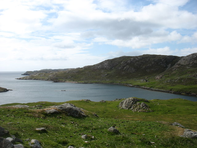
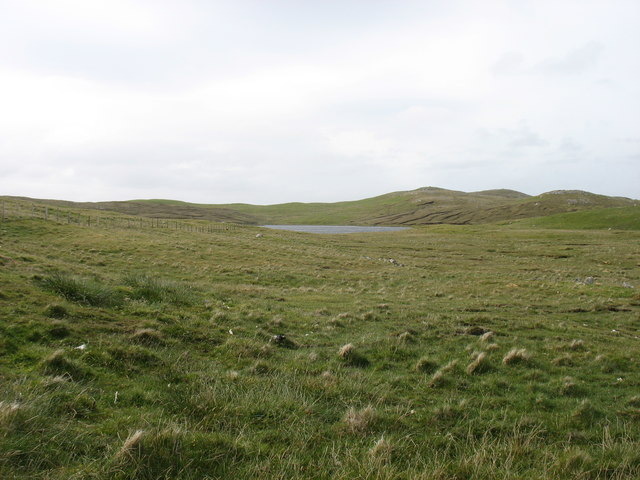
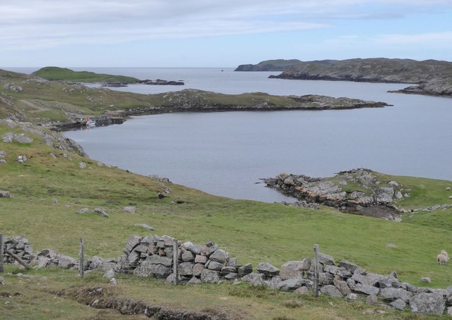
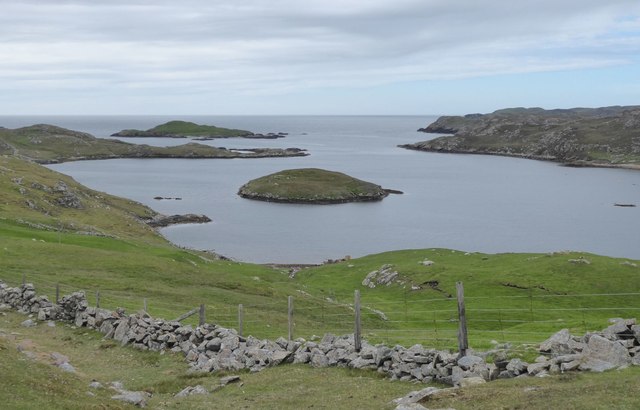
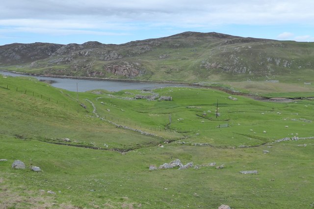
Smirna Dale, located in the Shetland Islands, is a picturesque valley surrounded by rolling hills and stunning natural beauty. Situated in the northernmost part of Scotland, these islands are known for their rugged landscapes and unique wildlife. Smirna Dale is no exception, offering visitors a tranquil and idyllic escape from the hustle and bustle of everyday life.

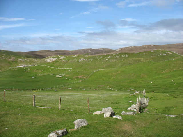
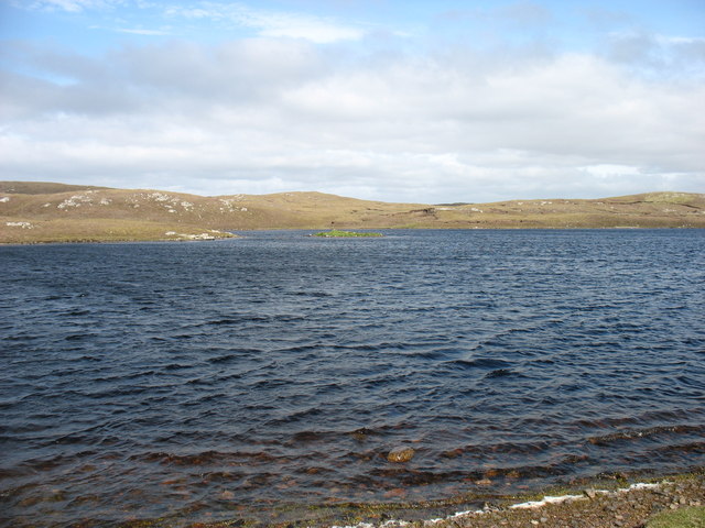
The valley is characterized by its lush green meadows, dotted with colorful wildflowers during the summer months. It is flanked by towering cliffs and cascading waterfalls, which add to its dramatic appeal. The crystal-clear streams that meander through the valley provide a haven for various species of fish and create a soothing ambiance.

Smirna Dale is home to a diverse range of flora and fauna, including numerous bird species, such as puffins and guillemots, which nest in the cliffs. The valley also supports a variety of plant life, including heather, mosses, and lichens, which thrive in the cool, damp climate of the Shetland Islands.

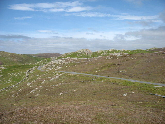
The valley offers ample opportunities for outdoor activities, such as hiking, birdwatching, and fishing. Visitors can explore the numerous walking trails that wind through the valley and ascend the surrounding hills for breathtaking panoramic views of the surrounding landscape. The valley's tranquil atmosphere makes it an ideal spot for picnicking or simply immersing oneself in the peace and serenity of nature.

In summary, Smirna Dale in Shetland is a stunning valley that encapsulates the natural beauty and tranquility of the Scottish islands. Its picturesque landscapes, diverse wildlife, and abundance of outdoor activities make it a must-visit destination for nature enthusiasts and those seeking a peaceful retreat.

If you have any feedback on the listing, please let us know in the comments section below.

Smirna Dale Images

Images are sourced within 2km of 60.45613/-1.4050155 or Grid Reference HU3274. Thanks to Geograph Open Source API. All images are credited.

Gunnister Voe
Gunnister Voe
The lane from Nibon One of many minor cul-de-sacs branching off from the A970, the main road running north/south along the spine of Shetland Mainland.
The lane from Nibon
One of many minor cul-de-sacs branching off from the A970, the main road running north/south along the spine of Shetland Mainland.
Country at Gunnister
Trolladale Water One of many sizable lochs in this part of Shetland Mainland.
Trolladale Water
One of many sizable lochs in this part of Shetland Mainland.
"Gunnister Man's Grave" For an explanation, see <a href="https://www.geograph.org.uk/photo/5024770">HU3273 : "Gunnister Man's Grave" - notice</a>.
"Gunnister Man's Grave"
"Gunnister Man's Grave" - notice For a photo of the grave, see <a href="https://www.geograph.org.uk/photo/5024763">HU3273 : "Gunnister Man's Grave"</a>.
"Gunnister Man's Grave" - notice
For a photo of the grave, see HU3273 : "Gunnister Man's Grave".
Glussdale Water The A970 runs beside the opposite (east) bank.
Glussdale Water
The A970 runs beside the opposite (east) bank.
Stubba Water, and its surrounding low hills
The north tip of Punds Water
Punds Water One of the larger lochs in this part of Shetland.
Punds Water
One of the larger lochs in this part of Shetland.
The A970 heading for Brae Passing Smirnadale Water on the right.
The A970 heading for Brae
Passing Smirnadale Water on the right.
Standing stone, overlooking the Loch of Burraland
Punds Water View from the lay-by at Punds Water
Punds Water
View from the lay-by at Punds Water
Loch of Burraland Sullum Voe oil terminal can be seen in the background.
Loch of Burraland
Sullum Voe oil terminal can be seen in the background.
Field at Snowbuil On Gunnister Voe.
Field at Snowbuil
On Gunnister Voe.
Looking down Gunnister Voe Holm of Gunnister in the centre.
Looking down Gunnister Voe
Holm of Gunnister in the centre.
Gruna A deserted croft at the head of Gunnister Voe.
Gruna
A deserted croft at the head of Gunnister Voe.
Trolladale Water With the 99m hill Lanches Vird beyond it.
Trolladale Water
With the 99m hill Lanches Vird beyond it.
Show me another place!

Smirna Dale is located at Grid Ref: HU3274 (Lat: 60.45613, Lng: -1.4050155)

Unitary Authority: Shetland Islands

Police Authority: Highlands and Islands

What 3 Words

///glider.senses.shrubbery. Near Brae, Shetland Islands

Related Wikis

Punds Water

Punds Water is a freshwater loch near Mangaster in Northmavine, Shetland. It also gives its name to a nearby Neolithic heel-shaped cairn. == Heel-shaped... ==

Gunnister

Gunnister is a small 'abandoned' village at the North-West Mainland in Shetland, Scotland. It is most commonly known for the Gunnister Man - the remains...

Sullom

Sullom is a village on the Shetland peninsula of Northmavine, between Haggrister and Bardister. It lies on the northwest side of Sullom Voe, to which it...

Eela Water

Eela Water is a freshwater loch (lake) in Northmavine, part of the mainland of Shetland in Scotland. Besides being a freshwater fishing location, the site...

Nearby Amenities

Located within 500m of 60.45613,-1.4050155
Barrier: cattle_grid
Lat/Long: 60.455549/-1.3961116
Power: pole
Lat/Long: 60.4562497/-1.396358
Power: pole
Lat/Long: 60.4566716/-1.3968623
Power: pole
Lat/Long: 60.4573897/-1.3977394
Power: pole
Lat/Long: 60.4579029/-1.3983133
Power: pole
Lat/Long: 60.4583657/-1.3988471
Power: pole
Lat/Long: 60.458904/-1.3994828
Power: pole
Lat/Long: 60.4594515/-1.4000997
Power: pole
Lat/Long: 60.4600267/-1.4007863
Power: pole
Lat/Long: 60.4604841/-1.4042696
Power: pole
Lat/Long: 60.460256/-1.405154
Power: pole
Lat/Long: 60.459989/-1.4061678
Power: pole
Lat/Long: 60.4597432/-1.4070929
Power: pole
Lat/Long: 60.4595151/-1.4079437
Power: pole
Lat/Long: 60.4592528/-1.4089023
Power: pole
Lat/Long: 60.4589503/-1.4101246
Power: pole
Lat/Long: 60.4586112/-1.4114044
Power: pole
Lat/Long: 60.4582638/-1.4124925
The data included in this document is from www.openstreetmap.org. The data is made available under ODbL.

Have you been to Smirna Dale?

Leave your review of Smirna Dale below (or comments, questions and feedback).