Mill Loch of Gunnister

Lake, Pool, Pond, Freshwater Marsh in Shetland

Scotland

Mill Loch of Gunnister

Gunnister Voe
Gunnister Voe Credit: David Purchase

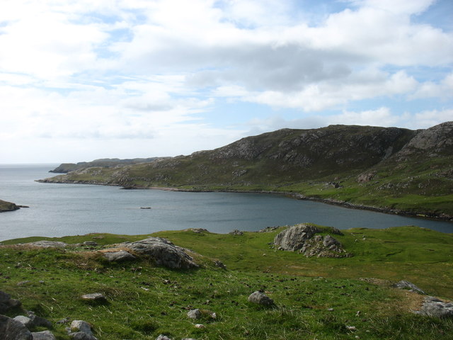
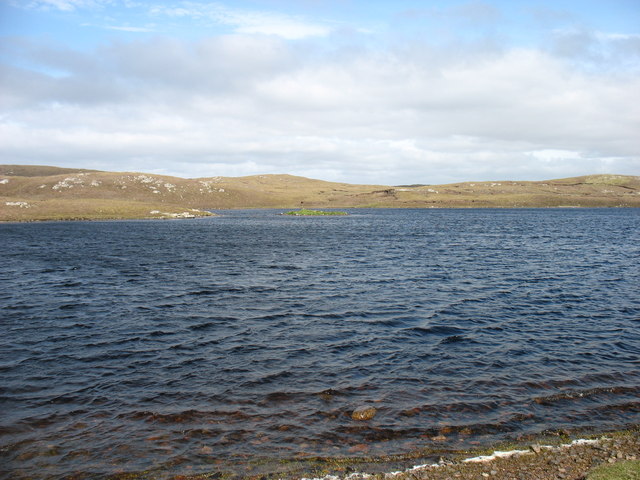
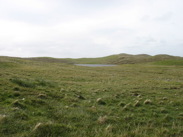
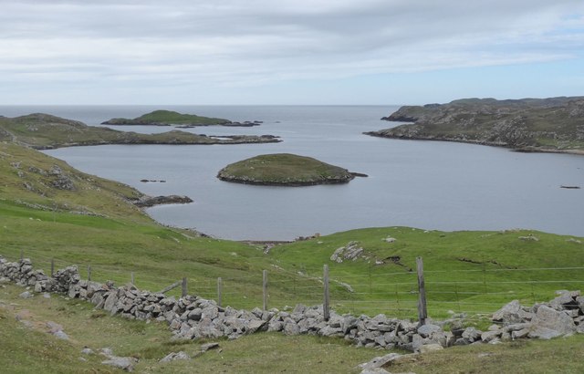
Mill Loch of Gunnister is a picturesque freshwater loch located in the Shetland Islands, Scotland. Situated near the village of Gunnister, the loch covers an area of approximately 10 acres and is surrounded by rolling hills and lush green vegetation.

The loch is fed by a network of small streams and springs, ensuring a constant flow of freshwater. Its crystal-clear waters are home to a diverse range of aquatic flora and fauna, making it a haven for wildlife enthusiasts and nature lovers.

The loch's shoreline is characterized by a mix of rocky outcrops, sandy beaches, and reed beds, creating a diverse habitat for various species. Common plant life found in and around the loch includes water lilies, reeds, and rushes. These provide shelter and nesting grounds for numerous bird species, such as swans, ducks, and herons.

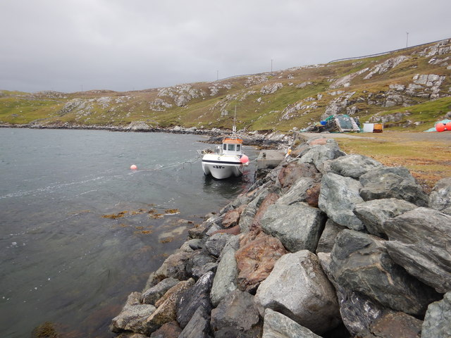
Fishing is a popular activity at Mill Loch of Gunnister, with anglers enjoying the abundance of trout and salmon. The loch also attracts birdwatchers, who come to observe the numerous avian species that reside or visit the area during migration seasons.

Surrounded by stunning natural beauty, Mill Loch of Gunnister offers a peaceful and serene environment for visitors to relax and enjoy the tranquility of nature. Its accessibility and well-maintained paths also make it a popular spot for leisurely walks and picnics.

If you have any feedback on the listing, please let us know in the comments section below.

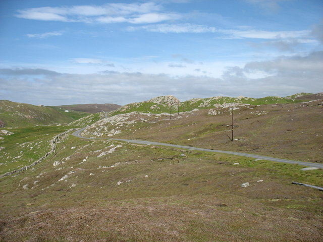
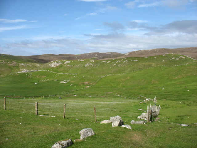
Mill Loch of Gunnister Images

Images are sourced within 2km of 60.454256/-1.4096488 or Grid Reference HU3274. Thanks to Geograph Open Source API. All images are credited.

Gunnister Voe
Gunnister Voe
The lane from Nibon One of many minor cul-de-sacs branching off from the A970, the main road running north/south along the spine of Shetland Mainland.
The lane from Nibon
One of many minor cul-de-sacs branching off from the A970, the main road running north/south along the spine of Shetland Mainland.
Country at Gunnister
Trolladale Water One of many sizable lochs in this part of Shetland Mainland.
Trolladale Water
One of many sizable lochs in this part of Shetland Mainland.
"Gunnister Man's Grave" For an explanation, see <a href="https://www.geograph.org.uk/photo/5024770">HU3273 : "Gunnister Man's Grave" - notice</a>.
"Gunnister Man's Grave"
"Gunnister Man's Grave" - notice For a photo of the grave, see <a href="https://www.geograph.org.uk/photo/5024763">HU3273 : "Gunnister Man's Grave"</a>.
"Gunnister Man's Grave" - notice
For a photo of the grave, see HU3273 : "Gunnister Man's Grave".
Glussdale Water The A970 runs beside the opposite (east) bank.
Glussdale Water
The A970 runs beside the opposite (east) bank.
Stubba Water, and its surrounding low hills
The north tip of Punds Water
Punds Water One of the larger lochs in this part of Shetland.
Punds Water
One of the larger lochs in this part of Shetland.
The A970 heading for Brae Passing Smirnadale Water on the right.
The A970 heading for Brae
Passing Smirnadale Water on the right.
Standing stone, overlooking the Loch of Burraland
Punds Water View from the lay-by at Punds Water
Punds Water
View from the lay-by at Punds Water
Fish farm boat, Gunnista Voe A rather steep and rough track (I'd have attempted it in a Mini in my youth, but rather more circumspect in middle age, high clearance 4-wheel drive seemed a better idea) reaches this small quay on Gunnista Voe, which is occupied by fish farming installations. We were prospecting for a place to put on with sea kayaks, and this seemed a little too awkward, though it was the only place near the water with adequate parking in the vicinity.
Fish farm boat, Gunnista Voe
A rather steep and rough track (I'd have attempted it in a Mini in my youth, but rather more circumspect in middle age, high clearance 4-wheel drive seemed a better idea) reaches this small quay on Gunnista Voe, which is occupied by fish farming installations. We were prospecting for a place to put on with sea kayaks, and this seemed a little too awkward, though it was the only place near the water with adequate parking in the vicinity.
Loch of Burraland Sullum Voe oil terminal can be seen in the background.
Loch of Burraland
Sullum Voe oil terminal can be seen in the background.
Valliers Ness In Gunnister Voe.
Valliers Ness
In Gunnister Voe.
Field at Snowbuil On Gunnister Voe.
Field at Snowbuil
On Gunnister Voe.
Looking down Gunnister Voe Holm of Gunnister in the centre.
Looking down Gunnister Voe
Holm of Gunnister in the centre.
Show me another place!

Mill Loch of Gunnister is located at Grid Ref: HU3274 (Lat: 60.454256, Lng: -1.4096488)

Unitary Authority: Shetland Islands

Police Authority: Highlands and Islands

What 3 Words

///curated.spin.condition. Near Brae, Shetland Islands

Related Wikis

Gunnister

Gunnister is a small 'abandoned' village at the North-West Mainland in Shetland, Scotland. It is most commonly known for the Gunnister Man - the remains...

Punds Water

Punds Water is a freshwater loch near Mangaster in Northmavine, Shetland. It also gives its name to a nearby Neolithic heel-shaped cairn. == Heel-shaped... ==

Sullom

Sullom is a village on the Shetland peninsula of Northmavine, between Haggrister and Bardister. It lies on the northwest side of Sullom Voe, to which it...

Eela Water

Eela Water is a freshwater loch (lake) in Northmavine, part of the mainland of Shetland in Scotland. Besides being a freshwater fishing location, the site...

Nearby Amenities

Located within 500m of 60.454256,-1.4096488
Croogans
Place: hamlet
Lat/Long: 60.4541899/-1.4166697
Power: pole
Lat/Long: 60.4541099/-1.4181462
Power: pole
Lat/Long: 60.4542742/-1.417559
Power: pole
Lat/Long: 60.4586112/-1.4114044
Power: pole
Lat/Long: 60.4582638/-1.4124925
Power: pole
Lat/Long: 60.4579187/-1.4136549
Power: pole
Lat/Long: 60.4576233/-1.4146591
Power: pole
Lat/Long: 60.4572262/-1.4159365
Power: pole
Lat/Long: 60.4567689/-1.4165165
Power: pole
Lat/Long: 60.4562938/-1.4170893
Power: pole
Lat/Long: 60.45584/-1.4176189
Power: pole
Lat/Long: 60.4553792/-1.418175
Power: pole
Lat/Long: 60.4548154/-1.4178538
Power: pole
Lat/Long: 60.4536407/-1.4176333
Power: pole
Lat/Long: 60.4529883/-1.4176908
Power: pole
Lat/Long: 60.4522662/-1.4177747
The data included in this document is from www.openstreetmap.org. The data is made available under ODbL.

Have you been to Mill Loch of Gunnister?

Leave your review of Mill Loch of Gunnister below (or comments, questions and feedback).