Dale Bottom

Valley in Derbyshire Derbyshire Dales

England

Dale Bottom

Stanage Edge Stanage Edge above the path to Hook's Car parking
Stanage Edge Credit: Shaun Ferguson

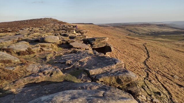
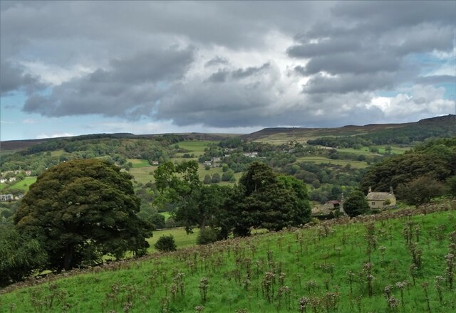
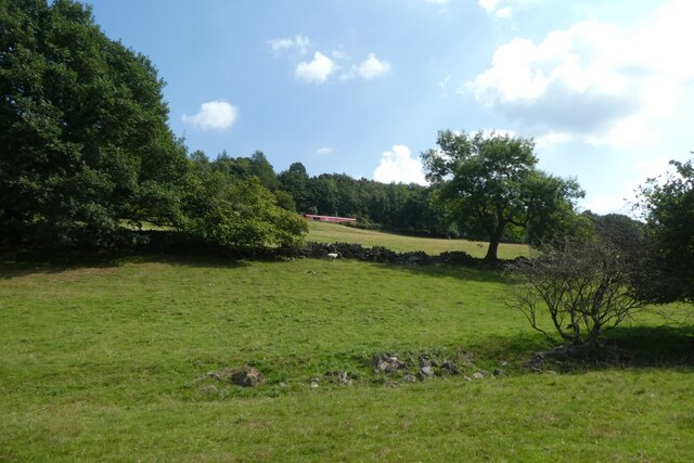
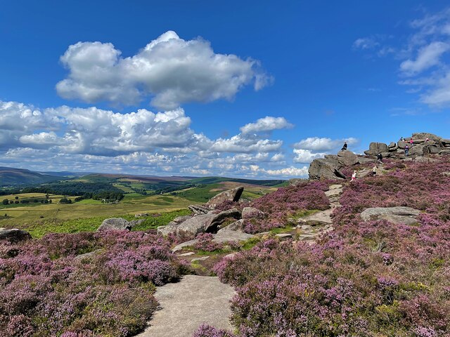
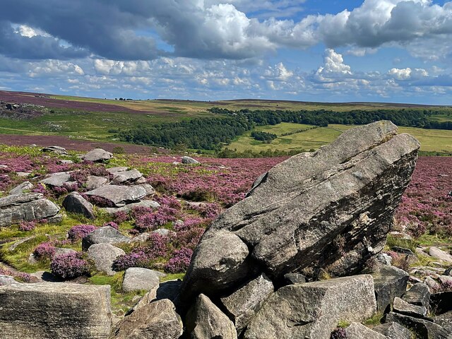
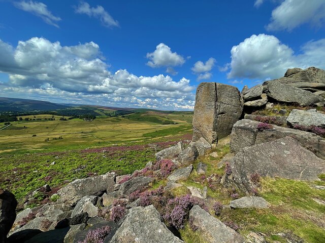
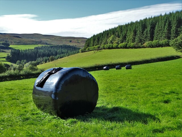
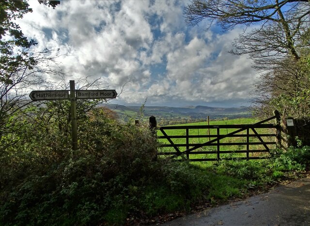
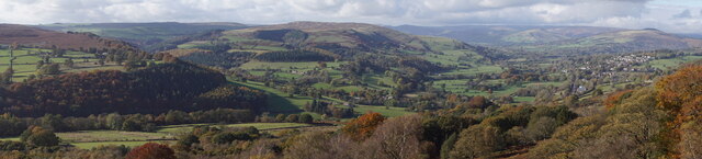
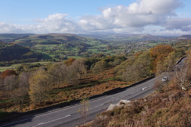
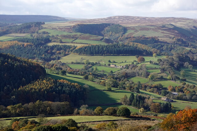
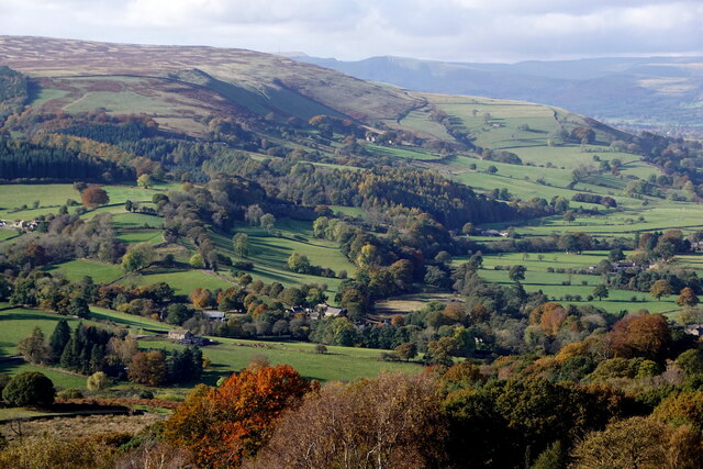
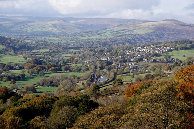
Dale Bottom is a picturesque valley located in the Derbyshire region of England. Situated amidst the rolling hills and lush greenery, it is a haven for nature lovers and outdoor enthusiasts. The valley is known for its scenic beauty, offering breathtaking views of the surrounding countryside.

Nestled along the banks of a meandering river, Dale Bottom boasts an abundance of wildlife and diverse flora. The valley is home to numerous species of birds, making it a popular spot for birdwatching. Visitors can often spot herons gracefully gliding through the air or catch a glimpse of kingfishers darting along the riverbanks.

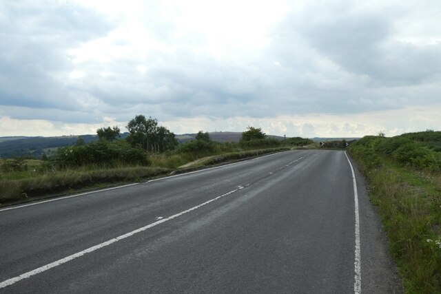
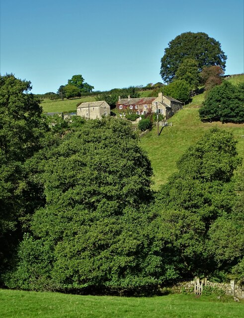
The tranquil atmosphere of Dale Bottom makes it an ideal destination for walking and hiking. There are numerous trails that wind through the valley, taking hikers past charming cottages, ancient woodlands, and idyllic meadows. The valley is also dotted with quaint villages, where visitors can immerse themselves in the local culture and enjoy traditional English hospitality.

One of the valley's notable landmarks is Dale Bottom Manor, a historic country house that dates back to the 18th century. The manor is surrounded by well-manicured gardens and offers a glimpse into the region's rich history.

Overall, Dale Bottom is a hidden gem in Derbyshire, offering a serene and picturesque escape from the hustle and bustle of city life. With its stunning landscapes, abundant wildlife, and charming villages, it is a destination that appeals to nature lovers, hikers, and those seeking a peaceful retreat in the heart of the English countryside.

If you have any feedback on the listing, please let us know in the comments section below.

Dale Bottom Images

Images are sourced within 2km of 53.331663/-1.6410245 or Grid Reference SK2481. Thanks to Geograph Open Source API. All images are credited.

Stanage Edge Stanage Edge above the path to Hook's Car parking
Stanage Edge
Stanage Edge above the path to Hook's Car parking
Hazelford Hall above The Hope Valley
Moss covered and abandoned millstones In Oxhay Wood. It is said that a day arrived in the early twentieth century when the demand for millstones suddenly dried up.
Moss covered and abandoned millstones
In Oxhay Wood. It is said that a day arrived in the early twentieth century when the demand for millstones suddenly dried up.
Abandoned millstones by the track to Bolehill Quarry
Towards the railway A DB class 66 hauls a train towards Grindleford on the Hope Valley Line.
Towards the railway
A DB class 66 hauls a train towards Grindleford on the Hope Valley Line.
Bend beside Surprise View Looking along Sheffield Road which leads to Hathersage.
Bend beside Surprise View
Looking along Sheffield Road which leads to Hathersage.
On Hathersage Moor Looking north west from the footpath below Over Owler Tor
On Hathersage Moor
Looking north west from the footpath below Over Owler Tor
On Hathersage Moor Looking south east from Over Owler Tor
On Hathersage Moor
Looking south east from Over Owler Tor
On Hathersage Moor Looking north west from Over Owler Tor
On Hathersage Moor
Looking north west from Over Owler Tor
Hay bales wrapped in plastic With Birch Low to the right. One wonders how much plastic is used in this way in The British Isles each year. Farmers never used to use it.
Hay bales wrapped in plastic
With Birch Low to the right. One wonders how much plastic is used in this way in The British Isles each year. Farmers never used to use it.
Broadhay Not to be confused with nearby Broadhay Farm
Broadhay
Not to be confused with nearby Broadhay Farm
Pheasant feeder near Broadhay
At the junction of Birley Lane and Coggers Lane Looking towards Hope Cement Works in The Hope Valley.
At the junction of Birley Lane and Coggers Lane
Looking towards Hope Cement Works in The Hope Valley.
Surprise View from Millstone Edge
Leadmill, from Surprise View, Millstone Edge
Derwent Valley from Surprise View, Millstone Edge
Hathersage, from Surprise View, Millstone Edge
Show me another place!

Dale Bottom is located at Grid Ref: SK2481 (Lat: 53.331663, Lng: -1.6410245)

Administrative County: Derbyshire

District: Derbyshire Dales

Police Authority: Derbyshire

What 3 Words

///groups.mend.formless. Near Hathersage, Derbyshire

Nearby Locations

Dale Bottom

Related Wikis

St Michael and All Angels' Church, Hathersage

St Michael and All Angels’ Church, Hathersage, is a Grade I listed parish church in the Church of England in Hathersage, Derbyshire. == History == The...

Hathersage railway station

Hathersage railway station serves the village of Hathersage in the Derbyshire Peak District, in England. == History == The station was opened on 25 June...

Hood Brook

Hood Brook is a stream in the Derbyshire Peak District, originating near Stanage Edge, close to Robin Hoods Cave. == Background == Hood Brook flows south...

Hathersage

Hathersage ( HATHə-sidge) is a village and civil parish in the Peak District in Derbyshire, England. It lies slightly to the north of the River Derwent...

Master's Edge

Master's Edge is an 18-metre (59 ft) gritstone arête that is a rock climbing route in the "Corners Area" of Millstone Edge quarry, in the Peak District...

Higger Tor

Higger Tor or Higgar Tor is a gritstone tor in the Dark Peak, in the north of the Peak District National Park in England. It overlooks the Burbage Valley...

Stanage Edge

Stanage Edge, or simply Stanage (from "stone edge") is a gritstone escarpment in the Peak District, England, famous as a location for climbing. It lies...

Carl Wark

Carl Wark (sometimes Carl's Wark) is a rocky promontory on Hathersage Moor in the Peak District National Park, just inside the boundary of Sheffield, England...

Nearby Amenities

Located within 500m of 53.331663,-1.6410245
Barrier: stile
Material: wood
Step Count: 1
Stile: stepover
Lat/Long: 53.3345414/-1.6432836
Barrier: cattle_grid
Bicycle: yes
Foot: yes
Motorcycle: yes
Lat/Long: 53.3345769/-1.6437806
Generator Method: photovoltaic
Generator Output Electricity: yes
Generator Source: solar
Generator Type: solar_photovoltaic_panel
Location: roof
Power: generator
Lat/Long: 53.3325979/-1.6466668
Generator Method: photovoltaic
Generator Output Electricity: yes
Generator Source: solar
Generator Type: solar_photovoltaic_panel
Location: roof
Power: generator
Lat/Long: 53.3325992/-1.6464011
Generator Method: photovoltaic
Generator Output Electricity: yes
Generator Source: solar
Generator Type: solar_photovoltaic_panel
Location: roof
Power: generator
Lat/Long: 53.3323188/-1.6469646
Generator Method: photovoltaic
Generator Output Electricity: yes
Generator Source: solar
Generator Type: solar_photovoltaic_panel
Location: roof
Power: generator
Lat/Long: 53.332621/-1.6446716
Generator Method: photovoltaic
Generator Output Electricity: yes
Generator Source: solar
Generator Type: solar_photovoltaic_panel
Location: roof
Power: generator
Lat/Long: 53.3321786/-1.6426543
Barrier: stile
Foot: yes
Material: wood
Lat/Long: 53.3353472/-1.6390793
The data included in this document is from www.openstreetmap.org. The data is made available under ODbL.

Have you been to Dale Bottom?

Leave your review of Dale Bottom below (or comments, questions and feedback).