Holes Clough

Valley in Yorkshire

England

Holes Clough

Approaching "Strines Inn"
Approaching "Strines Inn" Credit: Neil Theasby

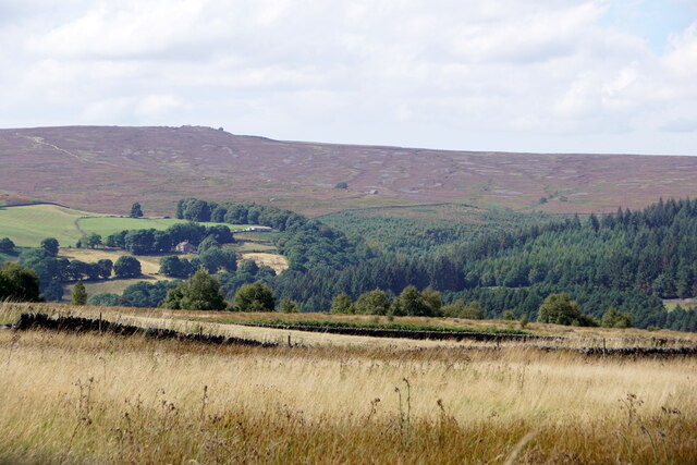
Holes Clough, located in Yorkshire, is a picturesque valley that offers stunning natural beauty and a serene atmosphere. Nestled within the beautiful countryside, this valley is a popular destination for nature enthusiasts, hikers, and photographers alike.

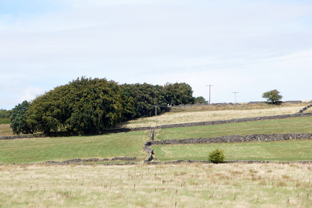
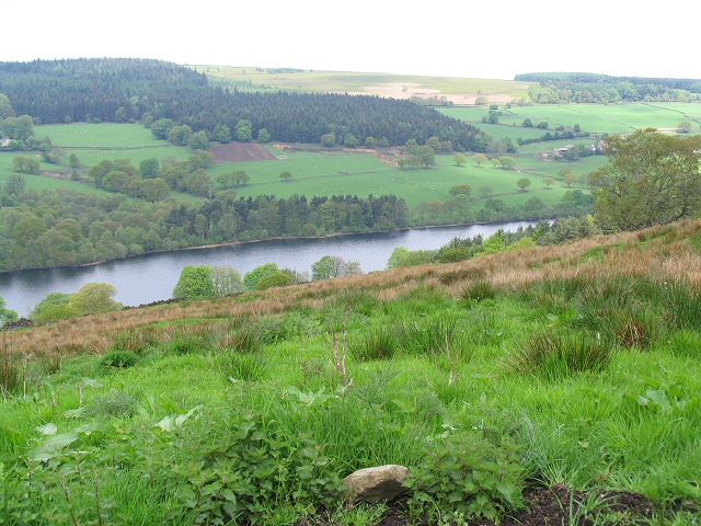
The valley is surrounded by rolling hills and lush greenery, showcasing the region's diverse flora and fauna. Holes Clough is home to a variety of plant species, including heather, ferns, and wildflowers, creating a vibrant and colorful landscape throughout the year. The gently flowing stream that runs through the valley adds to the charm, providing a calming soundtrack to the tranquil surroundings.

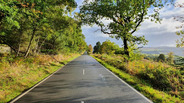
Hikers and walkers are drawn to Holes Clough for its extensive network of trails, offering options for both leisurely strolls and more challenging treks. The paths wind through the valley, offering breathtaking views of the surrounding countryside and the opportunity to spot wildlife such as rabbits, squirrels, and various bird species.

Photographers are also captivated by Holes Clough's natural beauty, with its picturesque landscapes, cascading waterfalls, and secluded spots perfect for capturing stunning shots. The changing seasons bring different colors and moods to the valley, making it an ideal location for capturing the essence of Yorkshire's countryside.

Visitors to Holes Clough can also take advantage of nearby amenities, including picnic spots, cafes, and visitor centers that provide information about the valley's history, geology, and wildlife. Whether exploring the valley's trails, immersing oneself in nature's tranquility, or capturing its beauty through a lens, Holes Clough offers a truly memorable and enriching experience for all who visit.

If you have any feedback on the listing, please let us know in the comments section below.
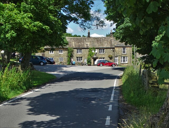
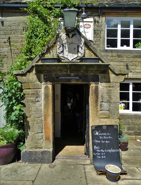
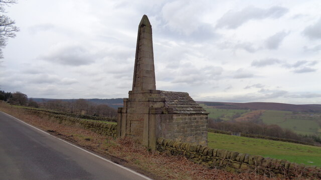
Holes Clough Images

Images are sourced within 2km of 53.41091/-1.6450818 or Grid Reference SK2390. Thanks to Geograph Open Source API. All images are credited.

Approaching "Strines Inn"
Entrance to "The Strines Inn" "The building that now houses The Strines Inn was originally a manor house built in 1275. Over the years it was extended and eventually converted into an inn in 1771." - copied from the pub's website.
Entrance to "The Strines Inn"
"The building that now houses The Strines Inn was originally a manor house built in 1275. Over the years it was extended and eventually converted into an inn in 1771." - copied from the pub's website.
Monument on Well On Hoar Stones Road near Eastfield Farm
Monument on Well
On Hoar Stones Road near Eastfield Farm
Fields near Ughill
Fields near Ughill
View north from West Shaw Lane, Ughill Moors
View to Dale Dike Reservoir from West Shaw Lane
Mortimer Road
Mortimer Road
Walker House Viewed from the other side of Bradfield Dale, with Dale Dike flowing in the trees at the bottom.
Walker House
Viewed from the other side of Bradfield Dale, with Dale Dike flowing in the trees at the bottom.
Blindside Lane The lane is descending into Bradfield Dale.
Blindside Lane
The lane is descending into Bradfield Dale.
Partially cleared forest It looks as though the conifers have been cleared, leaving the broad-leaved trees. This is the southern side of Bradfield Dale.
Partially cleared forest
It looks as though the conifers have been cleared, leaving the broad-leaved trees. This is the southern side of Bradfield Dale.
Footpath in Bradfield Dale Part of the Sheffield Country Walk passing through autumn woodland.
Footpath in Bradfield Dale
Part of the Sheffield Country Walk passing through autumn woodland.
Sheffield Country Walk Heading up Bradfield Dale with Dale Dike Reservoir below the trees to the right.
Sheffield Country Walk
Heading up Bradfield Dale with Dale Dike Reservoir below the trees to the right.
Footpath in Bradfield Dale The path climbs out of the dale on its southern side. It is not as well used as the path which goes round the dale.
Footpath in Bradfield Dale
The path climbs out of the dale on its southern side. It is not as well used as the path which goes round the dale.
Sheffield Country Walk Heading up the dale through land which used to be farmed.
Sheffield Country Walk
Heading up the dale through land which used to be farmed.
Andrew Wood A strip of woodland up the southern side of Bradfield Dale, but it is not very dense.
Andrew Wood
A strip of woodland up the southern side of Bradfield Dale, but it is not very dense.
Dale Dike Reservoir The water level is very low, leaving a lot of the upper reaches bone dry.
Dale Dike Reservoir
The water level is very low, leaving a lot of the upper reaches bone dry.
Path by Dale Dike Reservoir Following the northern side of the reservoir. The water level is very low.
Path by Dale Dike Reservoir
Following the northern side of the reservoir. The water level is very low.
Dale Dike Reservoir The water is at a very low level.
Dale Dike Reservoir
The water is at a very low level.
Show me another place!

Holes Clough is located at Grid Ref: SK2390 (Lat: 53.41091, Lng: -1.6450818)

Division: West Riding

Unitary Authority: Sheffield

Police Authority: South Yorkshire

What 3 Words

///either.healers.allows. Near Bradfield, South Yorkshire

Related Wikis

Bradfield Dale

Bradfield Dale is a rural valley 12 kilometres (7.5 mi) west-northwest of the City of Sheffield in England. The valley stands within the north-eastern...

Strines Reservoir

Strines Reservoir is a water storage reservoir situated at 53.4099°N 1.6557°W / 53.4099; -1.6557 (Strines_Reservoir), 8 miles (13 km) west of the centre...

Dale Dike Reservoir

Dale Dike Reservoir or Dale Dyke Reservoir (grid reference SK240913) is a reservoir in the north-east Peak District, in the City of Sheffield, South Yorkshire...

Hallfield House

Hallfield House is a Grade II listed building situated in Bradfield Dale, 1.7 miles (2.74 km) west of the village of Low Bradfield, near Sheffield in England...

Nearby Amenities

Located within 500m of 53.41091,-1.6450818
Barrier: stile
Check Date: 2024-03-31
Material: stone
Source: survey;gps
Step Count: 4
Stile: stepover
Lat/Long: 53.4115681/-1.6489433
Barrier: stile
Material: stone
Source: survey;gps
Stile: stepover
Lat/Long: 53.4139614/-1.6432721
Site of Coo House
Historic Place: isolated_dwelling
Lat/Long: 53.4106279/-1.6496038
Holes Clough
Place: locality
Lat/Long: 53.4105155/-1.6448223
Hoyles Farm
Alt Name: Upper Holes
Place: farm
Lat/Long: 53.4108436/-1.642119
Lee Bank
Place: locality
Lat/Long: 53.4085601/-1.6480018
Loftshaw House
Historic Place: isolated_dwelling
Lat/Long: 53.411858/-1.6388358
Barrier: stile
Material: wood
Source: survey;gps
Step Count: 3
Stile: stepover
Lat/Long: 53.4122699/-1.6463673
Barrier: stile
Check Date: 2024-03-31
Material: stone
Source: survey;gps
Stile: squeezer
Lat/Long: 53.4124808/-1.6451184
Barrier: stile
Foot: yes
Lat/Long: 53.4070802/-1.646694
Natural: spring
Lat/Long: 53.4080447/-1.6488593
Power: pole
Lat/Long: 53.4123353/-1.6495295
Material: wood
Power: pole
Lat/Long: 53.4109265/-1.6501198
Material: wood
Power: pole
Lat/Long: 53.4094518/-1.6507113
Power: pole
Lat/Long: 53.4133379/-1.6491582
Power: pole
Lat/Long: 53.4132526/-1.6489776
Power: pole
Ref: S1160/43
Lat/Long: 53.4116005/-1.649618
Material: wood
Power: pole
Lat/Long: 53.410944/-1.6498789
Material: wood
Power: pole
Lat/Long: 53.4102936/-1.6501534
Material: wood
Power: pole
Lat/Long: 53.4093775/-1.650505
Material: wood
Power: pole
Lat/Long: 53.4089221/-1.6514156
Power: pole
Lat/Long: 53.4133846/-1.6494649
Power: pole
Lat/Long: 53.4139242/-1.6500958
Material: wood
Power: pole
Lat/Long: 53.4098145/-1.6503373
The data included in this document is from www.openstreetmap.org. The data is made available under ODbL.

Have you been to Holes Clough?

Leave your review of Holes Clough below (or comments, questions and feedback).