Highshaw Clough

Valley in Derbyshire High Peak

England

Highshaw Clough

Path to Stanage Edge Off the A57 the path to Stanage Edge
Path to Stanage Edge Credit: Shaun Ferguson

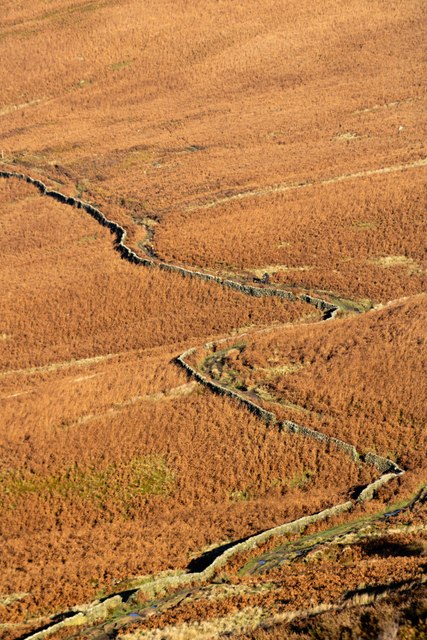
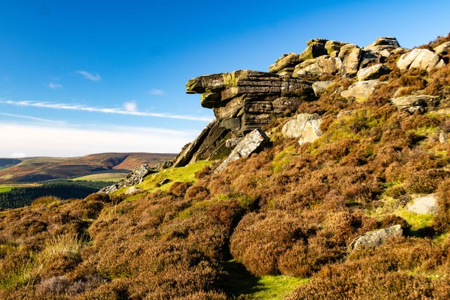
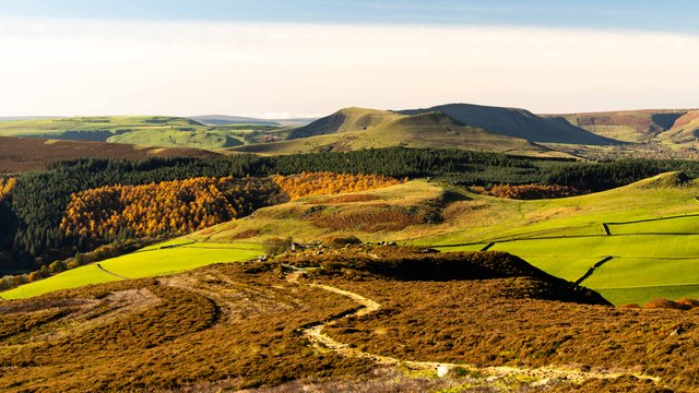
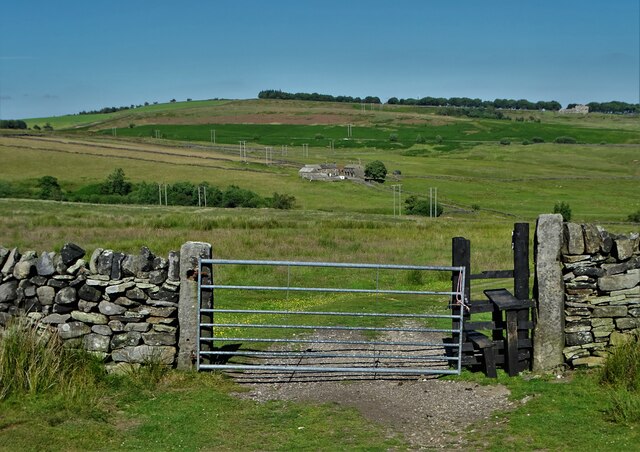
Highshaw Clough is a picturesque valley located in Derbyshire, England. Situated within the Peak District National Park, it offers breathtaking natural beauty and a tranquil escape from the hustle and bustle of city life.

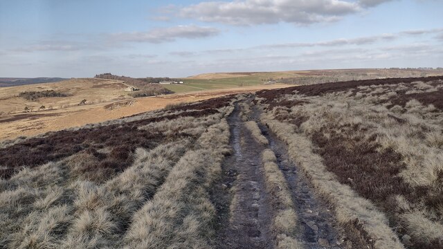
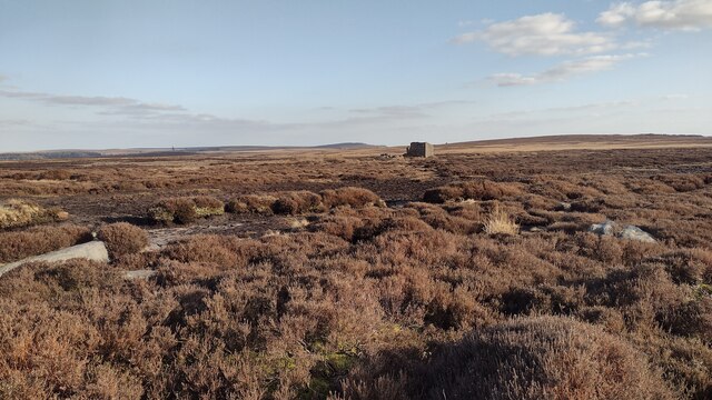
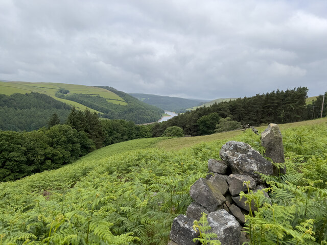
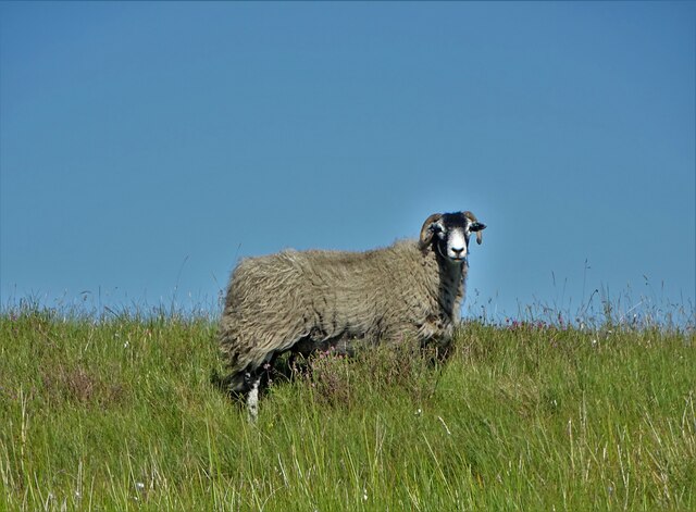
The valley is characterized by its lush greenery, rolling hills, and meandering streams. It is home to a diverse range of flora and fauna, including rare plant species such as the Jacob's ladder and the globe flower. Wildlife enthusiasts can spot various animals like foxes, rabbits, and a variety of bird species within the valley.

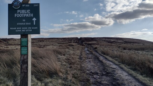
Highshaw Clough is renowned for its walking trails, attracting hikers and nature lovers throughout the year. The trails vary in difficulty, catering to both beginners and experienced hikers. The routes offer stunning panoramic views of the surrounding countryside, making it a popular destination for photographers and artists.

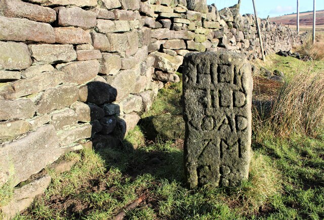
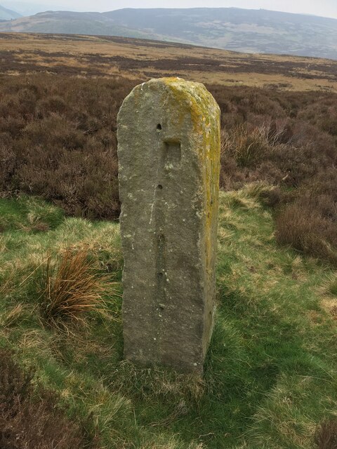
In addition to its natural beauty, Highshaw Clough has historical significance as well. The valley was once a hub of industrial activity during the 19th century, with coal mining and quarrying being prominent industries. Today, remnants of the past can still be seen, including disused mine shafts and the ruins of old buildings.

The valley is easily accessible, with nearby parking facilities and public transport options available. Visitors can also find amenities such as cafes, picnic areas, and toilets within the vicinity.

Overall, Highshaw Clough is a captivating valley that offers a perfect blend of natural splendor, recreational opportunities, and historical charm, making it a must-visit destination for outdoor enthusiasts and nature lovers.

If you have any feedback on the listing, please let us know in the comments section below.

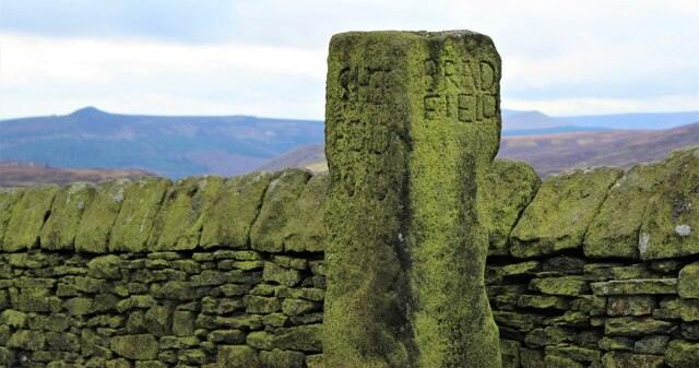
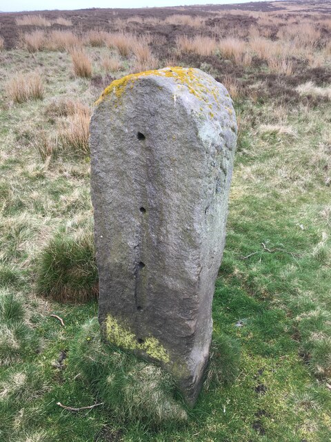
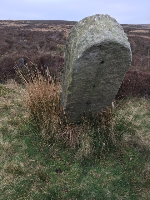
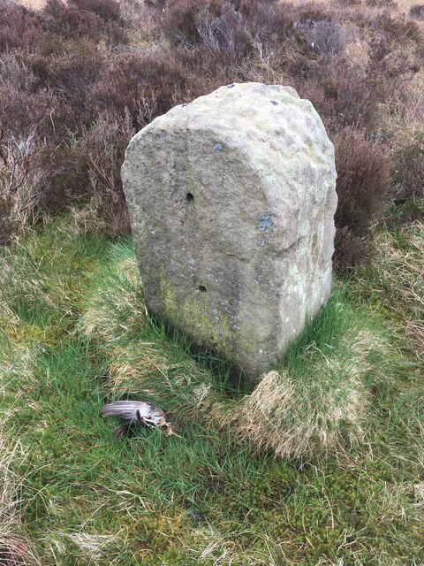
Highshaw Clough Images

Images are sourced within 2km of 53.385767/-1.679059 or Grid Reference SK2187. Thanks to Geograph Open Source API. All images are credited.

Path to Stanage Edge Off the A57 the path to Stanage Edge
Path to Stanage Edge
Off the A57 the path to Stanage Edge
Path heading to the A57 From Stanage End the path heading to the A57 at Moscar Lodge
Path heading to the A57
From Stanage End the path heading to the A57 at Moscar Lodge
Ruined Building Ruined building South of Stanag End
Ruined Building
Ruined building South of Stanag End
View across to Derwent Reservoir A view from the hillside across to the local reservoir.
View across to Derwent Reservoir
A view from the hillside across to the local reservoir.
Bridleway
Bridleway
White Tor White Tor on Derwent Edge.
White Tor
White Tor on Derwent Edge.
Whinstone Lee Tor View from <a href="https://www.geograph.org.uk/photo/7650036">SK2087 : Hurkling Stones</a> looking down to Whinstone Lee Tor (in the foreground).  In the middle distance is <a href="https://www.geograph.org.uk/photo/7649449">SK1886 : Crook Hill</a> and beyond the woodland above Ladybower Reservoir, the peaks of <a href="https://www.geograph.org.uk/photo/4522426">SK1585 : Lose Hill</a>, <a href="https://www.geograph.org.uk/photo/7603095">SK1283 : Mam Tor</a> and <a href="https://www.geograph.org.uk/photo/7603618">SK1183 : Lord's Seat</a> are visible.
Whinstone Lee Tor
View from SK2087 : Hurkling Stones looking down to Whinstone Lee Tor (in the foreground). In the middle distance is SK1886 : Crook Hill and beyond the woodland above Ladybower Reservoir, the peaks of SK1585 : Lose Hill, SK1283 : Mam Tor and SK1183 : Lord's Seat are visible.
Sheepfold marker stone
Marker post at Moscar Lodge
Old Boundary Marker on Bamford Moor Boundary Marker on Bamford Moor in Bamford parish. One of eleven similar stone posts set in a straight line almost north to south on Bamford Moor. No boundary is shown on old OS maps and they have no inscription. The stones have been drilled presumably for fence wire and this may be their original function.

Milestone Society National ID: DE_BAMF01bm
Old Boundary Marker on Bamford Moor
Boundary Marker on Bamford Moor in Bamford parish. One of eleven similar stone posts set in a straight line almost north to south on Bamford Moor. No boundary is shown on old OS maps and they have no inscription. The stones have been drilled presumably for fence wire and this may be their original function. Milestone Society National ID: DE_BAMF01bm
Old Boundary Marker on Bamford Moor Boundary Marker on Bamford Moor in Bamford parish. One of eleven similar stone posts set in a straight line almost north to south on Bamford Moor. No boundary is shown on old OS maps and they have no inscription. The stones have been drilled presumably for fence wire and this may be their original function.

Milestone Society National ID: DE_BAMF02bm
Old Boundary Marker on Bamford Moor
Boundary Marker on Bamford Moor in Bamford parish. One of eleven similar stone posts set in a straight line almost north to south on Bamford Moor. No boundary is shown on old OS maps and they have no inscription. The stones have been drilled presumably for fence wire and this may be their original function. Milestone Society National ID: DE_BAMF02bm
Old Boundary Marker on Bamford Moor Boundary Marker on Bamford Moor in Bamford parish. One of eleven similar stone posts set in a straight line almost north to south on Bamford Moor. No boundary is shown on old OS maps and they have no inscription. The stones have been drilled presumably for fence wire and this may be their original function.

Milestone Society National ID: DE_BAMF03bm
Old Boundary Marker on Bamford Moor
Boundary Marker on Bamford Moor in Bamford parish. One of eleven similar stone posts set in a straight line almost north to south on Bamford Moor. No boundary is shown on old OS maps and they have no inscription. The stones have been drilled presumably for fence wire and this may be their original function. Milestone Society National ID: DE_BAMF03bm
Old Boundary Marker on Bamford Moor Boundary Marker on Bamford Moor in Bamford parish. One of eleven similar stone posts set in a straight line almost north to south on Bamford Moor. No boundary is shown on old OS maps and they have no inscription. The stones have been drilled presumably for fence wire and this may be their original function.

Milestone Society National ID: DE_BAMF04bm
Old Boundary Marker on Bamford Moor
Boundary Marker on Bamford Moor in Bamford parish. One of eleven similar stone posts set in a straight line almost north to south on Bamford Moor. No boundary is shown on old OS maps and they have no inscription. The stones have been drilled presumably for fence wire and this may be their original function. Milestone Society National ID: DE_BAMF04bm
Sheffield Milestone A partially damaged Milestone showing the distance to the City of Sheffield.
Sheffield Milestone
A partially damaged Milestone showing the distance to the City of Sheffield.
Path to The Wheelstones on Derwent Edge
The Wheelstones seen from the south
Sheep above Highshaw Clough
Looking towards Moscar House
Show me another place!

Highshaw Clough is located at Grid Ref: SK2187 (Lat: 53.385767, Lng: -1.679059)

Administrative County: Derbyshire

District: High Peak

Police Authority: Derbyshire

What 3 Words

///triangles.actor.oaks. Near Hope Valley, Derbyshire

Nearby Locations

Highshaw Clough

Related Wikis

Hordron Edge stone circle

Hordron Edge stone circle, also known as 'The Seven Stones of Hordron' is a Bronze Age stone circle (grid reference SK2152486851) in Derbyshire, England...
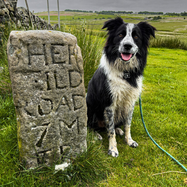
Moscar Cross

Moscar Cross is the name of a standing stone (or "guide stoop") and surrounding area in the Peak District on the border between Derbyshire and Sheffield...

Birchinlee

Birchinlee is the site of "Tin Town", a village built by the Derwent Valley Water Board for the workers (and their families) who constructed the Derwent...
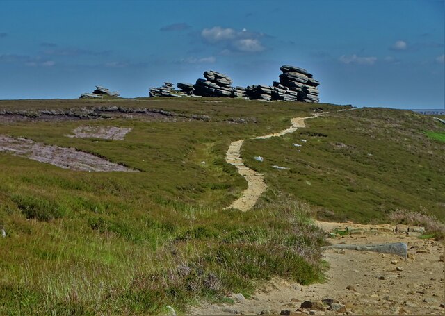
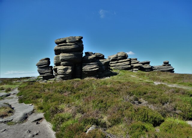
Derwent Edge

Derwent Edge is a Millstone Grit escarpment that lies above the Upper Derwent Valley in the Peak District National Park in the English county of Derbyshire...

Ladybower Reservoir

Ladybower Reservoir is a large Y-shaped, artificial reservoir, the lowest of three in the Upper Derwent Valley in Derbyshire, England. The River Ashop...

River Ashop

The River Ashop is a river in the Derbyshire Peak District, England. Its source is on the eastern slopes of Mill Hill, three miles south east of Glossop...

Hollow Meadows

Hollow Meadows is a hamlet in the civil parish of Bradfield, west of Sheffield in South Yorkshire, England. It lies along the A57 road, between Moscar...

Sugworth Hall

Sugworth Hall is an English country house on Sugworth Road in Bradfield Dale, near Sheffield, England. It is situated approximately 8 miles (13 km) west...

Nearby Amenities

Located within 500m of 53.385767,-1.679059
Parking
Access: yes
Fee: no
Parking: layby
Lat/Long: 53.3832002/-1.6756483
Barrier: stile
Dog Gate: yes
Material: wood
Stile: ladder
Lat/Long: 53.3859844/-1.672817
Ford: yes
Lat/Long: 53.3835769/-1.6802845
Material: wood
Power: pole
Lat/Long: 53.3842935/-1.6769863
Material: wood
Power: pole
Lat/Long: 53.3830465/-1.6825841
Material: wood
Power: pole
Lat/Long: 53.3834257/-1.6808811
Material: wood
Power: pole
Lat/Long: 53.3838667/-1.6788925
Material: wood
Power: pole
Lat/Long: 53.3862772/-1.6722387
Material: wood
Power: pole
Lat/Long: 53.3846934/-1.6751838
Material: wood
Power: pole
Lat/Long: 53.3851301/-1.6732097
Barrier: stile
Material: wood
Source: survey;gps
Stile: stepover
Lat/Long: 53.3827038/-1.6803385
Material: wood
Power: pole
Lat/Long: 53.3863639/-1.6724846
Material: wood
Power: pole
Lat/Long: 53.3852931/-1.6734003
Material: wood
Power: pole
Lat/Long: 53.384868/-1.6752949
Material: wood
Power: pole
Lat/Long: 53.3844671/-1.6770767
Material: wood
Power: pole
Lat/Long: 53.3840233/-1.6789971
Material: wood
Power: pole
Lat/Long: 53.383575/-1.6810025
Material: wood
Power: pole
Lat/Long: 53.3831942/-1.6826904
Bus Stop
Ashopton/Cutthroat Bridge
Bench: no
Bin: no
Bus: yes
Lit: no
Public Transport: platform
Ref: 1000DACB3964
Shelter: no
Tactile Paving: no
Lat/Long: 53.3833154/-1.6777426
Bus Stop
Ashopton/Cutthroat Bridge
Bench: no
Bin: no
Bus: yes
Lit: no
Naptan AtcoCode: 1000DACB3963
Naptan NaptanCode: dbsadtgt
Public Transport: platform
Ref: 1000DACB3963
Shelter: no
Tactile Paving: no
Lat/Long: 53.3833594/-1.6781892
Ashopton/Cutthroat Bridge
Bus: yes
Public Transport: stop_position
Lat/Long: 53.3833118/-1.6781849
Ashopton/Cutthroat Bridge
Bus: yes
Public Transport: stop_position
Lat/Long: 53.3833529/-1.6777427
Ford: yes
Lat/Long: 53.3841388/-1.6806443
Hunting Stand
Hunting Stand: grouse_butt
Lat/Long: 53.3882279/-1.6835579
Hunting Stand
Hunting Stand: grouse_butt
Lat/Long: 53.3882129/-1.6825241
Hunting Stand
Hunting Stand: grouse_butt
Lat/Long: 53.3882439/-1.681536
Hunting Stand
Hunting Stand: grouse_butt
Lat/Long: 53.3883046/-1.6804816
Hunting Stand
Hunting Stand: grouse_butt
Lat/Long: 53.3882663/-1.6845895
The data included in this document is from www.openstreetmap.org. The data is made available under ODbL.

Have you been to Highshaw Clough?

Leave your review of Highshaw Clough below (or comments, questions and feedback).