Bents Clough

Valley in Yorkshire

England

Bents Clough

View north to Back Tor The rock formation on Derwent Edge is topped by a triangulation pillar.
View north to Back Tor Credit: Neil Theasby

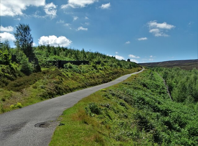
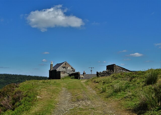
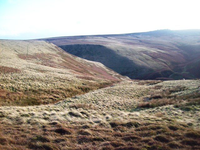
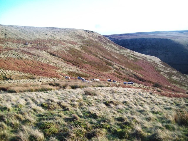
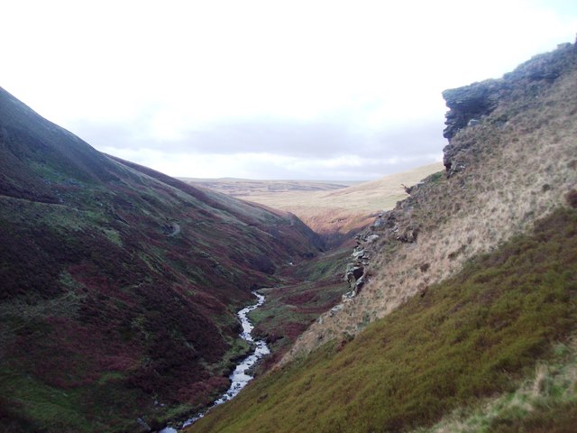
Bents Clough is a picturesque valley located in the county of Yorkshire, England. It is situated in the southern part of the Yorkshire Dales National Park, renowned for its stunning natural landscapes. Bents Clough is nestled between the rolling hills and is characterized by its lush greenery, enchanting woodlands, and meandering streams.

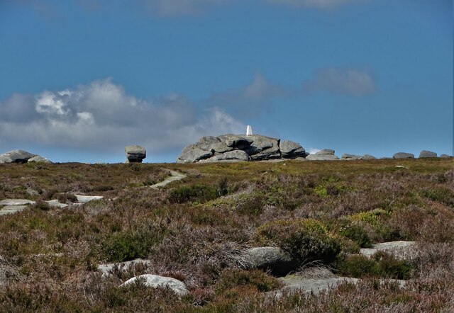
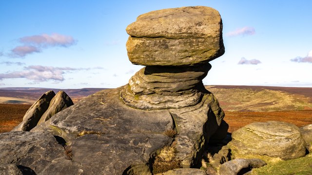
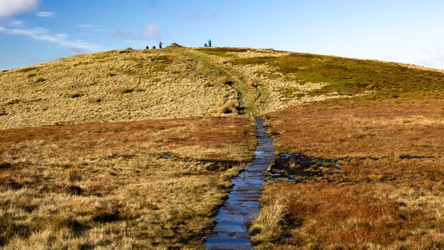
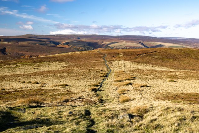
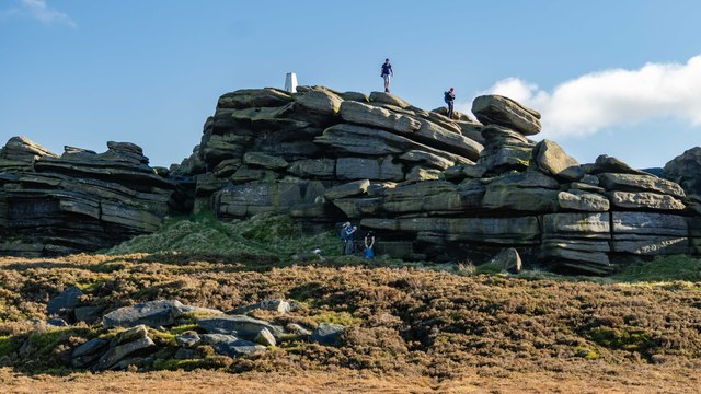
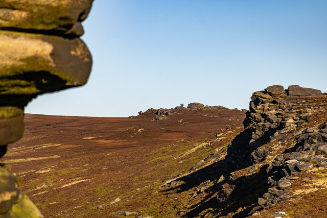
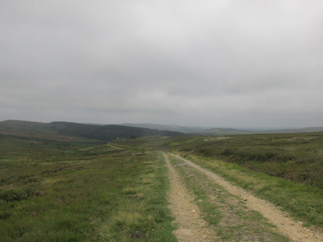
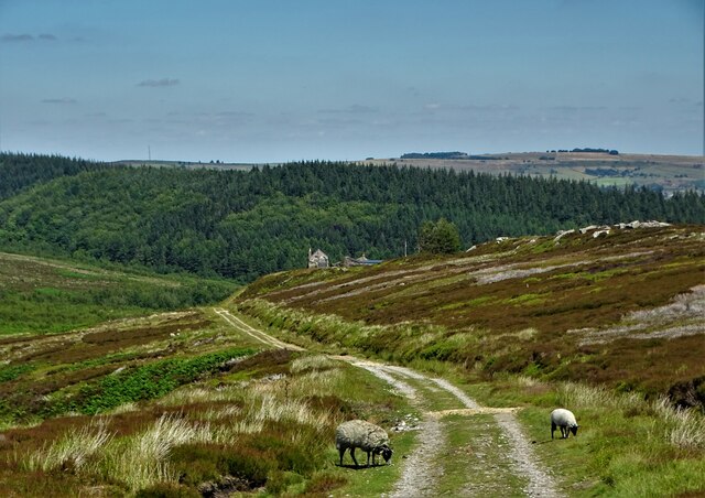
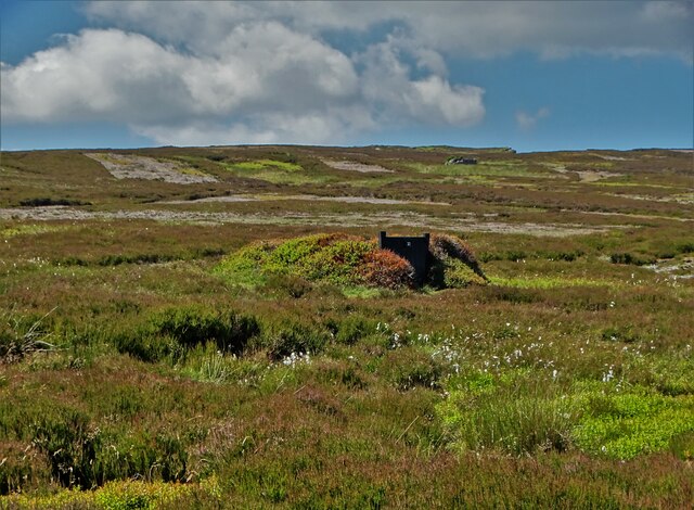
The valley is known for its tranquil atmosphere and untouched beauty, attracting nature enthusiasts, hikers, and photographers alike. The scenic hiking trails that crisscross through Bents Clough offer visitors the opportunity to explore its idyllic surroundings and discover hidden gems along the way. The valley is home to diverse flora and fauna, including rare species of wildflowers and a variety of birdlife, making it a haven for wildlife enthusiasts.

Bents Clough boasts a rich history, with archaeological evidence suggesting human habitation in the area dating back to prehistoric times. The remains of ancient settlements, stone walls, and medieval farmsteads can still be seen within the valley, providing a glimpse into its past.

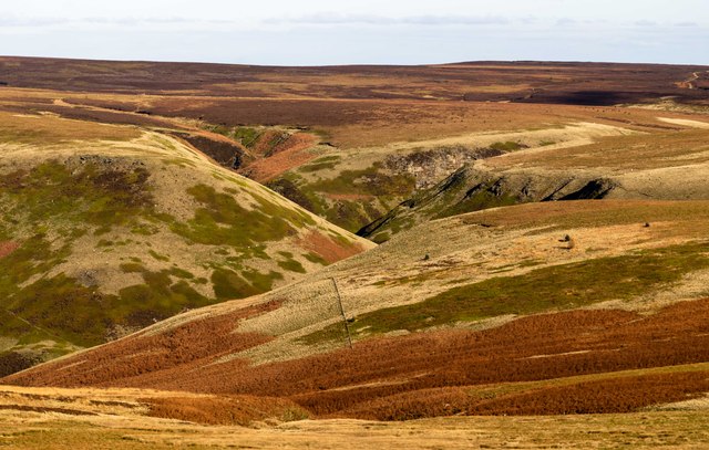
The valley offers breathtaking panoramic views, particularly from its highest points, providing visitors with a stunning vista of the surrounding countryside. The peaceful ambiance of Bents Clough makes it an ideal place for relaxation and rejuvenation, away from the hustle and bustle of city life.

Overall, Bents Clough is a captivating destination, where visitors can immerse themselves in the natural beauty and tranquility of the Yorkshire countryside.

If you have any feedback on the listing, please let us know in the comments section below.
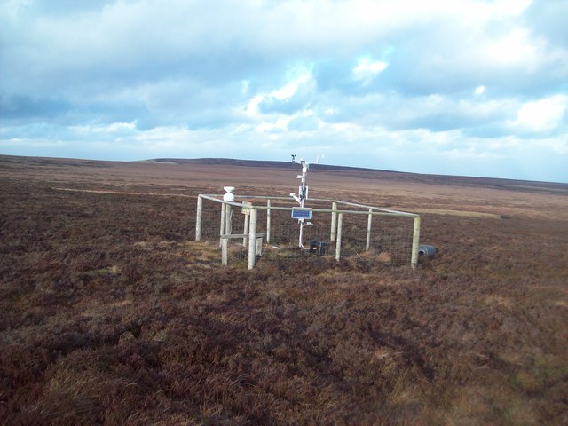
Bents Clough Images

Images are sourced within 2km of 53.426418/-1.6981214 or Grid Reference SK2092. Thanks to Geograph Open Source API. All images are credited.

View north to Back Tor The rock formation on Derwent Edge is topped by a triangulation pillar.
View north to Back Tor
The rock formation on Derwent Edge is topped by a triangulation pillar.
Lost Lad Path leading up to Lost Lad.
Lost Lad
Path leading up to Lost Lad.
Lost Lad View from Lost Lad looking northwest over Howden Moor.
Lost Lad
View from Lost Lad looking northwest over Howden Moor.
Back Tor View from the Salt Cellar looking along Derwent Edge, past Dovestone Tor, towards <a href="https://www.geograph.org.uk/photo/7649461">SK1990 : Back Tor</a>.
Back Tor
View from the Salt Cellar looking along Derwent Edge, past Dovestone Tor, towards SK1990 : Back Tor.
The Foulstone Road Looking back downhill on the way up to Back Tor.
The Foulstone Road
Looking back downhill on the way up to Back Tor.
Foulstone Road It leads to Foulstone Delf and Derwent Moors. The area is under the control of Fitzwilliam Wentworth Estates - mostly for the purposes of grouse shooting.
Foulstone Road
It leads to Foulstone Delf and Derwent Moors. The area is under the control of Fitzwilliam Wentworth Estates - mostly for the purposes of grouse shooting.
Summer cloud over Foulstone Delf This moorland property is part of the Fitzwilliam-Wentworth Estates and is almost certainly connected with grouse shooting and rearing of game birds.
Summer cloud over Foulstone Delf
This moorland property is part of the Fitzwilliam-Wentworth Estates and is almost certainly connected with grouse shooting and rearing of game birds.
Looking back along Foulstone Road To Foulstone Delf - the property to the right of the track
Looking back along Foulstone Road
To Foulstone Delf - the property to the right of the track
Grouse butt No.10 on Foulstone Moor From here, during the shooting season, men with shotguns blast grouse out of the sky. They call it sport.
Grouse butt No.10 on Foulstone Moor
From here, during the shooting season, men with shotguns blast grouse out of the sky. They call it sport.
Abbey Brook The head of Abbey Brook, the confluence of Cartledge Brook and Crook Clough.
Abbey Brook
The head of Abbey Brook, the confluence of Cartledge Brook and Crook Clough.
Flagstone Path Approaching Back Tor The path also marks the county boundary here with South Yorkshire to the right and Derbyshire to the left.
Flagstone Path Approaching Back Tor
The path also marks the county boundary here with South Yorkshire to the right and Derbyshire to the left.
Flagstone Path near the Cakes of Bread Looking north towards Back Tor which is visible on the left horizon. The white bags contain small loose boulders which will presumably be used to shore up the eroded pathside. The path here also marks the county boundary.
Flagstone Path near the Cakes of Bread
Looking north towards Back Tor which is visible on the left horizon. The white bags contain small loose boulders which will presumably be used to shore up the eroded pathside. The path here also marks the county boundary.
Weather Station on Featherbed Moss This monitoring equipment appears to be taking a range of atmospheric measurements. The anemometer was going like the clappers.
Weather Station on Featherbed Moss
This monitoring equipment appears to be taking a range of atmospheric measurements. The anemometer was going like the clappers.
Foul Clough Small clough which falls sharply towards Abbey Brook further ahead. The heather on the higher ground has given way to tussocks of rough grass in this area.
Foul Clough
Small clough which falls sharply towards Abbey Brook further ahead. The heather on the higher ground has given way to tussocks of rough grass in this area.
Sheep in Foul Clough Hardy sheep grazing above Abbey Clough. Their narrow tracks pick the easiest route down the steep gorge to the brook below.
Sheep in Foul Clough
Hardy sheep grazing above Abbey Clough. Their narrow tracks pick the easiest route down the steep gorge to the brook below.
Abbey Brook and Berristers Tor Looking downstream from a slightly precarious position near the tor which juts out to the right of picture.
Abbey Brook and Berristers Tor
Looking downstream from a slightly precarious position near the tor which juts out to the right of picture.
Show me another place!

Bents Clough is located at Grid Ref: SK2092 (Lat: 53.426418, Lng: -1.6981214)

Division: West Riding

Unitary Authority: Sheffield

Police Authority: South Yorkshire

What 3 Words

///shade.extremely.minerals. Near Bradfield, South Yorkshire

Related Wikis

Lost Lad

Lost Lad is a hill, 518 metres (1,699 ft) high on the Derwent Edge in the Peak District in the county of Derbyshire in England. It is a subpeak of Back...

High Stones

High Stones, at 548 metres (1,798 ft), is the highest point within the boundaries of both the City of Sheffield and South Yorkshire, England.High Stones...

Howden Edge

Howden Edge (grid reference SK187943) is a peak in the north-east of the Upper Derwent Valley area of the Peak District National Park in England. At 545...

Derwent Edge

Derwent Edge is a Millstone Grit escarpment that lies above the Upper Derwent Valley in the Peak District National Park in the English county of Derbyshire...

River Westend

The River Westend flows through the Dark Peak of the Derbyshire Peak District in England. Its source is at Bleaklow Stones on Bleaklow, from where it...

Hallfield House

Hallfield House is a Grade II listed building situated in Bradfield Dale, 1.7 miles (2.74 km) west of the village of Low Bradfield, near Sheffield in England...

Derwent Reservoir (Derbyshire)

Derwent Reservoir is the middle of three reservoirs in the Upper Derwent Valley in the north of Derbyshire, England. It lies approximately 10 mi (16 km...

Strines Reservoir

Strines Reservoir is a water storage reservoir situated at 53.4099°N 1.6557°W / 53.4099; -1.6557 (Strines_Reservoir), 8 miles (13 km) west of the centre...

Nearby Amenities

Located within 500m of 53.426418,-1.6981214
Ford: yes
Lat/Long: 53.4272947/-1.6988204
Ford: yes
Lat/Long: 53.4274865/-1.7047432
Low Tor
Place: locality
Lat/Long: 53.4232064/-1.7000694
Howden Chest
Place: locality
Lat/Long: 53.4292028/-1.6979957
The data included in this document is from www.openstreetmap.org. The data is made available under ODbL.

Have you been to Bents Clough?

Leave your review of Bents Clough below (or comments, questions and feedback).