Cartledge Flat

Downs, Moorland in Yorkshire

England

Cartledge Flat

Bog asphodel on the open moorland. Pathless terrain.
Bog asphodel on the open moorland. Credit: steven ruffles

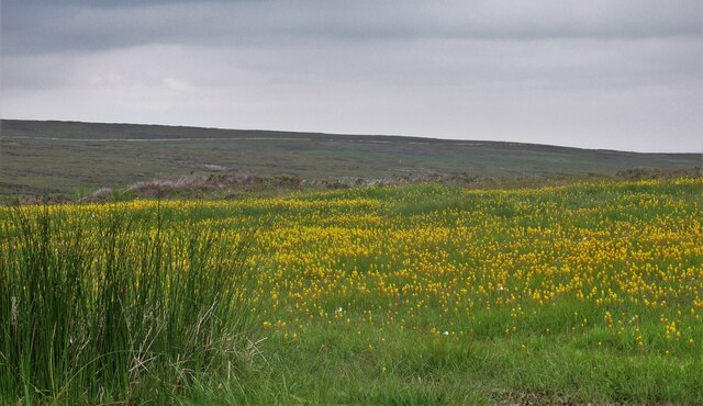
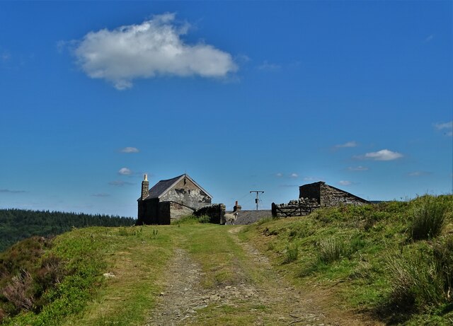
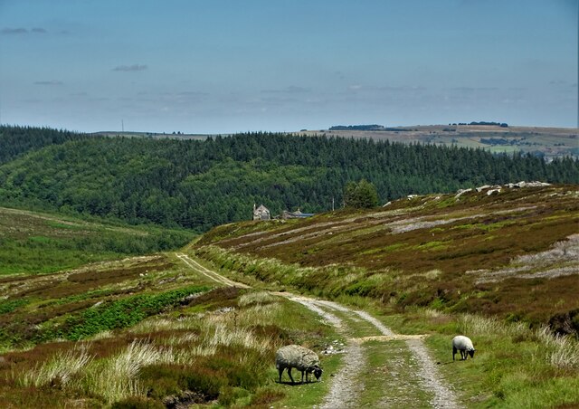
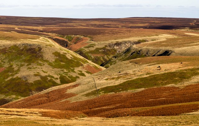
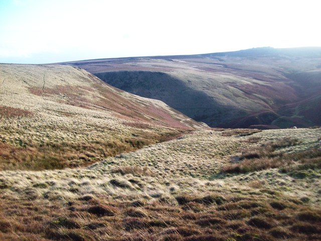
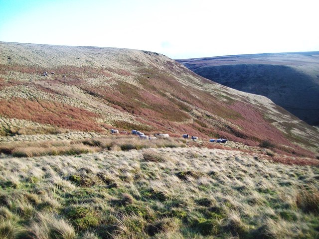
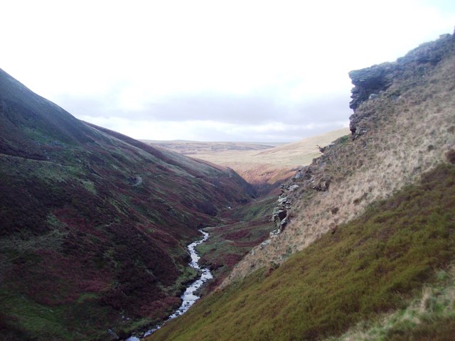
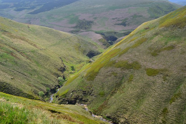
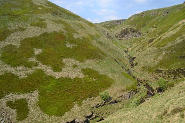
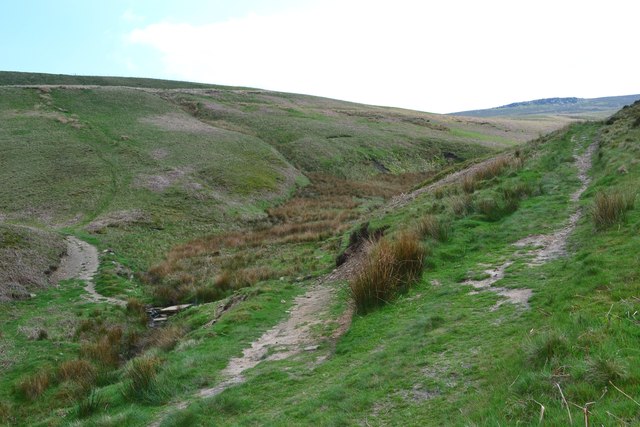
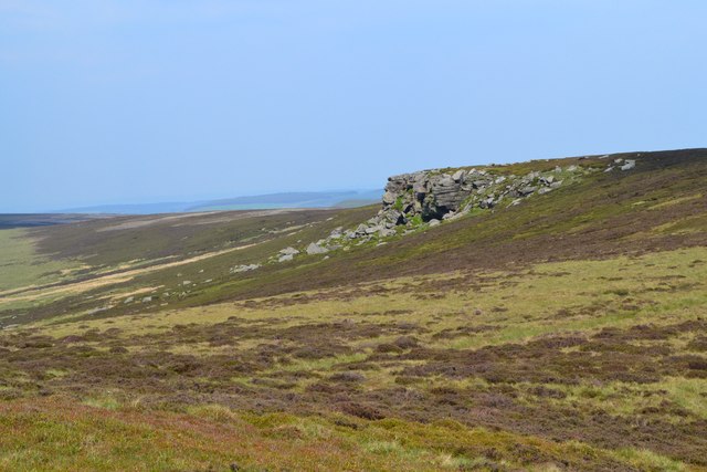
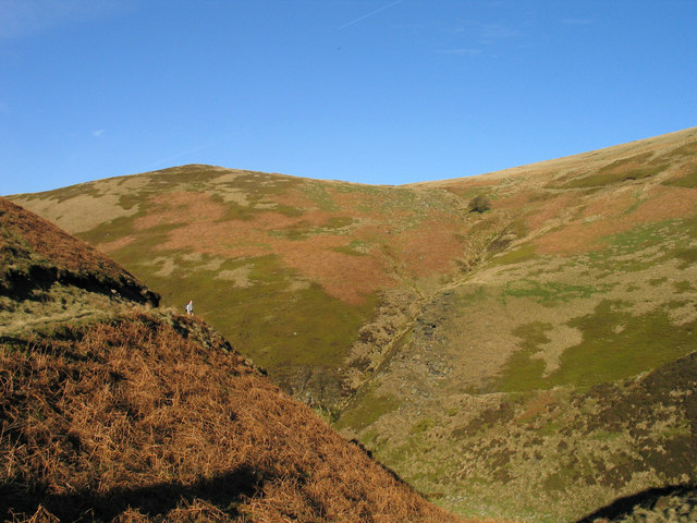
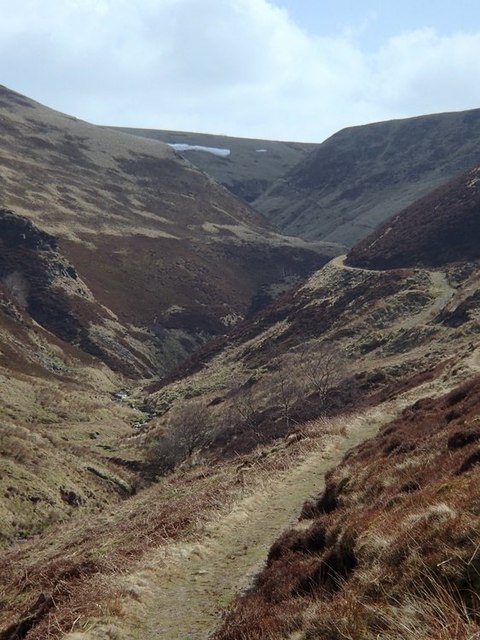
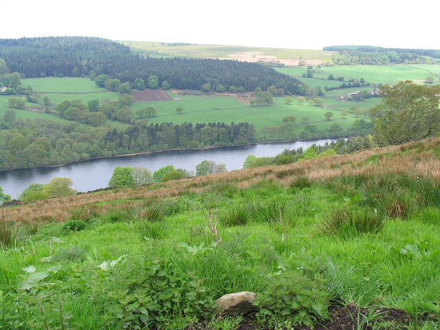
Cartledge Flat is a picturesque area located in Yorkshire, England, known for its stunning natural beauty and diverse landscapes. Situated in the heart of the Yorkshire Downs, this region offers a unique combination of moorland and flat terrain, making it a popular destination for outdoor enthusiasts and nature lovers.

The area is characterized by vast stretches of open grasslands, interspersed with patches of heather-clad moorland and scattered woodlands. This variety of habitats attracts a wide range of wildlife, including various bird species, such as curlews, lapwings, and skylarks. Visitors can often spot rabbits, hares, and even the occasional deer roaming freely.

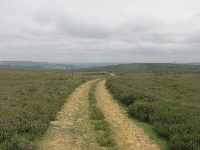
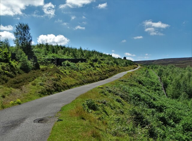
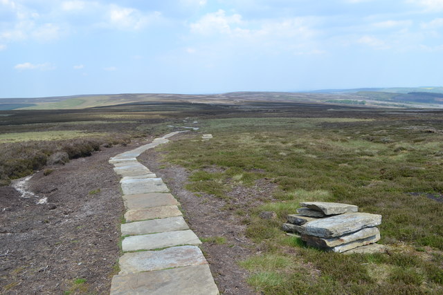
Cartledge Flat is also known for its extensive network of walking trails, offering breathtaking views of the surrounding countryside. Hikers and nature enthusiasts can explore the rolling hills, ancient stone walls, and peaceful valleys that make up this idyllic landscape.

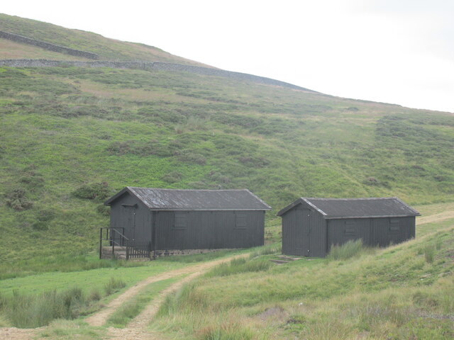
In addition to its natural beauty, Cartledge Flat is home to several charming villages and small towns, where visitors can experience the warm hospitality of the local community. These towns offer a range of amenities, including cozy pubs, quaint tea rooms, and traditional shops, allowing visitors to immerse themselves in the local culture.

Overall, Cartledge Flat in Yorkshire is a haven for those seeking tranquility and natural splendor. Its unique combination of moorland and flat terrain, diverse wildlife, and picturesque villages make it an ideal destination for outdoor enthusiasts and nature lovers alike.

If you have any feedback on the listing, please let us know in the comments section below.

Cartledge Flat Images

Images are sourced within 2km of 53.431079/-1.6860628 or Grid Reference SK2092. Thanks to Geograph Open Source API. All images are credited.

Bog asphodel on the open moorland. Pathless terrain.
Bog asphodel on the open moorland.
Pathless terrain.
Wet Slack Ridge Track alongside line of grouse butts.
Wet Slack Ridge
Track alongside line of grouse butts.
Holling Dale shooting cabins
Foulstone Road It leads to Foulstone Delf and Derwent Moors. The area is under the control of Fitzwilliam Wentworth Estates - mostly for the purposes of grouse shooting.
Foulstone Road
It leads to Foulstone Delf and Derwent Moors. The area is under the control of Fitzwilliam Wentworth Estates - mostly for the purposes of grouse shooting.
Summer cloud over Foulstone Delf This moorland property is part of the Fitzwilliam-Wentworth Estates and is almost certainly connected with grouse shooting and rearing of game birds.
Summer cloud over Foulstone Delf
This moorland property is part of the Fitzwilliam-Wentworth Estates and is almost certainly connected with grouse shooting and rearing of game birds.
Looking back along Foulstone Road To Foulstone Delf - the property to the right of the track
Looking back along Foulstone Road
To Foulstone Delf - the property to the right of the track
Abbey Brook The head of Abbey Brook, the confluence of Cartledge Brook and Crook Clough.
Abbey Brook
The head of Abbey Brook, the confluence of Cartledge Brook and Crook Clough.
Foul Clough Small clough which falls sharply towards Abbey Brook further ahead. The heather on the higher ground has given way to tussocks of rough grass in this area.
Foul Clough
Small clough which falls sharply towards Abbey Brook further ahead. The heather on the higher ground has given way to tussocks of rough grass in this area.
Sheep in Foul Clough Hardy sheep grazing above Abbey Clough. Their narrow tracks pick the easiest route down the steep gorge to the brook below.
Sheep in Foul Clough
Hardy sheep grazing above Abbey Clough. Their narrow tracks pick the easiest route down the steep gorge to the brook below.
Abbey Brook and Berristers Tor Looking downstream from a slightly precarious position near the tor which juts out to the right of picture.
Abbey Brook and Berristers Tor
Looking downstream from a slightly precarious position near the tor which juts out to the right of picture.
Newly paved moorland path north of Back Tor
Looking westwards along Abbey Clough
Looking north to Berristers Tor
Paths meeting in Sheepfold Clough
Howshaw Tor
Howshaw Tor
Howden Edge and Foul Clough Foul Clough is the stream groove descending steeply in the centre of the image. The view is across the gulf of the valley of Abbey Brook from a track in Sheepfold Clough.
Howden Edge and Foul Clough
Foul Clough is the stream groove descending steeply in the centre of the image. The view is across the gulf of the valley of Abbey Brook from a track in Sheepfold Clough.
Gravy Clough from the Abbey Brook footpath Looking across the deep cleft of Abbey Brook to the side valley of Gravy Clough.
Gravy Clough from the Abbey Brook footpath
Looking across the deep cleft of Abbey Brook to the side valley of Gravy Clough.
Upper section of Abbey Brook, looking upstream An unexpectedly wild and rugged valley system opens up when rounding the corner opposite Gravy Clough.  This is a fine km grid square scenically, hidden well away from the busy upper Derwent valley and the Derwent edges to the south.  The path is very clear but does not seem to be heavily used.
Upper section of Abbey Brook, looking upstream
An unexpectedly wild and rugged valley system opens up when rounding the corner opposite Gravy Clough. This is a fine km grid square scenically, hidden well away from the busy upper Derwent valley and the Derwent edges to the south. The path is very clear but does not seem to be heavily used.
Show me another place!

Cartledge Flat is located at Grid Ref: SK2092 (Lat: 53.431079, Lng: -1.6860628)

Division: West Riding

Unitary Authority: Sheffield

Police Authority: South Yorkshire

What 3 Words

///left.refills.bangle. Near Bradfield, South Yorkshire

Related Wikis

Lost Lad

Lost Lad is a hill, 518 metres (1,699 ft) high on the Derwent Edge in the Peak District in the county of Derbyshire in England. It is a subpeak of Back...

High Stones

High Stones, at 548 metres (1,798 ft), is the highest point within the boundaries of both the City of Sheffield and South Yorkshire, England.High Stones...

Howden Edge

Howden Edge (grid reference SK187943) is a peak in the north-east of the Upper Derwent Valley area of the Peak District National Park in England. At 545...

Hallfield House

Hallfield House is a Grade II listed building situated in Bradfield Dale, 1.7 miles (2.74 km) west of the village of Low Bradfield, near Sheffield in England...

Strines Reservoir

Strines Reservoir is a water storage reservoir situated at 53.4099°N 1.6557°W / 53.4099; -1.6557 (Strines_Reservoir), 8 miles (13 km) west of the centre...

Dale Dike Reservoir

Dale Dike Reservoir or Dale Dyke Reservoir (grid reference SK240913) is a reservoir in the north-east Peak District, in the City of Sheffield, South Yorkshire...

Bradfield Dale

Bradfield Dale is a rural valley 12 kilometres (7.5 mi) west-northwest of the City of Sheffield in England. The valley stands within the north-eastern...

Margery Hill

Margery Hill is a 546-metre (1,791 ft) hill on the Howden Moors in South Yorkshire, England. It lies towards the northern boundary of the Peak District...

Nearby Amenities

Located within 500m of 53.431079,-1.6860628
Natural: peak
Lat/Long: 53.4294884/-1.6911204
Hunting Stand
Hunting Stand: grouse_butt
Lat/Long: 53.4275714/-1.6821994
Hunting Stand
Hunting Stand: grouse_butt
Lat/Long: 53.4282764/-1.6856543
Hunting Stand
Hunting Stand: grouse_butt
Lat/Long: 53.4287313/-1.6875036
Hunting Stand
Hunting Stand: grouse_butt
Lat/Long: 53.4278611/-1.6834911
Hunting Stand
Hunting Stand: grouse_butt
Lat/Long: 53.4281231/-1.684751
Hunting Stand
Hunting Stand: grouse_butt
Lat/Long: 53.4285756/-1.6867932
Hunting Stand
Hunting Stand: grouse_butt
Lat/Long: 53.4277382/-1.6829313
Hunting Stand
Hunting Stand: grouse_butt
Lat/Long: 53.4279942/-1.6841355
Hunting Stand
Hunting Stand: grouse_butt
Lat/Long: 53.4284408/-1.6862464
Hunting Stand
Hunting Stand: grouse_butt
Lat/Long: 53.4289013/-1.688111
Cartledge Stones
Place: locality
Lat/Long: 53.4306402/-1.6897177
The data included in this document is from www.openstreetmap.org. The data is made available under ODbL.

Have you been to Cartledge Flat?

Leave your review of Cartledge Flat below (or comments, questions and feedback).