Letty Brongu

Settlement in Glamorgan

Wales

Letty Brongu

Gateway on Track
Gateway on Track Credit: Adrian Dust

Letty Brongu is a small hamlet located in Glamorgan, a historic county in South Wales, United Kingdom. Nestled amidst the scenic beauty of the Welsh countryside, Letty Brongu is renowned for its tranquil atmosphere and stunning natural surroundings.

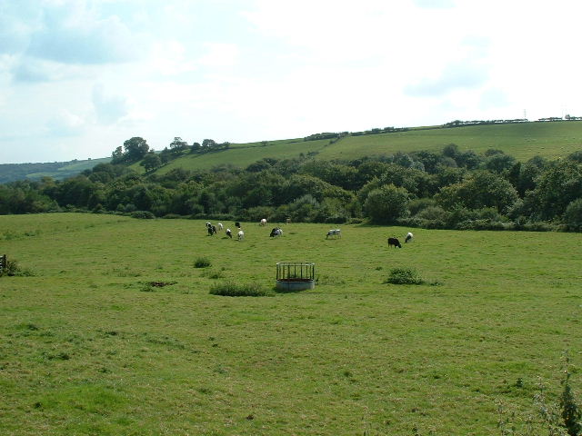
Situated near the town of Bridgend, Letty Brongu is characterized by its picturesque landscapes, with rolling hills, lush green fields, and charming country lanes. The hamlet is primarily residential, with a small population that enjoys the peaceful and idyllic lifestyle offered by this rural community.

Letty Brongu boasts a close-knit and friendly community, where residents take pride in their Welsh heritage and traditions. The residents actively participate in local events and activities, fostering a strong sense of community cohesion.

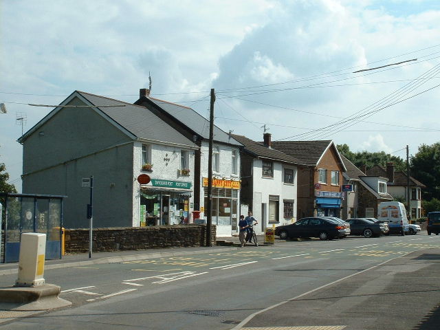
Despite its small size, Letty Brongu offers easy access to a range of amenities and services. The nearby town of Bridgend provides residents with shops, supermarkets, schools, and healthcare facilities, ensuring that all essential needs are met. Additionally, the hamlet is well-connected to major transportation routes, enabling convenient travel to nearby towns and cities.

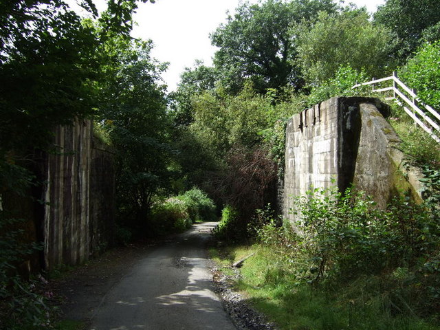
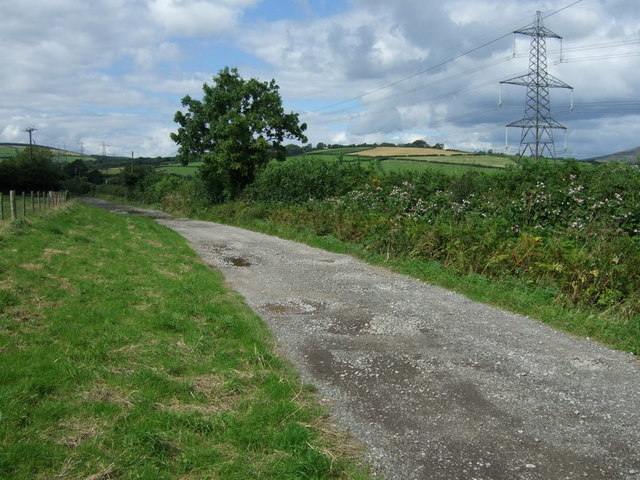
For nature enthusiasts, Letty Brongu offers ample opportunities for outdoor activities. The surrounding countryside is ideal for hiking, cycling, and horseback riding, allowing residents to explore the stunning Welsh landscapes and enjoy the fresh air.

In summary, Letty Brongu is a charming hamlet in Glamorgan, known for its peaceful ambiance, beautiful countryside, and close-knit community. It provides residents with a serene escape from the hustle and bustle of city life while offering convenient access to essential amenities and delightful outdoor pursuits.

If you have any feedback on the listing, please let us know in the comments section below.

Letty Brongu Images

Images are sourced within 2km of 51.586074/-3.615143 or Grid Reference SS8888. Thanks to Geograph Open Source API. All images are credited.

Gateway on Track
Gateway on Track
Ordnance Survey Rivet This OS rivet can be found on the SE buttress of the bridge. It marks a point 126.635m above mean sea level.
Ordnance Survey Rivet
This OS rivet can be found on the SE buttress of the bridge. It marks a point 126.635m above mean sea level.
Ordnance Survey Cut Mark This OS cut mark can be found a stone east side of the track. It marks a point 140.592m above mean sea level.
Ordnance Survey Cut Mark
This OS cut mark can be found a stone east side of the track. It marks a point 140.592m above mean sea level.
Pont Rhyd-y-cyff Shops Near the north side of the square
Pont Rhyd-y-cyff Shops
Near the north side of the square
Pont Rhyd-y-Cyff Houses on the Maesteg Road at the south of the square
Pont Rhyd-y-Cyff
Houses on the Maesteg Road at the south of the square
River Llynfi From the bridge at Pont Rhyd-y-cyff
River Llynfi
From the bridge at Pont Rhyd-y-cyff
Nr Lletty Brongu Looking South over green pastures and the valley hiding the River Llynfi and the railway
Nr Lletty Brongu
Looking South over green pastures and the valley hiding the River Llynfi and the railway
Lletty Brongu Terrace of cottages in the village in the western half of the square
Lletty Brongu
Terrace of cottages in the village in the western half of the square
Part of the Darren Valley Near Maesteg View from the south west
Part of the Darren Valley Near Maesteg
View from the south west
The Tylers Arms Not a million miles from anywhere, just seems like it.
The Tylers Arms
Not a million miles from anywhere, just seems like it.
Bridge abutments near Letty Brongu Earthwork of abandoned railway line and site of bridge carrying line over lane.
Bridge abutments near Letty Brongu
Earthwork of abandoned railway line and site of bridge carrying line over lane.
Power line next to track to Bryn Cynan Farm Pylon and grid lines as they drop towards the Llynfi Valley.
Power line next to track to Bryn Cynan Farm
Pylon and grid lines as they drop towards the Llynfi Valley.
Pylon and junction of land and entrance to Bryn Cynan Farm Pylon seen at a point where the lines drop towards the Georgia Pacific Paper Mills.
Pylon and junction of land and entrance to Bryn Cynan Farm
Pylon seen at a point where the lines drop towards the Georgia Pacific Paper Mills.
Georgia Pacific Paper Mills Entrance to the paper mills, seen from the A4063 Bridgend to Maesteg road.
Georgia Pacific Paper Mills
Entrance to the paper mills, seen from the A4063 Bridgend to Maesteg road.
New railway bridge. Recently installed bridge over the Bridgend to Maesteg railway line, south-east of the Georgia Pacific papermills.
New railway bridge.
Recently installed bridge over the Bridgend to Maesteg railway line, south-east of the Georgia Pacific papermills.
Footpath, Moel Giliau
Cattle below  Moel Giliau lane Bettws can be seen on the hilltop in the distance
Cattle below Moel Giliau lane
Bettws can be seen on the hilltop in the distance
Terrace at Lletty Brongu
Show me another place!

Letty Brongu is located at Grid Ref: SS8888 (Lat: 51.586074, Lng: -3.615143)

Unitary Authority: Bridgend

Police Authority: South Wales

Also known as: Lletty Brongu

What 3 Words

///protester.compliant.elevates. Near Pont Rhyd-y-cyff, Bridgend

Nearby Locations

Lletty Brongu Letty Brongu

Related Wikis

Llangynwyd railway station

Llangynwyd railway station is on the Maesteg Line in Bridgend County Borough, Wales. It was closed to regular passenger trains on 22 June 1970 but continued...

A4063 road

The A4063 links the town of Bridgend with Cymer in Wales. == Settlements on route == Settlements served by the route include: Bridgend Wild Mill Pen-y...

Ysgol Gyfun Gymraeg Llangynwyd

Ysgol Gyfun Gymraeg Llangynwyd is a Welsh-medium secondary school for pupils aged between 11 and 18. The school is based in the village of Llangynwyd in...

Llangynwyd

Llangynwyd is a village (and electoral ward) 2 miles to the south of Maesteg, in the county borough of Bridgend, Wales. It was part of the medieval commote...

Nearby Amenities

Located within 500m of 51.586074,-3.615143
Lletty Brongu
Place: hamlet
Lat/Long: 51.5858229/-3.615693
Power: pole
Lat/Long: 51.5878913/-3.6153522
Power: pole
Lat/Long: 51.587348/-3.6138591
Power: tower
Lat/Long: 51.5843466/-3.6124031
Power: pole
Lat/Long: 51.5839466/-3.619696
Power: tower
Lat/Long: 51.586479/-3.6123575
Power: pole
Lat/Long: 51.5890128/-3.6180152
Power: pole
Lat/Long: 51.5830765/-3.6186213
Power: pole
Lat/Long: 51.5822823/-3.6176276
Power: pole
Lat/Long: 51.5896028/-3.619468
Power: pole
Lat/Long: 51.5893445/-3.615894
Power: pole
Lat/Long: 51.5874869/-3.6133414
Power: pole
Lat/Long: 51.5902627/-3.6171518
Power: pole
Lat/Long: 51.5875781/-3.6084026
Power: pole
Lat/Long: 51.5869931/-3.6084107
Power: pole
Lat/Long: 51.5864348/-3.6084375
Power: pole
Lat/Long: 51.5858465/-3.6084723
Power: pole
Lat/Long: 51.5852832/-3.6084858
Power: pole
Lat/Long: 51.5876197/-3.6088076
Location Transition: yes
Power: pole
Lat/Long: 51.5826383/-3.612729
Booth: K6
Covered: booth
Disused Amenity: telephone
Man Made: telephone_box
Lat/Long: 51.5855631/-3.6142219
Post Box
Post Box Type: lamp
Royal Cypher: EIIR
Royal Cypher Wikidata: Q33102113
Lat/Long: 51.5855525/-3.6142577
Bench
Lat/Long: 51.5856047/-3.6141817
The data included in this document is from www.openstreetmap.org. The data is made available under ODbL.

Have you been to Letty Brongu?

Leave your review of Letty Brongu below (or comments, questions and feedback).