Letton Green

Settlement in Norfolk Breckland

England

Letton Green

Letton Hall and grounds from the lane View across parkland grounds to the hall now run as a Christian centre.
Letton Hall and grounds from the lane Credit: Andrew Hill

Letton Green is a small village located in the county of Norfolk, England. Nestled amidst picturesque countryside, it is situated about 10 miles northwest of the market town of Dereham. The village is known for its tranquil and idyllic setting, making it a popular destination for those seeking a peaceful retreat from the hustle and bustle of city life.

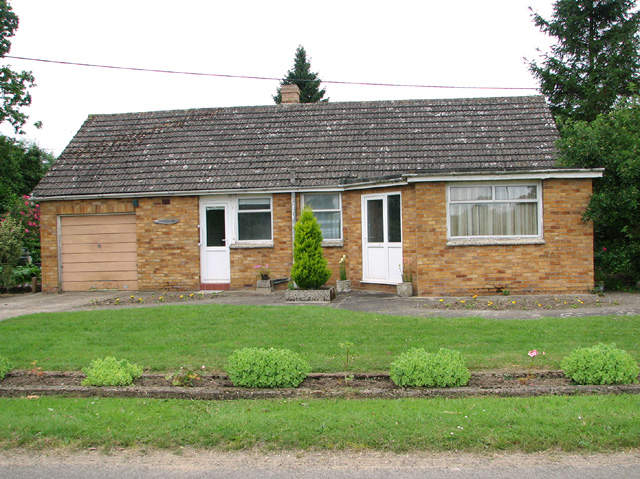
Letton Green is characterized by its charming and traditional architecture, with many of the buildings dating back several centuries. The village is home to a close-knit community, and its residents take pride in preserving the local heritage and maintaining a strong sense of community spirit.

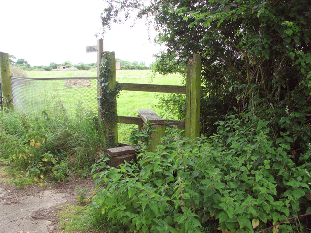
The surrounding countryside offers opportunities for outdoor activities such as walking, cycling, and horse riding, with numerous trails and paths crisscrossing the area. Additionally, Letton Green is close to several nature reserves and parks, providing ample opportunities for nature enthusiasts to explore the local flora and fauna.

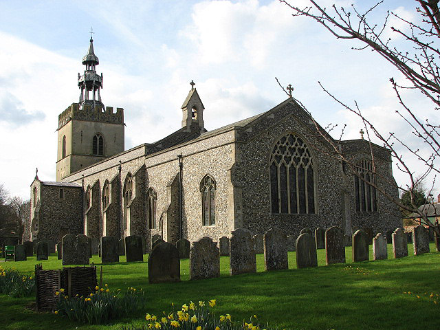
While it may be a small village, Letton Green boasts some amenities, including a village hall, a pub, and a church. The village hall serves as a social hub and hosts various community events throughout the year, fostering a sense of togetherness among the residents.

Overall, Letton Green is a charming and peaceful village, offering a quintessential English countryside experience. Its beautiful setting, strong community spirit, and proximity to nature make it an attractive destination for both locals and visitors seeking a serene and relaxing environment.

If you have any feedback on the listing, please let us know in the comments section below.
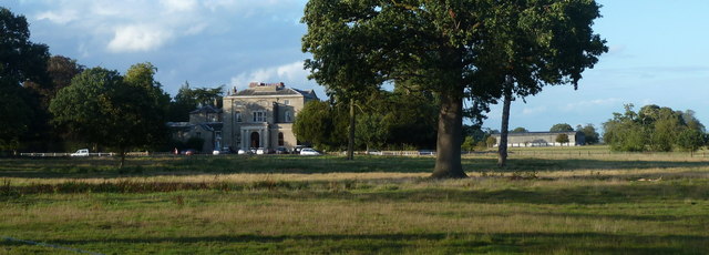
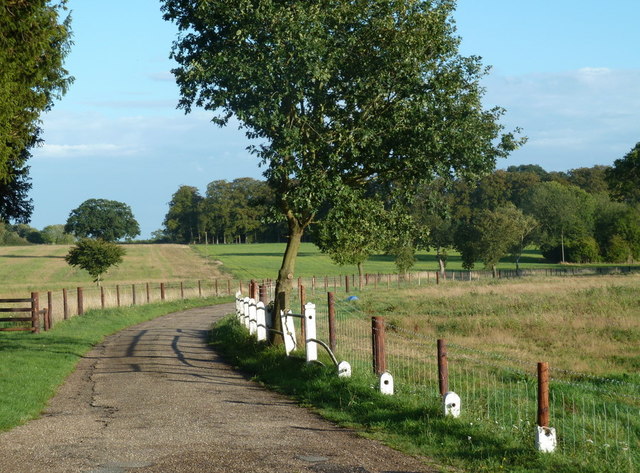
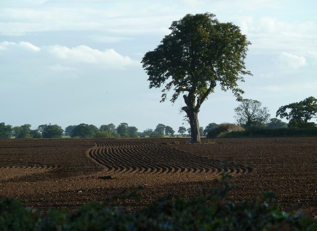
Letton Green Images

Images are sourced within 2km of 52.622307/0.925983 or Grid Reference TF9806. Thanks to Geograph Open Source API. All images are credited.

Letton Hall and grounds from the lane View across parkland grounds to the hall now run as a Christian centre.
Letton Hall and grounds from the lane
View across parkland grounds to the hall now run as a Christian centre.
Letton Hall driveway The driveway has been fenced off since a previous visit to the Christian Centre.
Letton Hall driveway
The driveway has been fenced off since a previous visit to the Christian Centre.
Field near Letton Hall A newly ploughed and drilled field just east of the edge of Shipdham Grove.
Field near Letton Hall
A newly ploughed and drilled field just east of the edge of Shipdham Grove.
Triangulation pillar at rural crossroads See also > <a title="https://www.geograph.org.uk/photo/18133" href="https://www.geograph.org.uk/photo/18133">Link</a>.
Triangulation pillar at rural crossroads
See also > Link.
Triangulation pillar at a field's edge
Footpath across High Common
High Common
High Common
Cattle grazing on the  former Communal site A of RAF Shipdham The air vent of an air raid shelter can be seen in the foreground.
Cattle grazing on the former Communal site A of RAF Shipdham
The air vent of an air raid shelter can be seen in the foreground.
WW2 air raid shelter On the former Communal site A of RAF Shipdham. The air raid shelter is flooded and hence inaccessible > <a title="https://www.geograph.org.uk/photo/4035637" href="https://www.geograph.org.uk/photo/4035637">Link</a>.
WW2 air raid shelter
On the former Communal site A of RAF Shipdham. The air raid shelter is flooded and hence inaccessible > Link.
Flooded WW2 air raid shelter On the former Communal site A of RAF Shipdham. For a full view of this air raid shelter see > <a title="https://www.geograph.org.uk/photo/4035634" href="https://www.geograph.org.uk/photo/4035634">Link</a>.
Flooded WW2 air raid shelter
On the former Communal site A of RAF Shipdham. For a full view of this air raid shelter see > Link.
The former Communal site A of RAF Shipdham Cattle are grazing in the surrounding pastures.
The former Communal site A of RAF Shipdham
Cattle are grazing in the surrounding pastures.
Generator house on the former Communal site A It is now used for storage. Cattle graze the surrounding pastures.
Generator house on the former Communal site A
It is now used for storage. Cattle graze the surrounding pastures.
Disused RAF building I believe this was the pump house on the former Communal site A of RAF Shipdham.  Cattle graze the surrounding pastures.
Disused RAF building
I believe this was the pump house on the former Communal site A of RAF Shipdham. Cattle graze the surrounding pastures.
Generator house on Communal site A of RAF Shipdham Communal site A is located in the middle of a large cattle pasture which is traversed by a public footpath.
Generator house on Communal site A of RAF Shipdham
Communal site A is located in the middle of a large cattle pasture which is traversed by a public footpath.
George V postbox on High Common For a wider view of this location see > <a title="https://www.geograph.org.uk/photo/4035652" href="https://www.geograph.org.uk/photo/4035652">Link</a>.
George V postbox on High Common
For a wider view of this location see > Link.
Rural lane past High Common
Converted Methodist chapel Now Chapel House.
Converted Methodist chapel
Now Chapel House.
Bungalow at High Common
Show me another place!

Letton Green is located at Grid Ref: TF9806 (Lat: 52.622307, Lng: 0.925983)

Administrative County: Norfolk

District: Breckland

Police Authority: Norfolk

What 3 Words

///badge.foot.dragging. Near Shipdham, Norfolk

Related Wikis

Letton, Norfolk

Letton, a former village civil parish, is now part of the parish of Cranworth, in the Breckland district of Norfolk, England. The settlement is south-east...
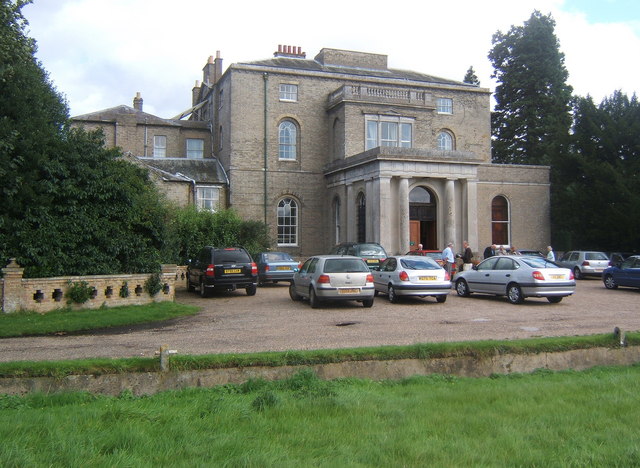
Letton Hall

Letton Hall is a Grade II listed eighteenth-century Neoclassical stately home designed by Sir John Soane for the Gurdon family between 1783 and 1789. It...

Cranworth

Cranworth is a village and civil parish in the Breckland district of the English county of Norfolk. == History == Cranworth's name is of Anglo-Saxon origin...

Shipdham

Shipdham is a village and civil parish in the Breckland district, in Norfolk, England, approximately 5 miles (8.0 km) south-south-west of Dereham. In...

Nearby Amenities

Located within 500m of 52.622307,0.925983
Letton Green
Place: hamlet
Lat/Long: 52.6219537/0.9274059
The data included in this document is from www.openstreetmap.org. The data is made available under ODbL.

Have you been to Letton Green?

Leave your review of Letton Green below (or comments, questions and feedback).