Cressbrook Dale

Valley in Derbyshire Derbyshire Dales

England

Cressbrook Dale

Old Milestone by the B6465, South of Rolley Low The milestone is located on the verge bank, under a bush, on the east side of the road. Parish of Great Longstone (Derbyshire Dales District). Carved stone post, Chapel Wedge design, erected by the Chesterfield & Hernstone Lane Head (& branches) turnpike trust in the 19th century. 

Inscription once read:- : (Bakewell / 4) : : (Tideswell / 4) : {From Old-maps}
Carved benchmark lower right side.

Milestone Society National ID: DE_BKTW04
Old Milestone by the B6465, South of Rolley Low Credit: Louise Marsden

Cressbrook Dale is a picturesque valley located in the Derbyshire Peak District, England. It is nestled between the villages of Litton and Cressbrook, and is renowned for its natural beauty and diverse wildlife.

The dale is formed by the River Wye, which meanders through the valley, surrounded by steep limestone cliffs and lush green meadows. The river provides a serene and tranquil atmosphere, with its gentle flow and the soothing sound of flowing water.

Cressbrook Dale is a haven for nature enthusiasts, offering a wide range of flora and fauna. The valley is home to a variety of wildflowers, including bluebells, orchids, and primroses, creating a vibrant and colorful landscape during spring and summer. The meadows attract numerous species of butterflies, while the woodlands provide a habitat for birds such as kingfishers and woodpeckers.

The valley also boasts an impressive geological history, with its limestone cliffs showcasing the remnants of ancient coral reefs. Fossils can still be found embedded in the rocks, offering a glimpse into the region's prehistoric past.

Cressbrook Dale is a popular destination for hikers and walkers, with numerous trails and footpaths that allow visitors to explore the valley's beauty up close. The dale offers stunning viewpoints, such as Peter's Stone, which provide panoramic views of the surrounding countryside.

Overall, Cressbrook Dale is a natural gem in Derbyshire, offering a peaceful retreat for those seeking solace in nature's embrace.

If you have any feedback on the listing, please let us know in the comments section below.

Cressbrook Dale Images

Images are sourced within 2km of 53.25808/-1.7411739 or Grid Reference SK1773. Thanks to Geograph Open Source API. All images are credited.

Old Milestone by the B6465, South of Rolley Low The milestone is located on the verge bank, under a bush, on the east side of the road. Parish of Great Longstone (Derbyshire Dales District). Carved stone post, Chapel Wedge design, erected by the Chesterfield & Hernstone Lane Head (& branches) turnpike trust in the 19th century. 

Inscription once read:- : (Bakewell / 4) : : (Tideswell / 4) : {From Old-maps}
Carved benchmark lower right side.

Milestone Society National ID: DE_BKTW04
Old Milestone by the B6465, South of Rolley Low
The milestone is located on the verge bank, under a bush, on the east side of the road. Parish of Great Longstone (Derbyshire Dales District). Carved stone post, Chapel Wedge design, erected by the Chesterfield & Hernstone Lane Head (& branches) turnpike trust in the 19th century. Inscription once read:- : (Bakewell / 4) : : (Tideswell / 4) : {From Old-maps} Carved benchmark lower right side. Milestone Society National ID: DE_BKTW04
Heather on Longstone Moor, NW of Great Longstone Fin Cop is the prominent hill in the distance.
Heather on Longstone Moor, NW of Great Longstone
Fin Cop is the prominent hill in the distance.
Bridge on R Wye at Upperdale
View NNE towards Wardlow Hay Cop
Trig point on Wardlow Hay Cop
Northern end of Cressbrook Dale from W of Wardlow Hay Cop
Northern end of Cressbrook Dale
View WSW along Cressbrook Dale towards Peter's Stone
Terrecettes, Litton Dale
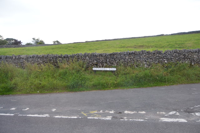
Bottomhill Rd
Bottomhill Rd
Litton Litton is a village in the Peak District of Derbyshire. It is one mile from Tideswell and six miles from Bakewell.
The village has a primary school, a post office run by a co-operative of villagers and the Red Lion pub. There are two churches, one at the east end of the village, and one at the west, on the outskirts of the village on the road to Tideswell.
Litton
Litton is a village in the Peak District of Derbyshire. It is one mile from Tideswell and six miles from Bakewell. The village has a primary school, a post office run by a co-operative of villagers and the Red Lion pub. There are two churches, one at the east end of the village, and one at the west, on the outskirts of the village on the road to Tideswell.
Shop in Litton Litton is a village in the Peak District of Derbyshire. It is one mile from Tideswell and six miles from Bakewell.
The village has a primary school, a post office run by a co-operative of villagers and the Red Lion pub. There are two churches, one at the east end of the village, and one at the west, on the outskirts of the village on the road to Tideswell.
Shop in Litton
Litton is a village in the Peak District of Derbyshire. It is one mile from Tideswell and six miles from Bakewell. The village has a primary school, a post office run by a co-operative of villagers and the Red Lion pub. There are two churches, one at the east end of the village, and one at the west, on the outskirts of the village on the road to Tideswell.
Road sign, Litton Litton is a village in the Peak District of Derbyshire. It is one mile from Tideswell and six miles from Bakewell.
The village has a primary school, a post office run by a co-operative of villagers and the Red Lion pub. There are two churches, one at the east end of the village, and one at the west, on the outskirts of the village on the road to Tideswell.
Road sign, Litton
Litton is a village in the Peak District of Derbyshire. It is one mile from Tideswell and six miles from Bakewell. The village has a primary school, a post office run by a co-operative of villagers and the Red Lion pub. There are two churches, one at the east end of the village, and one at the west, on the outskirts of the village on the road to Tideswell.
Cottages, Litton Litton is a village in the Peak District of Derbyshire. It is one mile from Tideswell and six miles from Bakewell.
The village has a primary school, a post office run by a co-operative of villagers and the Red Lion pub. There are two churches, one at the east end of the village, and one at the west, on the outskirts of the village on the road to Tideswell.
Cottages, Litton
Litton is a village in the Peak District of Derbyshire. It is one mile from Tideswell and six miles from Bakewell. The village has a primary school, a post office run by a co-operative of villagers and the Red Lion pub. There are two churches, one at the east end of the village, and one at the west, on the outskirts of the village on the road to Tideswell.
Litton School Litton is a village in the Peak District of Derbyshire. It is one mile from Tideswell and six miles from Bakewell.
The village has a primary school, a post office run by a co-operative of villagers and the Red Lion pub. There are two churches, one at the east end of the village, and one at the west, on the outskirts of the village on the road to Tideswell.
Litton School
Litton is a village in the Peak District of Derbyshire. It is one mile from Tideswell and six miles from Bakewell. The village has a primary school, a post office run by a co-operative of villagers and the Red Lion pub. There are two churches, one at the east end of the village, and one at the west, on the outskirts of the village on the road to Tideswell.
Hammerton Hill
Hammerton Hill
The Monsal Trail The Monsal Trail is a traffic free route for walkers, cyclists, horse riders and wheelchair users through some of the Peak District's most spectacular limestone dales.
The trail runs along the former Midland Railway line ( <span class="nowrap"><a title="https://en.wikipedia.org/wiki/Manchester,_Buxton,_Matlock_and_Midland_Junction_Railway" rel="nofollow ugc noopener" href="https://en.wikipedia.org/wiki/Manchester,_Buxton,_Matlock_and_Midland_Junction_Railway">Link</a><img style="margin-left:2px;" alt="External link" title="External link - shift click to open in new window" src="https://s1.geograph.org.uk/img/external.png" width="10" height="10"/></span> ), which closed in 1968, for 8.5 miles between Blackwell Mill <a href="https://www.geograph.org.uk/photo/4786486">SK1172 : The start of The Monsal Trail</a>, in Chee Dale and Coombs Road, at Bakewell.
Most of the route was opened to the public in 1981 but four former railway tunnels had to remain closed due to safety reasons, with public footpaths taking people around them. In 2011 the four railway tunnels - Headstone Tunnel, Cressbrook Tunnel, Litton Tunnel, Chee Tor Tunnel were opened for trail users. Each tunnel is about 400 metres long and will be lit during normal daylight hours.
Wikipedia: <span class="nowrap"><a title="https://en.wikipedia.org/wiki/Monsal_Trail" rel="nofollow ugc noopener" href="https://en.wikipedia.org/wiki/Monsal_Trail">Link</a><img style="margin-left:2px;" alt="External link" title="External link - shift click to open in new window" src="https://s1.geograph.org.uk/img/external.png" width="10" height="10"/></span>
The Monsal Trail
The Monsal Trail is a traffic free route for walkers, cyclists, horse riders and wheelchair users through some of the Peak District's most spectacular limestone dales. The trail runs along the former Midland Railway line ( LinkExternal link ), which closed in 1968, for 8.5 miles between Blackwell Mill SK1172 : The start of The Monsal Trail, in Chee Dale and Coombs Road, at Bakewell. Most of the route was opened to the public in 1981 but four former railway tunnels had to remain closed due to safety reasons, with public footpaths taking people around them. In 2011 the four railway tunnels - Headstone Tunnel, Cressbrook Tunnel, Litton Tunnel, Chee Tor Tunnel were opened for trail users. Each tunnel is about 400 metres long and will be lit during normal daylight hours. Wikipedia: LinkExternal link
Show me another place!

Cressbrook Dale is located at Grid Ref: SK1773 (Lat: 53.25808, Lng: -1.7411739)

Administrative County: Derbyshire

District: Derbyshire Dales

Police Authority: Derbyshire

What 3 Words

///country.aliens.tutored. Near Tideswell, Derbyshire

Related Wikis

Cressbrook Dale

Cressbrook Dale (also called Ravensdale) is a dry carboniferous limestone gorge near Bakewell, Derbyshire, in the Peak District of England. The dale is...

Cressbrook

Cressbrook is a village in the Peak District National Park in Derbyshire. It lies in Water-cum-Jolly Dale at the foot of Cressbrook Dale. Population details...

Wardlow, Derbyshire

Wardlow is a parish and linear village in the Derbyshire Dales two miles from Tideswell, Derbyshire, England. The population at the 2011 census was 118...

Litton Mill

Litton Mill is a textile mill at Millers Dale, near Tideswell in Derbyshire. The original 19th-century mill became notorious during the Industrial Revolution...

Nearby Amenities

Located within 500m of 53.25808,-1.7411739
Cressbrook
Is In: Derbyshire, England, UK
Place: village
Wikidata: Q5184488
Wikipedia: en:Cressbrook
Lat/Long: 53.2548332/-1.7458863
Barrier: stile
Bicycle: no
Foot: yes
Horse: no
Motor Vehicle: no
Stile: squeezer
Lat/Long: 53.2584789/-1.7364856
Waste Basket
Waste: dog_excrement
Lat/Long: 53.2549102/-1.7452642
Bench
Openbenches Id: 31039
Lat/Long: 53.2548168/-1.7455774
Bench
Lat/Long: 53.2548225/-1.7455504
The data included in this document is from www.openstreetmap.org. The data is made available under ODbL.

Have you been to Cressbrook Dale?

Leave your review of Cressbrook Dale below (or comments, questions and feedback).