Wicking Clough

Valley in Yorkshire

England

Wicking Clough

Wall enclosed Law Slack Road Looking north-eastward in the direction of Green Gate and Law Head.
Wall enclosed Law Slack Road Credit: Peter Wood

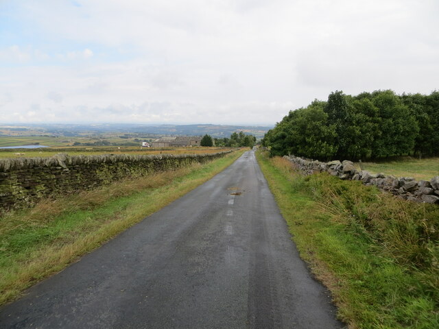
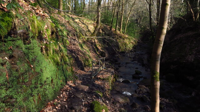
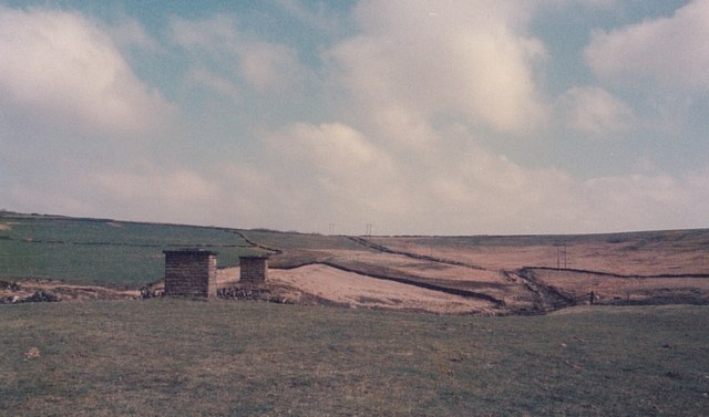
Wicking Clough is a picturesque valley located in the county of Yorkshire, England. Nestled in the stunning Pennine Hills, this tranquil valley offers breathtaking natural beauty and a serene escape from the hustle and bustle of city life.

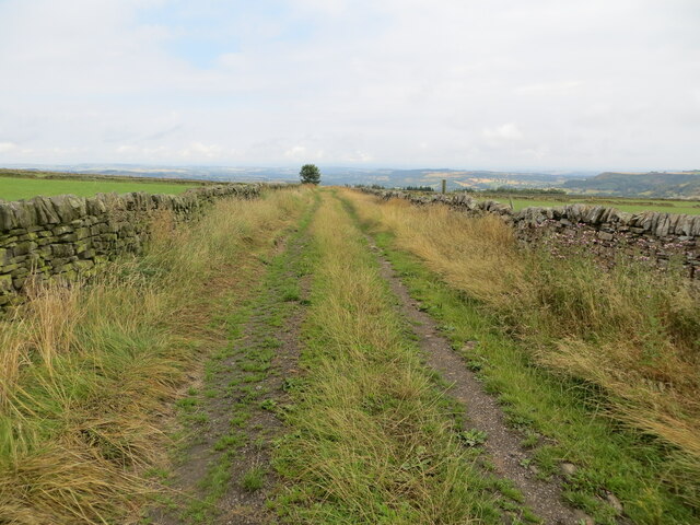
The valley is characterized by its lush greenery, rolling hills, and cascading waterfalls. Wicking Clough is renowned for its diverse wildlife, making it a haven for nature lovers and birdwatchers. Rare species such as red grouse, curlews, and lapwings can be spotted in the area, adding to its ecological significance.

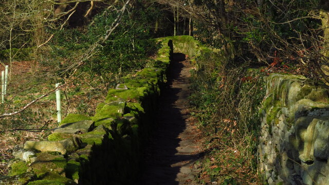
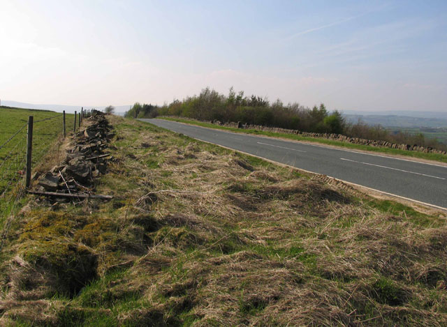
The valley also boasts an extensive network of walking trails, making it a paradise for hikers and outdoor enthusiasts. The trails wind through ancient woodlands, open moorlands, and babbling brooks, providing visitors with an opportunity to immerse themselves in the peaceful countryside.

One of the notable attractions in Wicking Clough is its magnificent waterfalls. The cascading waters create a mesmerizing spectacle, drawing visitors from far and wide. The sound of rushing water combined with the surrounding tranquility creates an idyllic setting for relaxation and rejuvenation.

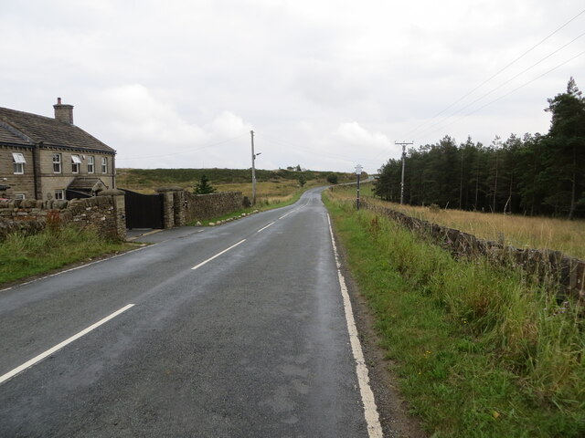
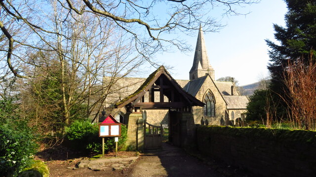
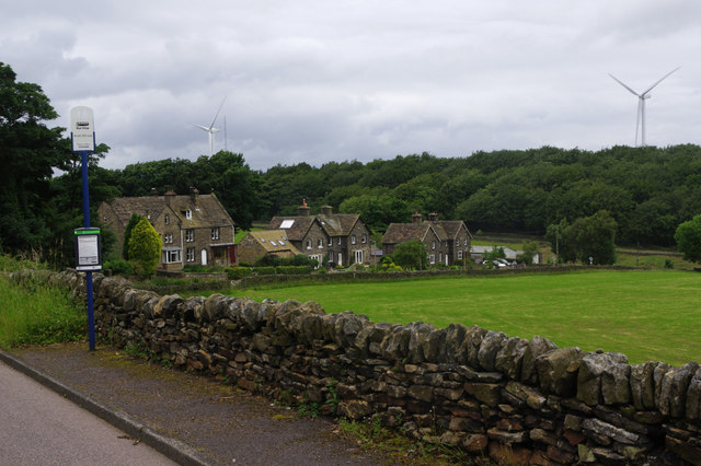
In addition to its natural beauty, Wicking Clough is home to a charming village that offers a glimpse into rural life. The village features traditional stone cottages, a centuries-old church, and a friendly community. Local pubs and tea rooms provide a warm welcome to visitors, offering a taste of Yorkshire hospitality.

Overall, Wicking Clough is a true gem in the heart of Yorkshire. Its stunning landscapes, rich biodiversity, and peaceful atmosphere make it an ideal destination for those seeking a natural retreat and a chance to connect with nature.

If you have any feedback on the listing, please let us know in the comments section below.

Wicking Clough Images

Images are sourced within 2km of 53.545138/-1.7405295 or Grid Reference SE1705. Thanks to Geograph Open Source API. All images are credited.

Wall enclosed Law Slack Road Looking north-eastward in the direction of Green Gate and Law Head.
Wall enclosed Law Slack Road
Looking north-eastward in the direction of Green Gate and Law Head.
Wall enclosed track near Law Head Looking north-westward. Use by the Barnsley Boundary Walk.
Wall enclosed track near Law Head
Looking north-westward. Use by the Barnsley Boundary Walk.
Bedding Edge Road at Law Bottom Cottage Looking north-eastward.
Bedding Edge Road at Law Bottom Cottage
Looking north-eastward.
Old milestone In 2017 this West Riding CC milestone from 1893/94 had lost most of its paint.   It is not known who has painted it but it certainly looks much smarter.   It is nearly opposite Gate Head Lane and Gatehead Methodist Chapel which on the day of this photo was 'SOLD'. After passing the milestone going southwards there is a sharp left bend and a short distance up the road is a tollhouse from the Wadsley and Langsett, Holmfirth District, turnpike first enacted in 1823, closed in 1879.  The milestone is Grade II listed 1191204.
Old milestone
In 2017 this West Riding CC milestone from 1893/94 had lost most of its paint. It is not known who has painted it but it certainly looks much smarter. It is nearly opposite Gate Head Lane and Gatehead Methodist Chapel which on the day of this photo was 'SOLD'. After passing the milestone going southwards there is a sharp left bend and a short distance up the road is a tollhouse from the Wadsley and Langsett, Holmfirth District, turnpike first enacted in 1823, closed in 1879. The milestone is Grade II listed 1191204.
Old milestone This, once sad looking, sunken milestone at Crow Edge had, in 2017 been dug out and the wall behind it repaired.   It is one of the 615 milestones erected in 1893/94 by the family firm of Gill and Frank Stead of Mirfield for the newly-formed West Riding County Council.  Over half are still to be found by the roadside all over the old West Riding.   This one has been smartly painted in a similar pattern to several others in this part of Yorkshire.
Old milestone
This, once sad looking, sunken milestone at Crow Edge had, in 2017 been dug out and the wall behind it repaired. It is one of the 615 milestones erected in 1893/94 by the family firm of Gill and Frank Stead of Mirfield for the newly-formed West Riding County Council. Over half are still to be found by the roadside all over the old West Riding. This one has been smartly painted in a similar pattern to several others in this part of Yorkshire.
Path through Morton Wood, Dean Dike near Hepworth
Hepworth - Holy Trinity Church
Enclosed path running N down to Dean Dike from Hepworth Church
Old milestone The 1893/94 West Riding CC milestone on the A616 in Hepworth becomes more desperate for a repaint as years roll by.   It is on a narrow verge on a sharp bend, Sheffield Road, Hepworth.   Eight milestones were commissioned for the New Mill District of the Sheffield to Huddersfield route, 7 are still in situ.  This one is Grade II listed 1134817.
Old milestone
The 1893/94 West Riding CC milestone on the A616 in Hepworth becomes more desperate for a repaint as years roll by. It is on a narrow verge on a sharp bend, Sheffield Road, Hepworth. Eight milestones were commissioned for the New Mill District of the Sheffield to Huddersfield route, 7 are still in situ. This one is Grade II listed 1134817.
Inverted siphon The two manholes are the shafts for an inverted siphon crossing Calf Hey Lane
Inverted siphon
The two manholes are the shafts for an inverted siphon crossing Calf Hey Lane
B6106 towards Holmfirth
B6106 towards Penistone
Gateway into field Note the stone gatepost to the left.
Gateway into field
Note the stone gatepost to the left.
Crow Edge The A616 Langsett to New Mill road north of Foxholes Grove.
Crow Edge
The A616 Langsett to New Mill road north of Foxholes Grove.
Brook Hill Lane, Carlecotes This is the northern end of Carlecotes, but there is not much here anyway. The road heads down the hill to the B6106.
Brook Hill Lane, Carlecotes
This is the northern end of Carlecotes, but there is not much here anyway. The road heads down the hill to the B6106.
Telephone box - Carlecotes This K6 telephone box is in a sadly derelict condition, no longer housing a phone and clearly unloved and neglected. Perhaps it might have a future as a book exchange or something similar, as with some other boxes in rural areas.
Telephone box - Carlecotes
This K6 telephone box is in a sadly derelict condition, no longer housing a phone and clearly unloved and neglected. Perhaps it might have a future as a book exchange or something similar, as with some other boxes in rural areas.
Farmland at Carlecotes Seen from Brook Hill Lane.
Farmland at Carlecotes
Seen from Brook Hill Lane.
"The Fox House Inn" near Holmfirth
Show me another place!

Wicking Clough is located at Grid Ref: SE1705 (Lat: 53.545138, Lng: -1.7405295)

Division: West Riding

Unitary Authority: Kirklees

Police Authority: West Yorkshire

What 3 Words

///deployed.mystified.marmalade. Near Holmfirth, West Yorkshire

Related Wikis

Barnside

Barnside is a hamlet on Barnside Lane approximately 3/4 mile to the southeast of Hepworth in West Yorkshire, England. It is in the civic parish of Holme...

Crow Edge

Crow Edge is a hamlet in Dunford civil parish, situated on the A616, two miles southeast of Hepworth, West Yorkshire in the metropolitan borough of Barnsley...

Hepworth, West Yorkshire

Hepworth is a village and former civil parish, now in the parish of Holme Valley, in the metropolitan borough of Kirklees, in West Yorkshire, England....

Carlecotes

Carlecotes is a village in the metropolitan borough of Barnsley in South Yorkshire, England. Carlecotes is within Dunford civil parish. The village is...

Nearby Amenities

Located within 500m of 53.545138,-1.7405295
Bus Stop
Bedding Edge Road
Alt Name: Bedding Edge Road
Bus: yes
Naptan AltCommonName: Bedding Edge Road
Naptan AtcoCode: 370050980
Naptan Bearing: N
Naptan CommonName: Bedding Edge Road
Naptan Indicator: 50980
Naptan Landmark: OPPOSITE STONE HOUSE
Naptan PlusbusZoneRef: ROTHCEN
Naptan Street: Bedding Edge Road
Naptan Verified: no
Public Transport: platform
Source: naptan_import
Lat/Long: 53.541466/-1.7405074
Bus Stop
Bedding Edge Road
Alt Name: Bedding Edge Road
Bus: yes
Naptan AltCommonName: Bedding Edge Road
Naptan AtcoCode: 370050981
Naptan Bearing: NE
Naptan CommonName: Bedding Edge Road
Naptan Indicator: 50981
Naptan Landmark: NEW WHITE HOUSE FARM
Naptan PlusbusZoneRef: ROTHCEN
Naptan Street: Bedding Edge Road
Naptan Verified: no
Public Transport: platform
Source: naptan_import
Lat/Long: 53.5440979/-1.7356168
Bedding Edge Road/Upper Nab
Naptan AtcoCode: 370055557
Naptan Bearing: N
Naptan BusStopType: CUS
Naptan CommonName: Bedding Edge Road/Upper Nab
Naptan Indicator: 55557
Naptan Landmark: OPPOSITE STONE HOUSE
Naptan PlusbusZoneRef: ROTHCEN
Naptan Street: Bedding Edge Road
Naptan Verified: no
Source: naptan_import
Lat/Long: 53.5416013/-1.7407631
Bedding Edge Road/New White House Farm
Naptan AtcoCode: 370055624
Naptan Bearing: SW
Naptan BusStopType: CUS
Naptan CommonName: Bedding Edge Road/New White House Farm
Naptan Indicator: 55624
Naptan Landmark: NEW WHITE HOUSE FARM
Naptan PlusbusZoneRef: ROTHCEN
Naptan Street: Bedding Edge Road
Naptan Verified: no
Source: naptan_import
Lat/Long: 53.5439808/-1.7355119
Barrier: stile
Stile: stepover
Lat/Long: 53.54735/-1.736712
Generator Method: wind_turbine
Generator Source: wind
Power: generator
Lat/Long: 53.5438346/-1.7338787
Hepshaw Brow
Place: locality
Lat/Long: 53.5416704/-1.7380591
Victoria Crossroads
Junction: yes
Lat/Long: 53.5451229/-1.7329827
Barrier: stile
Step Count: 3
Stile: stepover
Lat/Long: 53.5471757/-1.7368543
Power: pole
Lat/Long: 53.5423896/-1.7364515
Power: pole
Lat/Long: 53.5431988/-1.7375939
Power: pole
Lat/Long: 53.5444526/-1.7381793
Power: pole
Lat/Long: 53.5451821/-1.7384639
Power: pole
Lat/Long: 53.5460379/-1.7389182
Power: pole
Lat/Long: 53.5474528/-1.7396145
Power: pole
Lat/Long: 53.5489156/-1.7403113
Power: pole
Lat/Long: 53.549398/-1.7402168
Power: pole
Lat/Long: 53.5488445/-1.7395654
Power: pole
Lat/Long: 53.5482951/-1.7387995
Power: pole
Lat/Long: 53.5484824/-1.7384329
Power: pole
Lat/Long: 53.5488861/-1.7374826
Power: pole
Lat/Long: 53.5490623/-1.7370669
Power: pole
Lat/Long: 53.5406929/-1.741688
Power: pole
Lat/Long: 53.5408349/-1.7426571
Power: pole
Lat/Long: 53.5466158/-1.7467664
Power: pole
Lat/Long: 53.5459491/-1.7444694
Power: pole
Lat/Long: 53.5451423/-1.7432294
Power: pole
Lat/Long: 53.5442461/-1.7419
Power: pole
Lat/Long: 53.5432677/-1.7404527
Power: pole
Lat/Long: 53.5422168/-1.738859
Power: pole
Lat/Long: 53.5413954/-1.7376231
Victoria
Place: hamlet
Lat/Long: 53.545033/-1.7330038
Power: pole
Lat/Long: 53.5407653/-1.7389706
Power: pole
Lat/Long: 53.5411243/-1.7393536
Power: pole
Lat/Long: 53.5414154/-1.7396667
Power: pole
Lat/Long: 53.5419819/-1.7402744
Power: pole
Lat/Long: 53.5425593/-1.7408904
Power: pole
Lat/Long: 53.5431464/-1.7415225
Power: pole
Lat/Long: 53.5437443/-1.7421608
Power: pole
Lat/Long: 53.544376/-1.7428479
Power: pole
Lat/Long: 53.5450016/-1.7435024
Power: pole
Lat/Long: 53.5456159/-1.7453945
Power: pole
Lat/Long: 53.5459522/-1.746395
Power: pole
Lat/Long: 53.5462789/-1.7473981
Power: pole
Lat/Long: 53.5452606/-1.7442982
Barrier: stile
Step Count: 1
Stile: stepover
Lat/Long: 53.5418036/-1.742355
Barrier: stile
Step Count: 1
Stile: stepover
Lat/Long: 53.5409687/-1.7427809
Barrier: stile
Step Count: 2
Stile: stepover
Lat/Long: 53.5410282/-1.7425074
Generator Method: wind_turbine
Generator Source: wind
Power: generator
Lat/Long: 53.544384/-1.739368
Barrier: stile
Step Count: 2
Stile: stepover
Lat/Long: 53.5417717/-1.7442848
Barrier: stile
Step Count: 2
Stile: stepover
Lat/Long: 53.5410587/-1.7413625
Events Venue
Blossom Barn Weddings
Lat/Long: 53.5421473/-1.7349522
Barrier: stile
Stile: stepover
Lat/Long: 53.5453021/-1.7416788
Barrier: stile
Step Count: 1
Stile: stepover
Lat/Long: 53.5466578/-1.7423333
Barrier: stile
Lat/Long: 53.5487242/-1.7444619
Barrier: stile
Step Count: 1
Stile: stepover
Lat/Long: 53.5487724/-1.7368457
Barrier: stile
Stile: stepover
Lat/Long: 53.5463252/-1.7375239
Barrier: stile
Lat/Long: 53.5457729/-1.7380032
Barrier: stile
Step Count: 1
Stile: stepover
Lat/Long: 53.5488974/-1.7365531
Barrier: stile
Stile: stepover
Lat/Long: 53.546071/-1.7373026
The data included in this document is from www.openstreetmap.org. The data is made available under ODbL.

Have you been to Wicking Clough?

Leave your review of Wicking Clough below (or comments, questions and feedback).