Bradwell Dale

Valley in Derbyshire Derbyshire Dales

England

Bradwell Dale

Dry Stone Wall and Stile, Tophole Road
Dry Stone Wall and Stile, Tophole Road Credit: David Dixon

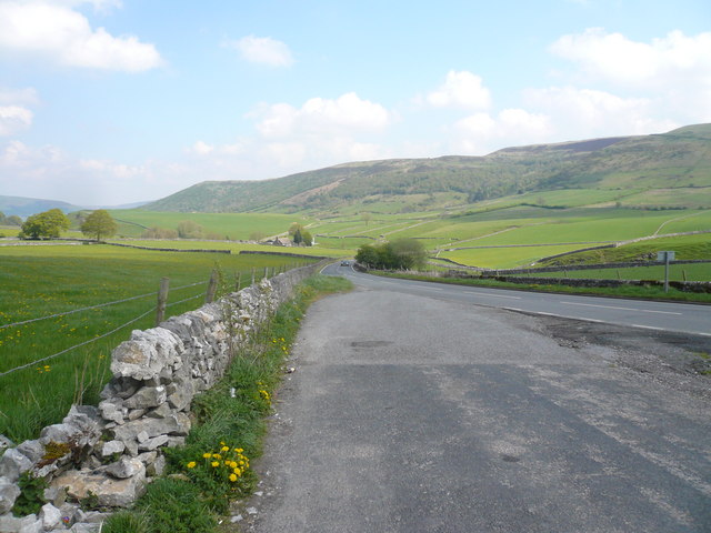
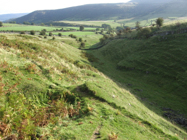
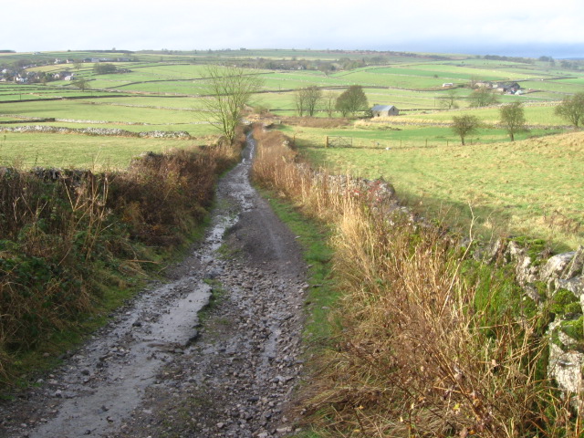
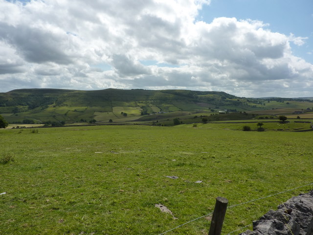
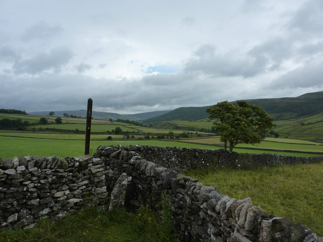
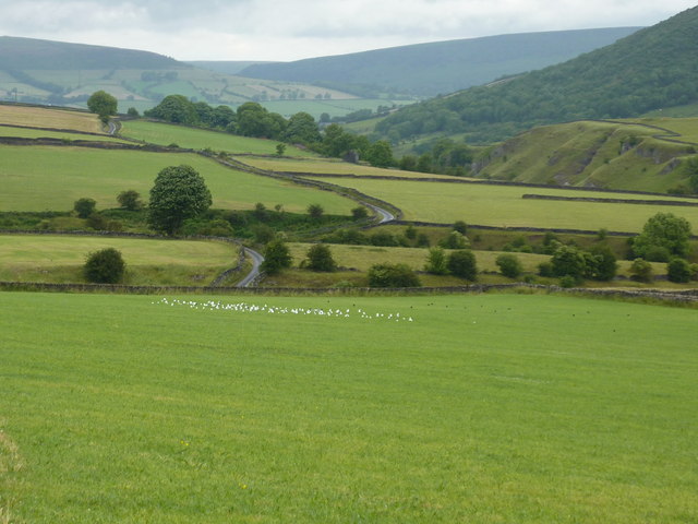
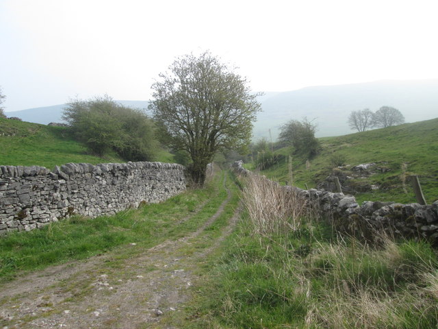
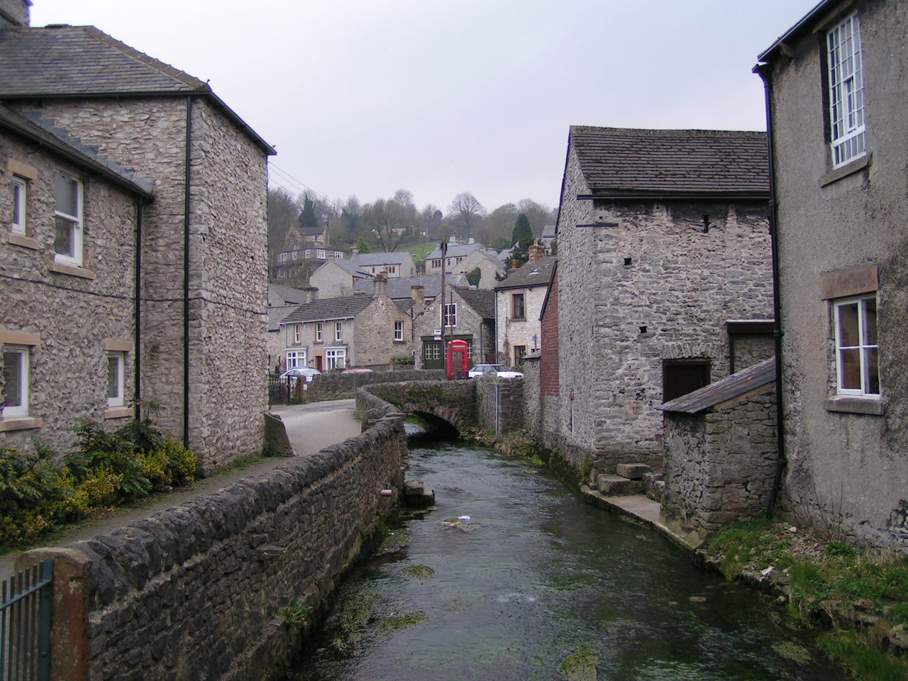
Bradwell Dale is a picturesque valley located in the county of Derbyshire, England. Nestled in the heart of the Peak District National Park, it is a popular destination for nature enthusiasts and walkers alike. The valley is characterized by its stunning natural beauty, with rolling hills, lush green meadows, and meandering streams.

The dale is known for its diverse wildlife, making it a haven for birdwatchers and nature lovers. Visitors can spot a variety of bird species, including buzzards, kestrels, and peregrine falcons, soaring high above the valley. The surrounding woodlands are home to a range of mammals, such as deer, foxes, and badgers.

One of the main attractions of Bradwell Dale is its network of walking trails, which allow visitors to explore the area at their own pace. These trails offer breathtaking views of the surrounding countryside and lead to notable landmarks, such as the picturesque Bradwell Edge and the historic Bradwell Roman Fort.

In addition to its natural beauty, Bradwell Dale also holds historical significance. The valley has evidence of human habitation dating back to the Roman era, with remnants of the Roman fort still visible today. The nearby village of Bradwell is a charming place to visit, with its traditional stone cottages and friendly atmosphere.

Overall, Bradwell Dale is a delightful destination for those seeking tranquility and natural beauty. With its stunning landscapes, abundant wildlife, and rich history, it truly offers a memorable experience for visitors of all ages.

If you have any feedback on the listing, please let us know in the comments section below.

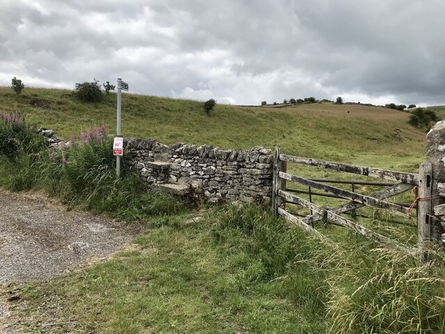
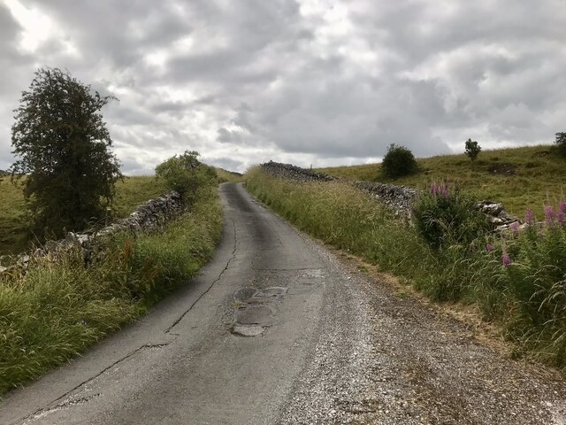
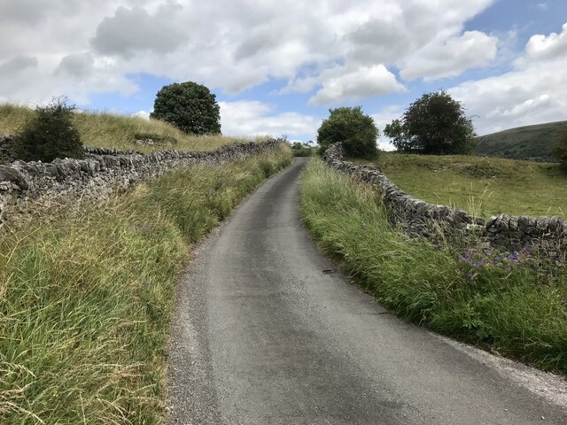
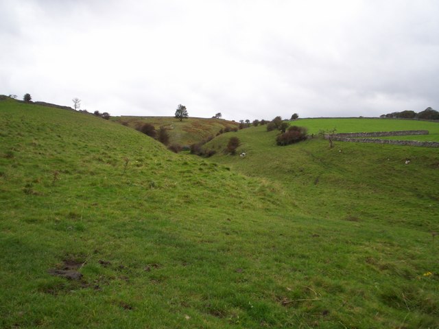
Bradwell Dale Images

Images are sourced within 2km of 53.320665/-1.7434529 or Grid Reference SK1780. Thanks to Geograph Open Source API. All images are credited.

Dry Stone Wall and Stile, Tophole Road
Tophole Road Tophole Road is a narrow road to south of the village of Bradwell.
Tophole Road
Tophole Road is a narrow road to south of the village of Bradwell.
Greendale, Tophole Road Tophole Road is a narrow road to south of the village of Bradwell.
Greendale, Tophole Road
Tophole Road is a narrow road to south of the village of Bradwell.
Coplow Dale Derelict farmhouse above the occupied houses at Coplow Dale. A constant stream of quarry trucks thunder through this hamlet during weekdays.
Coplow Dale
Derelict farmhouse above the occupied houses at Coplow Dale. A constant stream of quarry trucks thunder through this hamlet during weekdays.
Shuttle Rake Even at noon, the frozen ground on the north-facing slope of the depression remains untouched by the sun. Looking west up Shuttle Rake towards the old open cast workings.
Shuttle Rake
Even at noon, the frozen ground on the north-facing slope of the depression remains untouched by the sun. Looking west up Shuttle Rake towards the old open cast workings.
Intake Dale Intake Dale pictured here on a breezy Saturday afternoon in October. This is a comparatively minor dale although it is designated Access Land.
Intake Dale
Intake Dale pictured here on a breezy Saturday afternoon in October. This is a comparatively minor dale although it is designated Access Land.
Little Hucklow
Little Hucklow
View down New Road (B6049)
Intake Dale
Intake Dale
Track from Great Hucklow
Durham Edge Fields with the moors of Abney in the distance.
Durham Edge
Fields with the moors of Abney in the distance.
Shuttle Rake in summer Looking west up towards the site of old mine workings.
Shuttle Rake in summer
Looking west up towards the site of old mine workings.
Farm buildings, yellow old banger and dilapidated tractor At a farm at Coplow Dale, near Little Hucklow.
Farm buildings, yellow old banger and dilapidated tractor
At a farm at Coplow Dale, near Little Hucklow.
Garden at Coplow Dale
On a path to Intake Dale Walking south from Coplow Dale towards Bradwell, the path soon joins Tophole Road. It's a day of sunshine and showers. Win Hill is to the left of the post, on the horizon.
On a path to Intake Dale
Walking south from Coplow Dale towards Bradwell, the path soon joins Tophole Road. It's a day of sunshine and showers. Win Hill is to the left of the post, on the horizon.
Gulls in a field near Intake Dale They are just about to take off as we approach. Poor gulls, so far from the sea in landlocked Derbyshire !
Gulls in a field near Intake Dale
They are just about to take off as we approach. Poor gulls, so far from the sea in landlocked Derbyshire !
Camphill, Abney Moor (1997) Launch site for the Derbyshire & Lancashire Gliding Club.
Camphill, Abney Moor (1997)
Launch site for the Derbyshire & Lancashire Gliding Club.
Green Dale
Green Dale
Show me another place!

Bradwell Dale is located at Grid Ref: SK1780 (Lat: 53.320665, Lng: -1.7434529)

Administrative County: Derbyshire

District: Derbyshire Dales

Police Authority: Derbyshire

What 3 Words

///clef.sweetened.stamp. Near Hope Valley, Derbyshire

Related Wikis

Hazlebadge

Hazlebadge is a civil parish within the Derbyshire Dales district, in the county of Derbyshire, England. Largely rural, Hazlebadge's population is reported...

St Barnabas' Church, Bradwell

St Barnabas' Church, Bradwell is a Grade II listedparish church in the Church of England in Bradwell, Derbyshire. == History == The church was designed...

Bradwell, Derbyshire

Bradwell is a village and civil parish in the Derbyshire Peak District of England. The population of the civil parish taken at the 2011 Census was 1,416...

Deadman's Clough

Deadman's Clough is a stream in the civil parish of Hazlebadge in the Derbyshire Peak District. The stream rises to the south of Bradwell, where it meets...

Nearby Amenities

Located within 500m of 53.320665,-1.7434529
Bagshaw Cavern
Tourism: attraction
Lat/Long: 53.3243783/-1.7434284
Barrier: stile
Ele: 246.4617920
Stile: squeezer
Lat/Long: 53.3185232/-1.7470842
Ele: 203.9238281
Lat/Long: 53.31928/-1.7446327
Barrier: stile
Stile: squeezer
Lat/Long: 53.3192763/-1.7445659
Ele: 202.4818115
Lat/Long: 53.3192751/-1.7445432
Ele: 203.2027588
Lat/Long: 53.3192878/-1.7445243
Ele: 201.5205078
Lat/Long: 53.3193477/-1.7444229
Ele: 186.6202393
Lat/Long: 53.3242326/-1.7398955
Ele: 255.5943604
Lat/Long: 53.321755/-1.7444612
Ele: 270.2542725
Lat/Long: 53.3219728/-1.746376
Ele: 272.4172363
Lat/Long: 53.3221102/-1.746453
Ele: 280.8287354
Lat/Long: 53.3233106/-1.7478728
Fixme: precise position of change in speed limit not recorded
Lat/Long: 53.3242887/-1.7397371
Barrier: stile
Material: stone
Source: survey;gps
Stile: squeezer
Lat/Long: 53.3162221/-1.7439743
Barrier: stile
Material: stone
Source: survey;gps
Stile: squeezer
Lat/Long: 53.3162873/-1.7431137
Barrier: stile
Material: stone
Source: survey;gps
Stile: squeezer
Lat/Long: 53.3231878/-1.7389892
Barrier: stile
Lat/Long: 53.3196141/-1.7453349
Barrier: stile
Lat/Long: 53.3198429/-1.7464262
Barrier: stile
Material: stone
Source: survey;gps
Stile: squeezer
Lat/Long: 53.3162675/-1.7441168
Barrier: stile
Lat/Long: 53.317669/-1.7451821
Bench
Backrest: yes
Lat/Long: 53.3250107/-1.7449104
Noexit: yes
Note: Path blocked by brambles. February 2024.
Lat/Long: 53.3195563/-1.7452817
Natural: cave_entrance
Lat/Long: 53.3203815/-1.7424881
Historic: iron_age_fort
Lat/Long: 53.3226385/-1.7400437
Echo Rock
Description: A small collection of rocks in the path. Face towards the village and says something. Your voice echoes back.
Height: 0.50
Natural: cliff
Lat/Long: 53.3217176/-1.7394351
The data included in this document is from www.openstreetmap.org. The data is made available under ODbL.

Have you been to Bradwell Dale?

Leave your review of Bradwell Dale below (or comments, questions and feedback).