Eaton Dale

Valley in Derbyshire Derbyshire Dales

England

Eaton Dale

Tissington Trail crossing Liffs Road The former railway heading north towards Johnson's Knoll - topped by a stand of trees.
Tissington Trail crossing Liffs Road Credit: Chris Heaton

Eaton Dale is a picturesque valley located in the county of Derbyshire, England. Nestled within the Peak District National Park, it offers visitors and residents breathtaking natural beauty and a tranquil atmosphere. The valley is situated near the charming village of Eaton, which adds to its appeal.

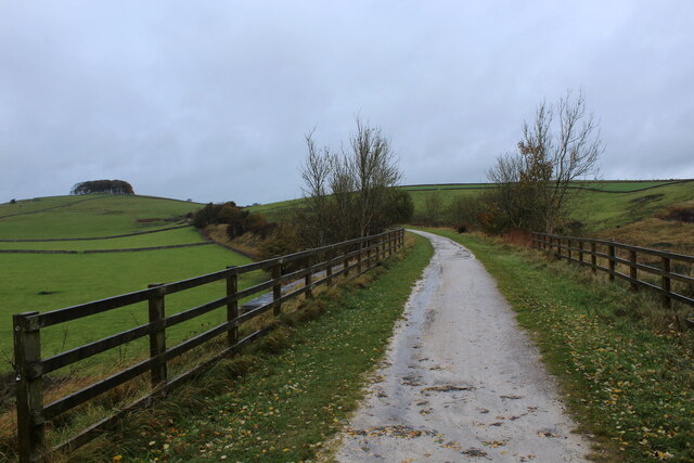
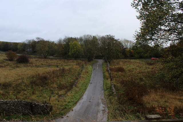
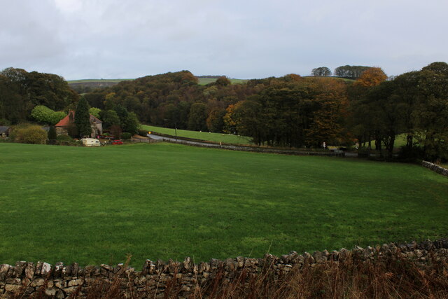
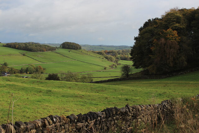
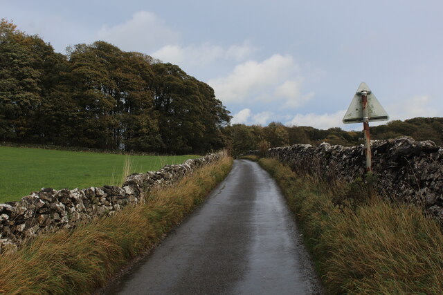
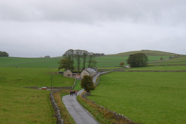
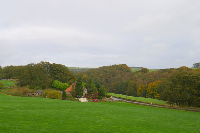
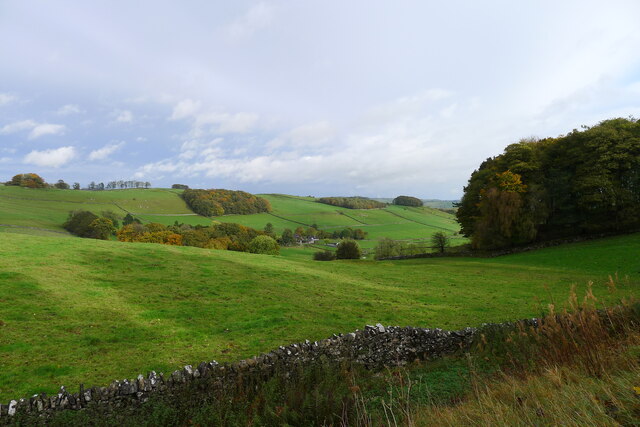
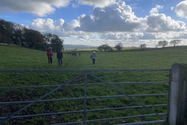
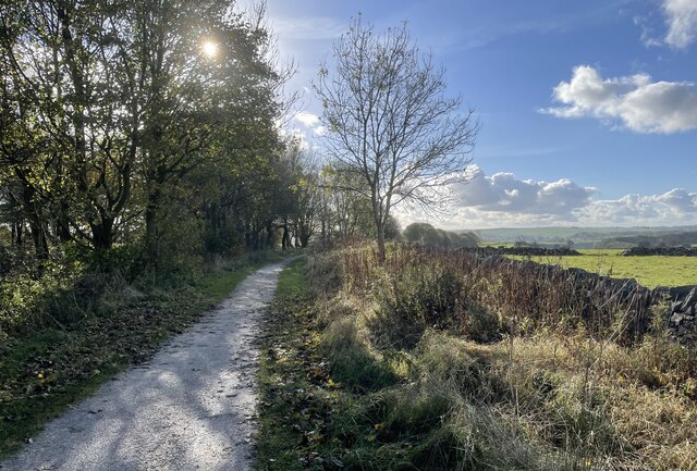
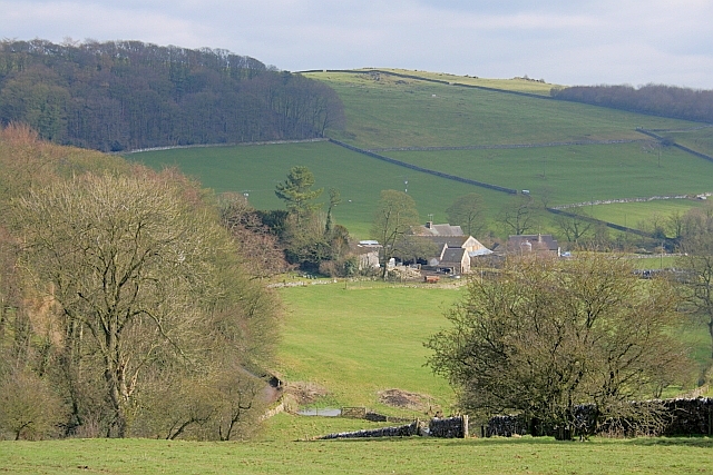
The landscape of Eaton Dale is characterized by rolling hills, lush green meadows, and meandering streams. The valley is surrounded by dense woodland, providing a habitat for a variety of wildlife, including deer, rabbits, and numerous bird species. Walking trails and footpaths crisscross the valley, allowing visitors to explore its scenic beauty at their own pace.

Eaton Dale is known for its stunning views, particularly from the elevated areas that overlook the valley. On a clear day, one can see for miles, taking in the expansive countryside and surrounding peaks. These views are especially popular among photographers and nature enthusiasts.

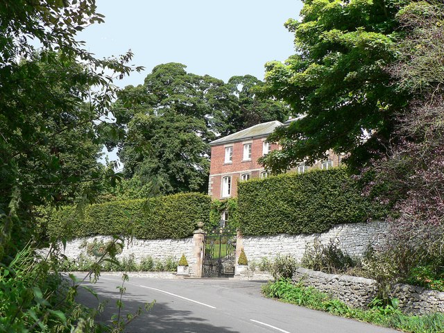
The valley is also home to several historic landmarks, such as Eaton Hall, a stately mansion dating back to the 19th century. The hall is surrounded by well-maintained gardens that showcase a variety of flora and provide a delightful setting for a leisurely stroll.

Eaton Dale offers a peaceful and idyllic retreat from the hustle and bustle of city life. Whether it is for a day trip or an extended stay, visitors to this Derbyshire gem will find themselves immersed in nature's beauty and serenity.

If you have any feedback on the listing, please let us know in the comments section below.

Eaton Dale Images

Images are sourced within 2km of 53.096478/-1.7458623 or Grid Reference SK1755. Thanks to Geograph Open Source API. All images are credited.

Tissington Trail crossing Liffs Road The former railway heading north towards Johnson's Knoll - topped by a stand of trees.
Tissington Trail crossing Liffs Road
The former railway heading north towards Johnson's Knoll - topped by a stand of trees.
Liffs Road approaching the A515 As seen from the former railway bridge that carries the Tissington Trail across Liffs Road
Liffs Road approaching the A515
As seen from the former railway bridge that carries the Tissington Trail across Liffs Road
Looking towards Greenlowfield and the A515 As seen from the Tissington Trail, slightly to the north of the former Alsop station.
Looking towards Greenlowfield and the A515
As seen from the Tissington Trail, slightly to the north of the former Alsop station.
Countryside near Alsop en le Dale As seen from the Tissington Trail beside Stonepit Plantation
Countryside near Alsop en le Dale
As seen from the Tissington Trail beside Stonepit Plantation
Oxclose Lane Climbing out of the trench of Dovedale towards the A515
Oxclose Lane
Climbing out of the trench of Dovedale towards the A515
Walkers on the road past Lees Barn The group was on its way to join the Tissington Trail
Walkers on the road past Lees Barn
The group was on its way to join the Tissington Trail
Greenlowfield from the Tissington Trail Semi-detached cottages on the A515
Greenlowfield from the Tissington Trail
Semi-detached cottages on the A515
Alsop en le Dale from the Tissington Trail
Cottages in Parwich On Dam Lane in the village of Parwich.
Cottages in Parwich
On Dam Lane in the village of Parwich.
Track from Middlehill Farm Crossing the farm track on the public footpath from Parwich.
Track from Middlehill Farm
Crossing the farm track on the public footpath from Parwich.
Field beside Eatondale Wood On the footpath from Parwich walkers are passing Eatondale Wood.
Field beside Eatondale Wood
On the footpath from Parwich walkers are passing Eatondale Wood.
Tissington Trail On the Tissington Trail close to the River Dove.
Tissington Trail
On the Tissington Trail close to the River Dove.
Approaching bridge On the Tissington Trail with walkers approaching a bridge carrying the A515 over the trail.
Approaching bridge
On the Tissington Trail with walkers approaching a bridge carrying the A515 over the trail.
Tissington Trail The former railway line is a popular walking and cycling trail.
Tissington Trail
The former railway line is a popular walking and cycling trail.
Valley of Bletch Brook from Tissington Trail
Embankment on Tissington Trail This is a 13 mile leisure track from Ashbourne in the south to Parsley Hay in the north, where it joins the High Peak Trail. It is in joint usage as a cycling trail, a bridleway and a walking route. 
The Tissington Trail used to be part of the former railway between Ashbourne and Buxton.
The Pennine Bridleway has adopted part of the northern portion of the  route.
Embankment on Tissington Trail
This is a 13 mile leisure track from Ashbourne in the south to Parsley Hay in the north, where it joins the High Peak Trail. It is in joint usage as a cycling trail, a bridleway and a walking route. The Tissington Trail used to be part of the former railway between Ashbourne and Buxton. The Pennine Bridleway has adopted part of the northern portion of the route.
Farm bridge over Tissington Trail north of Newton Grange This is a 13 mile leisure track from Ashbourne in the south to Parsley Hay in the north, where it joins the High Peak Trail. It is in joint usage as a cycling trail, a bridleway and a walking route. 
The Tissington Trail used to be part of the former railway between Ashbourne and Buxton.
The Pennine Bridleway has adopted part of the northern portion of the  route.
Farm bridge over Tissington Trail north of Newton Grange
This is a 13 mile leisure track from Ashbourne in the south to Parsley Hay in the north, where it joins the High Peak Trail. It is in joint usage as a cycling trail, a bridleway and a walking route. The Tissington Trail used to be part of the former railway between Ashbourne and Buxton. The Pennine Bridleway has adopted part of the northern portion of the route.
Tissington Trail with bridge railings on embankment This is a 13 mile leisure track from Ashbourne in the south to Parsley Hay in the north, where it joins the High Peak Trail. It is in joint usage as a cycling trail, a bridleway and a walking route. 
The Tissington Trail used to be part of the former railway between Ashbourne and Buxton.
The Pennine Bridleway has adopted part of the northern portion of the  route.
Tissington Trail with bridge railings on embankment
This is a 13 mile leisure track from Ashbourne in the south to Parsley Hay in the north, where it joins the High Peak Trail. It is in joint usage as a cycling trail, a bridleway and a walking route. The Tissington Trail used to be part of the former railway between Ashbourne and Buxton. The Pennine Bridleway has adopted part of the northern portion of the route.
Show me another place!

Eaton Dale is located at Grid Ref: SK1755 (Lat: 53.096478, Lng: -1.7458623)

Administrative County: Derbyshire

District: Derbyshire Dales

Police Authority: Derbyshire

What 3 Words

///finest.generally.mentions. Near Newhaven, Derbyshire

Nearby Locations

Eaton Dale

Related Wikis

Alsop en le Dale

Alsop en le Dale is a village in Derbyshire, England about 5 miles (8.0 km) north of Ashbourne close to the Staffordshire border, and a mile from Dovedale...

St Michael and All Angels' Church, Alsop-en-le-Dale

St Michael and all Angels' Church, Alsop en le Dale is a Grade II listed parish church in the Church of England in Alsop en le Dale, Derbyshire. ��2�...

Eaton and Alsop

Eaton and Alsop is a civil parish within the Derbyshire Dales district, in the county of Derbyshire, England. Largely rural, Along with the adjacent Newton...

Alsop en le Dale railway station

Alsop en le Dale railway station was opened in 1899 near Alsop en le Dale and Alstonefield, villages in Derbyshire southeast of Buxton. It was on the...

Parwich Hall

Parwich Hall is a privately owned 18th-century mansion house at Parwich, near Ashbourne, Derbyshire Dales. It is a Grade II* listed building.The Manor...

Ashbourne line

The Ashbourne line was a 33+1⁄2 mi (53.9 km) railway from Buxton via Ashbourne to Uttoxeter. It was built by the London and North Western Railway using...

Tissington Trail

The Tissington Trail is a bridleway, footpath and cycleway in Derbyshire, England, along part of the trackbed of the former railway line connecting Ashbourne...

Parwich

Parwich is a village and parish in the Derbyshire Dales, 7 miles north of Ashbourne. In the 2011 census the population of the civil parish was 472.Village...

Nearby Amenities

Located within 500m of 53.096478,-1.7458623
Barrier: entrance
Source: survey;gps
Lat/Long: 53.0935007/-1.7431218
Barrier: stile
Material: stone
Source: survey;gps
Stile: squeezer
Lat/Long: 53.0945058/-1.7438854
Barrier: stile
Material: wood
Source: survey;gps
Stile: stepover
Lat/Long: 53.0983282/-1.7496086
Barrier: stile
Lat/Long: 53.0971308/-1.7479841
The data included in this document is from www.openstreetmap.org. The data is made available under ODbL.

Have you been to Eaton Dale?

Leave your review of Eaton Dale below (or comments, questions and feedback).