Hanging Bottom

Valley in Yorkshire Harrogate

England

Hanging Bottom

Thruscross Reservoir Dam
Thruscross Reservoir Dam Credit: Martin Norman

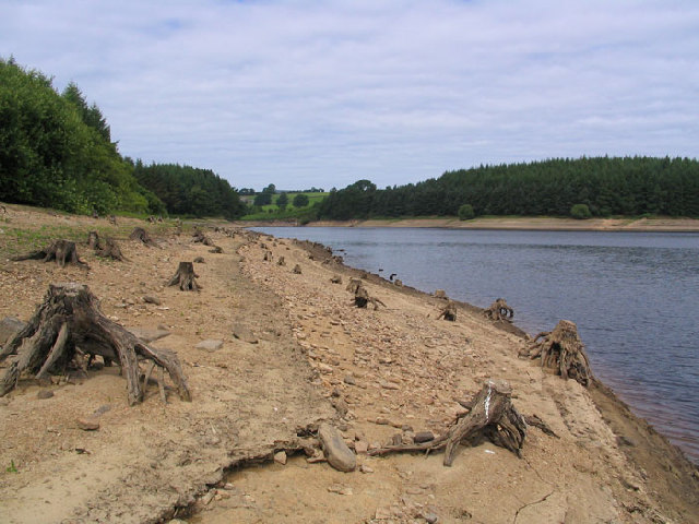
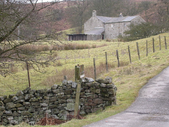
Hanging Bottom is a picturesque valley located in the county of Yorkshire, England. Nestled within the North York Moors National Park, it offers stunning views and a tranquil atmosphere for visitors to enjoy. The valley is surrounded by rolling hills and dense woodlands, creating a sense of seclusion and natural beauty.

Hanging Bottom takes its name from the steep slopes that characterize the valley, which appear to hang over the small river that runs through it. The river, known as Hanging Bottom Beck, adds to the charm of the area with its crystal-clear waters and gentle flow. The beck is home to various species of fish and provides a refreshing spot for locals and tourists to cool off during the summer months.

The valley is also renowned for its diverse flora and fauna, with an array of wildflowers, including bluebells and primroses, carpeting the landscape during the spring. The woodlands surrounding Hanging Bottom are home to a variety of wildlife, including deer, foxes, and a wide range of bird species, making it a haven for nature enthusiasts and photographers.

Hanging Bottom offers several walking trails that allow visitors to explore the valley and enjoy its natural wonders. These trails range in difficulty, catering to both casual strollers and avid hikers. Additionally, there are designated picnic areas where visitors can relax and take in the breathtaking scenery.

Overall, Hanging Bottom is a hidden gem within Yorkshire, providing a peaceful retreat for nature lovers and a chance to immerse oneself in the serene beauty of the North York Moors.

If you have any feedback on the listing, please let us know in the comments section below.

Hanging Bottom Images

Images are sourced within 2km of 54.007344/-1.7608426 or Grid Reference SE1556. Thanks to Geograph Open Source API. All images are credited.

Thruscross Reservoir Dam
Blubberhouses Early Sunday morning at Blubberhouses Cricket club, locals prepare for a Duck race and Country fair in aid of Motor Neurone Disease Association
Blubberhouses
Early Sunday morning at Blubberhouses Cricket club, locals prepare for a Duck race and Country fair in aid of Motor Neurone Disease Association
Low Dam near the River Washburn Low dam is retained by an embankment which runs next to the River washburn, it is a good place to see Dragonflies
Low Dam near the River Washburn
Low dam is retained by an embankment which runs next to the River washburn, it is a good place to see Dragonflies
Thruscross Reservoir Old trees appear on the exposed side of the reservoir during a low water period.
Thruscross Reservoir
Old trees appear on the exposed side of the reservoir during a low water period.
Brandrith crags Blubberhouses A view to Brandrith Crags across Redshaw gill, prior to the CRoW act it was difficult to get permission to climb here
Brandrith crags Blubberhouses
A view to Brandrith Crags across Redshaw gill, prior to the CRoW act it was difficult to get permission to climb here
Weir on the River Washburn The Weir on the River Washburn close to where the road crosses Nethernooks Bridge
Weir on the River Washburn
The Weir on the River Washburn close to where the road crosses Nethernooks Bridge
Thruscross Reservoir The Name Thruscross derives from the name of the Norse God Thor, prior to the reservoir being completed in 1966 almost the whole of the village of West End was demolished, I remember a hiking trip to the deserted village in the early sixties when all the buildings where stood empty with every window and door frame removed prior to demolition.
Thruscross Reservoir
The Name Thruscross derives from the name of the Norse God Thor, prior to the reservoir being completed in 1966 almost the whole of the village of West End was demolished, I remember a hiking trip to the deserted village in the early sixties when all the buildings where stood empty with every window and door frame removed prior to demolition.
Washburn during reservoir release The Washburn with water during a release of water between the reservoirs up and downstream of here with kayakers taking full advantage.
Washburn during reservoir release
The Washburn with water during a release of water between the reservoirs up and downstream of here with kayakers taking full advantage.
The Stone House Public House Situated at Stone House Crossroads at SE160587. In the distance the radio mast on Greenhow  Hill Top can be clearly seen
The Stone House Public House
Situated at Stone House Crossroads at SE160587. In the distance the radio mast on Greenhow Hill Top can be clearly seen
Blubberhouses Quarry The quarry itself. This quarry opened in the mid 1980's and less than 20 years later it is closed.
Blubberhouses Quarry
The quarry itself. This quarry opened in the mid 1980's and less than 20 years later it is closed.
Slow Road
Slow Road
Bridleway onto Hanging Moor
Stony Land On Delves Ridge.
Stony Land
On Delves Ridge.
Bothams Farm Bothams Farm faces North-East and looks across the valley towards Blubberhouses on the opposite side of the A59. The track leading up to the farm is marked "Private" and barking dogs reinforce the fact!
Bothams Farm
Bothams Farm faces North-East and looks across the valley towards Blubberhouses on the opposite side of the A59. The track leading up to the farm is marked "Private" and barking dogs reinforce the fact!
Two kayakers on the Washburn
Blubberhouses, St Andrew's Church This Church is on the south side of the A59 at the junction with Shepherds Hill
Blubberhouses, St Andrew's Church
This Church is on the south side of the A59 at the junction with Shepherds Hill
Water Tower, Thruscross This tower can be seen by the road to Greenhow, at Stonehouse Crossroads
Water Tower, Thruscross
This tower can be seen by the road to Greenhow, at Stonehouse Crossroads
Copse on Little Hanging Ridge Windswept stand of trees struggling for survival off Greenhow Hill Road near Stonehouse Cross
Copse on Little Hanging Ridge
Windswept stand of trees struggling for survival off Greenhow Hill Road near Stonehouse Cross
Show me another place!

Hanging Bottom is located at Grid Ref: SE1556 (Lat: 54.007344, Lng: -1.7608426)

Division: West Riding

Administrative County: North Yorkshire

District: Harrogate

Police Authority: North Yorkshire

What 3 Words

///waiters.positions.dwarf. Near Pateley Bridge, North Yorkshire

Related Wikis

Thruscross Reservoir

Thruscross Reservoir is the northernmost of four reservoirs in the Washburn valley, lying north of Otley and west of Harrogate in North Yorkshire, England...

Thruscross

Thruscross is a small settlement and civil parish in the Harrogate district of North Yorkshire, England. It lies in the Washburn Valley, 11 miles (18...

Blubberhouses

Blubberhouses is a small village and civil parish in the Washburn Valley in North Yorkshire, England. The population as at the 2011 Census was less than...

Kex Gill Bypass

The Kex Gill Bypass is a future stretch of A-road across Kex Gill Moor to Blubberhouses in North Yorkshire, England. The route is part of the A59 road...

Thornthwaite, North Yorkshire

Thornthwaite is a small village in the Harrogate district of North Yorkshire, England. It lies in the valley of Padside Beck, a side valley on the south...

HMS Forest Moor

HMS Forest Moor was a Royal Navy land base located in Nidderdale in the borough of Harrogate, North Yorkshire, England. == History == The establishment...

Fewston Reservoir

Fewston Reservoir is located in the Washburn valley north of Otley and west of Harrogate in Yorkshire, England. It was built in 1879. The capacity is about...

Fewston

Fewston is a village and civil parish in the Harrogate district of North Yorkshire, England. It is situated north of Otley and close to Swinsty and Fewston...

Nearby Amenities

Located within 500m of 54.007344,-1.7608426
Toilets
Source: survey
Lat/Long: 54.0102725/-1.7633459
Description: Former mill weir. Sweet Surfing Wave
Rapids: 2
Waterway: rapids
Lat/Long: 54.0080399/-1.7616695
Description: half metre drop, stopper
Rapids: 2
Waterway: rapids
Lat/Long: 54.0075055/-1.761817
Description: half metre drop
Height: 0.5
Waterway: rapids
Lat/Long: 54.00472/-1.7589098
Fixme: please check whether stream comes out above
Lat/Long: 54.0048294/-1.7593587
Hare Carr
Natural: fell
Source: NPE
Lat/Long: 54.0081214/-1.7544435
Hanging Bottom
Description: Former buildings
Fixme: interpolated,exact location needs surveying
Historic: ruins
Ruins: building
Source: OS Yorkshire CLII,publ 1893
Lat/Long: 54.0078195/-1.760817
Ford: yes
Lat/Long: 54.0073275/-1.7618954
Barrier: stile
Material: stone
Stile: squeezer
Lat/Long: 54.0076426/-1.7638807
Barrier: stile
Foot: yes
Material: stone
Stile: stepover
Lat/Long: 54.0077615/-1.7630947
Barrier: stile
Material: wood
Stile: stepover
Lat/Long: 54.007633/-1.7638761
The data included in this document is from www.openstreetmap.org. The data is made available under ODbL.

Have you been to Hanging Bottom?

Leave your review of Hanging Bottom below (or comments, questions and feedback).