Blackwell Dale
Valley in Derbyshire Derbyshire Dales
England
Blackwell Dale

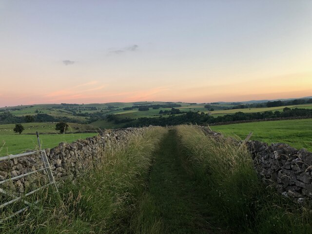
Blackwell Dale is a picturesque valley located in Derbyshire, England. It is situated in the southern part of the Peak District National Park, near the village of Blackwell. The dale stretches approximately 2 kilometers from north to south and is bordered by steep limestone cliffs on both sides.
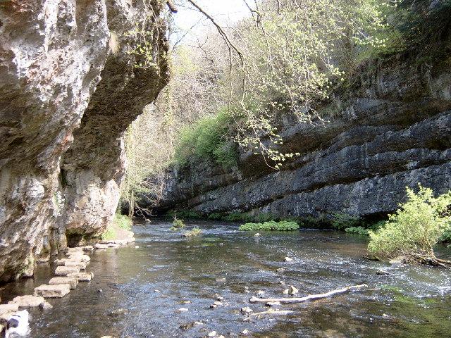
The valley boasts stunning natural beauty, with lush green meadows, dense woodlands, and a meandering river that flows through its heart. The river, known as the River Wye, adds to the charm of Blackwell Dale, providing a tranquil ambiance and creating small cascades and pools along its course.
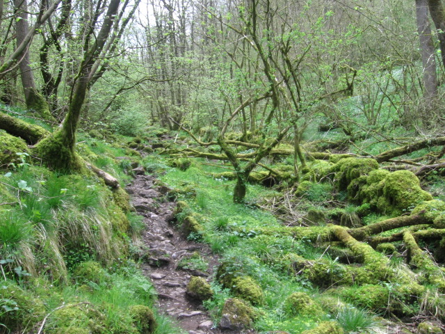
Blackwell Dale is a haven for nature lovers and outdoor enthusiasts. The area is home to a diverse range of flora and fauna, including rare orchids, ferns, and various bird species. The wooded areas are perfect for leisurely walks and exploration, while the open meadows offer idyllic spots for picnics and relaxation.
The valley is also renowned for its network of walking trails, attracting hikers and ramblers from far and wide. The paths wind through the dale, offering breathtaking views of the surrounding countryside and opportunities to spot wildlife. Additionally, the valley is intersected by the Monsal Trail, a popular cycling route that follows a disused railway line.
Blackwell Dale offers a peaceful retreat from the hustle and bustle of urban life. Its natural beauty, diverse wildlife, and recreational opportunities make it a must-visit destination for anyone seeking tranquility and a connection with nature.
If you have any feedback on the listing, please let us know in the comments section below.
Blackwell Dale Images
Images are sourced within 2km of 53.251843/-1.8033209 or Grid Reference SK1372. Thanks to Geograph Open Source API. All images are credited.


Blackwell Dale is located at Grid Ref: SK1372 (Lat: 53.251843, Lng: -1.8033209)
Administrative County: Derbyshire
District: Derbyshire Dales
Police Authority: Derbyshire
What 3 Words
///logic.songbook.spray. Near Tideswell, Derbyshire
Nearby Locations
Related Wikis

Millers Dale railway station
Millers Dale railway station was situated in Millers Dale, near Tideswell, in the Peak District. == History == It was built in 1863 by the Midland Railway...

Millers Dale
Millers Dale (Ordnance Survey: Miller's Dale) is a valley on the River Wye in Derbyshire, England, where there is also a hamlet of the same name. It is...

Blackwell in the Peak
Blackwell is a village in the Derbyshire Dales local government district of Derbyshire, England, on the A6 main road between Bakewell and Buxton.It is...

Priestcliffe
Priestcliffe is a hamlet in Derbyshire, England. The hamlet falls within the civil parish of Taddington. It is about 1.2 km (or 0.75 miles) north of Taddington...
Chee Dale
Chee Dale is a steep-sided gorge on the River Wye near Buxton, Derbyshire, in the Peak District of England. The Wye valley continues upstream towards Buxton...
Monk's Dale
Monk's Dale is a short steep-sided dry gorge near Buxton, Derbyshire, in the Peak District of England. The dale is cut into a plateau of farmland and lies...
Wormhill Hall
Wormhill Hall is a 17th-century grade II* listed country hall in Wormhill, Derbyshire. == History == The current Wormhill Hall was constructed in 1697...
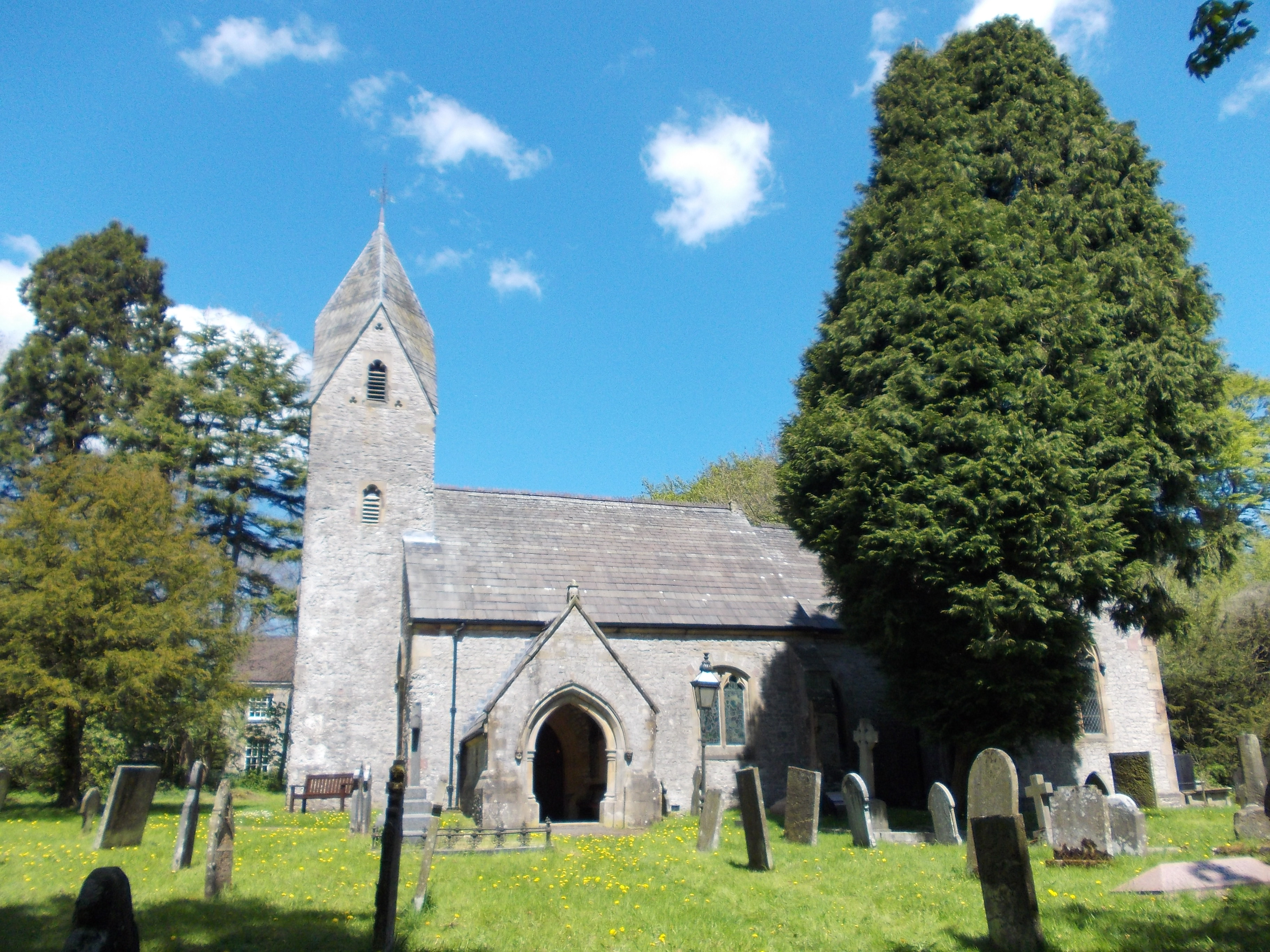
St Margaret's Church, Wormhill
St Margaret's Church, Wormhill is a Grade II* listed parish church in the Church of England in Wormhill, Derbyshire. == History == The medieval chapel...
Related Videos

Hiking Trails UK : Chee Dale's Famous Stepping Stones | Peak District
Embark on a breathtaking Hiking Trails uk journey through the picturesque landscapes of the Peak District as we explore the ...
Chee Dale Stepping Stones - Peak District #peakdistrict #hiking
Chee Dale Stepping Stones - Peak District #shorts #peakdistrict #hiking You'll love Chee Dale Stepping Stones, a thrilling ...

Hiking in the Peak district
Hiking in the Peak district, Day 1 we walked Bamford Edge, Ladybower reservoir and the lost village of Derwent, Derwent edge, ...

A Short Family Hike - Monsal Trail #peakdistrict #peakdistrictwalks #peakdistrictproud #hiking
peakdistrict #hiking #peakdistrictwalks #nationalpark #peakdistrictproud #littleexplorer #monsaltrail #walking.
Nearby Amenities
Located within 500m of 53.251843,-1.8033209Have you been to Blackwell Dale?
Leave your review of Blackwell Dale below (or comments, questions and feedback).